Tumamoc Hill Hike
View Photos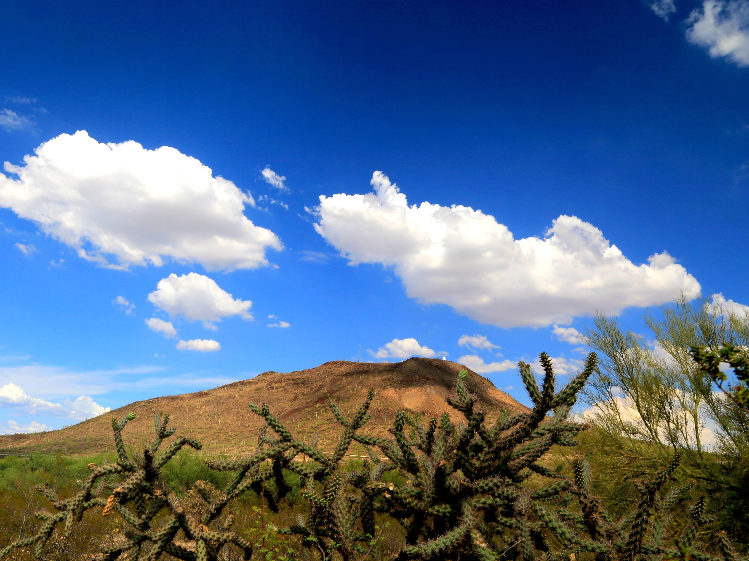
Tumamoc Hill Hike
Difficulty Rating:
Tumamoc Hill is one of the most popular hikes in Tucson thanks to its great city views, relatively short length, and night hiking opportunities. The route is paved, which is a plus for hikers who prefer or require even footing. Because Tumamoc Hill is on university property, it’s the only hike in the Tucson Mountain Range that is open for night hiking. If you want to watch the sunset or sunrise, this is the place to be!
The route is 3.1mi long, but some hikers turn around at the midpoint instead of going the entire way. Expect a 5ft paved route with plenty of signage. Some parts of the trail are steep, which could make using a stroller or wheelchair very difficult without some assistance. Overall we rate this trail as moderately difficult. If you come in hot weather, please ensure you’ve got lots of hydration and some sun protection with you.
Getting there
The trailhead for Tumamoc Hill is on Anklam Road.

About
| Backcountry Campground | No |
| When to do | September-May |
| Pets allowed | No |
| Family friendly | Yes |
| Route Signage | Average |
| Crowd Levels | High |
| Route Type | Out and back |
Tumamoc Hill Hike
Elevation Graph
Weather
Tumamoc Hill Hike Description
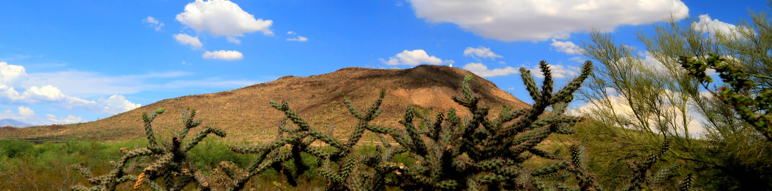
Tumamoc Hill rises 3107 feet above Tucson, with the Tumamoc Desert Laboratory built into its slopes. This hill is a very popular pick for hikers in the city for its panoramic city views, its views of the mountains of Tucson Mountain Park to the west, and its availability for night hiking. Because Tumamoc Hill is on university property, it’s open for sunrise and sunset hiking with open hours beginning at 4 AM and ending at 10 PM.
Keep in mind that this is an active ecological study area, so you are not permitted to hike anywhere off the paved path. No pets are allowed. Remember to take all of your trash with you when you leave.
The trail is perhaps more of an uphill walk than a hike for some because of its paving, but this makes it more accessible for hikers who need even footing and those with strollers. While the paving makes this route easier, keep in mind that it’s still a steep hike. Some people choose to turn around at the halfway point to skip the final climb to the top.
When you arrive, take care not to park in the lots for the hospital or the medical offices. These spaces are reserved for staff and patients and you may be ticketed or towed. Note that bikes aren’t allowed on the hill, so if you bring a bike, you’ll need to lock it to the entrance posts before starting your hike.
Although this route is only 3.0mi long, you’ll be out in the hot sun should you choose to hike outside of wintertime. Bring lots of water, wear sunscreen, don a hat, and avoid hiking in the heat of the day. An early start is recommended. There is water available at the halfway point on this trail.
From the trailhead, take Tumamoc Hill Road south towards the hill. There’s a route that branches off to the left a few steps in; keep right here.
Begin a gradual switchbacking ascent up the hill. The first half of the hike is less steep than the second half. By the time you reach the restrooms, the grade will increase. Pass the laboratory and make a few more wide turns before arriving on the summit.
Up top, you can see Tucson to the east and Saguaro National Park West to the west. Tall saguaros dot the hill and the mountains rise in the distance.
When you’re ready, you’ll return to the trailhead the same way you came up.
Hiking Route Highlights
Tucson
On Tumamoc Hill, your view of Tucson is unimpeded and wide. Home to the University of Arizona, Tucson is the second-largest city in Arizona after Phoenix. Tucson was founded as a military fort by the Spanish in 1775, became part of Mexican Sonora in 1821, and then was acquired by the United States in 1853. The name Tucson comes from the Spanish Tucsón, which means “at the base of the black hill.” This is in reference to the basalt-covered Sentinel Peak. Tucson is surrounded by five mountain ranges.
Frequently Asked Questions
Can you bring dogs on the Tumamoc Hill hike?
Pets are not allowed on this hike due to its location in an active ecological study area. Pets can disturb the plant life and wildlife under study.
What is the incline on Tumamoc Hill?
The grade falls between 6 percent and 8 percent for most of the hike, making this a moderately steep to steep hike.
Can you drive up Tumamoc Hill?
Private vehicles cannot drive up Tumamoc Hill.
Insider Hints
There’s an app you can download that educates you on the hill as you climb. Check out the signage when you arrive.
Plan your hike for early or late in the day for the best weather and to avoid some of the crowds.
Similar hikes to the Tumamoc Hill Hike hike

Shantz, Cholla, and Cactus Forest Loop
The Shantz, Cholla, and Cactus Forest Loop is an easy trail in Tucson’s Saguaro National Park East. The star of…

Cactus Forest, Squeeze Pen, and Pink Hill Loop
The Cactus Forest, Squeeze Pen, and Pink Hill Loop is an easy trail in Tucson’s Saguaro National Park East. This…

Hugh Norris, Sendero Esperanza, and Dobbie Wash Loop
The Hugh Norris, Sendero Esperanza, and Dobbie Wash Loop is a bit of a mouthful, but it’s a great hike…
Comments