Pontatoc Canyon Trail
View Photos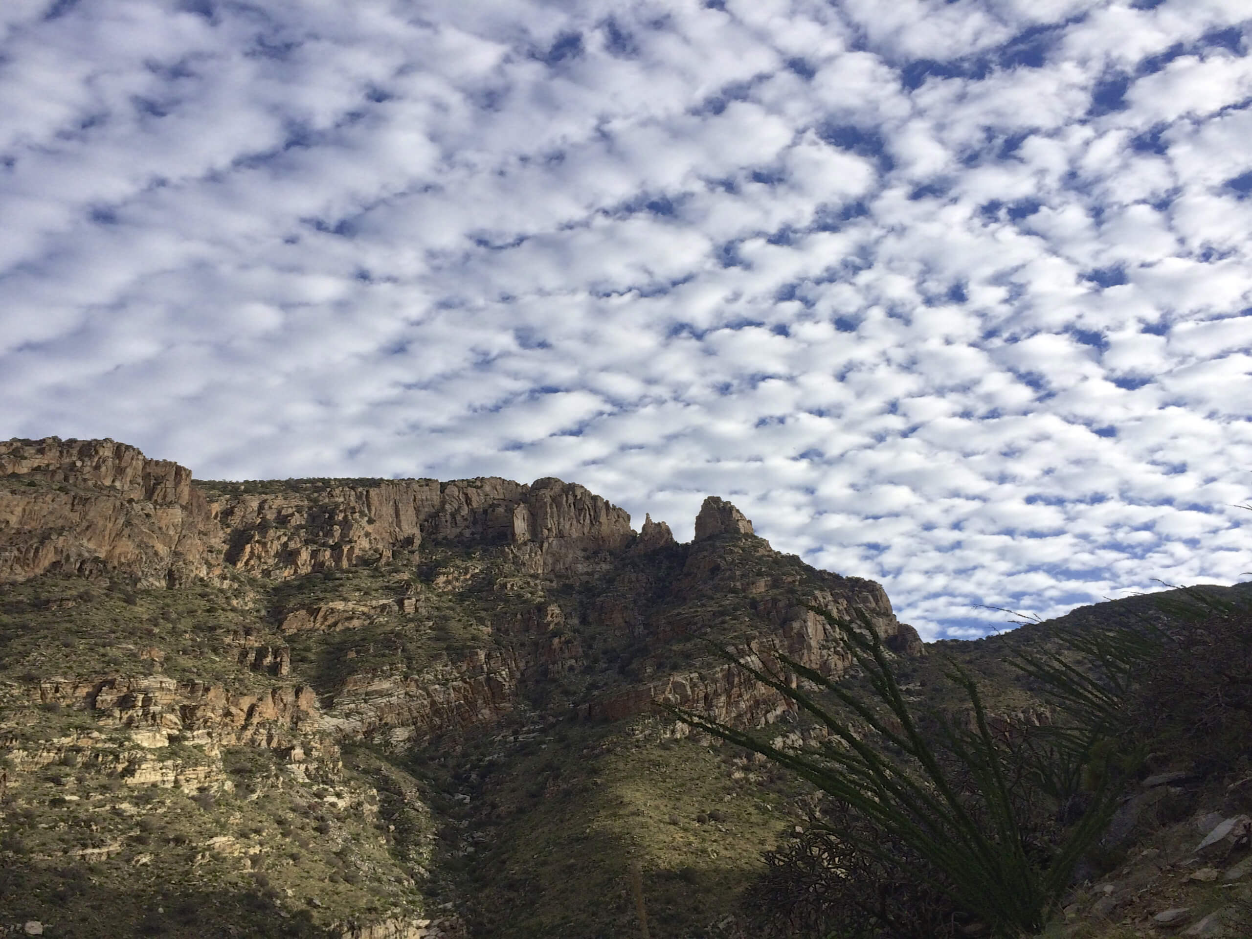
Pontatoc Canyon Trail
Difficulty Rating:
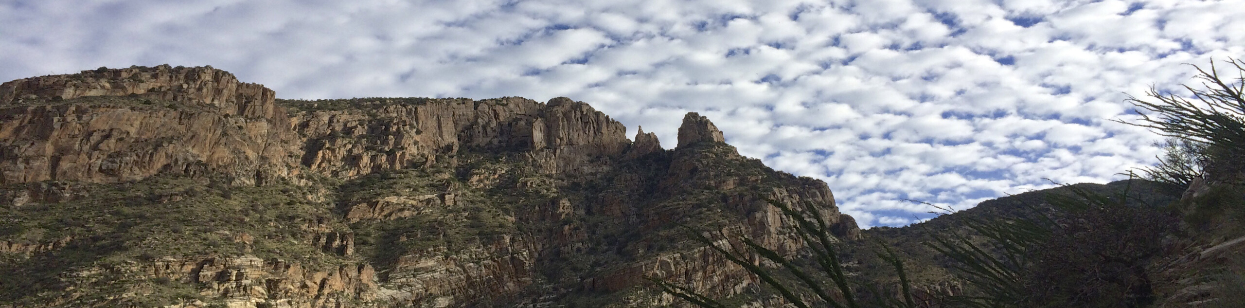
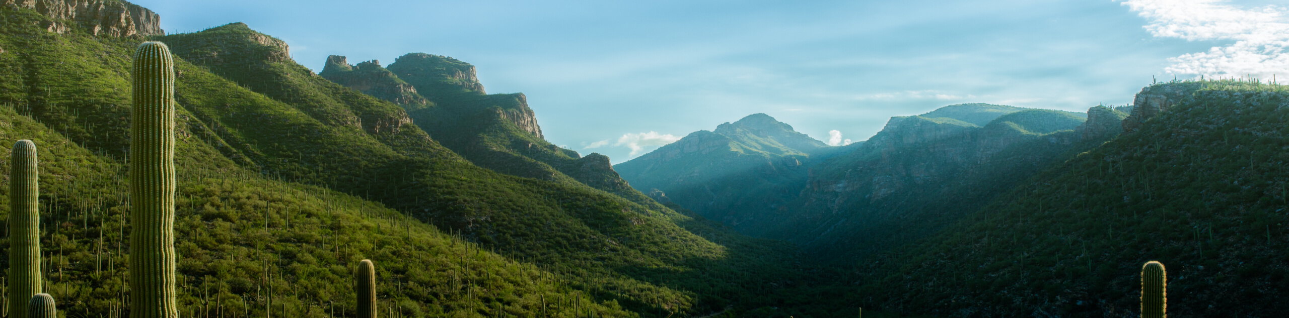
The Pontatoc Canyon Trail is one of several canyon trails in the gorgeous Sabino Canyon Recreation Area. Pontatoc Canyon sees fewer hikers than the more well-known Sabino and Bear Canyons, but the scenery is definitely still worth the hike. This route is 5.8mi long and rated as hard. As with all the hikes in this area, bring lots of water and avoid hiking in the heat of the day. It gets hot in here!
Getting there
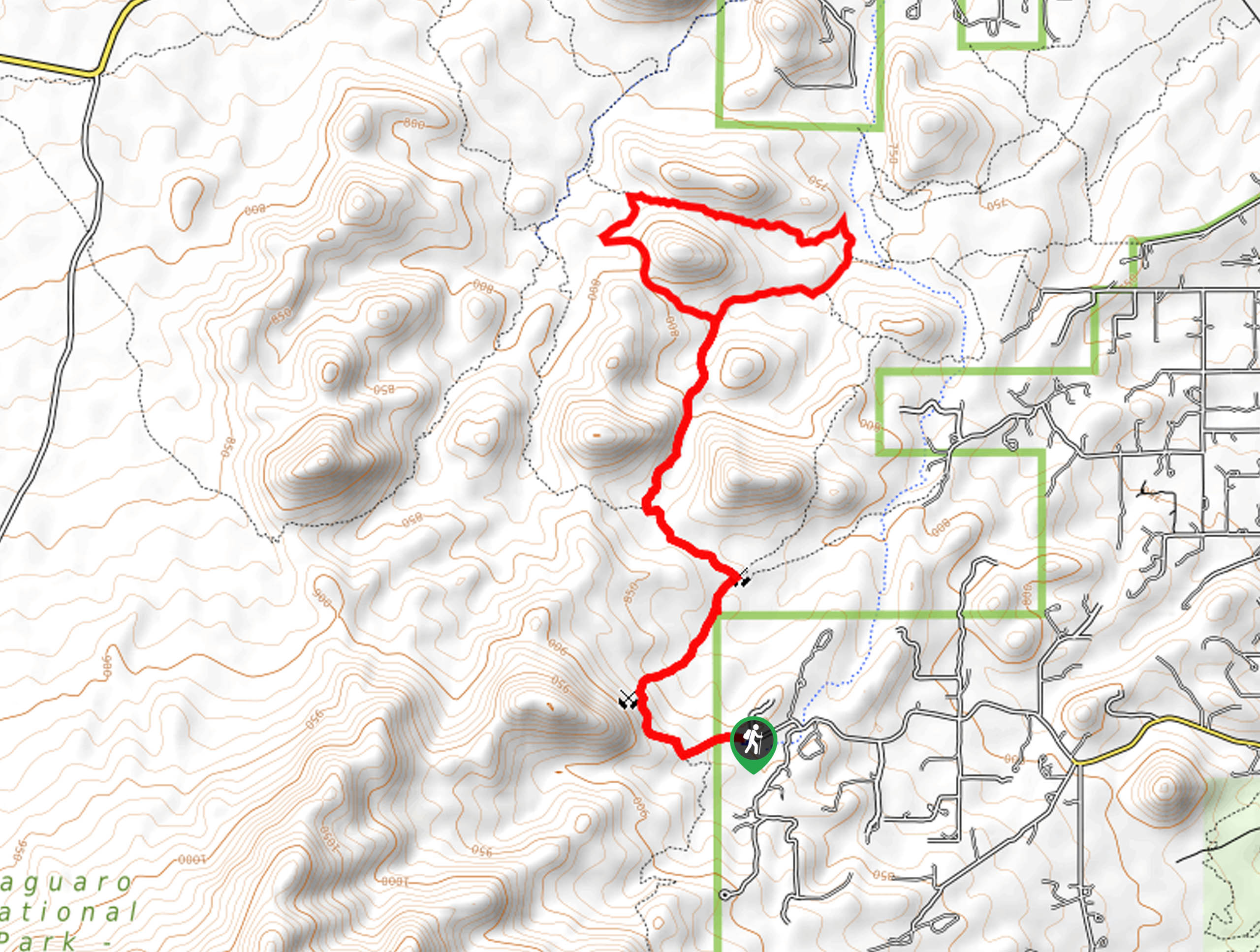
The trailhead for the Pontatoc Canyon Trail is off N Alvernon Way.

About
| Backcountry Campground | No |
| When to do | October-May |
| Pets allowed | No |
| Family friendly | No |
| Route Signage | Average |
| Crowd Levels | Moderate |
| Route Type | Out and back |
Pontatoc Canyon Trail
Elevation Graph
Weather
Pontatoc Canyon Trail Description
The Pontatoc Canyon Trail leads you through the southernmost of the three canyons in the Sabino Canyon Recreation Area. While less explored than nearby Sabino and Bear canyons, this route offers similar rugged scenery and a nice challenge. Give all three canyons a go and let us know which is your favorite.
This trail can get extremely hot in the summer, late spring, and early fall. We recommend visiting outside of these times and bringing lots of water with you. Wear sun protection and bring good boots and poles if you have them. Note that there is a small fee required to use the trails in the Sabino Canyon Recreation Area and dogs are not permitted on the trail.
From the trailhead, follow the road north and take FS 410 east towards the mouth of the canyon. After your quick warm-up, you’ll launch into a set of narrow switchbacks to climb the canyon wall. Keep left where FS 411 intersects and begin your traverse across the canyon, crossing over to the northern wall before climbing more switchbacks to gain elevation. You’ll cross over the middle once again before the most difficult part of the climb, which takes you up a cheer canyon face to the end of the route. From here, retrace your steps back to the trailhead.
Insider Hints
While most trails in this area are closed for bighorn sheep lambing season from January through April, the USDA has an exception for Pontatoc #410 that allows hikers on the trail year-round. This exception begins the closure 400 feet from the trail, so stay on the route as you always would.
Similar hikes to the Pontatoc Canyon Trail hike

Hugh Norris, Sendero Esperanza, and Dobbie Wash Loop
The Hugh Norris, Sendero Esperanza, and Dobbie Wash Loop is a bit of a mouthful, but it’s a great hike…
Bear Canyon Trail
Bear Canyon Trail is one of the main routes in Tucson’s Sabino Canyon Recreation Area. The entire trail is almost…
Cactus Canyon and Gila Monster Loop
The Cactus Canyon and Gila Monster Loop is a 6.0mi hike in Tucson’s Saguaro National Park that puts…
Comments