Mount Kimball via Pima Canyon Trail
View Photos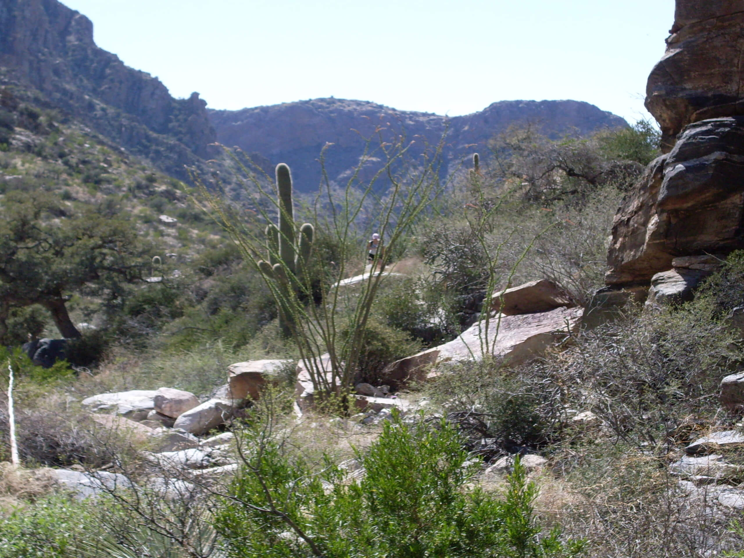
Mount Kimball via Pima Canyon Trail
Difficulty Rating:
Reach the top of Mount Kimball via Pima Canyon using this route guide. This route leads you through a canyon with impressive riparian habitats and rich biodiversity. Hiking through the canyon underneath the Pusch Ridge, the views get better and better as you climb. With a final push to the top, you’ll have a great viewpoint. Since this hike sees so much traffic through such a sensitive natural area, please remember to leave no trace. Stay on the marked trails, take your trash with you, leave dogs at home, and appreciate wildlife from afar.
Getting there
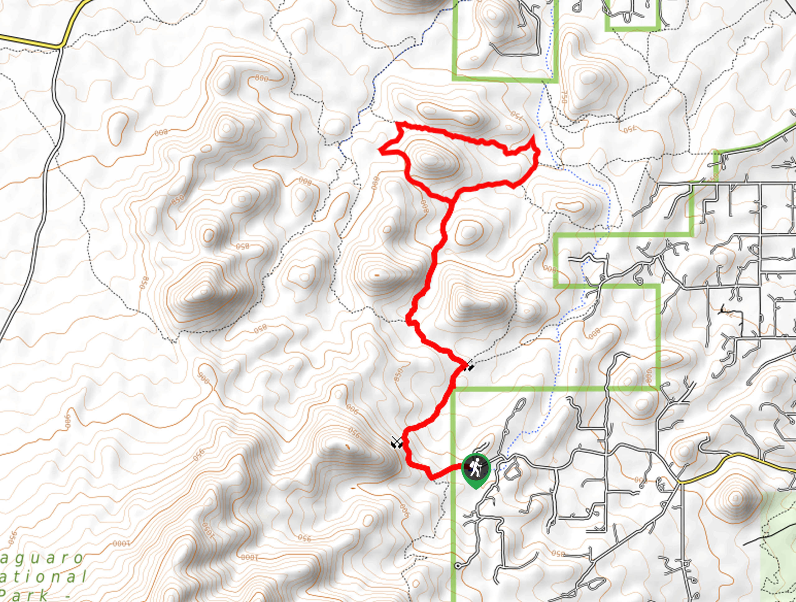
The trailhead for Mount Kimball via Pima Canyon Trail is at the end of E Magee Road.

About
| Backcountry Campground | No |
| When to do | October-May |
| Pets allowed | No |
| Family friendly | No |
| Route Signage | Average |
| Crowd Levels | Moderate |
| Route Type | Out and back |
Mount Kimball via Pima Canyon Trail
Elevation Graph
Weather
Mount Kimball via Pima Canyon Trail Description
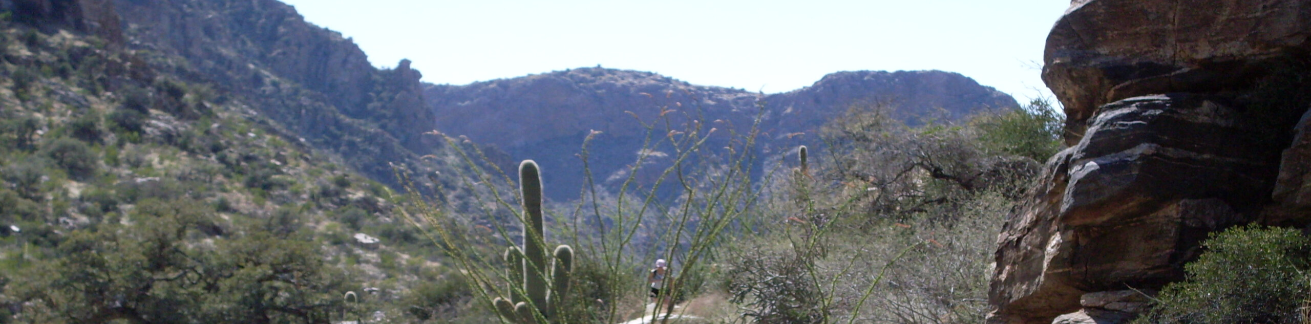
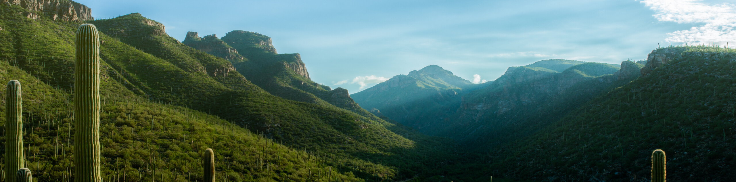
Summiting Mount Kimball via Pima Canyon Trail is a gorgeous and challenging adventure through the Pusch Ridge Wilderness in Tucson. This hike climbs through Pima Canyon underneath Pusch Ridge where a river flowing along the canyon floor supports a rich riparian habitat. The biodiversity in the canyon is a draw for many, as are the views you’ll discover from the top.
The canyon can get quite hot, so we recommend avoiding this hike in the summertime. No matter what time of year you visit in, bring lots of water, bring snacks, and wear sun protection. Poles and sturdy boots are recommended.
From the trailhead, take Pima Canyon Trail across E Barrel Cactus Court. Follow the route into the mouth of the canyon. It’s a straightforward trip from here as long as you keep heading up the canyon. As you hike, keep an eye out for birds and bighorn sheep. The view from the canyon improves the further you go, but the route gets harder to follow the further you get into the canyon. You’ll pass Pusch Peak, Bighorn Mountain, and Table Mountain on your left before approaching Mount Kimball on your right.
As you approach Mount Kimball, you’ll have a great view of Window Rock and Cathedral Rock. The route will turn sharply right to make the final ascent. From here, you’ll simply retrace your steps.
Insider Hints
This area is subject to closure to protect bighorn sheep during lambing season. Closures usually run from January 1 through April 30.
Similar hikes to the Mount Kimball via Pima Canyon Trail hike

Hugh Norris, Sendero Esperanza, and Dobbie Wash Loop
The Hugh Norris, Sendero Esperanza, and Dobbie Wash Loop is a bit of a mouthful, but it’s a great hike…
Bear Canyon Trail
Bear Canyon Trail is one of the main routes in Tucson’s Sabino Canyon Recreation Area. The entire trail is almost…
Cactus Canyon and Gila Monster Loop
The Cactus Canyon and Gila Monster Loop is a 6.0mi hike in Tucson’s Saguaro National Park that puts…
Comments