
Linda Vista Short Loop
View Photos
Linda Vista Short Loop
Difficulty Rating:
The Linda Vista Short Loop is a short route in Tucsons’ Pusch Ridge Wilderness. This hike is very quick and it’s easy to reach from Oro Valley and northeastern Tucson. It provides a great break in nature without requiring too much effort. Additionally, this route is easy enough for beginners and hikers of most ages. The terrain is varied and interesting with a few great photo ops along the way. The views of the city and of the Tortolitas, in particular, are quite enjoyable.
Getting there
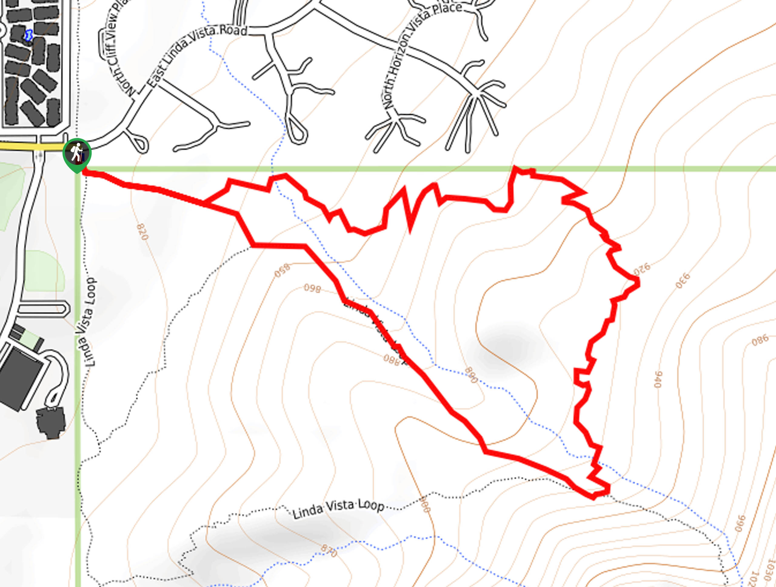
The trailhead for Linda Vista Short Loop is off E Linda Vista Blvd.

About
| Backcountry Campground | No |
| When to do | October-May |
| Pets allowed | No |
| Family friendly | Yes |
| Route Signage | Average |
| Crowd Levels | High |
| Route Type | Loop |
Linda Vista Short Loop
Elevation Graph
Weather
Linda Vista Short Loop Description
The Linda Vista Short Loop is a quick hike with solid views, making it a good pick for days when you’re short on time but still want a rewarding hike. This route is easily accessible from Oro Valley and northeastern Tucson and it takes most hikers less than two hours to complete. The views of the city and of the nearby mountains and cliffs in the Pusch Ridge Wilderness are photo-worthy and the variety of plant life on this trail is excellent, with lots of local plant and cactus species to appreciate.
As with all hikes near Tucson, this route can be very hot. We recommend bringing lots of water and wearing sun protection. Note that dogs are not permitted on this trail whether leashed or not.
This route is a loop. We’ll describe it clockwise as this is the approach most hikers take. The parking area is off E Linda Vista Road. Starting from the trailhead, you’ll hike southeast, keeping left. Stay left at the first junction to continue east. A few easy switchbacks take you up along the base of the hill through a low canyon. The route levels out a bit and then approaches a 4-way junction. There’s a route that heads steeply down through the canyon, which you certainly could take for a quicker descent, but you’ll want to go straight through the junction to gently descend a ridge.
After a couple of switchbacks, arrive at a junction. Go right here and hike north, staying left to pass by the school. This route takes you back to the trailhead.
Similar hikes to the Linda Vista Short Loop hike

Shantz, Cholla, and Cactus Forest Loop
The Shantz, Cholla, and Cactus Forest Loop is an easy trail in Tucson’s Saguaro National Park East. The star of…

Cactus Forest, Squeeze Pen, and Pink Hill Loop
The Cactus Forest, Squeeze Pen, and Pink Hill Loop is an easy trail in Tucson’s Saguaro National Park East. This…

Hugh Norris, Sendero Esperanza, and Dobbie Wash Loop
The Hugh Norris, Sendero Esperanza, and Dobbie Wash Loop is a bit of a mouthful, but it’s a great hike…
Comments