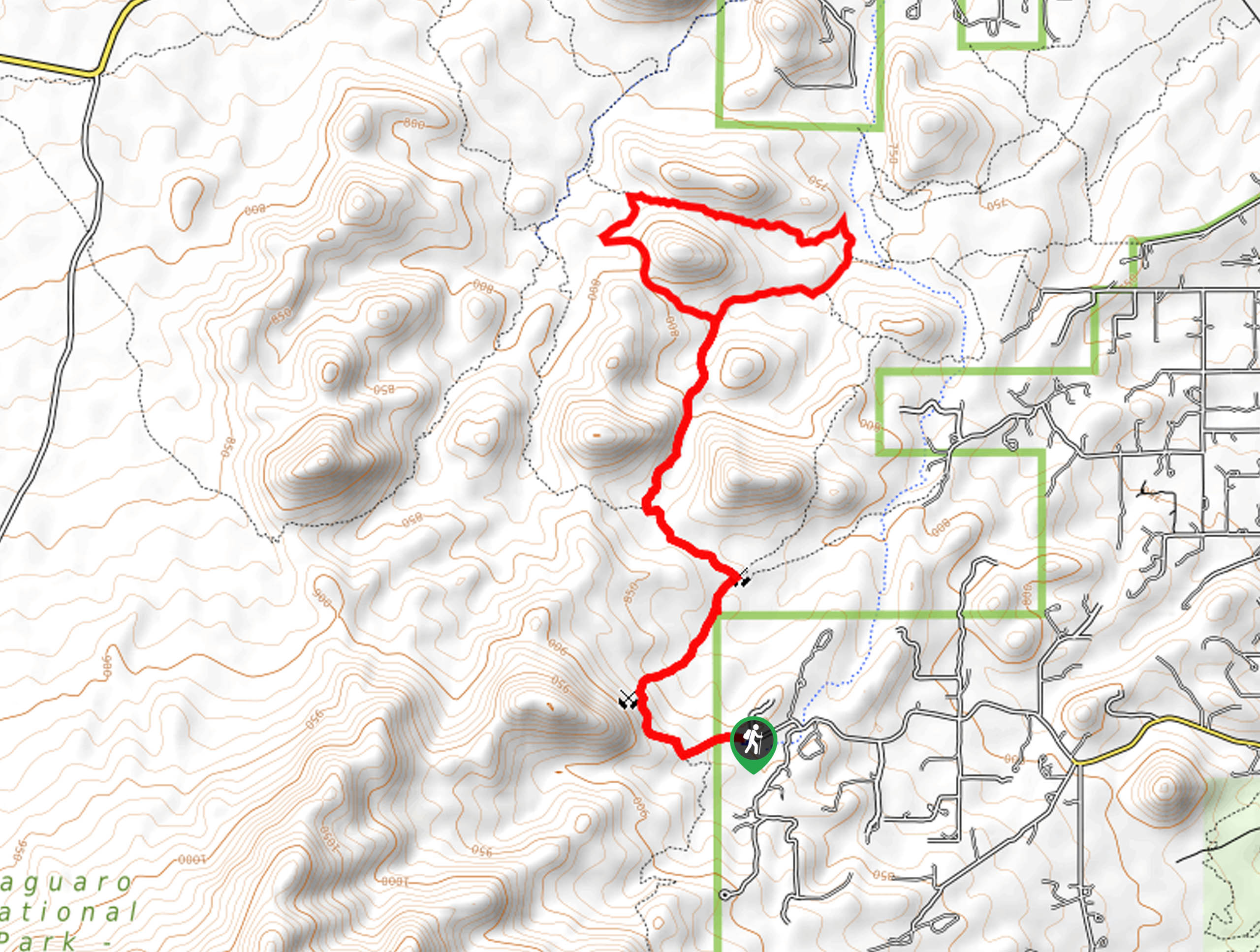
Finger Rock Trail to Pima Canyon Trail
View Photos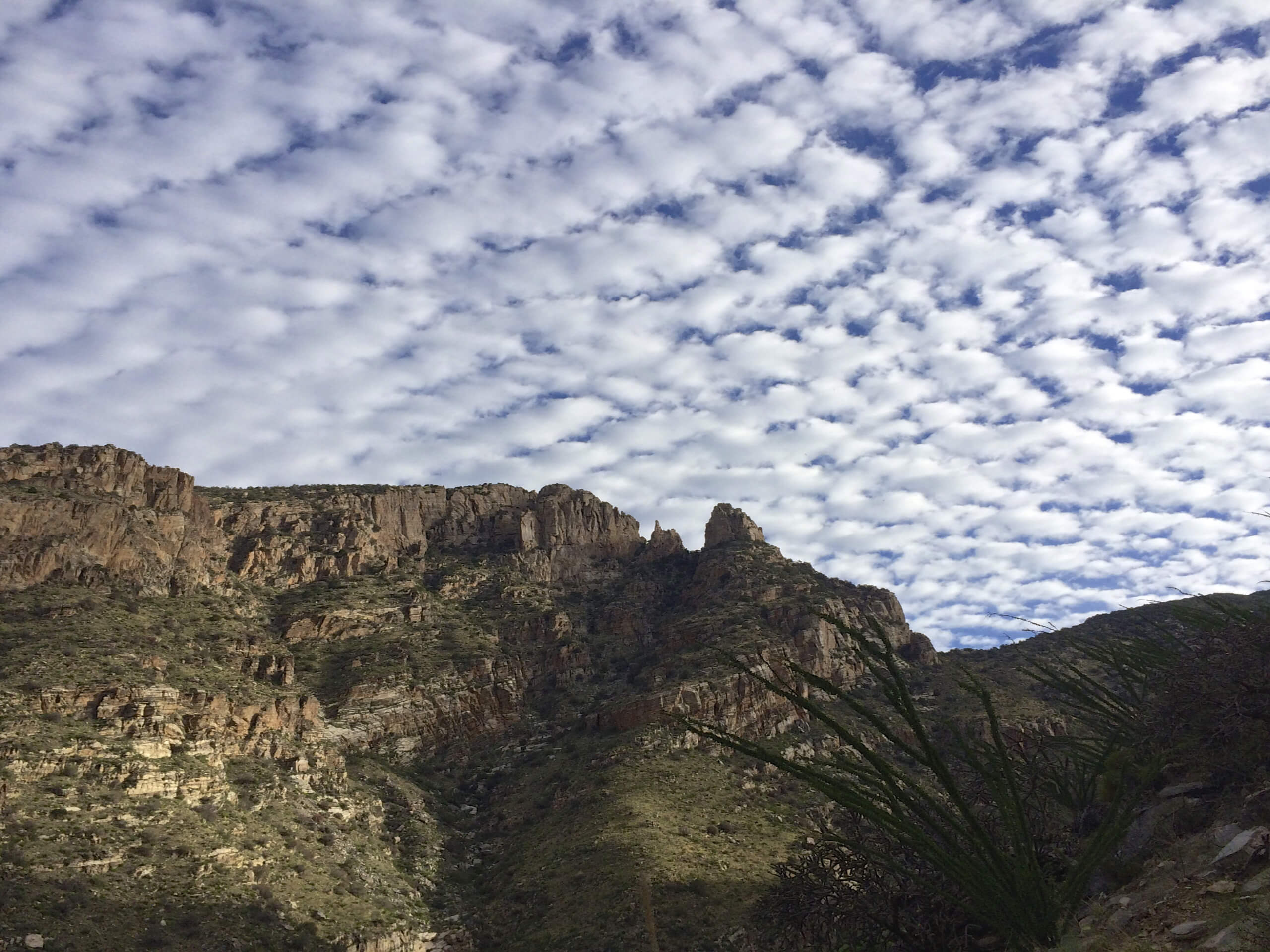
Finger Rock Trail to Pima Canyon Trail
Difficulty Rating:
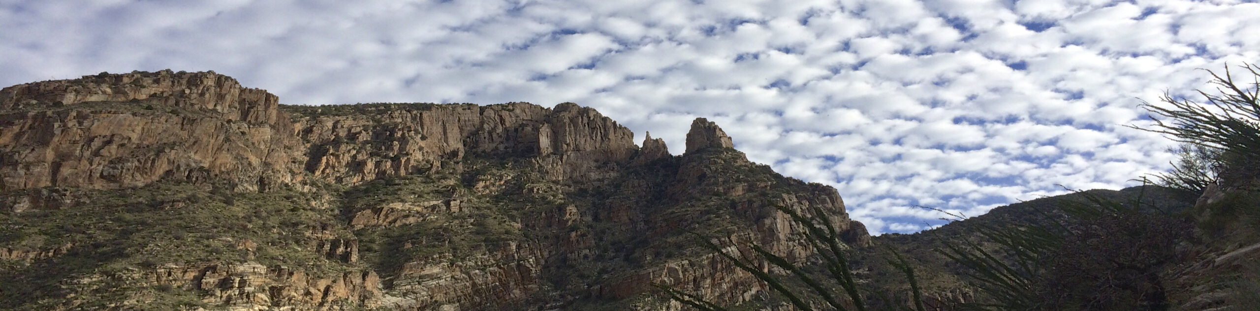
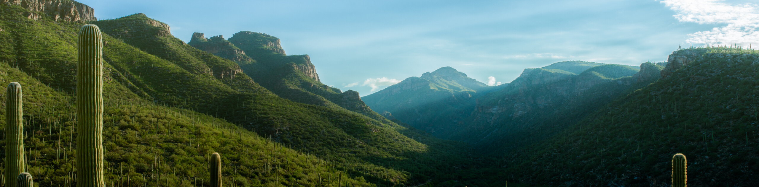
The Finger Rock Trail to Pima Canyon Trail hike is a 13.0mi route in Tucson’s Pusch Ridge Wilderness that is rated as hard. This route leads you through to canyons with impressive riparian habitats and rich biodiversity. The views get better and better as you climb, which you’ll do a fair amount of. Since this hike sees so much traffic through such a sensitive natural area, please remember to leave no trace. Stay on the marked trails, take your trash with you, leave dogs at home, and appreciate wildlife from afar.
Getting there
One of the trailheads for Finger Rock Trail to Pima Canyon Trail is at the end of E Magee Road and the other is on N Alvernon Way.

About
| Backcountry Campground | No |
| When to do | October-May |
| Pets allowed | No |
| Family friendly | No |
| Route Signage | Average |
| Crowd Levels | Moderate |
| Route Type | One Way |
Finger Rock Trail to Pima Canyon Trail
Elevation Graph
Weather
Finger Rock Trail to Pima Canyon Trail Description
Finger Rock Trail to Pima Canyon Trail is a gorgeous 13.0mi adventure in the Pusch Ridge Wilderness of northeastern Tucson. This hike climbs through two canyons underneath Pusch Ridge where the rivers flowing along the canyon floor support a rich riparian habitat. This is a challenging hike with a fair bit of climbing required, so we recommend arranging a car shuttle to make it as easy to complete as possible.
Because this hike travels through sensitive natural habitats, it’s extremely important that you hike in a way that leaves a minimal impact on the ecosystem. Stay on the trail and don’t veer off, take your trash with you, and leave lots of room between yourself and wildlife. Dogs are not allowed on this trail. The canyon can get quite hot, so we recommend avoiding this hike in the summertime.
From the trailhead, take FS 42 into the canyon ahead. As you hike, look for the many resident and migratory birds. Look for javelina and jackrabbits as well. If you’re lucky, you’ll spot surefooted bighorn sheep up on the hills. The view into the canyon improves the further you go, but the route gets harder to follow the further you get into the canyon. You’ll pass Pusch Peak, Bighorn Mountain, and Table Mountain on your left before approaching Mount Kimball on your right. Hitting the peak of Kimball, head north to the top of the canyon and then drop in southwest. Follow this canyon through to the endpoint of the trail.
Similar hikes to the Finger Rock Trail to Pima Canyon Trail hike

Hugh Norris, Sendero Esperanza, and Dobbie Wash Loop
The Hugh Norris, Sendero Esperanza, and Dobbie Wash Loop is a bit of a mouthful, but it’s a great hike…
Bear Canyon Trail
Bear Canyon Trail is one of the main routes in Tucson’s Sabino Canyon Recreation Area. The entire trail is almost…
Cactus Canyon and Gila Monster Loop
The Cactus Canyon and Gila Monster Loop is a 6.0mi hike in Tucson’s Saguaro National Park that puts…
Comments