
Bunny Loop
View Photos
Bunny Loop
Difficulty Rating:
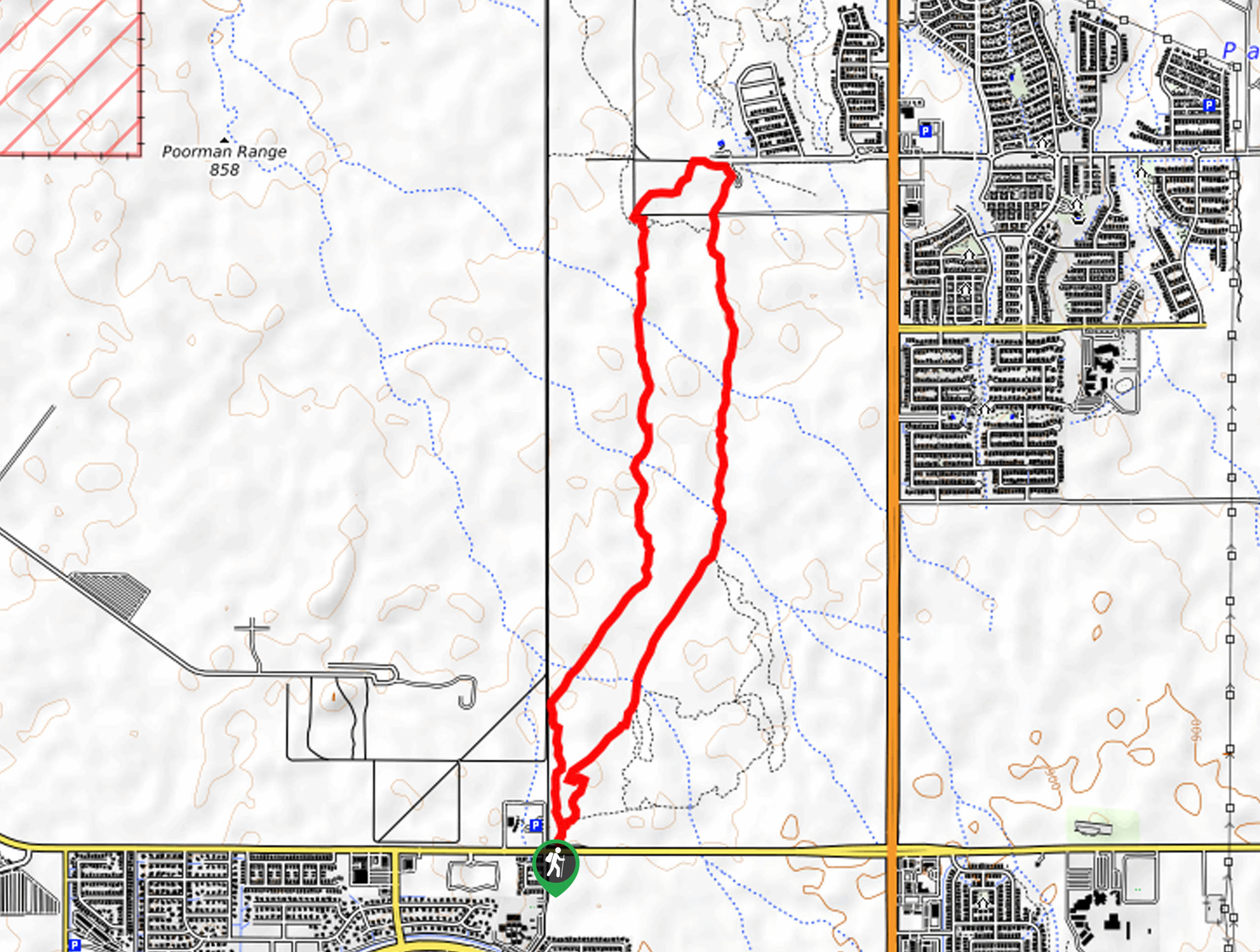
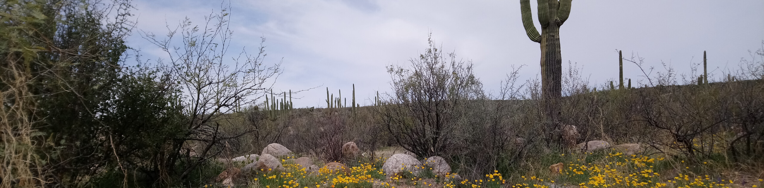
The Bunny Loop is a 4.7mi easy hiking and mountain biking trail south of Tucson. This route is flat and relaxed, with mostly scrubby bush, cholla, and mountains in the distance to see. While predominantly used by mountain bikers, hikers are welcome, just remember to share the trail and look out for one another. You’ll need a
Getting there
The trailhead for the Bunny Loop is on E Valencia Road.

About
| Backcountry Campground | No |
| When to do | October-May |
| Pets allowed | Yes - On Leash |
| Family friendly | Yes |
| Route Signage | Good |
| Crowd Levels | Moderate |
| Route Type | Loop |
Bunny Loop
Elevation Graph
Weather
Bunny Loop Description
The Bunny Loop is a relaxed flat route through a scrubby desert area dotted with cholla. This trail is mostly used by mountain bikers, but hikers are welcome and both are encouraged to share the trail with one another. This loop is suitable for all ages and skill levels and sees moderate traffic. The signage is great in this area.
Even though this is an easy trail, remember to bring water with you and avoid hiking in the heat of the day unless you’re making a winter visit.
From the trailhead, hike a few steps to where the route forks. Go right here, but take care to stay left where Snake Dance heads off to the right. You’ll cross a wash, then another, then a third. The route runs north to a green space, where you’ll loop back around and hike south, returning to the trailhead. Should you wish to keep going, you can explore the Harrison Greenway Path or another route in this area.
Similar hikes to the Bunny Loop hike

Shantz, Cholla, and Cactus Forest Loop
The Shantz, Cholla, and Cactus Forest Loop is an easy trail in Tucson’s Saguaro National Park East. The star of…

Cactus Forest, Squeeze Pen, and Pink Hill Loop
The Cactus Forest, Squeeze Pen, and Pink Hill Loop is an easy trail in Tucson’s Saguaro National Park East. This…
Dripping Spring via Sutherland Trail
Starting off in Tucson’s lovely Catalina State Park, the hike to Dripping Springs on Sutherland Trail is a charming easy…
Comments