

Derrick Trail
View PhotosDerrick Trail
Difficulty Rating:
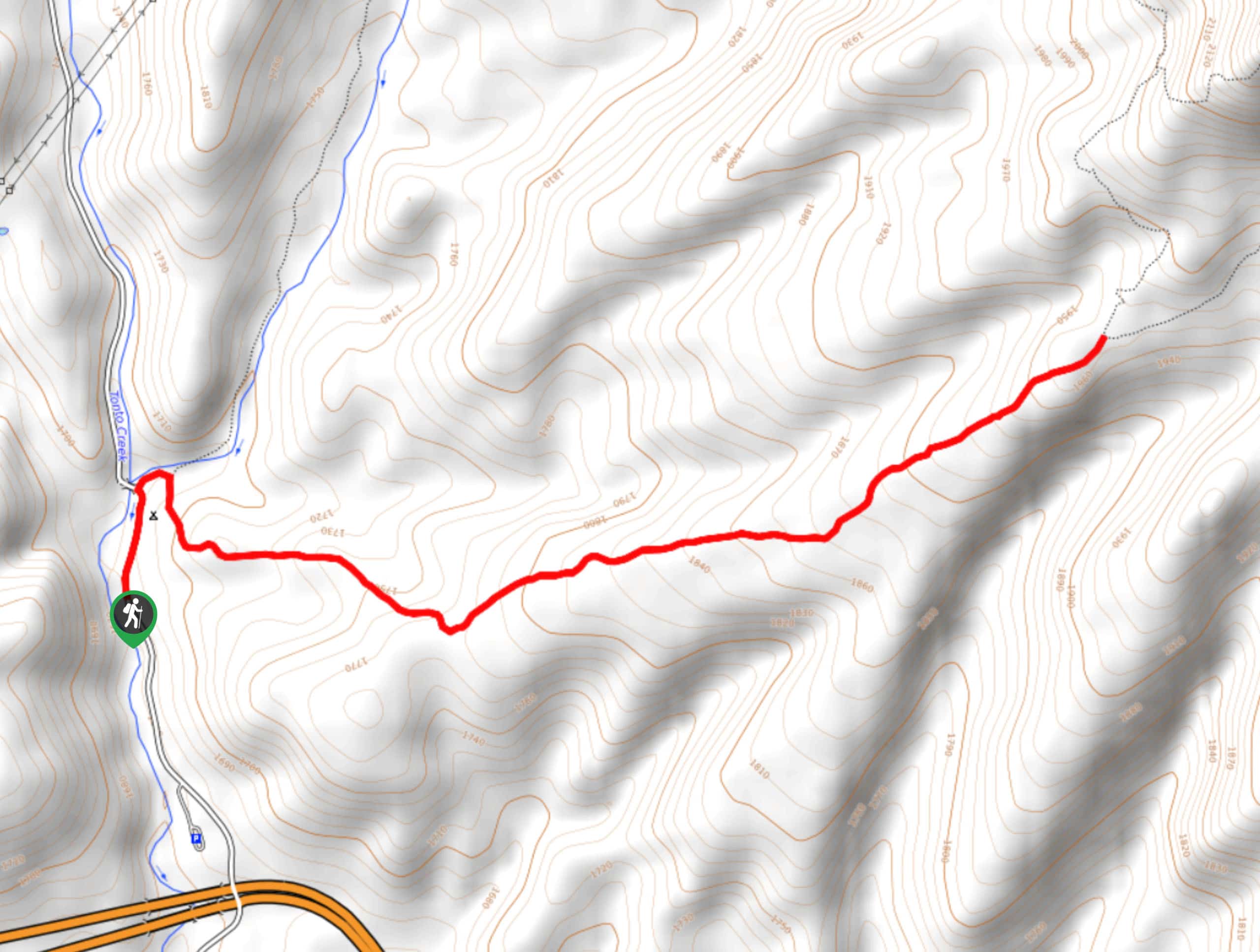
The Derrick Trail is a 5.7mi route near Payson that can be used on its own but is often used in addition to other routes for backpacking trips. This trail is nicely forested. While there aren’t any big, expansive views, you’ll enjoy the shade, the quiet of the trees, and the birds and wildlife that abound here. Expect moderate traffic on this hike.
Getting there
The trailhead for the Derrick Trail is on FR 289.
About
| Backcountry Campground | No |
| When to do | Year-round |
| Pets allowed | Yes - On Leash |
| Family friendly | Yes |
| Route Signage | Average |
| Crowd Levels | Moderate |
| Route Type | Out and back |
Derrick Trail
Elevation Graph
Weather
Derrick Trail Description
The Derrick Trail begins near Upper Tonto Creek Campground, making it a popular pick for backpackers on longer adventures. That being said, you can certainly enjoy this hike on its own as a shorter day hike. This trail is quite rocky, but it’s great if you like a good forest hike with lots of foliage. Birdwatchers will especially like this one.
If you intend to adventure beyond this route, we recommend bringing a GPS route or a map to help you find your way. Some of the trails in this area are harder to follow than others and cell reception can be spotty. Also, since this trail is so rocky, good boots are recommended.
From the trailhead, you’ll immediately head left to climb up a steep set of switchbacks. The trail soon evens out, although it never flattens. You’ll be climbing a consistent uphill grade until the end of the trail. See what birds you can spot, enjoy the peaceful forest, and keep on climbing to the trail’s end, which is at the junction with Highline Trail #31. From here, retrace your steps.
Similar hikes to the Derrick Trail hike
Jacob’s Crosscut Trail
Jacob’s Crosscut Trail is an important route in the network of trails in Lost Dutchman State Park. This route is…
Bronco Trail
The Bronco Trail is a 7.9mi out and back route used for hiking and horseback riding. This trail…
Pine Canyon Trail Loop
The Pine Canyon Trail Loop in Pine, Arizona is a quick 2.7mi loop that is rated as easy.…



Comments