Ben Nevis Mountain Path Walk
View Photos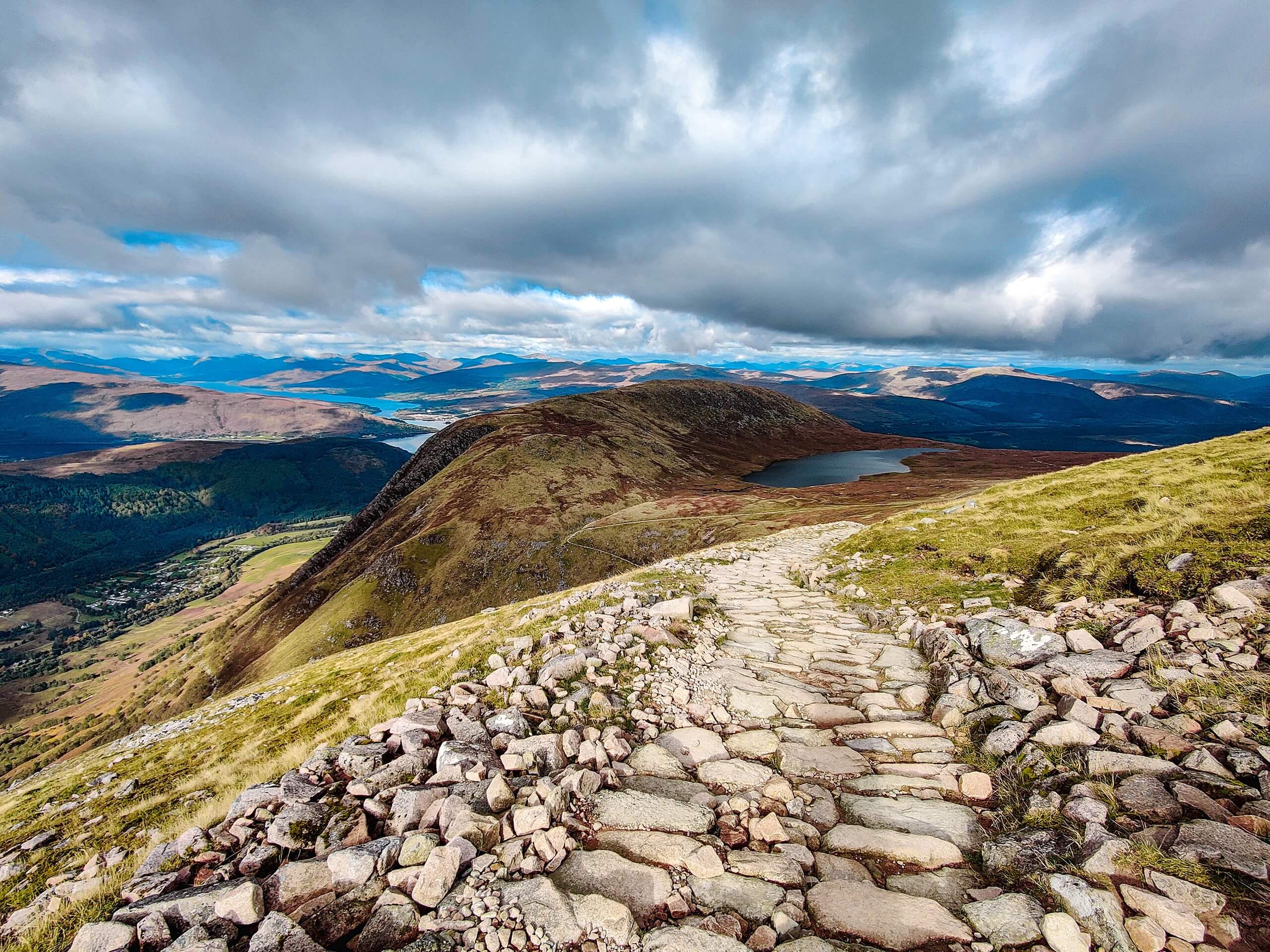
Ben Nevis Mountain Path Walk
Difficulty Rating:
Tackling Scotland’s Ben Nevis Mountain Path Walk is no easy feat! This adventure is best reserved for experienced hillwalkers, especially since snow usually cloaks the ground, adding yet another challenging component to overcome. However, after gaining a significant amount of elevation, nothing beats the feeling of standing atop the UK’s highest mountain with the views of the Highlands stretching into the horizon below. The route described below follows the most straightforward path to summit Ben Nevis!
If you're planning on bagging this Munro and are relatively new to hillwalking, we suggest avoiding this during the winter months when the route can get super technical. It can even hold snow during the summer. The bottom line: come prepared with the proper equipment for various weather conditions, even if you're walking in summer.
Getting there
To get to the Ben Nevis Mountain Path, head to Glen Nevis visitor centre park, where your walk begins! Do note that there may be a parking fee.

About
| Backcountry Campground | No |
| When to do | Year-round |
| Pets allowed | Yes - On Leash |
| Family friendly | No |
| Route Signage | Average |
| Crowd Levels | High |
| Route Type | Out and back |
Ben Nevis Mountain Path Walk
Elevation Graph
Weather
Ben Nevis Mountain Path Walk Description
Summiting the UK’s highest mountain isn’t a simple task! Completing the Ben Nevis Mountain Path Walk may be high on several adventurers’ bucket lists, but it should wait until you have a few other hillwalks under your belt, as this summit isn’t for the faint of heart. First of all, you’ll have to take on a steep path, which some fit folk may be thinking to themselves: “Ah yes, that’s no problem for me!” However, there are also some technicalities, such as rough terrain in the upper section, where snow tends to follow, eliminating any proof of path. Some tend to get lost and end up in dangerous sections. The likelihood of snow makes it essential to pack appropriate winter equipment. It can remain snowy late into the summer! It’s also advised to ignore the Ben Nevis Mountain Path Walk during the winter if you have limited snowy hillwalking experience.
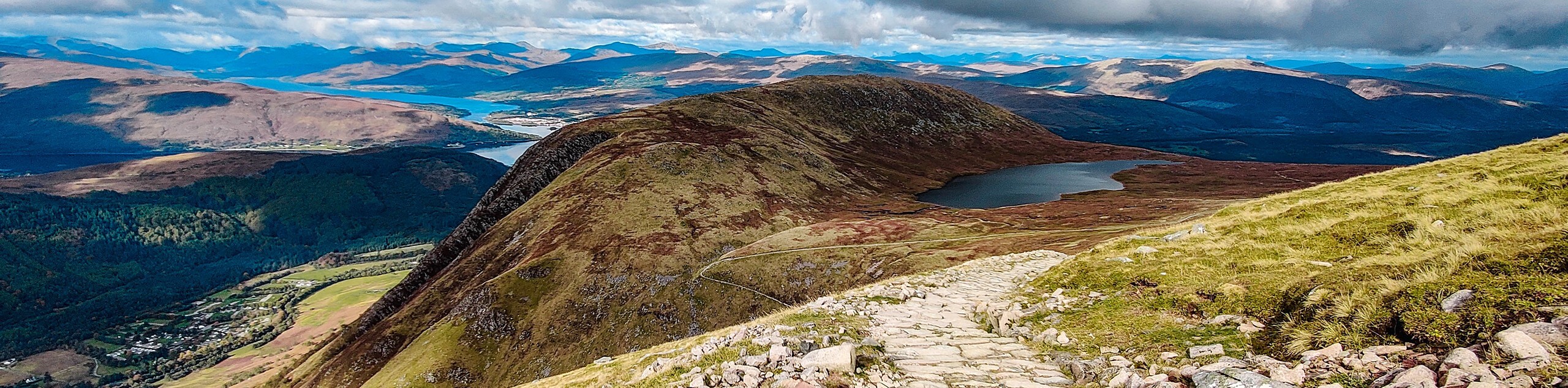
However, once you’re prepared and ready to take on this summit, the Ben Nevis Mountain Path Walk rewards like no other—revel in stunning views of the Highlands rolling into the horizon at the top. The high vantage point gives you the chance to see almost all of the Highlands. See streams, lochs, and valley views as you ascend!
From the Glen Nevis visitor centre park, be sure to read all the signs informing of the various precautions necessary for tackling the Ben Nevis Mountain Path. After soaking up the signs, head from the car park and cross the bridge stretching over River Nevis before taking an immediate right to follow the path fringing the river bank. Soon, a sign will emerge. Take a left here to follow a path that climbs between a fence and a wall. At the top, you’ll cross a stile to go along a track that eventually merges with another path. Take a right to veer up the wide track that travels across the hillside. And just after the plantation, you’ll meet up with the path that stretches from the Glen Nevis Youth Hostel. Those staying at the hostel can follow the path that leads directly to the main trail. There is limited parking at the hostel, which is why our route starts from the Glen Nevis visitor centre park. Continue following the main path, even as it doubles back, as it takes you to a more technical section that gains in elevation and takes you across rockier terrain. Pause to bask in the views of the Mamores with Stob Ban, another Munro worth bagging!
Continue walking along the path as it goes across some footbridges and tiny streams. Eventually, you’ll find yourself ascending above Red Burn, a lovely valley worth pausing to check out. Thankfully this walk grants many opportunities to break and catch your breath, thanks to the stunning views! Watch out, though, as the trail will soon take a sharp left. You may notice one path that looks loose and super technical—don’t take this one. The right path offers a more manageable climb towards Loch Meall an t-Suidhe—the exciting halfway mark! You won’t fully reach the loch, but you can still admire it as the path continues right.
After a moment of patting yourself on the back for making it half-way, brace yourself as the path continues to climb again! When you reach a junction, go left. Make sure you go left as the right-side path takes you under the mountain’s North Face. After heading left, walk for 1640ft before crossing the ever-flowing upper Red Burn stream. Appreciate the smooth-ish terrain at this point on your walk as it’s about to get tougher! Tackle zigzags as you climb through boulders and scree. As you gain in elevation, you’ll eventually reach the top of the Five Finger Gully. Several people have died here during the descent as they try to steer clear of the North Face but end up taking on too wide a turn, resulting in falling into the gully. Be super cautious here on both the ascent and descent.
However, the views are phenomenal here. Check out the scenery of the Glen and Càrn Dearg! Expect the path to level a bit as you reach the start of the summit’s plateau, granting you the chance to breathe and enjoy the scenery. Beware, though! Standing atop the Gardyloo gully may kindle some vertigo, but it’s beautiful nonetheless. You’ll notice memorials and cairns across the summit area. The best part, though, is the view of the Highlands. And if there’s no snow at the top, you can safely approach the north side and peer down the massive cliffs. Please do not approach this if you feel unsafe, shaky, or if there’s snow on the ground. The snow could deceive you into thinking it’s on land when it’s hanging over the mountain, and it could collapse if you step on it.
The Ben Nevis Mountain Path Walk is an out-and-back route, meaning you’ll retrace your steps to go back to the parking lot. Be sure to take extra precautions as you pass the Gardyloo Gully and Five Finger Gully. Be sure to reward yourself with something when you reach the bottom!
Trail highlights
Ben Nevis
Boasting the title as the highest mountain in the UK, Ben Nevis is a Munro worth bagging. Over 125,000 walkers tackle Ben Nevis yearly! Nowadays, Ben Nevis may be a popular hillwalking attraction, but if we rewind the tape, you’ll discover that Ben Nevis used to be an active volcano that exploded and collapsed on itself. If you see lightly brushed granite, you’ll know that’s evidence of this explosion!
In ancient Gaelic, one translation of Ben Nevis means “mountain with its head in the clouds.”
Frequently Asked Questions
Can I bring my dog on the Ben Nevis Mountain Path
While it’s allowed, we recommend leaving your pup at home as the terrain can be rough on their paws, and the technical descent, especially around Gardyloo Gully and Five Finger Gully, may not be safe with a dog. You’ll also need to keep your pup on a lead!
Can you climb Ben Nevis as a beginner?
New hillwalkers can climb Ben Nevis, but the technical terrain mixed with the steep elevation gain can be a lethal mix, especially when you consider the descent.
Do you need to train before climbing Ben Nevis?
While it’s recommended to have hillwalking experience before taking on the Ben Nevis Mountain Path, there’s no need to put in extra training hours to reach the summit. Most fit walkers can complete the route in around 8 hours. You’ll probably enjoy the adventure more if you’ve completed some hillwalks recently!
Insider Hints
While dogs are allowed on the trail, we suggest leaving them at home due to the technicalities of the route.
Only experienced winter hillwalkers should attack this route in snowy conditions.
Be sure to check the weather before as there can be snow at the top during the summer months, making it essential to pack along snow-friendly equipment.
There are public toilets at the Glen Nevis visitor centre park.
Public transport to reach this hike is available between May and September.
Similar hikes to the Ben Nevis Mountain Path Walk hike
The Saddle, Forcan Ridge and Sgùrr na Sgìne Walk
The Saddle, Forcan Ridge and Sgùrr na Sgìne Walk is a rugged adventure that boasts a thrilling challenge while unveiling…
Stob Ghabhar and Stob a'Choire Odhair Walk
Confident and experienced hillwalkers should only attempt the Stob Ghabhar and Stob a'Choire Odhair Walk due to the elevation gain,…
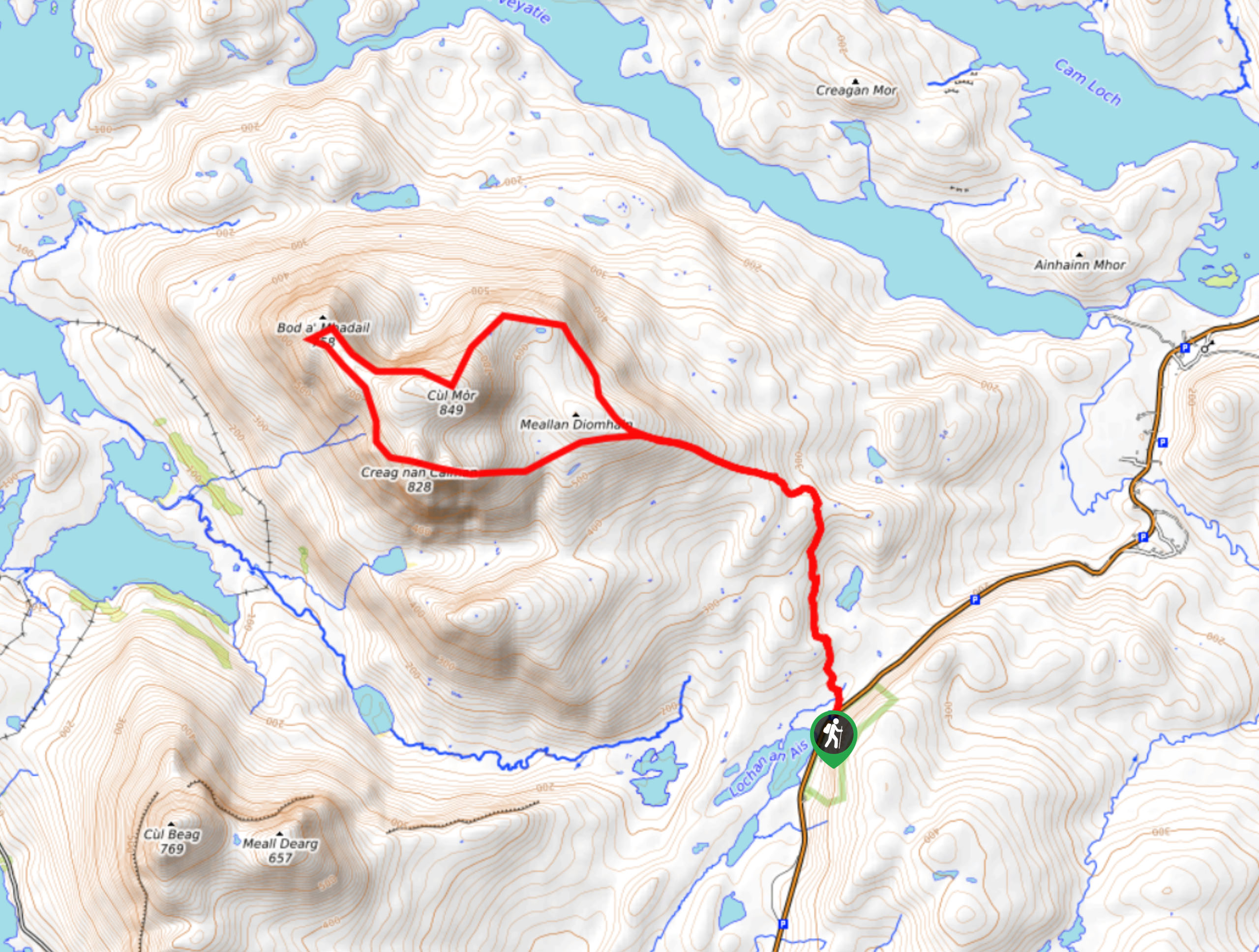
Cul Mor Walk
The Cul Mor Walk has you climbing a mostly easy-to-follow path leading up a Corbett, a mountain just not big…
Comments