Tre Cime di Lavaredo Hike
View Photos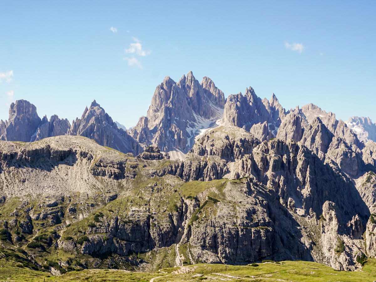
Tre Cime di Lavaredo Hike
Difficulty Rating:
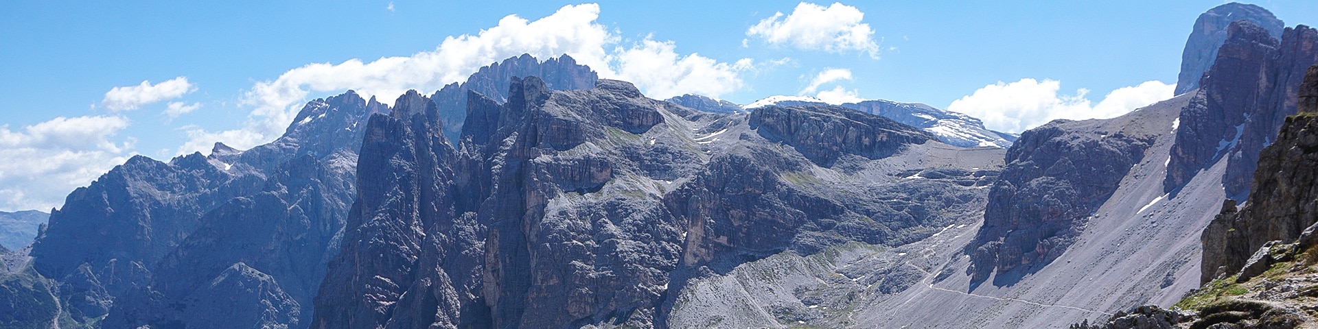
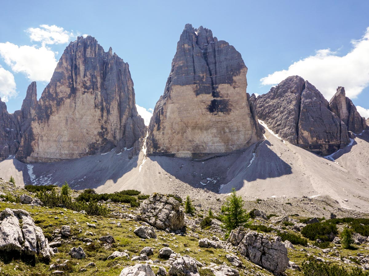
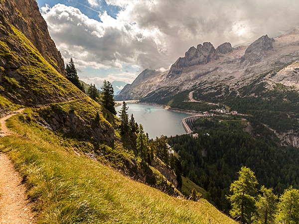
The Tre Cime di Lavaredo Circuit (also known as the Drei Zinnen) is a must-do trail for hikers in the Dolomites. Tre Cime is one of the best-known massifs in the Dolomites, and this walk gives stunning and varied views. Along the way, you will pass by Rifugio Auronzo, Rifugio Lavaredo and Rifugio Locatelli. You’ll enjoy great views and great food!
Getting there
To get to the Tre Cime di Lavaredo trailhead, head towards Misurina, which is east of Cortina d’Ampezzo on the SR 48. Pass the town and Lago di Sisurina and take a road heading off on the right. Part-way up you’ll pass through a toll-booth, where you’ll need to pay a fee, the money going to the local town. Continue to the top and you’ll be directed to one of the many parking lots.

About
| When to do | May to September |
| Backcountry Campsites | No |
| Toilets | No |
| Family friendly | No |
| Route Signage | Average |
| Crowd Levels | Moderate |
| Route Type | Circuit |
Tre Cime di Lavaredo Hike
Elevation Graph
Weather
Tre Cime di Lavaredo Route Description
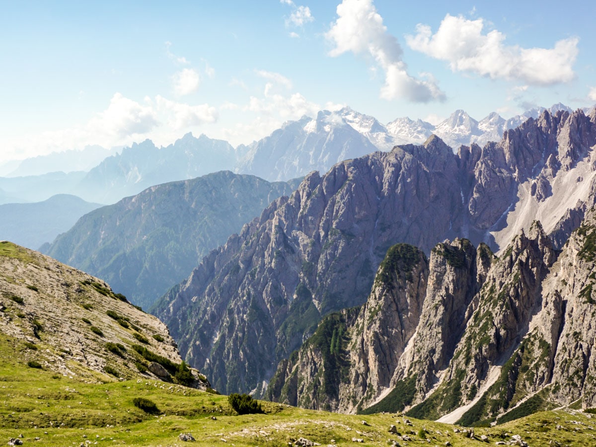
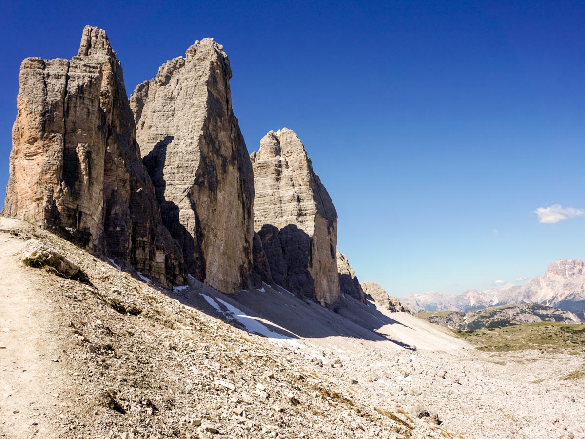
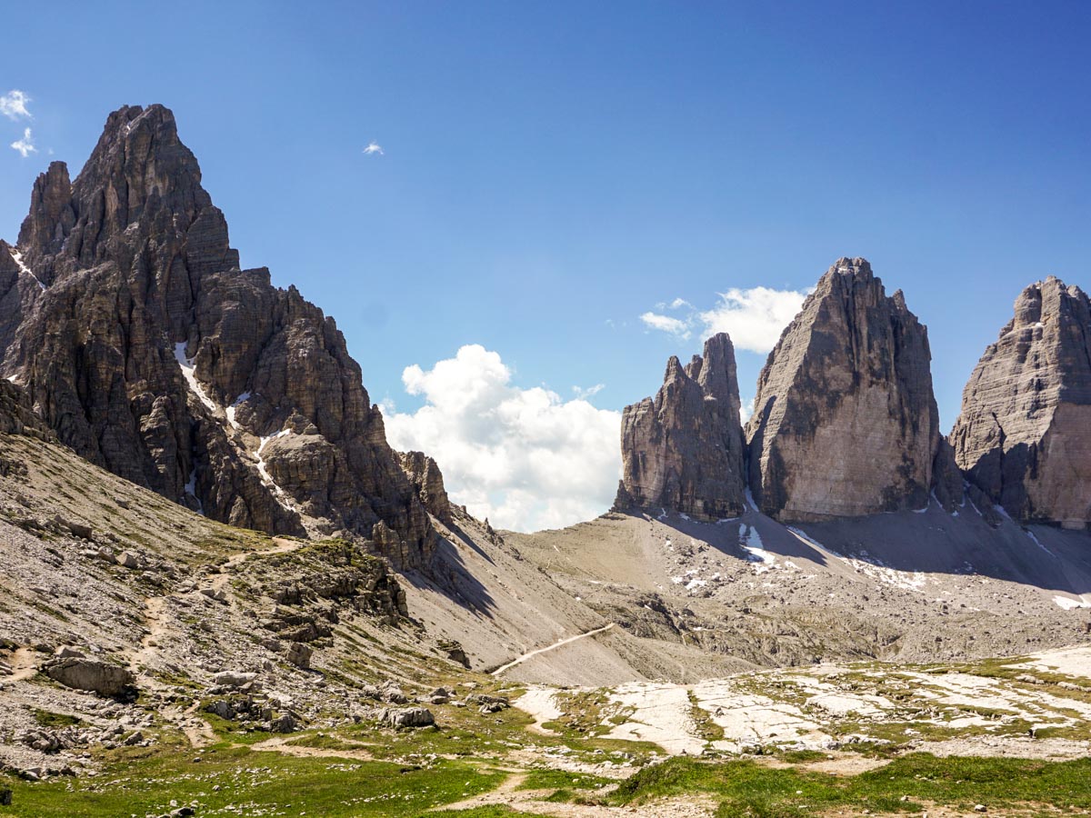
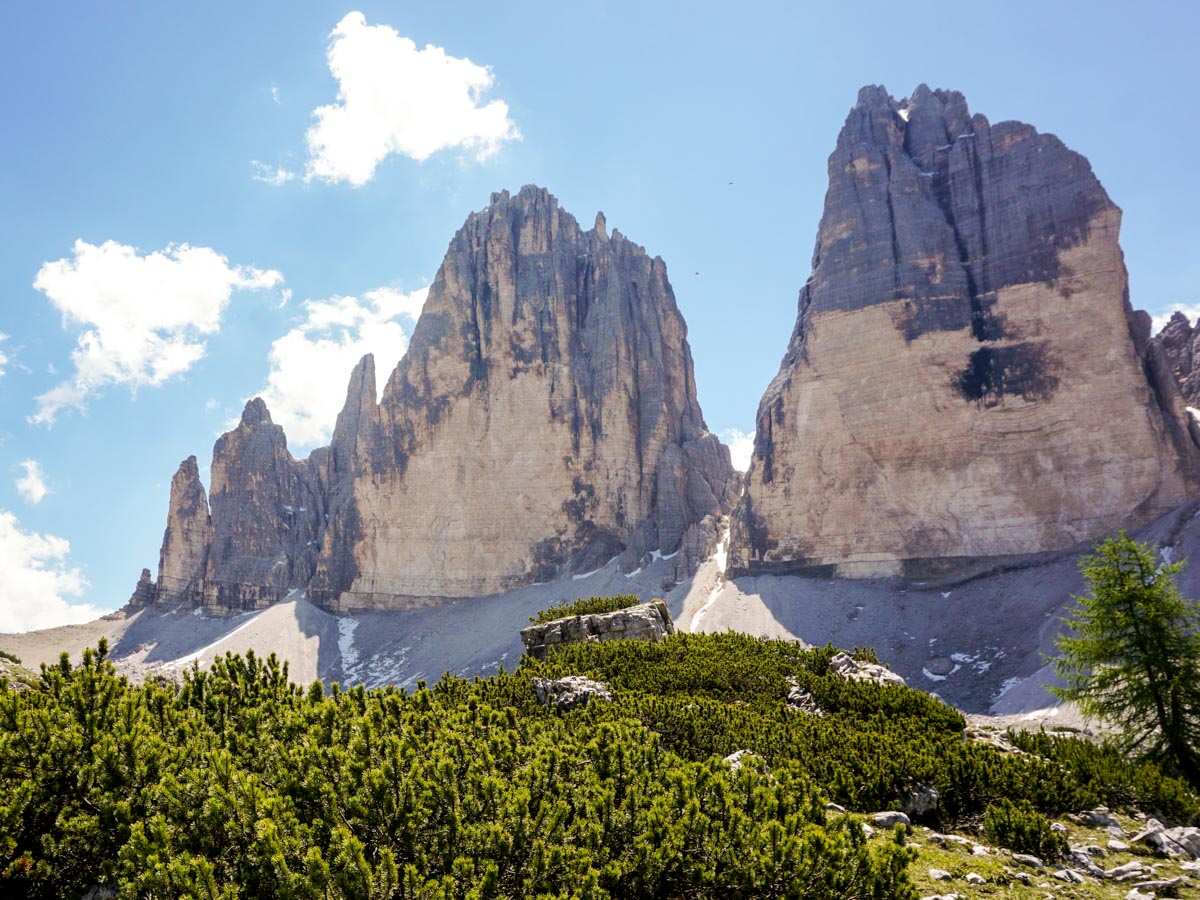
To start the Tre Cime di Lavaredo Circuit, head away from the parking lots towards Rifugio Auronzo pass around the rifugio and take the 4×4 path that leads counter-clockwise around Tre Cime di Lavaredo mountains. The three mountain spires will tower over you. The views to your right are incredible.
You’ll continue on the wide path for 1.2mi, before arriving at Rifugio Lavaredo. There is a clear path going up to the saddle on the left: take this if you want to walk below the cliffs.
Alternatively, you can follow the 4×4 track that goes past the rifugio and ascends to the saddle from the right. Both paths meet at the saddle, so the choice is yours. Part way up the trail to the saddle you’ll pass a large, crumbling stone wall, which is likely to date from World War I, when Tre Cime di Lavaredo was an important strategic battleground. After passing this wall take the left-hand path up to the Saddle.
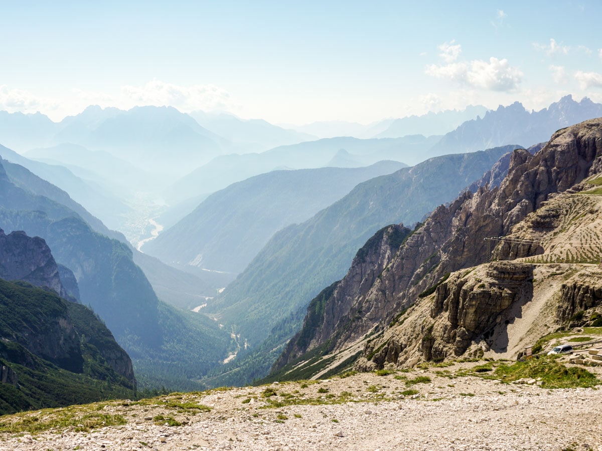
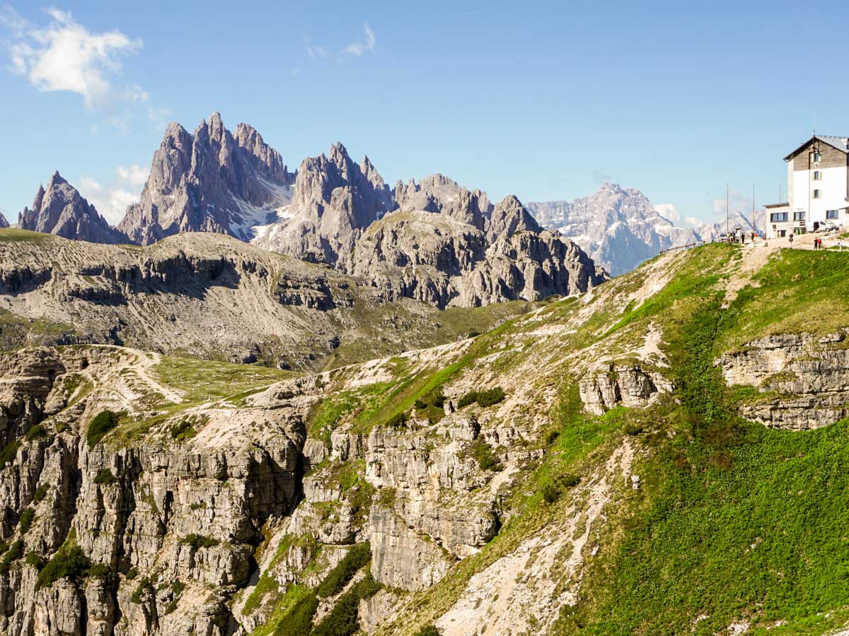
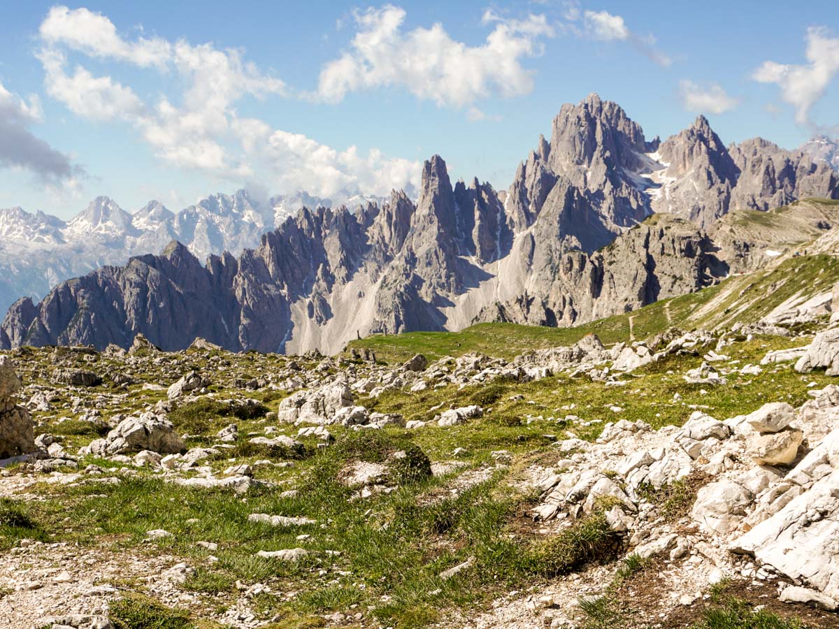
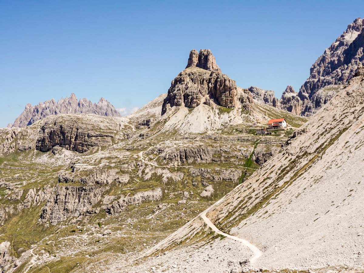
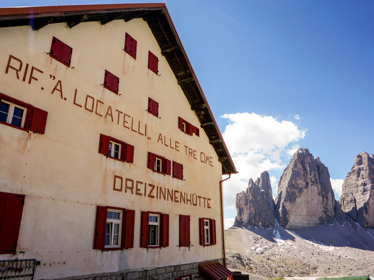
Enjoy the views at the Saddle, also known as Forcella Lavarado. Look down the next valley, to the right, and you’ll see a red-roofed rifugio. This is Rifugio Locatelli (also known as Dreizinnenhutte), and your next destination. Stay on the broad, lower route and ignore the narrow, higher routes to the rifugio.
Partway down the trail, the path splits. Take the right-hand path until you reach Rifugio Locatelli, which happens to be at a stunning location, with views in all directions!
After a nice break, it’s time to complete the Tre Cime di Lavaredo circuit and return to your car. Route 105 is signed to Rifugio Auronzo and they say it clocks in at 90 minutes. To proceed you need to head back down the route you came up for a short while and then take the path going down to your right. You can see another junction just below you. To continue the Tre Cime di Laveredo hike, cross this path and continue downhill on path 105 to Rifugio Auronzo, signed at 80 minutes away. Within a couple of minutes, go left at the signed junction, staying on route 105.
As you descend, stop to look around. The mountains are dotted with openings to tunnels from WWI. As you descend, a faint path goes off on your right to the other side of the valley: Ignore this path and continue ahead.
You’ll come to a small plateau where the path splits: go right and continue downhill. You’ll arrive at a small meadow before beginning your ascent to Forcella Col.
As you walk through some low brush, take in the fine views as you head towards a hut. Past the Langalm Hut (Malga Langalm) – which is a great place to sit and take in the views – the path goes to the left, and soon a sign points you to Rifugio Auronzo which is 40m away, over the Col.
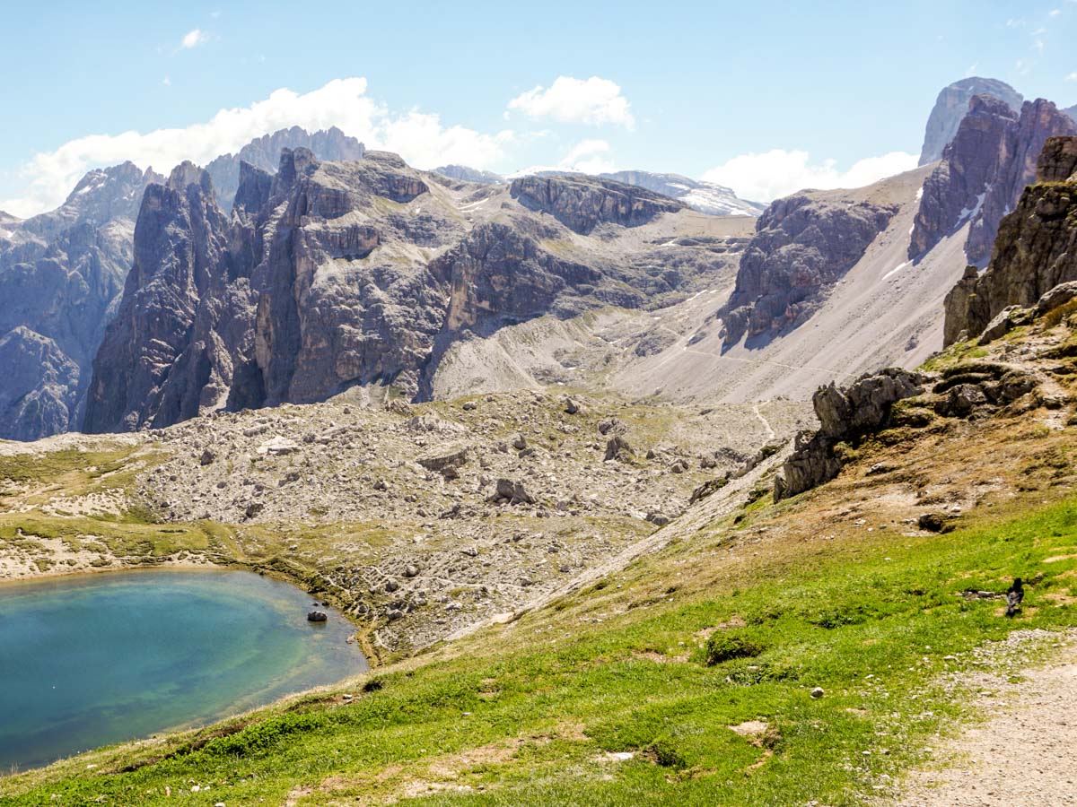
You’ll notice some stunning, small lakes on your left; these lakes offer beautiful places for photos.
Continue uphill to the Col, using the path heading to the right (there are some amazing views here). The final push to the Col is on a somewhat narrower scree slope, leading you to the final destination on the Tre Cime di Laveredo hike.
From the Col, a sign points down to the right on route 105 to Rifugio Auronzo and lists it at twenty minutes away. Once at Auronzo, you can find your way back to your car.
Hiking Tre Cime in 2024
Those looking to hike the iconic Tre Cime should be aware that the toll to access the parking lot in 2024 is quite hefty – it’s 30 EUR per vehicle. If you are not willing to pay such price, there are three alternatives:
- Walking Up: You can park your car before the toll booth and hike up to Rifugio Auronzo. This route is steep and winding, taking about 90 minutes to walk. This option is free but requires a good level of fitness and additional time.
- Public Transport: During the summer months of 2024, when the paths and lodges are going to be open, a public bus line will connect Cortina d’Ampezzo and Misurina to Rifugio Auronzo. Using the bus avoids the toll, but be sure to check the bus schedule and availability, especially outside the peak summer season.
- Hitchhiking: During the summer, it’s not uncommon to see hikers hitchhiking their way up to the starting point of the hike. This is more of an impromptu solution and depends on finding a willing driver.
Hiking Trail Highlights
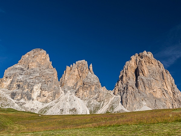
Tre Cime di Lavaredo
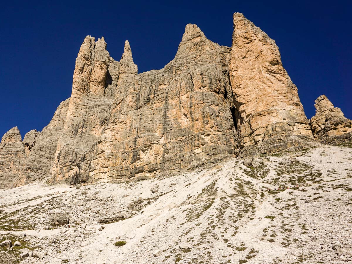
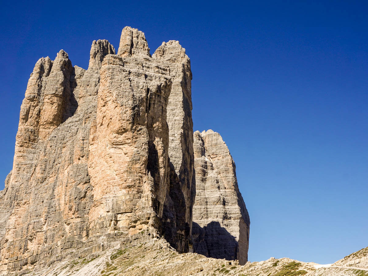
The three iconic towers of the Tre Cime di Lavaredo form the destination for one of the most popular hikes in the Dolomites. Set against a lush alpine backdrop with craggy peaks and glassy lakes, these three towers rise out of the ground like a cathedral of stone, creating plenty of opportunities for some spectacular photos.
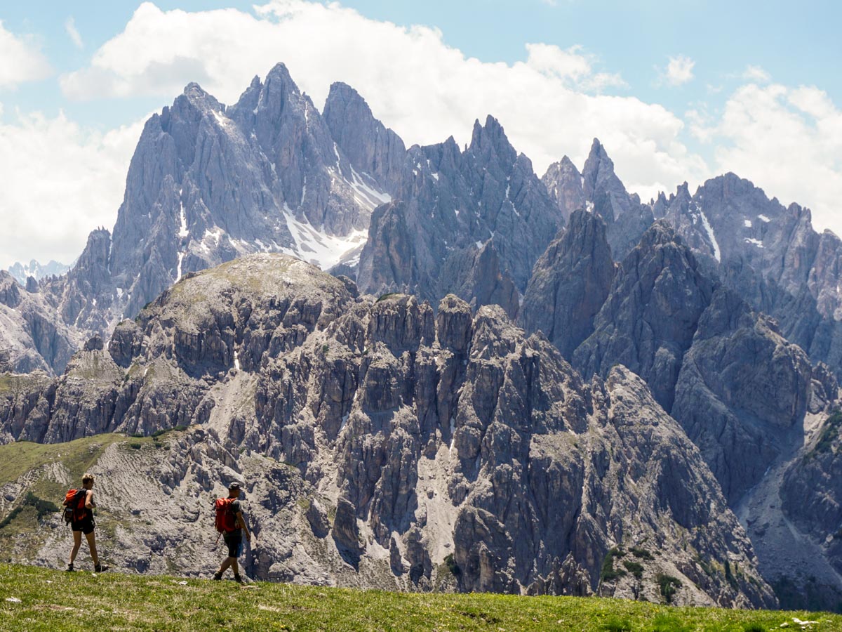
The views from the Tre Cime di Lavaredo circuit are some of the best in the Dolomites, with picturesque churches perched on rocky outcrops, beautiful alpine lakes, and dramatic peaks and ridges. It’s no wonder that this stunning corner of the Dolomites keeps travellers and hikers coming back again and again.
This region is also steeped in history, as it was once an important strategic site on the front line between Austria and Italy during World War One. The war left many scars on the surrounding landscape, including walls, fortifications, tunnels and trenches, many of which can be spotted during a hiking trip in the Dolomites. The area around Rifugio Locatelli is particularly well known for its trenches, which can be explored as part of the Tre Cime di Lavaredo circuit.
Insider Hints
The rifugios on this route get very busy, so consider bringing your own food.
Many people only do the first part of this walk, so that section can be incredibly busy.
Consider staying in one of the Rifugios if you don’t want to do the entire walk at once. The views at sunrise and sunset can be magical.

Similar hikes to the Tre Cime di Lavaredo Hike hike
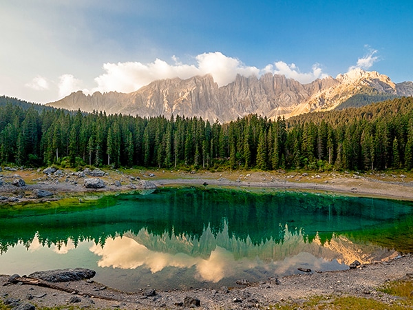
Lago di Carezza
The Lago di Carezza hike (also known as Karersee) should be on everybody’s bucket list for the Dolomites. The beautiful…
Viel del Pan Marmolada
The Viel del Pan hike treks over a historic path used by the flour and bread merchants to get from…
Sassopiatto and Sassolungo
The circumnavigation around Sassopiato and Sassolungo is a great hike in the Dolomites. If you can handle a longer walk…
Antoanette Lavroutte 4 years ago
Seriously, am I the only one who thinks the view of this hike are like paintings come to life?
TutiDulce 4 years ago
Natural beauty, a lovely place suitable for those who love nature
Gilberto Fattore 4 years ago
Huge mountain landscape and then an amazing view of the three mountain spires
Julian Chiras 5 years ago
What's the best spot for getting some nice photos during sunset? Anyone know please?
Richard Campbell 5 years ago
Hi Julian, the views are spectacular everywhere along the Tre Cime di Lavaredo walk. You can get easy pictures on the hike from Rifugio Auronzo to Rifugio Lavaredo.
Scott P. 5 years ago
The glassy lakes looks incredible. I enjoyed it a lot.
Laura K. 5 years ago
This hike is not only beautiful.. I was happy to hear that this also served as a strategic battleground in the past.
Filip l. 5 years ago
Places like this need to be cherished. Take things slow and enjoy the wonderful views of the Dolomites.
Saanvi Jt 5 years ago
Fantastic views of nearby mountain peaks, and the other side you can see Tre Cime. Just beautiful!
Jacob M. 5 years ago
This hike got some interesting geography. I can't help admiring the varied terrains and changes in scenery. Just fantastic.