Relief Reservoir Trail
View Photos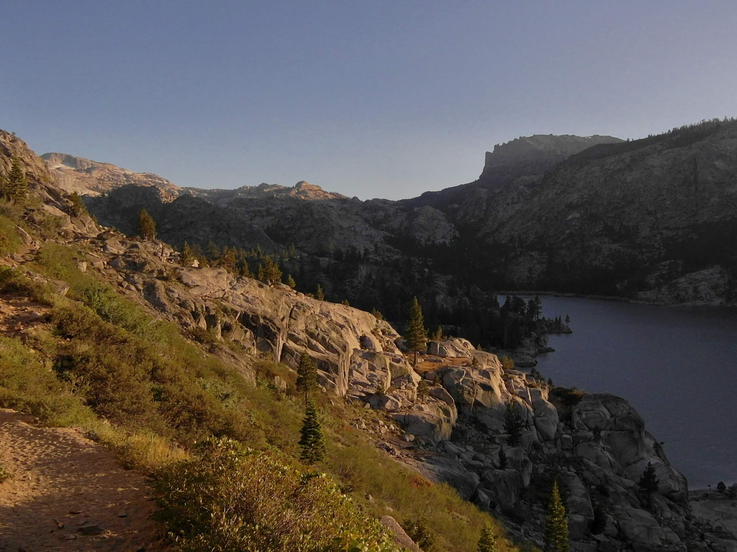
Relief Reservoir Trail
Difficulty Rating:
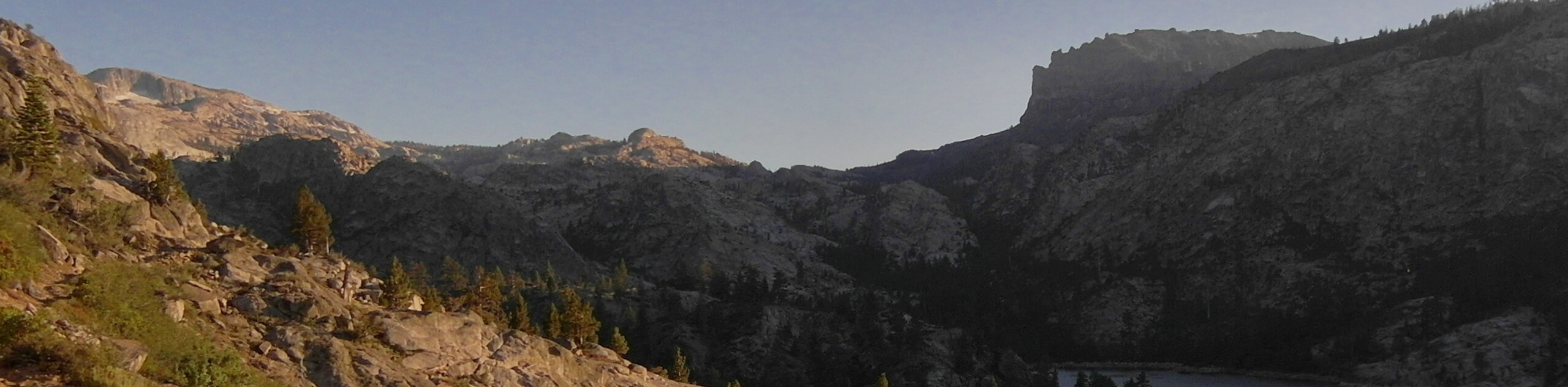
The Relief Reservoir Trail is one of the most scenic adventures in the Stanislaus National Park—we’re serious. This epic excursion boasts waterfalls, natural pools, wildflower meadows, granite valleys, and footbridges all before opening to the reservoir and dam. You’ve got to see this!
Getting there
The Relief Reservoir Trail is accessed via the trailhead in Kennedy Meadows Resort off the Sonora Pass Highway.

About
| Backcountry Campground | Backcountry Camping,wilderness permit required. |
| When to do | March-October |
| Pets allowed | Yes - On Leash |
| Family friendly | Older Children only |
| Route Signage | Average |
| Crowd Levels | Moderate |
| Route Type | Out and back |
Relief Reservoir Trail
Elevation Graph
Weather
Relief Reservoir Trail Description
The Relief Reservoir Trail is an awesome adventure that exhibits the natural beauty of the area. Wander this scenic path through the granite valley before culminating at the shimmering, picture-perfect reservoir—what more could you ask for? Make sure you wear sun protection as much of this path is exposed! Additionally, as this is a popular route, we suggest heading out in the morning for a more tranquil experience.
Departing from the trailhead, you will be guided south along the Relief Reservoir Trail. The initial segment of the trail is quite flat before climbing more intensely into the granite-bound valley. As you hike, admire the meadow abundant with wildflowers just prior to intersecting with the Middle Fork Stanislaus River. Enjoy the sights from the footbridge, then continue trekking to an overlook of a cascade. From here, you will be led over yet another footbridge where the path will merge onto the Huckleberry Trail.
Follow the Huckleberry Trail all the way to Relief Reservoir. You will be granted an amazing view of the shimmering waters and bounding bluffs from the shoreline cliff. Revel in the scenery, and when you are ready, retrace your footing along the path back to the trailhead.
Similar hikes to the Relief Reservoir Trail hike

Folger Peak Hike
The Folger Peak Hike is an awesome adventure that boasts 360-degree, panoramic vistas of the high country. This wonderful adventure…

Long Gulch Ridge Loop
Adventure the Long Gulch Ridge Loop for an exciting, scenic experience in the Stanislaus National Forest. This shared route travels…

Eagle Meadow Hike
Hiking the Eagle Meadow Trail makes for a unique experience. Hike amongst equestrians through the expansive meadowlands along Eagle Creek…
Comments