Hyatt Lake Trail
View Photos
Hyatt Lake Trail
Difficulty Rating:
The Hyatt Lake Hike is an epic off-trail adventure in the Stanislaus National Forest. The unique granite topography and expansive alpine views offer an unparalleled experience. If you seek an exciting excursion through the high country, then you have come to the right place.
Getting there
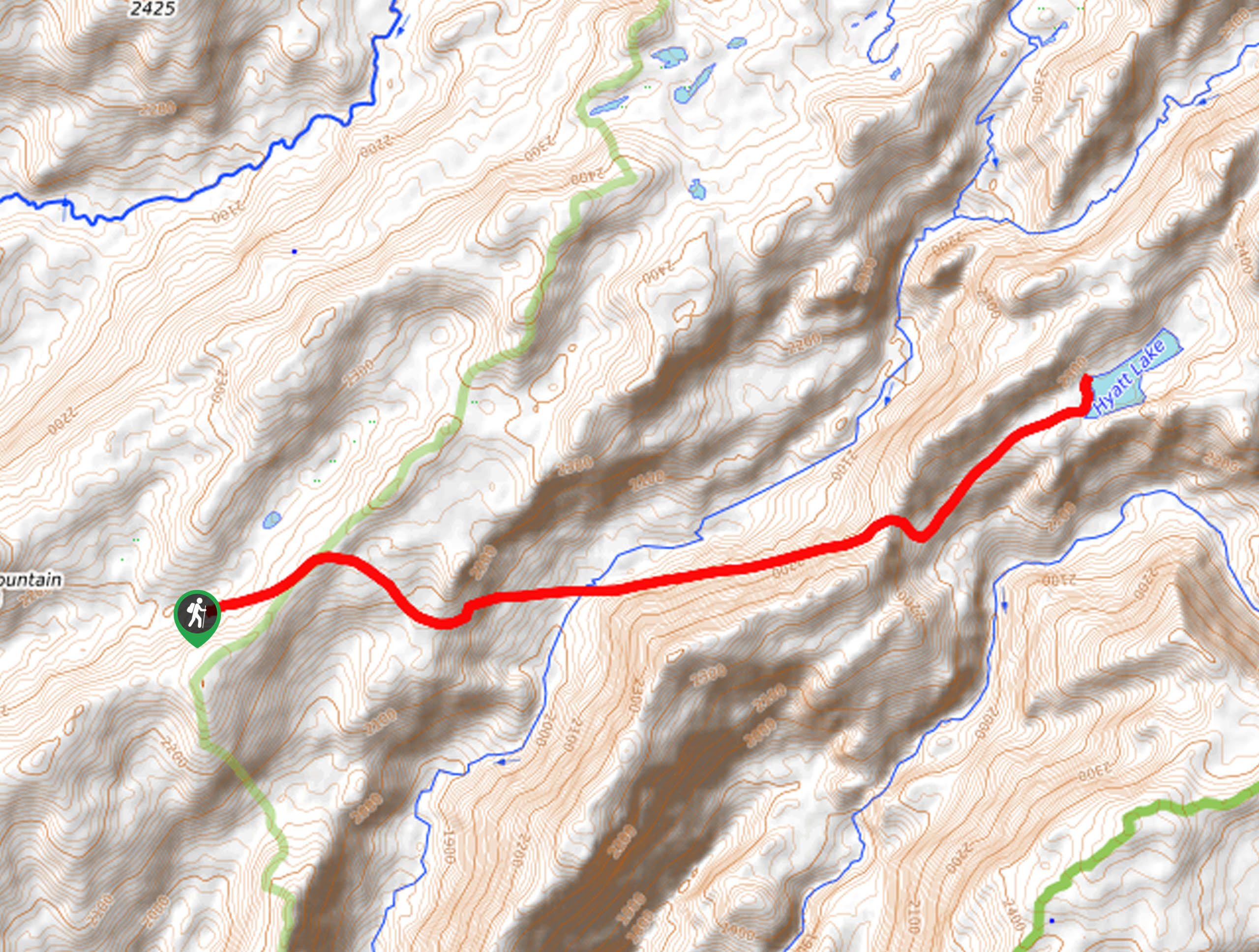
The Hyatt Lake Hike departs from the Bourland Meadow Trailhead off Forest Route 3N16.

About
| Backcountry Campground | Backcountry Camping, wilderness permit required. |
| When to do | May-September |
| Pets allowed | Yes |
| Family friendly | No |
| Route Signage | None |
| Crowd Levels | Moderate |
| Route Type | Out and back |
Hyatt Lake Trail
Elevation Graph
Weather
Hyatt Lake Trail Description
Put your navigational proficiency to the test when trekking the Hyatt Lake Hike. Explore the Emigrant Wilderness and revel in the particularity of the granite basin filled with crystal clear, blue-hued waters. This is perhaps one of the most picturesque hikes in the Stanislaus National Forest, though technical and taxing. As most hike travels through the untouched backcountry, you will need the trail GPS to guide you to the lake. Additionally, the exposed terrain at such high elevation warrants extreme weather conditions, so check the forecast and dress in layers. It is also important to be mindful of rattlesnakes, cougars and bears as you travel into the wilderness.
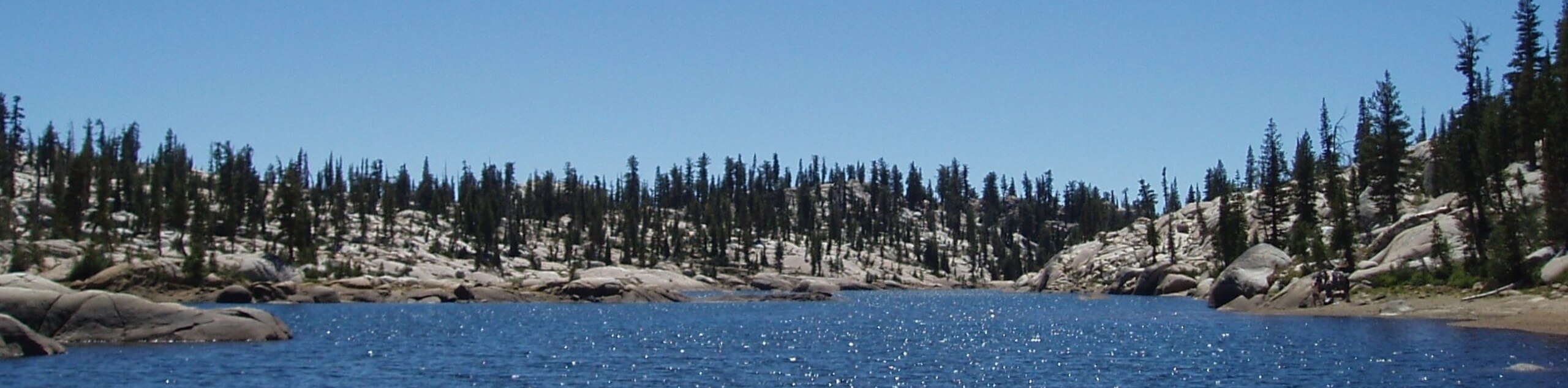
The Hyatt Lake Trail is a high-effort, high-reward type of adventure in the High Sierra. Exhibiting the diversity and grandeur of California’s topographies, this route travels through meadowlands and woodlands before opening to a granite oasis—decorated with a shimmering alpine lake. Reserved for intrepid explorers and adventurous spirits, this hike is no walk in the park. Though some may deem the primitiveness as a bother, we don’t mind bushwhacking and off-roading, especially because the route boasts such awe-inspiring panoramas. If you head out in the summer months, a dip in the alpine pool is an awesome post-hike reward.
Once your shoes are laced, and your trail GPS is downloaded, you are all set for your hike. Setting out from the Bourland Meadows trailhead, the Hyatt Lake Trail travels eastwardly through the forestlands. The initial segment of the route is the most easy-going, so enjoy it while you can. With the help of the trail GPS, the path will eventually drop down over a ridge to Cherry Creek. Here you may have to navigate a few fallen trees before climbing out of the valley. As you ascend the canyon wall, the tree coverage will become more sparse. This section of the route requires careful footing as you hike up the vertiginous path cloaked with alder, manzanita, and aspen thickets.
Soon you will summit Cherry Ridge, which exposes the granite oasis. Hiking northeast, the path will dramatically drop into the granite canyon. Here is where the most technical section of the trek begins. Using the GPS and the rock cairns to guide your way, you will maintain northeast, ascending the granite terrain, marked by a chute of cascading waters on your right. Navigating the uneven, rocky landscape, you will eventually summit the ridge to Hyatt Lake. Once the lake comes into view, you will be overwhelmed by the postcard-perfect scene—marvel at the beauty of the smooth granite boulders that stretch for miles, bounding the shimmering waters. Rejuvenate your tired feet in the chilly lake as you admire the beauty. To get back to the trailhead, simply go back the way you came.
Frequently Asked Questions
Where is the Hyatt Lake Trailhead?
The Hyatt Lake Hike is accessed via the Bourland Meadow Trailhead off Forest Route 3N16.
Is the Hyatt Lake Hike hard?
Yes, the Hyatt Lake Trail is a challenging adventure that demands stamina and navigation.
Insider Hints
There is no signposted route to Hyatt Lake, so use the trail GPS
Be prepared for inclement weather
Exercise caution on the rocky terrain, as the granite is slippery when wet
Wear sun protection to avoid overexposure
Be mindful of rattlesnakes bathing on the granite
Similar hikes to the Hyatt Lake Trail hike

Folger Peak Hike
The Folger Peak Hike is an awesome adventure that boasts 360-degree, panoramic vistas of the high country. This wonderful adventure…
Pinecrest Lake and Pinecrest Peak Loop
The alpine terrain is just waiting to be explored, and the Pinecrest Lake and Pinecrest Peak Loop is a great…
Y Meadow Lake Trail
Why hike the Y Meadow Lake Trail? Well, the Y Meadow Lake Trail is an incredible adventure through the Stanislaus…
Comments