
Columbia Ditch Trail
View Photos
Columbia Ditch Trail
Difficulty Rating:
The Columbia Ditch Trail is an enchanting adventure through the woodlands and along the canal, boasting a relaxing experience. Easy-going and accessible, the whole family can enjoy this wonderful trail.
Getting there
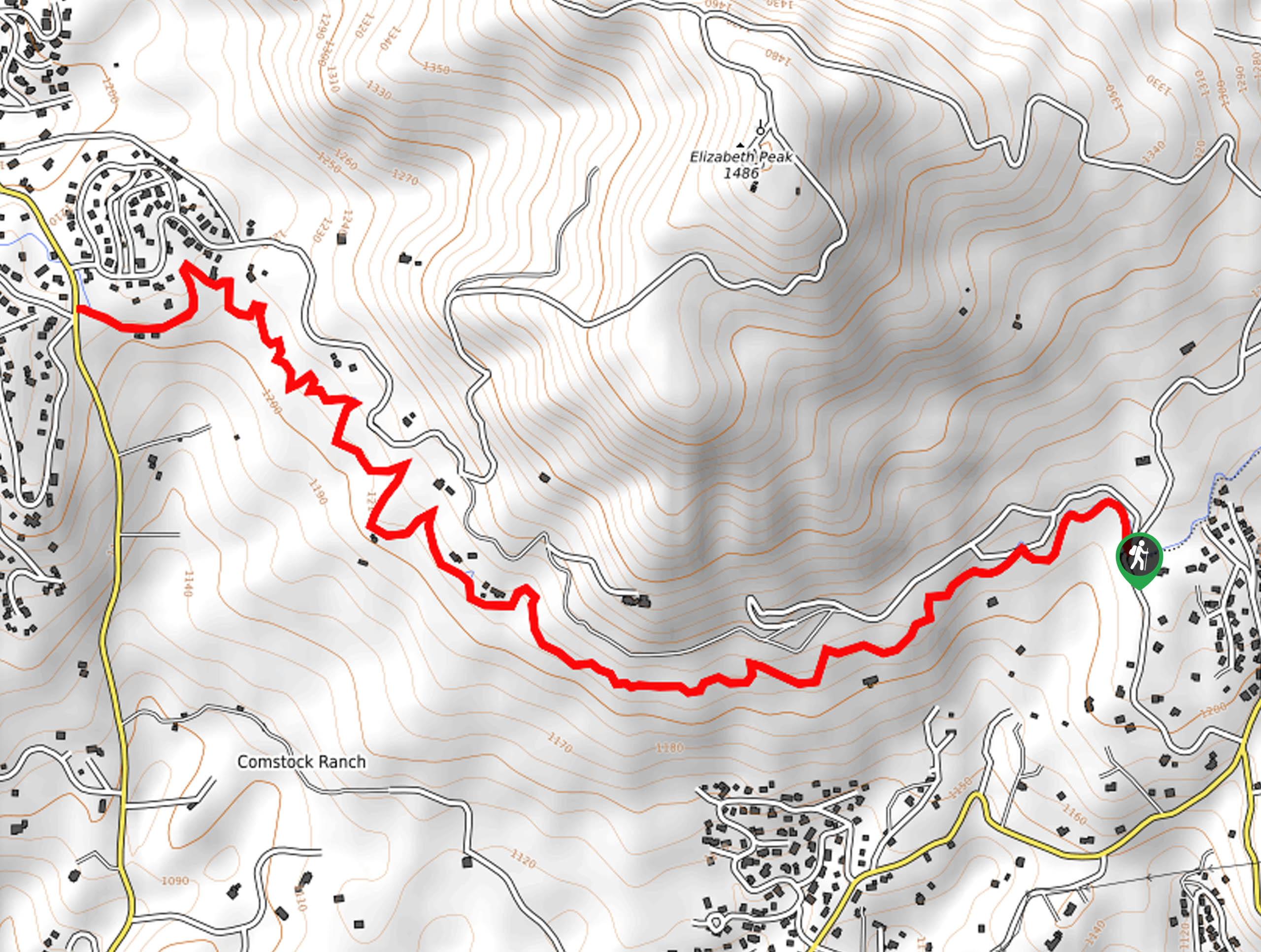
Access to the trailhead is found off Mount Elizabeth Road.

About
| Backcountry Campground | No |
| When to do | Year-round |
| Pets allowed | Yes - On Leash |
| Family friendly | Yes |
| Route Signage | Average |
| Crowd Levels | Low |
| Route Type | Out and back |
Columbia Ditch Trail
Elevation Graph
Weather
Columbia Ditch Trail Description
Disconnect from the real world and reconnect with nature along the Columbia Ditch Hike. This peaceful adventure travels through private property, hugging the shoreline of the canal the entirety of the way.
As this route is located on private property, it is important to respect the rules and regulations at the trailhead.
Setting out from the trailhead, follow the Main Tuolumne Ditch Trail west. This mildly undulating path will guide you beneath the shade of the towering red firs and mixed conifers. Enjoy the scene of the rushing waters through the canal and let the sounds lull you into a state of relaxation. Soon the path will redirect you northwest, ultimately delivering you to the intersection with Kewin Mill Road.
From here, turnaround and retrace your footing back along the route to the trailhead.
Similar hikes to the Columbia Ditch Trail hike

Folger Peak Hike
The Folger Peak Hike is an awesome adventure that boasts 360-degree, panoramic vistas of the high country. This wonderful adventure…

Long Gulch Ridge Loop
Adventure the Long Gulch Ridge Loop for an exciting, scenic experience in the Stanislaus National Forest. This shared route travels…

Eagle Meadow Hike
Hiking the Eagle Meadow Trail makes for a unique experience. Hike amongst equestrians through the expansive meadowlands along Eagle Creek…
Comments