The Highdown Walk
View Photos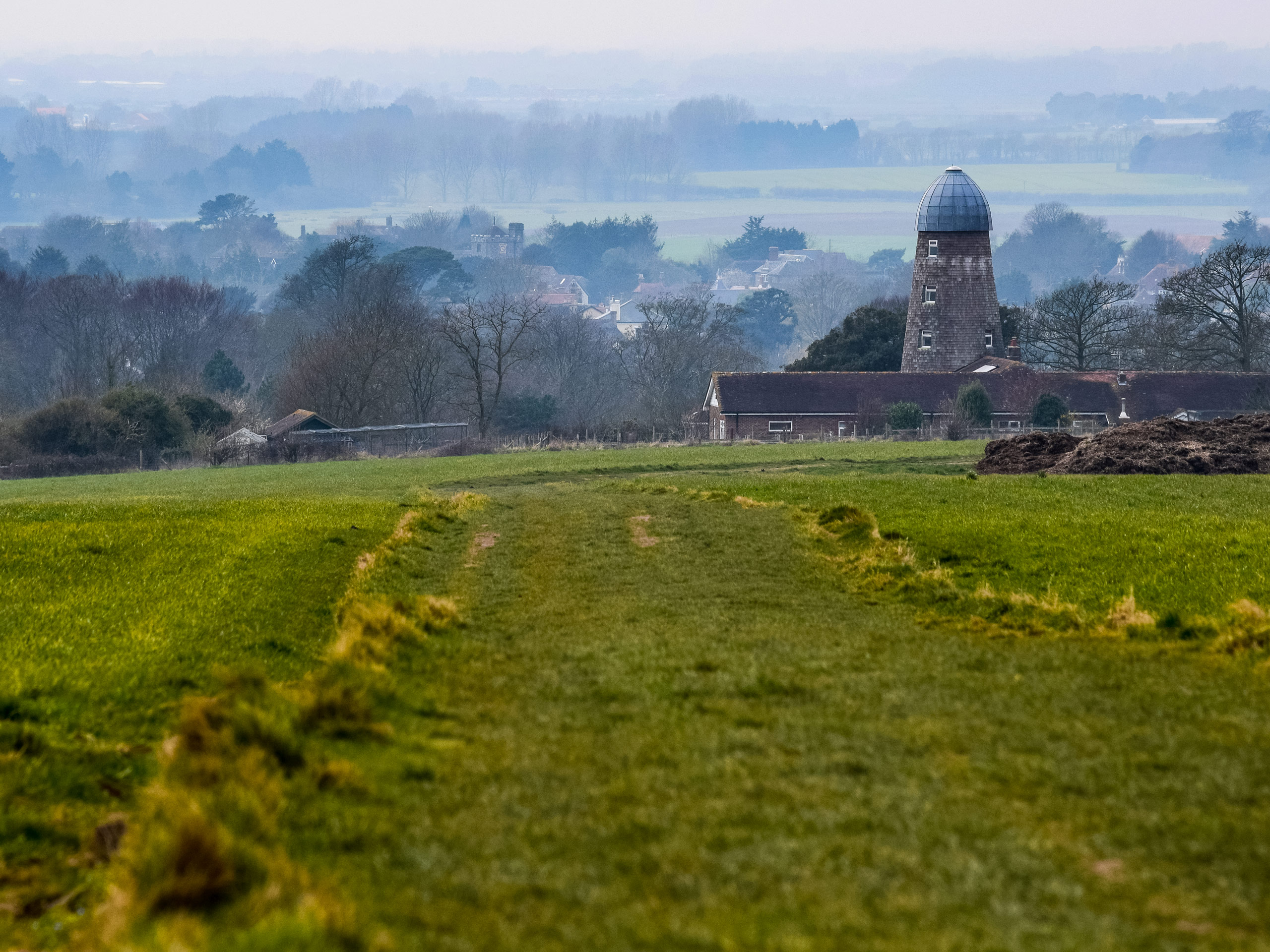
The Highdown Walk
Difficulty Rating:
The Highdown Walk leads you along a chalk ridge that borders the sparkling blue ocean. Explore the Highdown Pub that was formerly a family home built in the 1820’s and has been restored as a pub with guest bedrooms. The Highdown formal gardens are also a beautiful sight with wildflowers blanketing the grounds.
Getting there
Getting to the Highdown walk from Worthing, follow Broadwater Road/A24, A2032 and Littlehampton Road to Highdown Rise. In 6.5mi, continue on Highdown Rise to your destination, which will appear in 0.3mi.

About
| When to do | May - October |
| Backcountry Campsites | No |
| Pets allowed | Yes |
| Family friendly | No |
| Route Signage | Average |
| Crowd Levels | Moderate |
| Route Type | Lollipop |
The Highdown Walk
Elevation Graph
Weather
Highdown Walk Description
The Highdown Walk leads you along the coastline while also unveiling views of South Downs National Park and Miller’s tomb. Although beautiful, there are some steeper climbs and descents along this path, so be sure to wear appropriate footwear. The ridge along the chalk path that looks over the sea is exposed and does not have railings, so be careful when walking along it and watch for gusts of wind. Watch for mud in the wetter months, especially after heavy rain. And be prepared to navigate a few kissing gates.
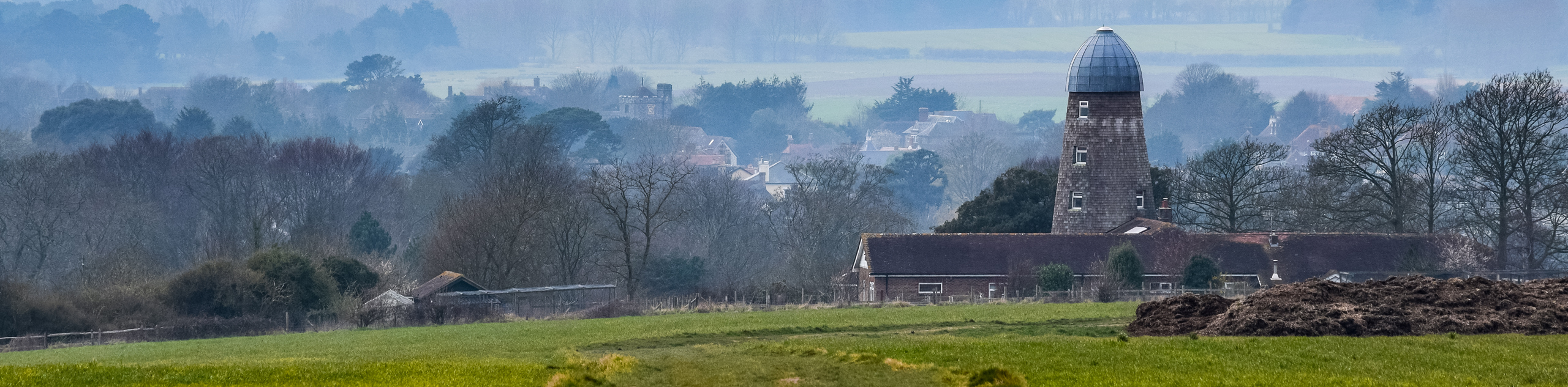
The path takes you along the chalk ridge that hangs over the coast, boasting beautiful sunrises and sunsets. You will be able to explore the Highdown Pub, which was initially built in the 1820s and used to be a single-family home. It has now been converted into a pub where many people gather to enjoy a drink and a meal and has guest rooms for anyone who wants to extend their stay.
Beginning at the carpark at the top of the Highdown access lane at the Highdown Pub, walk to the grassy area. Follow this path straight ahead with the gardens alongside and turn left, where you will see a fork in the path. Turn right, and then you will see three benches and Miller’s Tomb. Miller’s tomb is the resting place of Highdown Miller and rumoured smuggler John Olliver. Legend has it that John used to use the sails from the windmill to alert smugglers in their vessels.
When you are finished, continue along the path and maneuver a kissing gate. Entering the National Trust site, you will continue to walk and begin climbing uphill along a grassy area of the path. Moving along the path, views of the coastline will come into focus, and you will pass over the earthwork rings of the Highdown Hill Fort. As you keep going, you will come to the top of Highdown Hill, which sits at 81 meters above sea level, and showcases views of Isle of Wight and Beachy Head along the sea.
This area is a unique archaeological site where 86 burial plots have been found accompanied by jewelry, spears, shields and much more. After you take in the views, continue along the path, which will begin descending, and you will go through a kissing gate. You will then see the converted windmill, and as you walk forward, you will begin to ascend uphill quickly and then downhill. At this point, you will rejoin where you started, passing Miller’s Tomb and a kissing gate before arriving back at the Highdown Pub car park.
Insider Hints
Enjoy a meal and drink at the Highdown Pub or stay the night in one of their beautiful guest rooms
Wear proper footwear to navigate kissing gates as well as steady ascents and descents
Take a tour of the Highdown Vineyard that is popular among local people
The Connaught Theatre and Cinema is close by in Worthing, where you could catch a show after your walk
The Highdown Pier is a great place to enjoy views of the sea and enjoy an amusement arcade or a meal at the Art Deco tearoom
Similar hikes to the The Highdown Walk hike
Avington and Ovington Walk
Meander through lovely countryside fields and across bridges leading you over rivers carved into the stunning South Downs landscape on…
Amberley Wild Brooks Walk
The Amberley Wild Brooks and Bignor Roman Villa Walk offers a special mix of views, wildlife and history. The George…
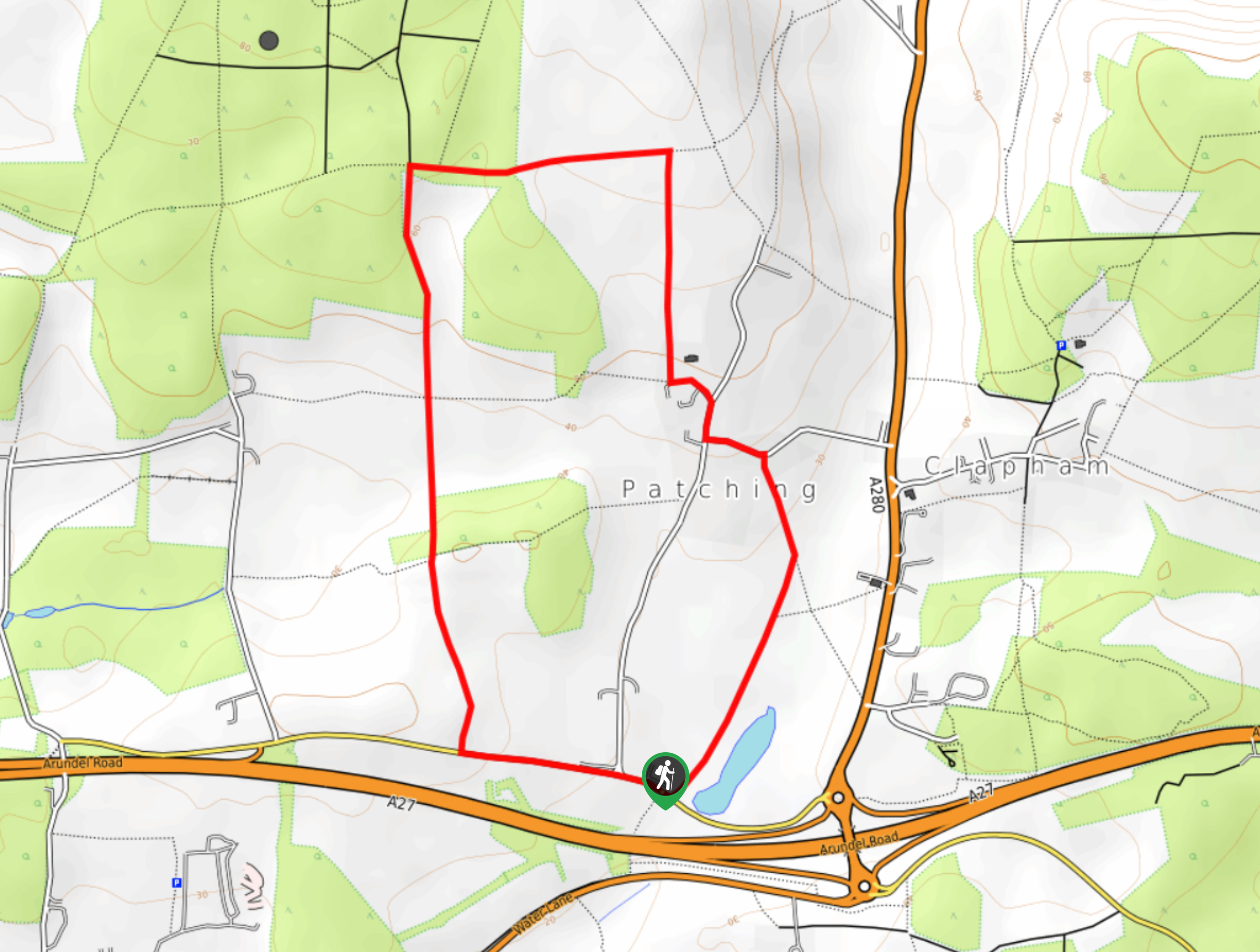
Worlds End and Patching Circular Walk
The Worlds End and Patching Circular Walk is a great path for the whole family, thanks to the gentle gradient…
Comments