Slater Walk
View Photos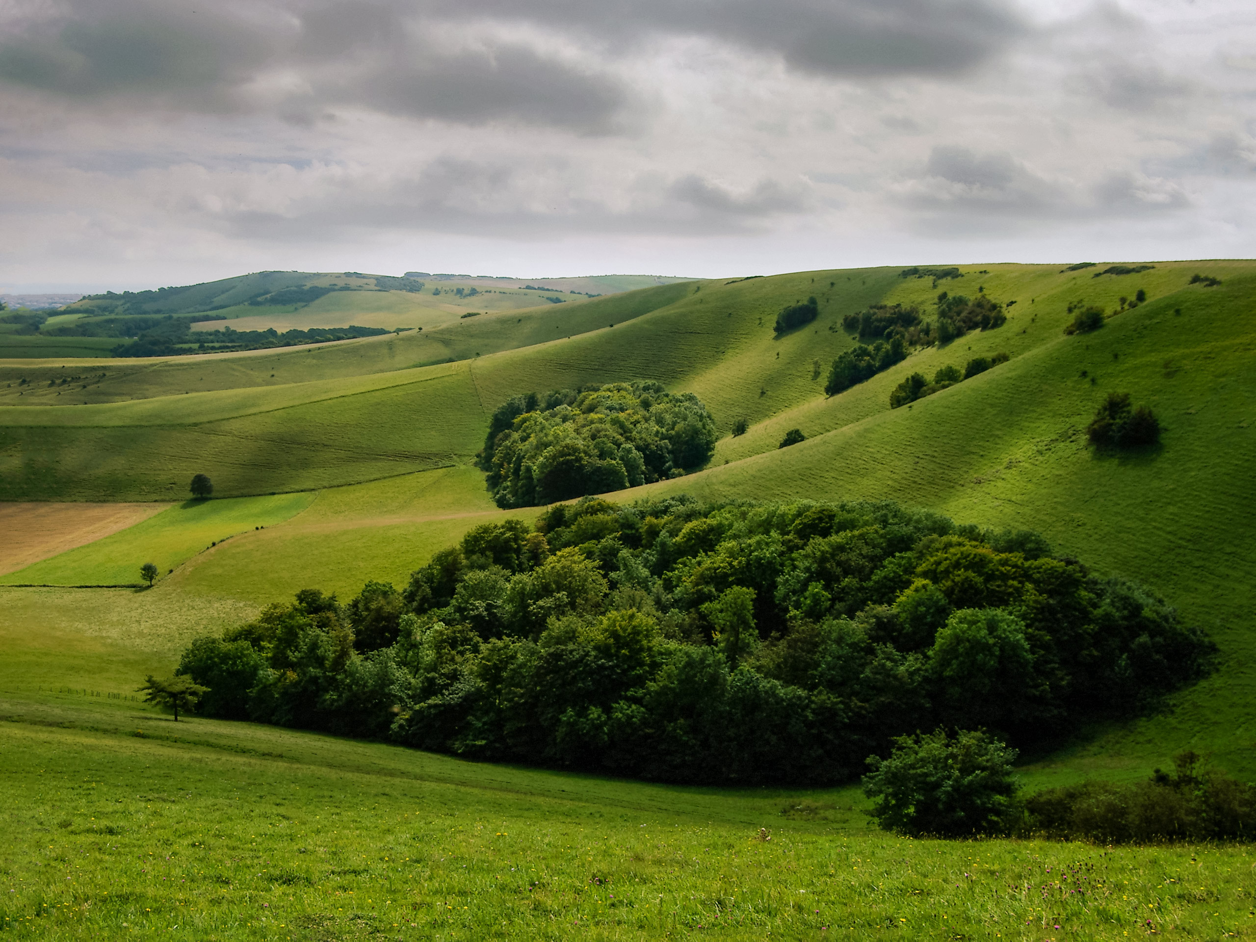
Slater Walk
Difficulty Rating:
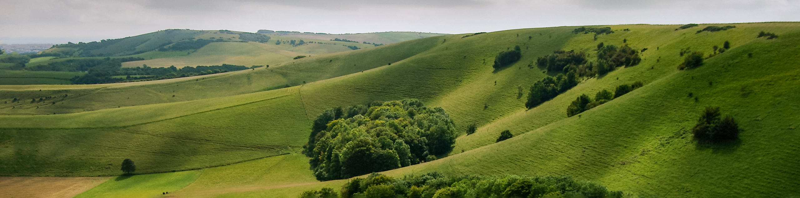
The Slater Walk is a stunning stroll that boasts scenery that inspired the artist known as Eric Slater. He took in the views of the sky, sea and cliffs that surrounded him and created exhibitions as well as a book about his life. Walk along the countryside and explore why this is such a popular area.
Getting there
To get to the Slater Walk from Seaford, take Sutton Drove to Alfriston Road and then take A259 to Beachy Head Road. In 6.8mi, continue on Beachy Head Road. Take Meads Road and Blackwater Road to Bolton Road, and in 1.8mi, arrive at your destination.

About
| When to do | April - October |
| Backcountry Campsites | No |
| Pets allowed | Yes |
| Family friendly | No |
| Route Signage | Average |
| Crowd Levels | Moderate |
| Route Type | Lollipop |
Slater Walk
Elevation Graph
Weather
Slater Walk Description
The Slater Walk is a beautiful stroll along the English countryside that has history. An artist known as Eric Slater drew his inspiration from this area, which led to his creation of exhibitions as well as a book about his life. The Slater Walk begins at the Seaford car park and follows along a well-worn path. Wandering along the path that borders the sparkling sea, you can look down and see the white-chalk cliffs that hang below.
This path is well marked and in the beginning can be a bit steep. After the initial climb, the path is relatively flat. Views of the Seven Sisters can be seen off in the distance as you continue to follow this path. The views that are consistent throughout this journey are captivating and are the reason that this path is so popular. As you continue to follow the walk, you will arrive back at the Seaford car park as this is a circular walk.
Similar hikes to the Slater Walk hike
Avington and Ovington Walk
Meander through lovely countryside fields and across bridges leading you over rivers carved into the stunning South Downs landscape on…
Amberley Wild Brooks Walk
The Amberley Wild Brooks and Bignor Roman Villa Walk offers a special mix of views, wildlife and history. The George…
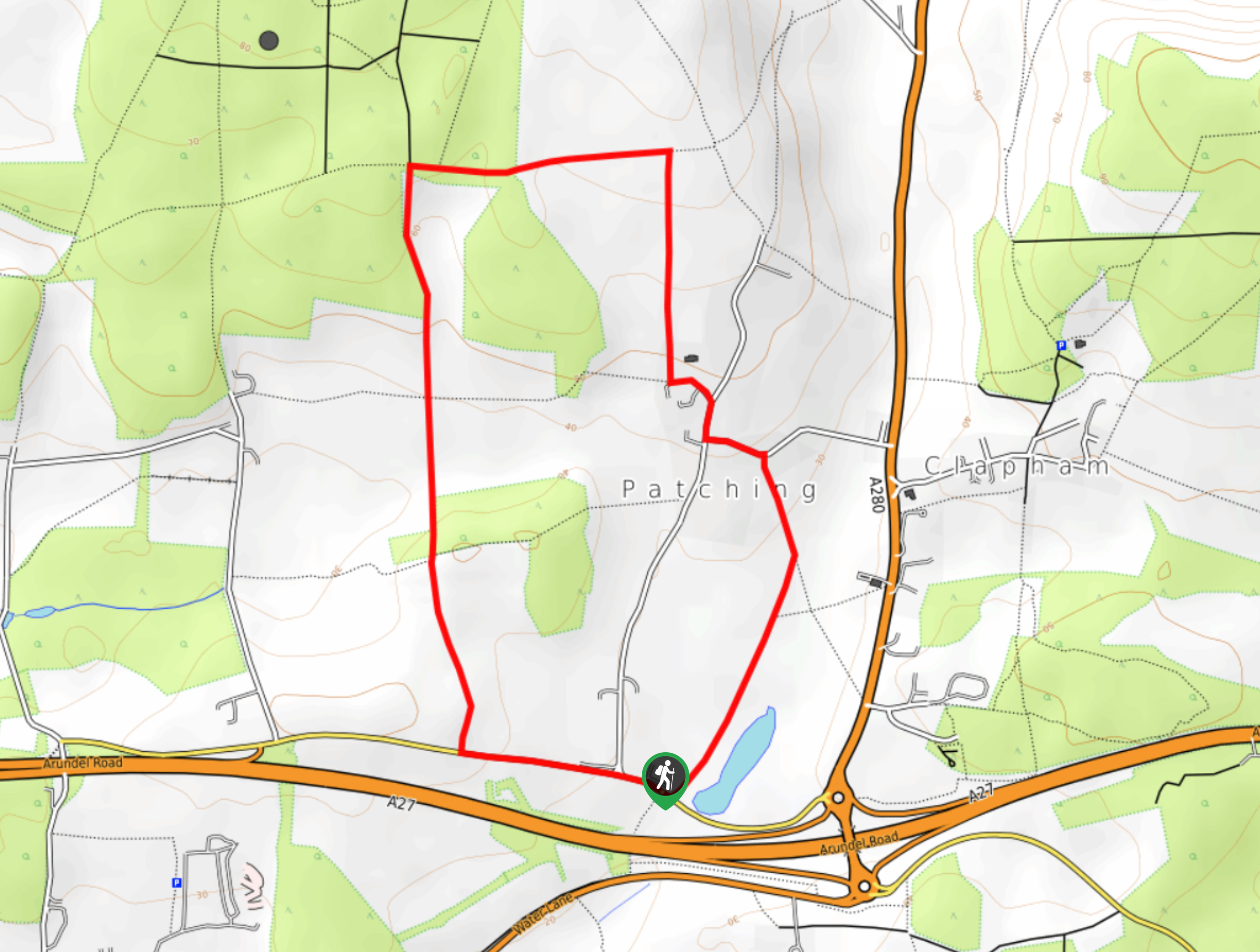
Worlds End and Patching Circular Walk
The Worlds End and Patching Circular Walk is a great path for the whole family, thanks to the gentle gradient…
Comments