Tryfan via South Ridge
View Photos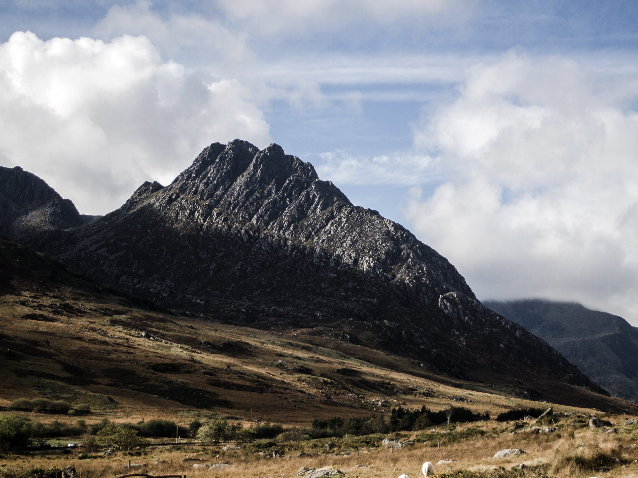
Tryfan via South Ridge
Difficulty Rating:
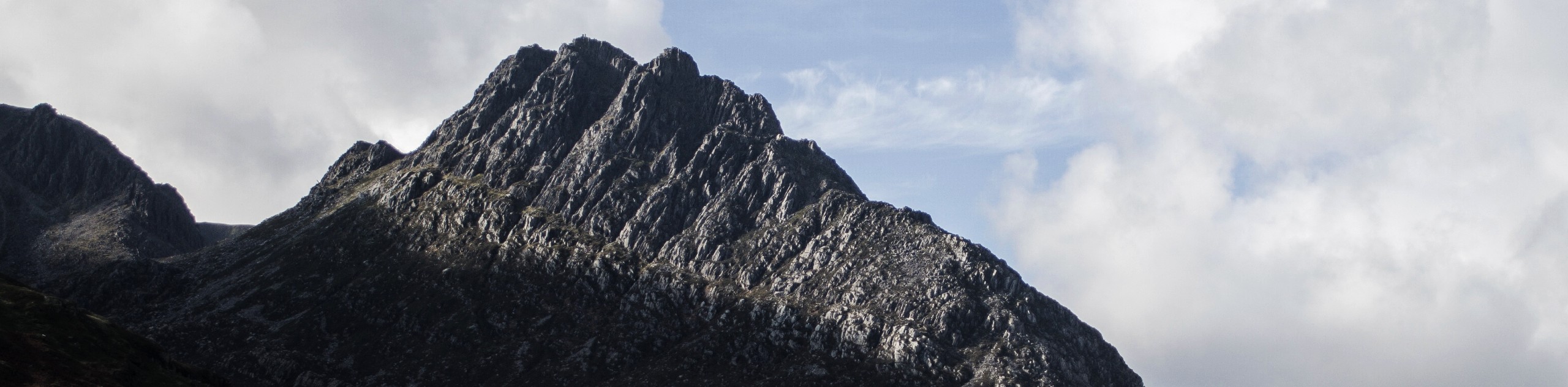
Tryfan’s South Ridge provides an alternate route up Snowdonia’s most iconic mountain, with the fantastic addition of the nearby Glyderau. Loop around to the south of Tryfan to make your ascent, then descend back to Bwlch Tryfan and take the Miners Track up to the summit of Glyder Fach. A lofty stroll along the peaks of Glyder Fach, Castell-y-Gwynt, and Glyder Fawr provides incredible views. Top it off by descending via the Devil's Kitchen, with striking vistas of Llyn Idwal below. This is one of the most engaging walks in all of Snowdonia!
Getting there
As with most Tryfan routes, this South Ridge walk starts along the A5 near Llyn Ogwen. This map starts from the car park at Glen Dana (just past the eastern tip of the lake), but you can really set off from any of the laybys along the lake or even from the Ogwen cottage.

About
| When to do | March-October |
| Backcountry Campsites | No |
| Pets allowed | Yes - On Leash |
| Family friendly | No |
| Route Signage | Poor |
| Crowd Levels | High |
| Route Type | Circuit |
Tryfan via South Ridge
Elevation Graph
Weather
Tryfan via South Ridge Trail Description
This is a slightly easier route up Tryfan than the more famous North Ridge, but do note that there is no such thing as an easy way to climb Tryfan! Your ascent up the mountain itself is more of a scramble than a walk, with plenty of steep sections requiring four limbs and cautious navigation. You should have experience and a head for heights when visiting this iconic mountain.
While this route does cover a greater distance (and typically requires more time) than the North Ridge version, it provides a bit more cover from the weather conditions that can make the North Ridge difficult. There are also options to shorten this route, which includes some of the nearby Glyderau peaks—you can descend via Llyn Bochlwyd if you want to wrap up the adventure after Tryfan.
From the A5, set off along the bridleway leading east to the Gwern Gof Uchaf campsite. At the farm in front of the campsite, a footpath on your right leads toward Tryfan. Turn and follow this south towards the mountain. Stay left at the fork, with Tryfan Bach (“little Tryfan”) on your right. As you walk along the lower slopes of Tryfan, you’ll see climbers on your right navigating the Heather Terrace Path. Just as you’re passing the mountain, head right to loop in a western direction towards Bwlch Tryfan. You’ll want to pause for a rest here, as there’s plenty of scrambling ahead!
On your left is Bristly Ridge; on your right, Tryfan’s South Ridge. There’s a direct path straight to the summit, but chances are you’ll be making small detours here and there to make your way as best you can. Keep your bearing up the mountain until you reach the top. On a mountain as popular as Tryfan, it’s likely to be busy with like-minded adventurers.
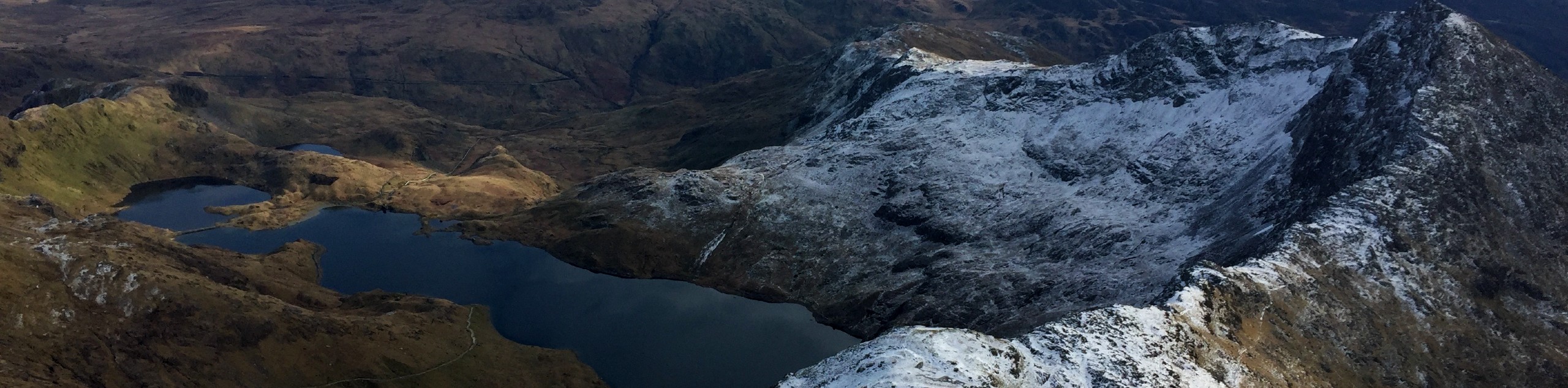
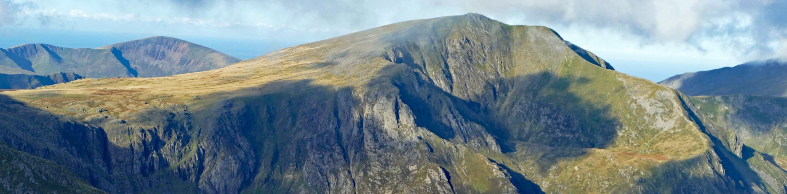
Leaving the summit, head back down to Bwlch Tryfan the way you came. If you want to cut the walk short, turn right here to descend to Llyn Bochlwyd and out to the A5. Otherwise, bear left to join the Miners Track, a well-established path. This path takes you left around Bristly Ridge then loops back to the right to ascend Glyder Fach. As you climb higher, the path fades and becomes harder to follow. Soon enough, you’re at the striking rocky summit of Glyder Fach, with views over the lakes to the north. From here, walk along the ridge past Castell-y-Gwynt to the summit of Glyder Fawr, where the path veers right down to Llyn y Cwn. The last stretch is quite difficult over loose scree, and a compass will come in handy in poor conditions.
From Llyn y Cwn, the path veers right towards the famed Devil’s Kitchen. Descend along this stretch towards Llyn Idwal. This map contours to the right along the base of the cliffs, and then north along the eastern edge of the lake; you can also head around its western shores. Either way, you’ll want to take the footpath from the northeast corner of the lake out towards the road, then left at the junction bringing you to Ogwen Cottage. Turn right to walk along the A5 back to your parking spot.
Insider Hints
There are plenty of famous photo spots on this route. The Adam and Eve stones at the summit of Tryfan are the stuff of legend. The Cantilever Stone atop Glyder Fach is a classic photo opportunity. Don’t forget a shot from the shores of Llyn Idwal looking up at the mountains!
If you’re spending a few days bagging peaks in the area, you have some options for local accommodation. The Gwern Gof Uchaf campsite is almost at the base of Tryfan itself - as convenient as it gets! The YHA Idwal Cottage Hostel is at the other end of Llyn Ogwen, with eco-friendly accommodations indoors and out.
Similar hikes to the Tryfan via South Ridge hike

Foel Goch via Bwlch Tryfan Walk
A walk up Foel Goch via Bwlch Tryfan is an excellent way to take in the iconic beauty of Tryfan…
Snowdon via Crib Goch and Miner’s Track
Of all the many routes up Snowdon, this approach via Crib Goch may be the most demanding! The walk starts…
Y Garn and the Glyderau
The Glyderau may be the most celebrated mountain range within Snowdonia National Park, and this full-day adventure visits the highlights!…
Comments