Miner’s Track to Snowdon
View Photos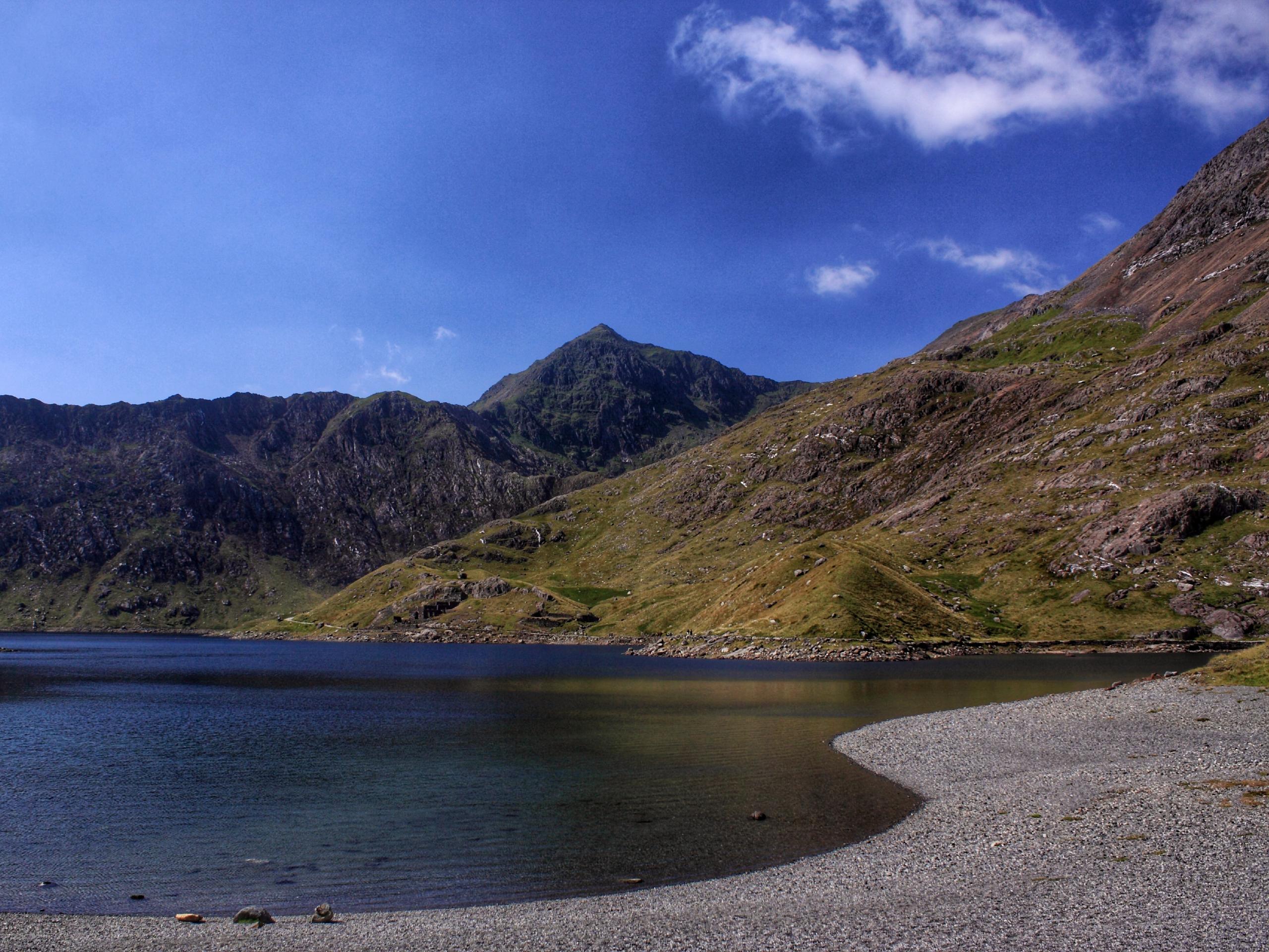
Miner’s Track to Snowdon
Difficulty Rating:
Miner’s Track is one of the most popular ways to ascend Snowdon, the highest mountain in Wales. This straightforward path enjoys an easier start and then a steeper, heart-pumping ascent. It makes the stellar views over Snowdonia National Park that much more worthwhile once you’re atop the summit! This easier approach conveniently begins and ends in Pen-y-Pass and enjoys a well-kept trail the majority of the way.
Getting there
To get to the Miner’s Track trailhead, you can take the Sherpa Bus from Llanberis and Betws y Coed to Pen-y-Pass, or take A4086 by car. The trailhead is on the opposite corner of the cafe and is clearly marked by a blue sign on an old gate.

About
| When to do | March-November |
| Backcountry Campsites | No |
| Pets allowed | Yes - On Leash |
| Family friendly | Older Children only |
| Route Signage | Good |
| Crowd Levels | High |
| Route Type | Loop |
Miner’s Track to Snowdon
Elevation Graph
Weather
Miner’s Track to Snowdon Trail Description
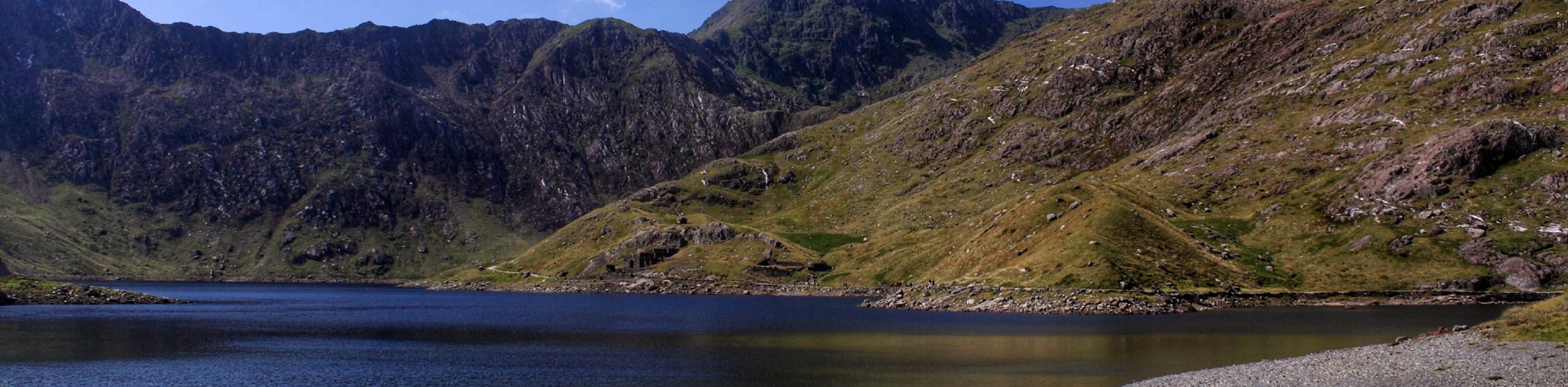
The Miner’s Track to Snowdon route begins at the clearly signed gate in Pen-y-Pass. The trail is wide, relatively smooth, and gradual to start. Enjoy this path as you climb upwards, finding lovely views over Llyn Teyrn and Yr Wyddfa.
You’ll soon curve to the right, crossing a causeway and skirting a lake before ascending into a hanging valley. Once you reach the lake at Glaslyn, enjoy a breather and the beautiful view.
Continuing to your right on stone steps, you’ll arrive at the fingerpost that marks Pyg Track. Take care from here on as the trail becomes somewhat obscured in places. This section can start to feel rather closed in, especially in the mist.
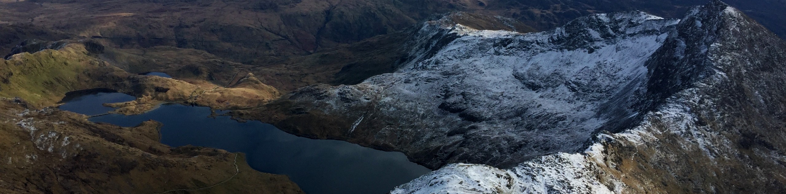
Be prepared to use your hands in spots as you navigate a much rockier section of the trail. Soon you come to Bwlch Glas, a relief after the last section of the trail. Keep left for about 20 minutes, joining Llanberis and Ranger as you approach the summit. Enjoy the peak, taking in expansive views across Snowdonia and Wales.
To descend, take care to stay on Miner’s Track at Bwlch Glas, referring to the stone markers if in doubt. You’ll also want to carefully follow the path past the clear junction with Pyg, as dropping off early will land you in the middle of an old mine. If you do lose the path, you can take Pyg back to Pen-y-Pass.
Insider Hints
The cafe near where the route begins is a great spot to have a snack and tea after your climb
Take care in poor weather, as Miner’s Track is susceptible to ice in certain spots
If it’s misty out, pay special attention to the junction of Pyg and Miner’s, as it’s easy to lose your way here
Similar hikes to the Miner’s Track to Snowdon hike

Foel Goch via Bwlch Tryfan Walk
A walk up Foel Goch via Bwlch Tryfan is an excellent way to take in the iconic beauty of Tryfan…
Snowdon via Crib Goch and Miner’s Track
Of all the many routes up Snowdon, this approach via Crib Goch may be the most demanding! The walk starts…
Y Garn and the Glyderau
The Glyderau may be the most celebrated mountain range within Snowdonia National Park, and this full-day adventure visits the highlights!…
Comments