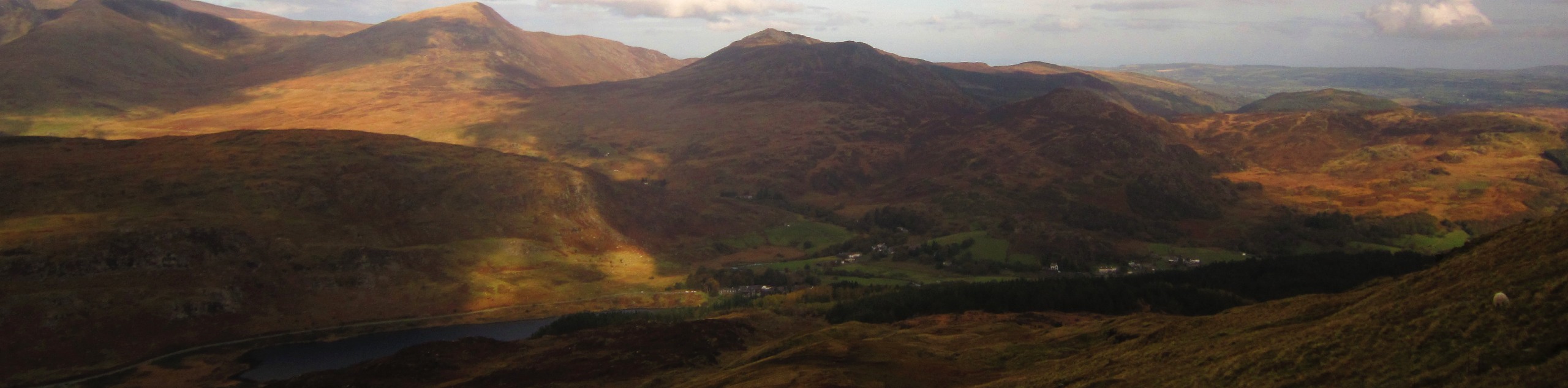
Llyn Crafnant from Capel Curig
View Photos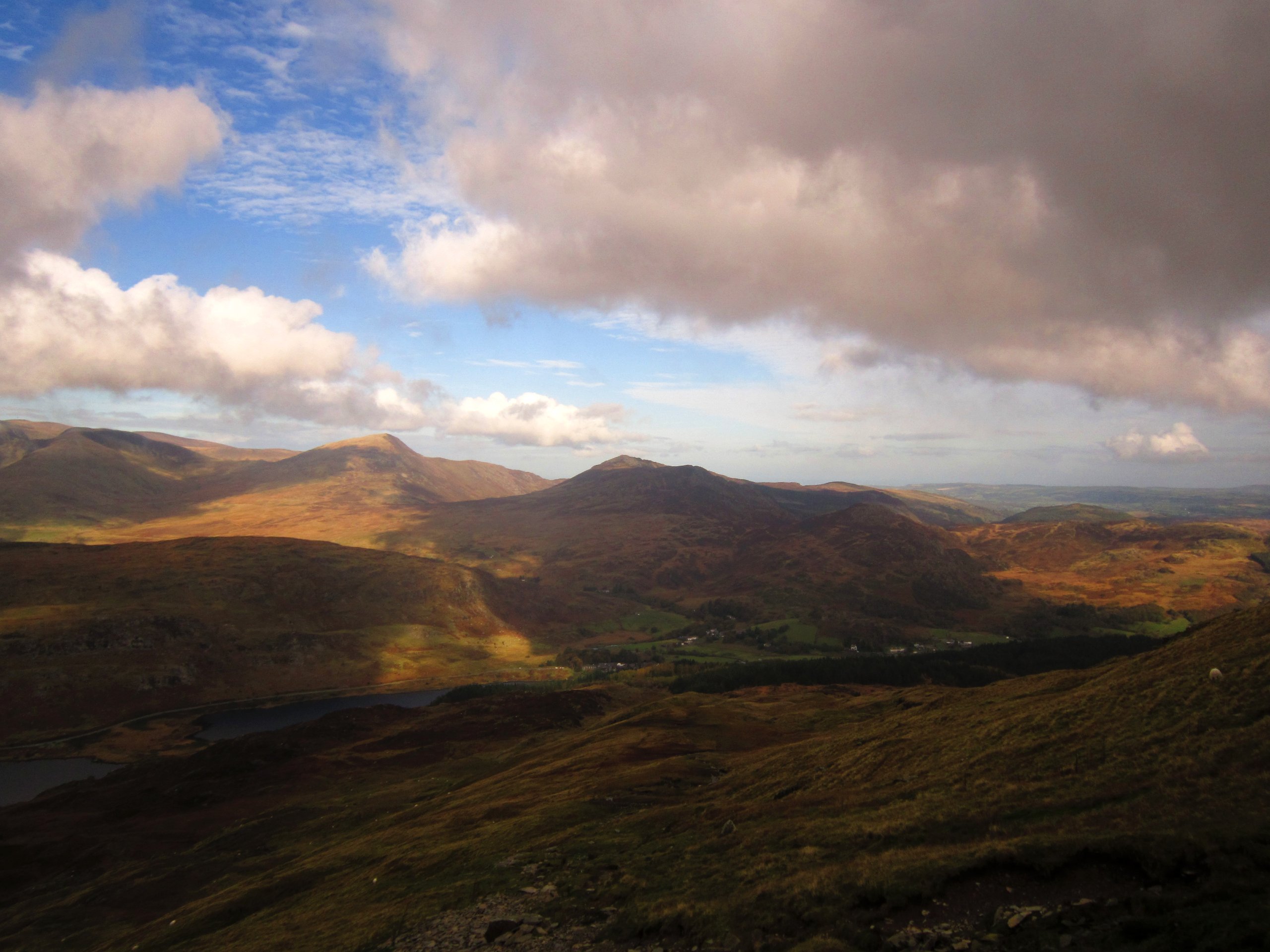
Llyn Crafnant from Capel Curig
Difficulty Rating:
There are plenty of ways to explore Llyn Crafnant, and this walk from Capel Curig offers longer sections of trail walking than its northern counterpart from Trefriw. The walk starts in the heart of the village, heading east and then north along well-defined paths. A steep section offers excellent views of the Crimpiau summit before a similarly steep descent links your route with Crafnant Road. Follow this up the eastern side of the lake, enjoying marvellous views of the mountains to the west, then loop around at the top to take a forestry track back down the opposite shore. A quick dash through the woods links up with the path you came in on, retracing your steps all the way back to Capel Curig.
Getting there
This walk around Llyn Crafnant starts from Capel Curig. The village lies at the intersection of the A5 and the A4086. Just north of the intersection is a smaller road that crosses the Afon Llugwy. Turn onto this road and cross the river - a car park is on your right-hand side.

About
| When to do | March-November |
| Backcountry Campsites | No |
| Pets allowed | Yes - On Leash |
| Family friendly | Older Children only |
| Route Signage | Average |
| Crowd Levels | Moderate |
| Route Type | Lollipop |
Llyn Crafnant from Capel Curig
Elevation Graph
Weather
Llyn Crafnant from Capel Curig Route Description
This is a relatively straightforward route with visible paths throughout. Portions of the walk to and from Llyn Crafnant are steep, so take plenty of care in wet weather. No technical ability or expertise is required to enjoy this wonderful walk!
From the car park, walk back to the intersection and cross the A5, heading east. Clamber over a stile next to an old chapel, and follow an increasingly clear path uphill. This path takes you through lush woodlands before coming to a footbridge. Cross the bridge and take the fainter path on the left.
What follows is the steepest ascent of the route on your way up to the bwlch. Take care in poor weather – fortunately, the path is clear enough to follow without issue. The rocky outcroppings of Crimpiau can be seen on your left. The descent from here is also steep, with the path skirting around any major obstacles. It bends momentarily to the left before curving back to the right as you approach Llyn Crafnant.
At the foot of the descent, the path meets Crafnant Road, which bends to the right. From here, it’s a simple matter of strolling along the tarmac north towards the lake. You’ll pass the Cornel Scout campsite before reaching the southern end of Llyn Crafnant. Continue along the road all the way up its eastern shores, taking in the views of the steep woodlands and looming mountains on the opposite bank.
At the north end of Llyn Crafnant is a monument commemorating the “gift” of the lake to the people of Llanrwst, a town just east of here. Turn left to cross the Afon Crafnant and meet up with a forestry track which makes up your return walk along the other (west) side of the lake. This is easy enough to follow until you reach the southern end, at which point the path narrows.
Continue until you reach two adjacent poles and a waymarked sign. Turn left and cut through the woods, climbing over a stile and crossing a footbridge above the river. The path continues due south until it meets up with the Crafnant Road and the path that you came in from Capel Curig. From here, turn right and retrace your steps, this time going up the steep zigzag path then down the other side as you return to the village.
Insider Hints
A lakeside cafe sits roughly one-third of the way up Llyn Crafnant, on its eastern side. The cafe is privately owned, and is open from Easter to the end of summer. An excellent place to stop for rest and refreshments!
If you’re looking to extend the walk, you can take a path that bears right about 300m from the northern end of Llyn Crafnant. This path loops around to the northern end of neighbouring Llyn Geirionydd, where you can stroll down its western shores. Once you’re at the southern end, take a right and then another right to make your way back to Crafnant Road, where you can return to Capel Curig as detailed above.
Similar hikes to the Llyn Crafnant from Capel Curig hike

Foel Goch via Bwlch Tryfan Walk
A walk up Foel Goch via Bwlch Tryfan is an excellent way to take in the iconic beauty of Tryfan…
Snowdon via Crib Goch and Miner’s Track
Of all the many routes up Snowdon, this approach via Crib Goch may be the most demanding! The walk starts…
Y Garn and the Glyderau
The Glyderau may be the most celebrated mountain range within Snowdonia National Park, and this full-day adventure visits the highlights!…
Comments