Arenig Fawr and Moel Llyfnant Loop
View Photos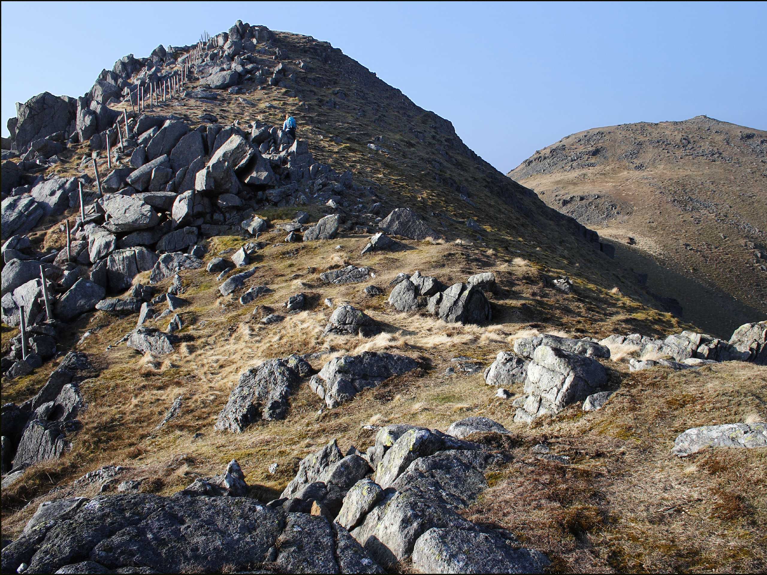
Arenig Fawr and Moel Llyfnant Loop
Difficulty Rating:
The walk up Arenig Fawr and Moel Llyfnant is an underappreciated gem in Snowdonia National Park, boasting impressive views from atop a lofty standalone peak. You’ll feel like you’re right in the middle of Snowdonia at the summit, and you nearly are! This route experiences relatively little traffic, making it the ideal way to enjoy the beauty of the park away from the crowds.
Getting there
The trailhead for the walk up Arenig Fawr and Moel Llyfnant is on the southwestern tip of Llyn Celyn. Heading northeast on the A4212 from Trawsfynydd, you’ll turn right onto the road to Arenig after the B4391 intersects on your left. Down this road, there is a very small parking area at the trailhead.

About
| When to do | March-November |
| Backcountry Campsites | No |
| Pets allowed | Yes - On Leash |
| Family friendly | Older Children only |
| Route Signage | Poor |
| Crowd Levels | Low |
| Route Type | Circuit |
Arenig Fawr and Moel Llyfnant Loop
Elevation Graph
Weather
Arenig Fawr and Moel Llyfnant Loop Description
The walk up Arenig Fawr and Moel Llyfnant begins off a small road near the hamlet of Arenig. There are a handful of parking spaces here, and while it doesn’t always fill up, you can also park at the old quarry or at the junction with the A4212. The trail begins opposite the road, starting steeply and soon levelling out.
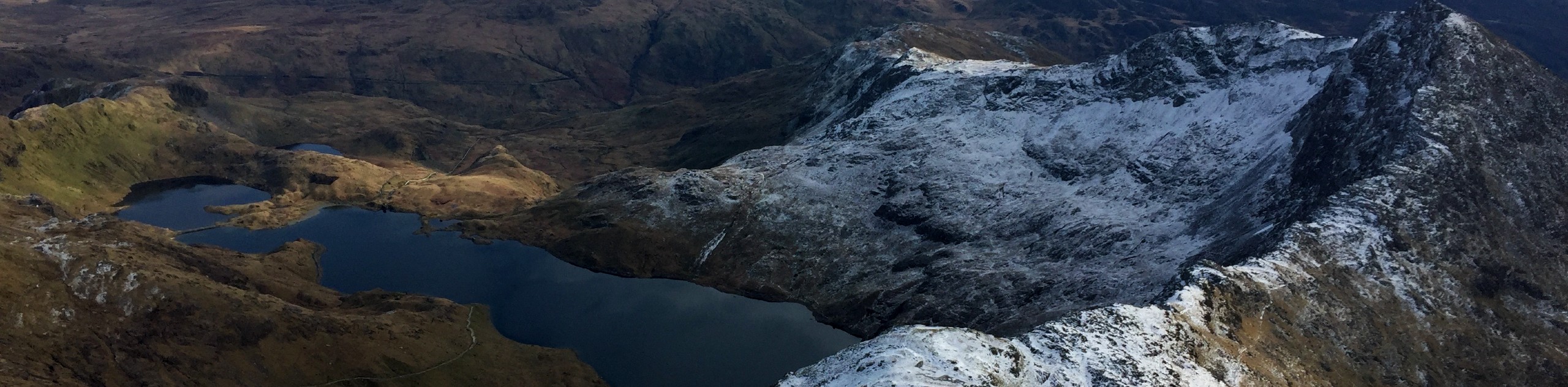
After about 1.2mi, you’ll arrive at Llyn Arenig Fawr, where views of the cliffs of Simdde Ddu start to appear. If you need to take a breather, there’s a tiny bothy here. If you had a tent and sleeping bag, you could feasibly camp here for the night if you wanted to. Cross the stile to the right and proceed across the river on the ladder. The trail meanders up a shoulder and then starts to gain elevation quickly.
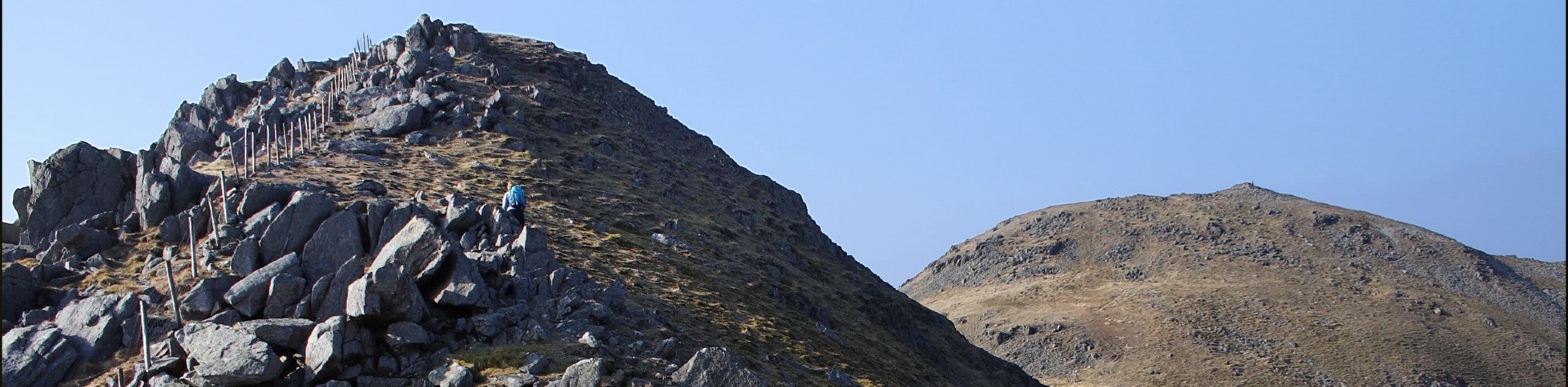
From here you’ll be following the obvious trail over a few rocky sections. You’ll reach a fence and hug Arenig Fawr as you approach the summit. It can get boggy here, so take care in wet weather.
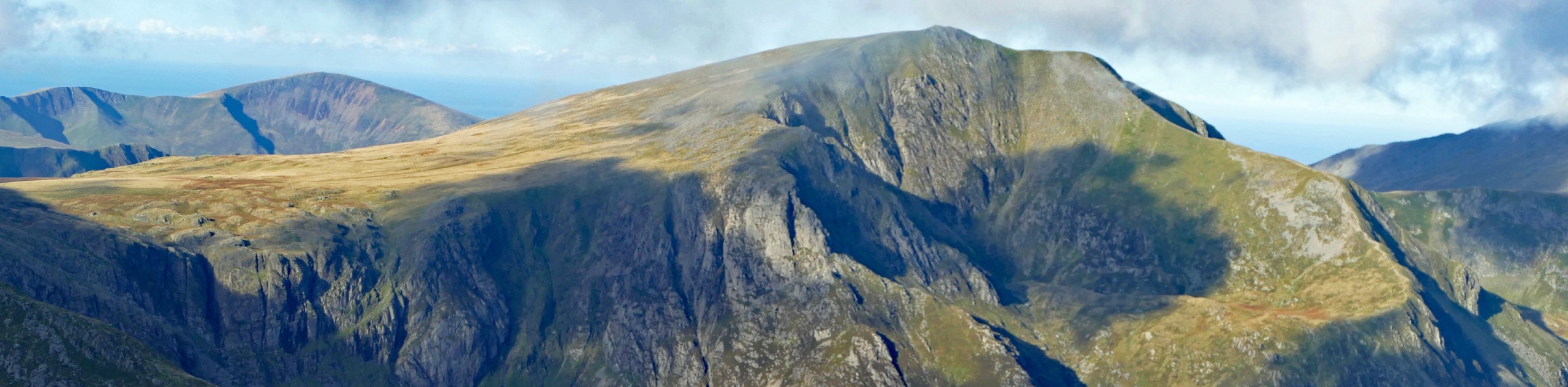
The final push to the summit is mostly over scree and loose rock. You’ll find a small shelter at the top and a memorial for a plane that crashed in 1943, killing 8. After familiarizing yourself with the memorial, enjoy the views of Snowdonia in every direction. You’re not done yet, though!
The trail from here to Moel Llyfnant isn’t always clear, but you’ll want to head generally south along a fence. You’ll head down to a col, then head right on a path towards a lower boggy col. Make sure you head southeast to avoid a straight descent down the steep face. Aim for the very green grass patch that you should be able to make out from where you are.
From the grassy patch, know that the path across to Moel Llyfnant is boggy and hard to make out for a stretch. Head through the bog and then follow a ruined wall, at which point you should be able to make out a very faint trail. Follow the wall to the skyline and then the ridge the rest of the way up.
To descend, follow the fence north, taking care to continue ahead when the fence veers off. There is a path here that’s hard to make out until you’re right on top of it.
Continue past a ruined farmhouse. From here, follow the forestry track downhill, turning right onto the new path where it intersects with the old railway. Follow the railway to where it joins with a lane heading to the start of the trail.
Insider Hints
There are no facilities near this trail, so arrive prepared
Bringing a compass may help mitigate some route finding challenges
If you prefer a shorter hike, you can turn around and descend from the summit of Arenig Fawr
Similar hikes to the Arenig Fawr and Moel Llyfnant Loop hike

Foel Goch via Bwlch Tryfan Walk
A walk up Foel Goch via Bwlch Tryfan is an excellent way to take in the iconic beauty of Tryfan…
Snowdon via Crib Goch and Miner’s Track
Of all the many routes up Snowdon, this approach via Crib Goch may be the most demanding! The walk starts…
Y Garn and the Glyderau
The Glyderau may be the most celebrated mountain range within Snowdonia National Park, and this full-day adventure visits the highlights!…
Comments