Panoramic Point to Park Ridge Hike
View Photos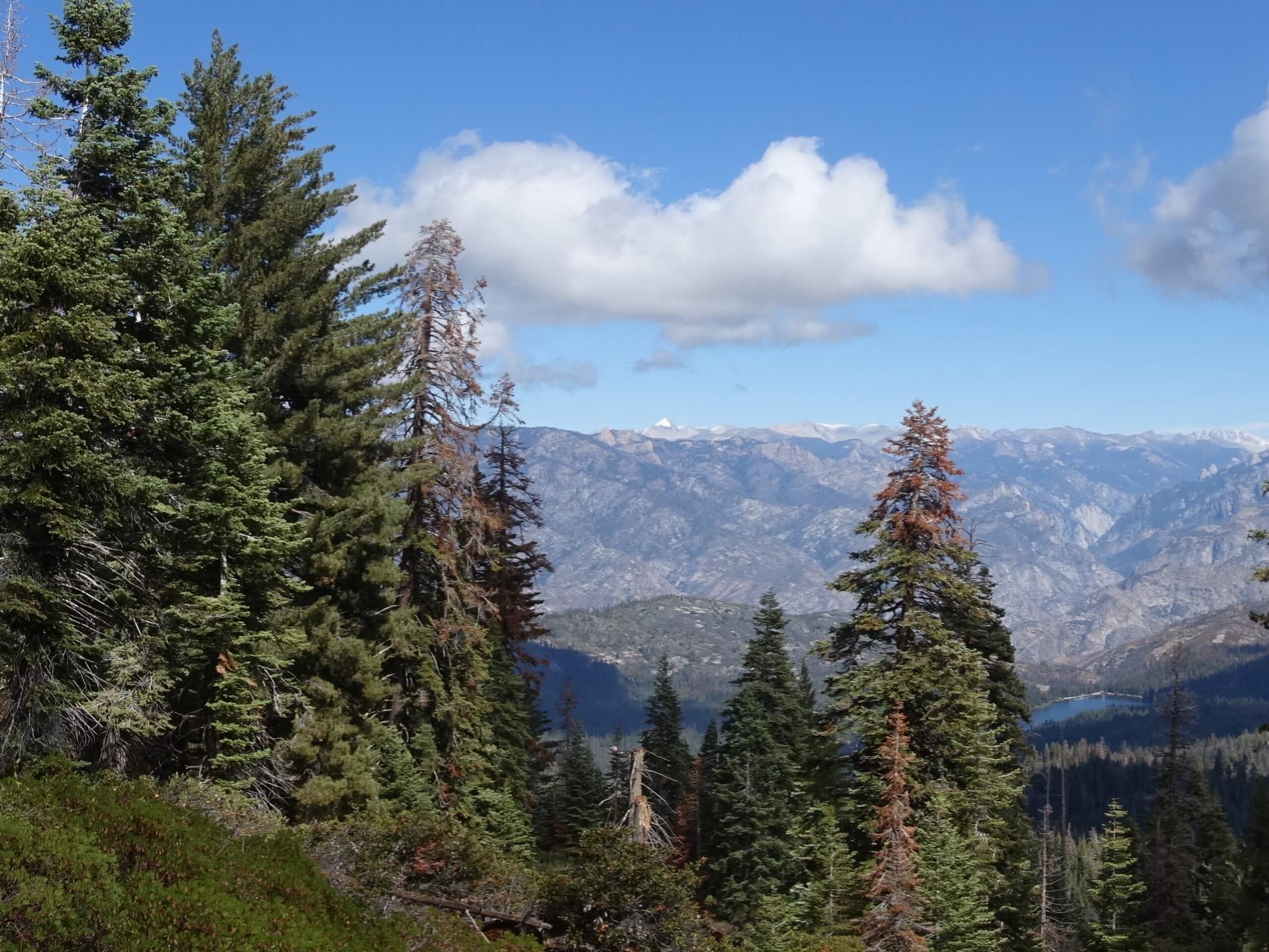
Panoramic Point to Park Ridge Hike
Difficulty Rating:
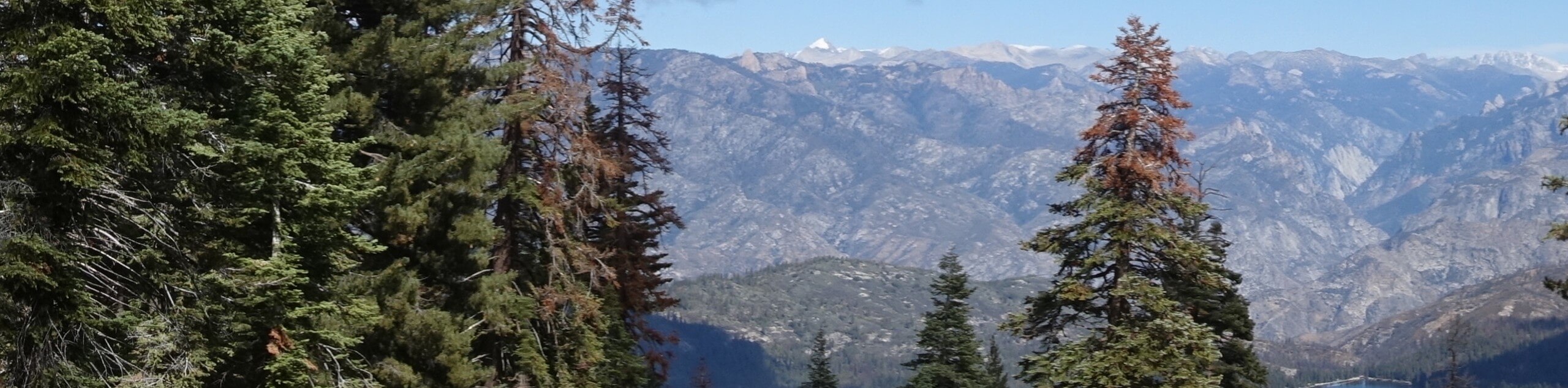
The Panoramic Point to Park Ridge Hike is full of wonderment and amazing scenery. Located in Kings Canyon Park, this wonderful adventure offers breathtaking views of the Great Western Divide, nearby crests of the Sierra Nevada, and encompassing woodlands.
Getting there
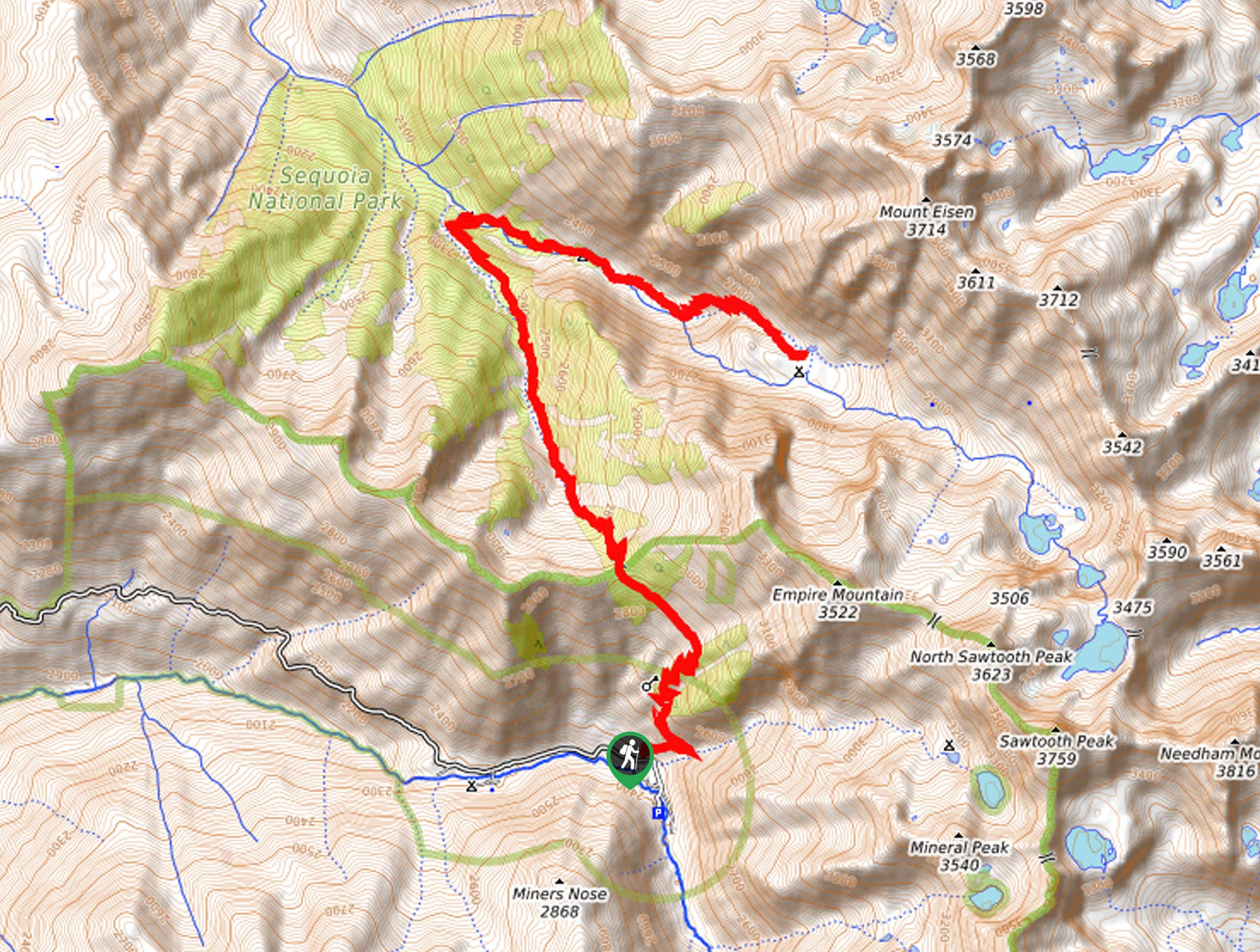
The Panoramic Point to Park Ridge Hike departs from the Park Ridge Trailhead off Panoramic Point Road.

About
| Backcountry Campground | No |
| When to do | April-October |
| Pets allowed | No |
| Family friendly | Older Children only |
| Route Signage | Average |
| Crowd Levels | Moderate |
| Route Type | Out and back |
Panoramic Point to Park Ridge Hike
Elevation Graph
Weather
Panoramic Point to Park Ridge Hike Description
The Panoramic Point to Park Ridge Trail is a beautiful trek that offers unrivaled scenery. This route is ideal for intermediate hikers and families with older children; this route provides a good workout with motivating views. Compared to most trails in the area, this one boasts a more secluded experience, especially in the mornings and evenings. Note the terrain is rocky in sections, so a sturdy pair of footwear is recommended. Additionally, it is important to be mindful of wildlife, including bears along the way. Note entrance to the park costs $35USD per vehicle or $20USD per person for pedestrians or cyclists.
Your journey along the Panoramic Point to Park Ridge Hike departs from the Park Ridge Trailhead. Setting out from here, the Park Ridge Trail will lead you east up to Panoramic Point. Revel in the amazing alpine scenery, then continue along the path tracking south. This section of the route will climb along the ridge, undulating through the forestlands.
Eventually, the trail will deliver you to the Fire Lookout Tower. Marvel at the scene of the Great Western Divide dusted in snow. When you are through appreciating the view, retrace your footing along the ridge and back to the trailhead.
Similar hikes to the Panoramic Point to Park Ridge Hike hike

Eagle and Bobcat Loop Hike
The Eagle and Bobcat Loop Hike is an amazing adventure that the whole family can enjoy. Wander through luxuriant meadows…
Pinto Lake Trail
Beckoning the exploration of intrepid spirits and experienced hikers, the Pinto Lake Trail is a no walk in the park.…

Huckleberry and Alta Loop Hike
The Huckleberry and Alta Loop Hike is a beautiful adventure that offers a wealth of incredible scenery for hikers to…
Comments