Emerald Lake Trail
View Photos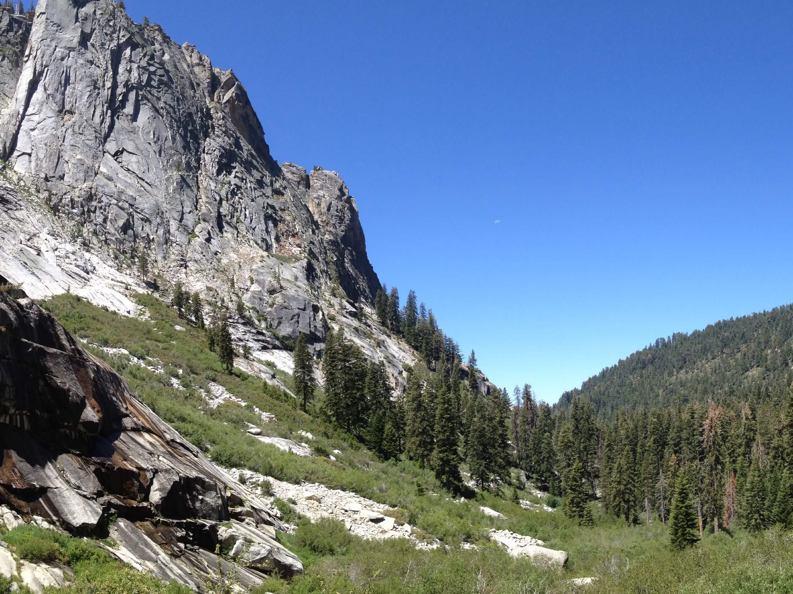
Emerald Lake Trail
Difficulty Rating:
The Emerald Lake Trail is an incredibly beautiful adventure through California’s high country in the Sequoia & Kings National Parks. Meander through the granite oasis adorned with glacially formed lakes and marvel at the scenes of the craggy ridges of the Sierra Nevada. We love this trek, and so will you!
Getting there
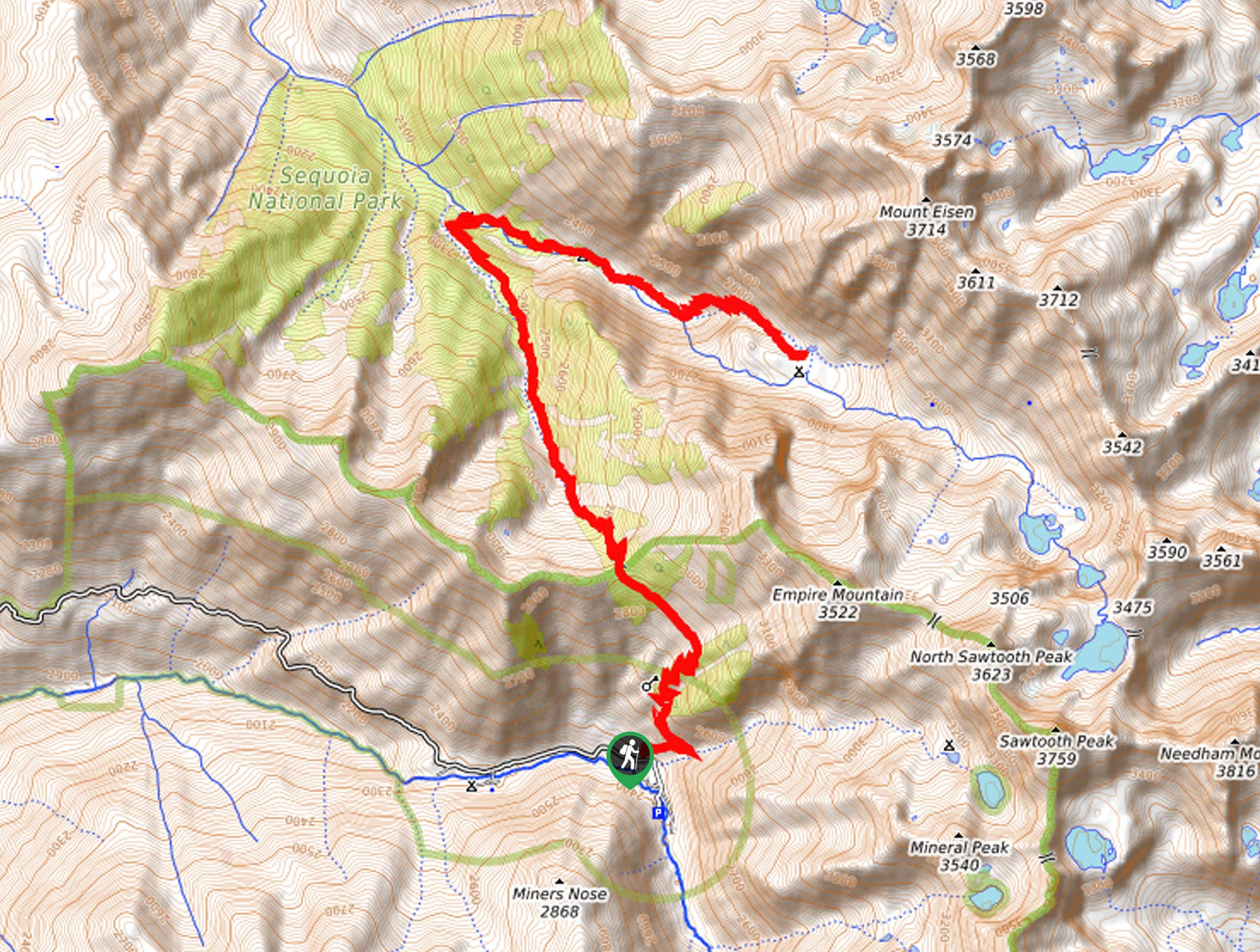
The Emerald Lake Hike departs from the Lakes Trailhead off Wolverton Road.

About
| Backcountry Campground | Emerald Lake Campsite, wilderness permits required. |
| When to do | April-October |
| Pets allowed | No |
| Family friendly | Older Children only |
| Route Signage | Average |
| Crowd Levels | Moderate |
| Route Type | Out and back |
Emerald Lake Trail
Elevation Graph
Weather
Emerald Lake Trail Description
The Emerald Lake Trail boasts a magical experience, offering stunning scenery of the alpine moonscape. This wonderful trek is well-revered—notably by those tackling the demanding Lakes Trail, so come prepared to share the route! Additionally, the campsites near the lakeshore are limited and first-come, first-serve—so arrive early to secure a spot. As this route travels at high altitudes, it is important to be mindful of afternoon storms and extreme weather—dress in layers and check the forecast before heading out. Note entrance to the park costs $35USD per vehicle or $20USD per person for pedestrians or cyclists.
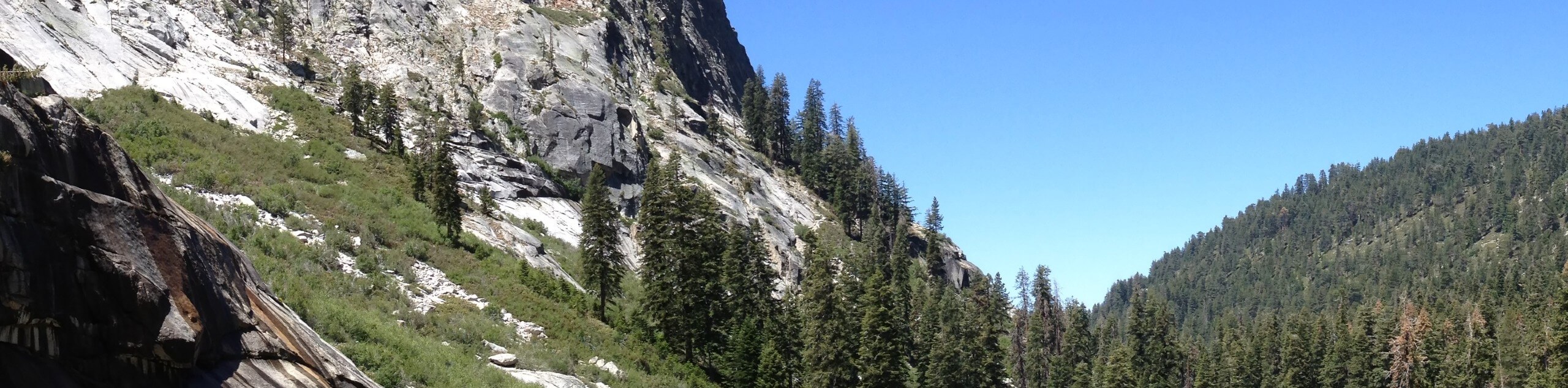
The alpine terrain is awaiting your exploration, and the Emerald Lake Hike boasts the perfect opportunity to do just that. Discover the natural sanctuary of glacier-carved basins and soaring crests in the granite valley. Get a wonderful workout in as you ascend into the high-country abundant with a diversity of flora and fauna. Though the exploration of this gorgeous landscape is doable in one day, we encourage those with the time to break this adventure into a two-day expedition for the most immersive experience! Though we aim to do our best detailing this route—it is impossible to illustrate the area’s beauty, so head out and experience it for yourself!
Embark on your adventure along the Emerald Lake Trail from the Lakes Trailhead off Wolverton Road. Setting out from here, you will be guided eastwardly through the moss-cloaked mixed-coniferous forest adorned with lush undergrowth. Admire the beauty of the verdant woodlands, keeping an eye out for wildlife as you trek! Gradually climbing along Wolverton Creek, you will eventually confront an intersection. Here, veer left, and you will be diverted onto the Lakes Trail- The Watchtower. Beyond this point, the tree coverage will become thinner, and the terrain rockier and rougher.
Mind your footing on the uneven terrain as you climb into the granite oasis. Marvel in the grandeur of the valley, and you will soon reach the summit of the Watchtower—this is a great spot to rehydrate and rest before commencing your final push up to the lakes. The first lake you reach is Heather Lake, a small but stunning alpine pool. From here, you will be guided to Aster Lake and Emerald Lake via switchbacks. Revel in the gorgeous scenery of the crystalline alpine lake framed by the craggy ridges of Alta Peak. Take a dip in the chilly alpine waters before beginning your return. When you are through appreciating the beauty of the high country, retrace your footing along the pathway all the way back to the trailhead.
Trail Highlights
Alta Peak
Alta Peak is a soaring crest in the Sierra Nevada Mountain Range near the Giant Forest. Sitting at an elevation of 11208ft, this prominent summit flanks the glacially formed basins—Emerald Lake and Pear Lake. Previously known as Tharp’s Peak, there is a notable jagged outcrop on the southwest of the summit known as Tharp’s Rock. This commanding crest boasts a postcard-perfect scene for those atop the nearby Moro Rock.
Frequently Asked Questions
How long is the Emerald Lake Trail?
The Emerald Lake Trail is a 10.3mi out-and-back hike in the Sequoia & Kings National Parks.
Can you swim in Emerald Lake?
Yes, adventurers are welcome to take a dip in the chilly alpine waters of Emerald Lake.
Insider Hints
Wear a sturdy pair of footwear as the terrain is rocky and rough
Dress in layers as insurance against varying conditions
Be mindful of afternoon altitude storms
Head out in the morning if you are seeking a more secluded experience
There are There are eight campsites at the lake which are first come first serve and fill up early in the summer monthseight campsites at the lake which are first come first serve and fill up early in the summer months
Those visiting from sea level are encouraged to acclimatize first
Similar hikes to the Emerald Lake Trail hike

Eagle and Bobcat Loop Hike
The Eagle and Bobcat Loop Hike is an amazing adventure that the whole family can enjoy. Wander through luxuriant meadows…
Pinto Lake Trail
Beckoning the exploration of intrepid spirits and experienced hikers, the Pinto Lake Trail is a no walk in the park.…

Huckleberry and Alta Loop Hike
The Huckleberry and Alta Loop Hike is a beautiful adventure that offers a wealth of incredible scenery for hikers to…
Comments