Yavapai Vista Trail
View Photos
Yavapai Vista Trail
Difficulty Rating:
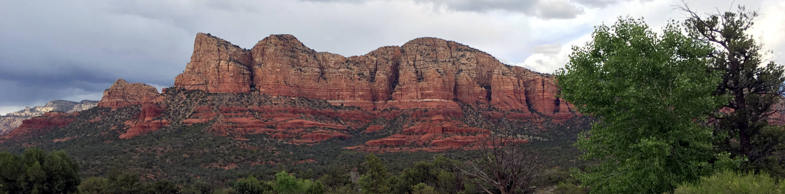
The Yavapai Vista Trail is a half-mile out and back route in Sedona that can either be hiked alone as a very easy venture or can be used as a part of a longer hike. This route’s proximity to Cathedral Rock makes it a frequent connector trail for hikes destined for the feature. Expect heavy traffic on this route.
Getting there
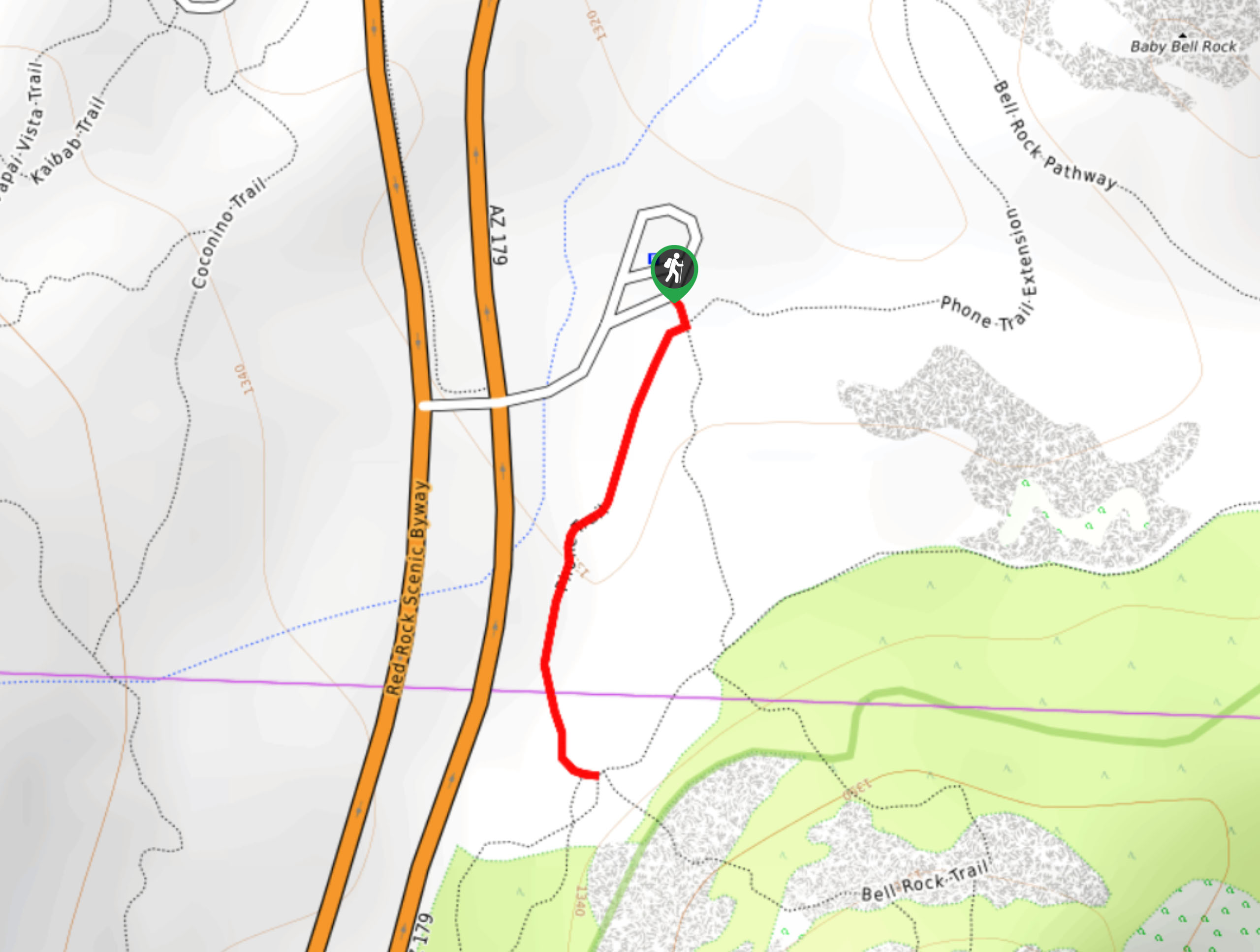
The trailhead for the Yavapai Vista Trail is off the Red Rock Scenic Byway.

About
| Backcountry Campground | No |
| When to do | Year-round |
| Pets allowed | Yes - On Leash |
| Family friendly | Yes |
| Route Signage | Average |
| Crowd Levels | Extreme |
| Route Type | Out and back |
Yavapai Vista Trail
Elevation Graph
Weather
Yavapai Vista Trail Description
Hiked alone, the Yavapai Vista Trail can easily be done in 30 minutes or less. It’s a quick out and back route with nice views of the deep ochre ridges ahead of it. More often, the Yavapai Trail is used in addition to other connecting routes to form longer adventures.
We recommend downloading a map of the area if you want to DIY your own route using the Yavapai Vista Trail. If you’re here for an out and back hike, the trail is short enough that navigation should be no worry.
The trail begins from the loop road. Keep right onto Yavapai Vista where the Coconino Spur and Kaibab Trail branch off to the left. You’ll cross Kaibab Trail in a few steps, so stay straight. Keep right at the next junction. The trail terminates at the junction with Slim Shady Trail, where you can turn back and retrace your steps to the trailhead.
Similar hikes to the Yavapai Vista Trail hike

Margs Draw Trail
Margs Draw Trail is a bit of a hidden gem. This trail doesn’t get as much traffic as other nearby…
Broken Arrow and Morgan Road Loop
Broken Arrow Trail is a very popular route in Sedona used by hikers, mountain bikers, and off-roaders. This route uses…
Phone Trail
If you’re hiking to Bell Rock from the Bell Rock Trailhead, Phone Trail can be used instead of the Bell…
Comments