Jacks Canyon Trail
View Photos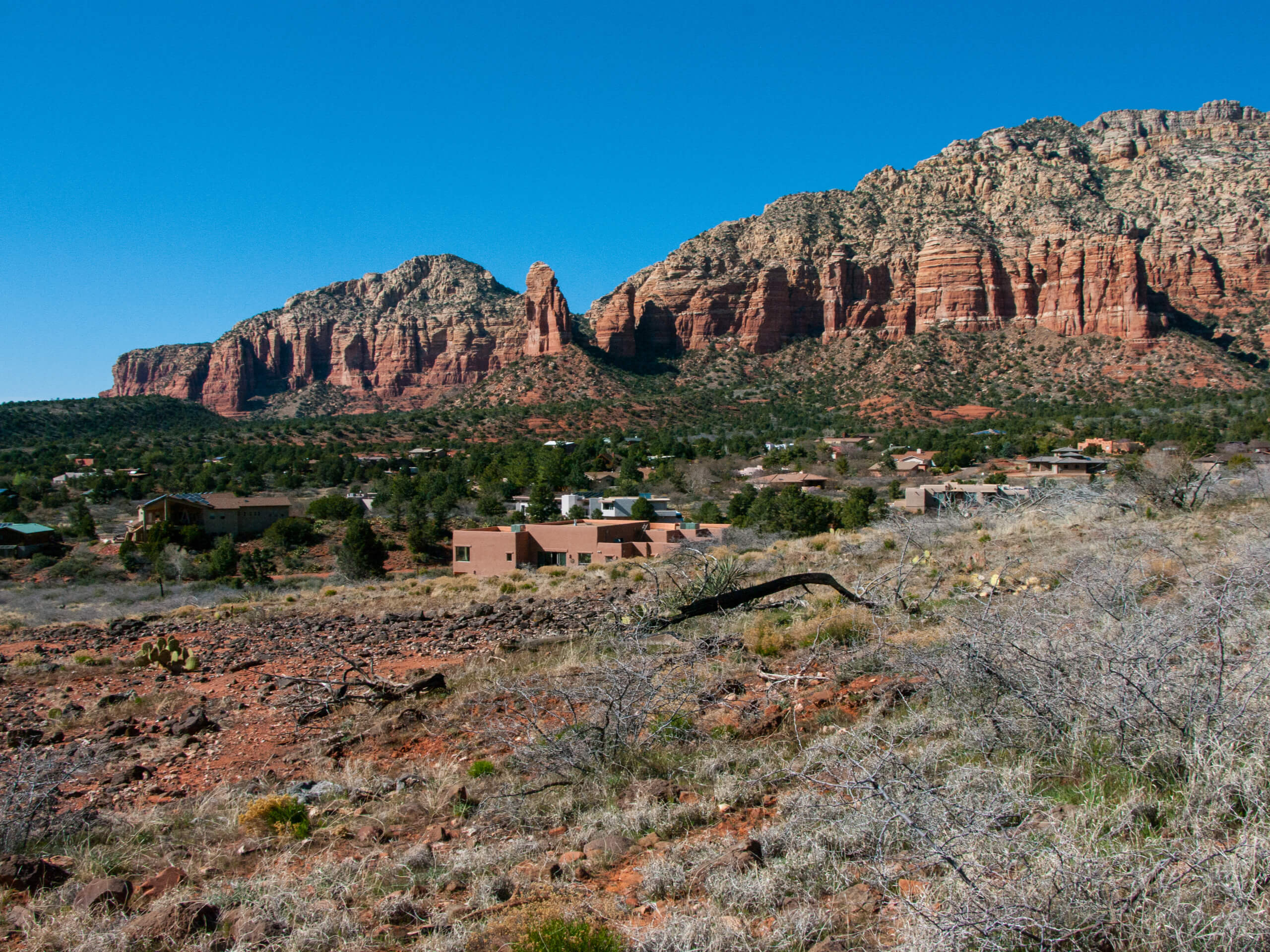
Jacks Canyon Trail
Difficulty Rating:
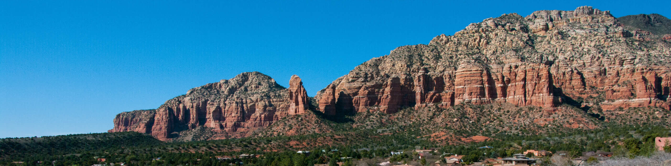
Jacks Canyon Trail is a 13.2mi out and back hike near the Village of Oak Creek, not far from Sedona. This hike is hard and requires some preparation, namely a downloaded GPS map and more water than you think you’ll need. The trail is fairly rugged and there is no cell service, and it can be very hot when the sun is out. If you’re prepared, you’ll love this off-the-beaten-path adventure. Expect moderate traffic.
Getting there
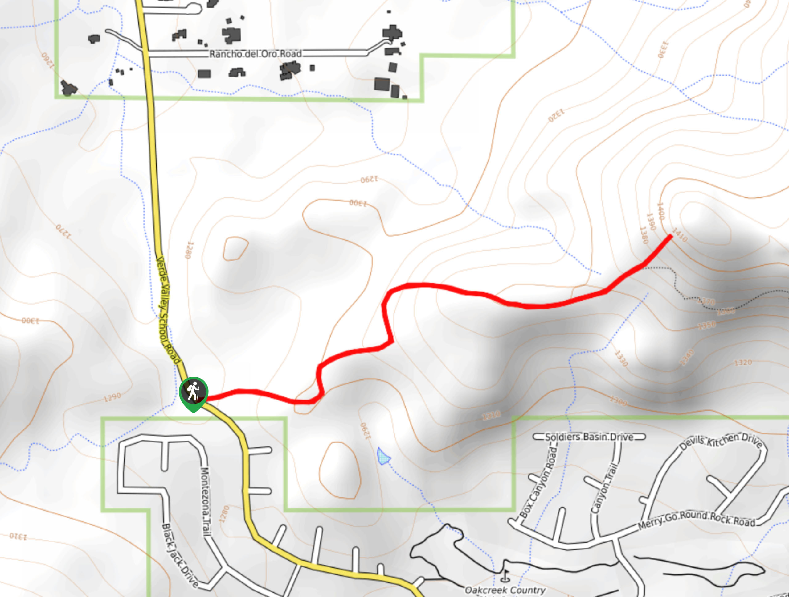
The trailhead for Jacks Canyon Trail is off Jacks Canyon Road.

About
| Backcountry Campground | No |
| When to do | Year-round |
| Pets allowed | Yes - On Leash |
| Family friendly | No |
| Route Signage | Average |
| Crowd Levels | Moderate |
| Route Type | Out and back |
Jacks Canyon Trail
Elevation Graph
Weather
Jacks Canyon Trail Description
Jacks Canyon Trail is a rugged, adventurous hike near the Village of Oak Creek that provides a real sense of adventure. You’ll hike through a true desert landscape full of red rocks, fascinating plants, and even some desert wildlife if you’re lucky. We like this hike best in the spring when there’s water in the creeks.
There is no cell service on this route, so download a GPS map ahead of time so you don’t get lost. We also recommend taking more water than you think you’ll need because the hike is largely unshaded.
Beginning from the trailhead, take Jacks Canyon Trail heading roughly north. There are a few trails that leave from this trailhead, so make sure you’re starting on the right one- you should be hiking parallel to Jacks Canyon Road for a stretch.
Stay left at the first split and right at the next. You’ll hike along the creek (which may or may not have water in it depending on the time of year) as it carves its way through the middle of the canyon. Watch the walls rise above you as you trek to the end of the canyon underneath Munds Mountain. The trail ends at the canyon end, so turn back and retrace your steps.
Similar hikes to the Jacks Canyon Trail hike

Baby Bell, Llama, and Bail Loop
The Baby Bell, Llama, and Bail Loop is a 3.6mi hike in Sedona near Bell Rock and Courthouse…

Herkenham Trail
Herkenham Trail is a 2.0mi out and back trail in the Coconino National Forest near Sedona. This route…
Transept Trail
The Transept Trail is a route less travelled in Sedona, Arizona. This hike is pretty quick and suitable for most.…
Comments