
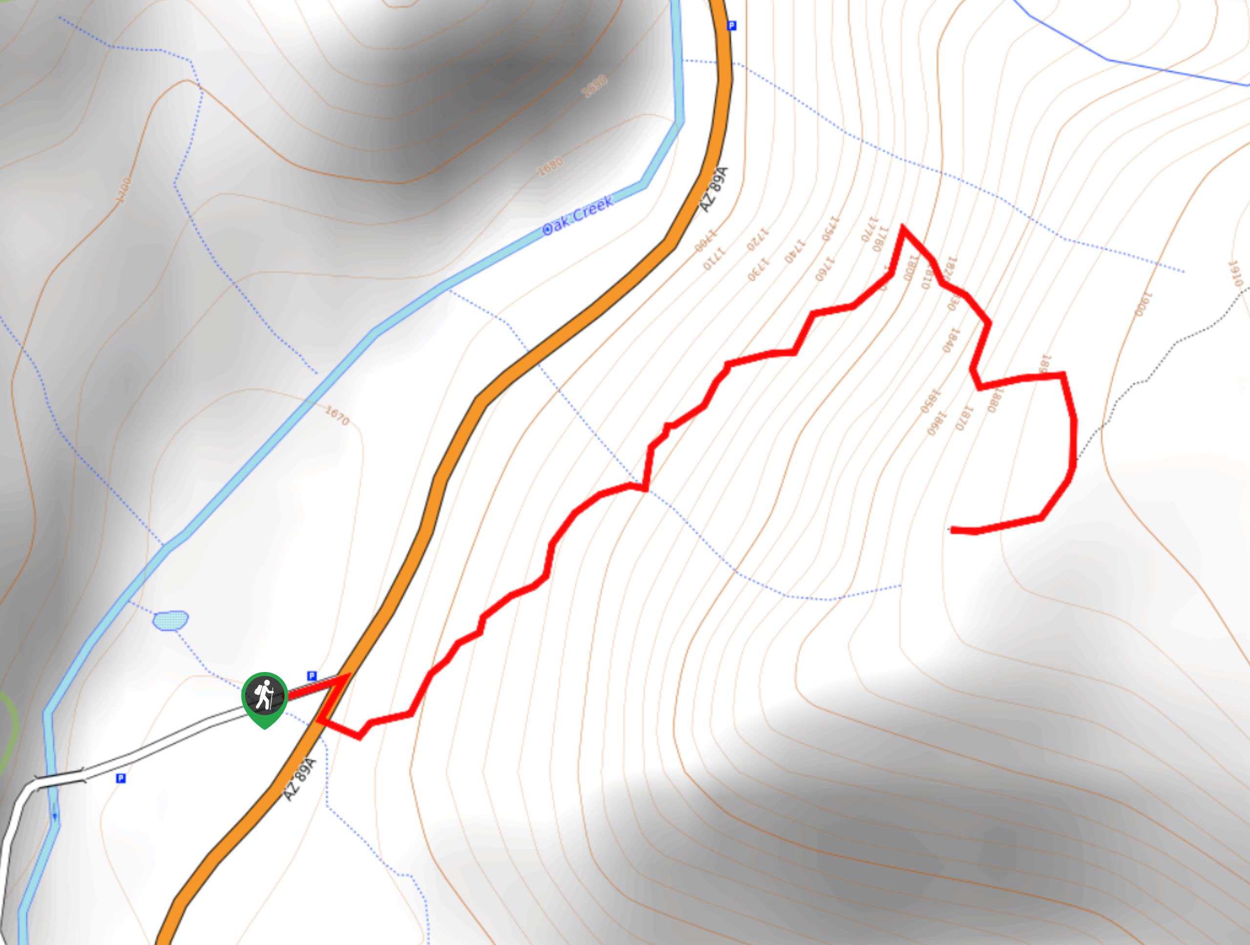
Harding Springs Trail
View Photos
Harding Springs Trail
Difficulty Rating:
Harding Springs Trail is a 1.4mi out and back route near Sedona. This hike takes you up a steep canyon wall to a great viewpoint over Oak Creek Canyon. While it’s a bit of a strenuous trip, it’s quite a short hike, keeping it accessible for active families and strong beginners. Expect moderate traffic on this route.
Getting there
The trailhead for the Harding Springs Trail is off Highway 89A just north of Cave Springs Campground.

About
| Backcountry Campground | Cave Springs Campground |
| When to do | Year-round |
| Pets allowed | Yes - On Leash |
| Family friendly | Yes |
| Route Signage | Average |
| Crowd Levels | Low |
| Route Type | Out and back |
Harding Springs Trail
Elevation Graph
Weather
Harding Springs Trail Description
Harding Springs Trail is a great short leg burner with a spectacular view of the Oak Creek canyon to enjoy at the end. This hike is short, but you should expect a fairly heavy climb. While the route isn’t technical, good boots and poles can make the rocky sections easier to navigate.
This hike is a nice pick if you’re staying at the nearby Cave Springs Campground or Pine Flat Campground or driving into Sedona.
From the trailhead, begin climbing uphill. There aren’t any switchbacks to help you out as you traverse the first section, but it’s not as steep as the second half. Once you’re warmed up, the trail turns straight uphill and you’ll climb through uneven zig-zagging turns to the top. From the viewpoint, take a breather and soak up the views before retracing your steps back to the trailhead.
Similar hikes to the Harding Springs Trail hike

Margs Draw Trail
Margs Draw Trail is a bit of a hidden gem. This trail doesn’t get as much traffic as other nearby…

Baby Bell, Llama, and Bail Loop
The Baby Bell, Llama, and Bail Loop is a 3.6mi hike in Sedona near Bell Rock and Courthouse…

Herkenham Trail
Herkenham Trail is a 2.0mi out and back trail in the Coconino National Forest near Sedona. This route…
Comments