Fay Canyon Trail
View Photos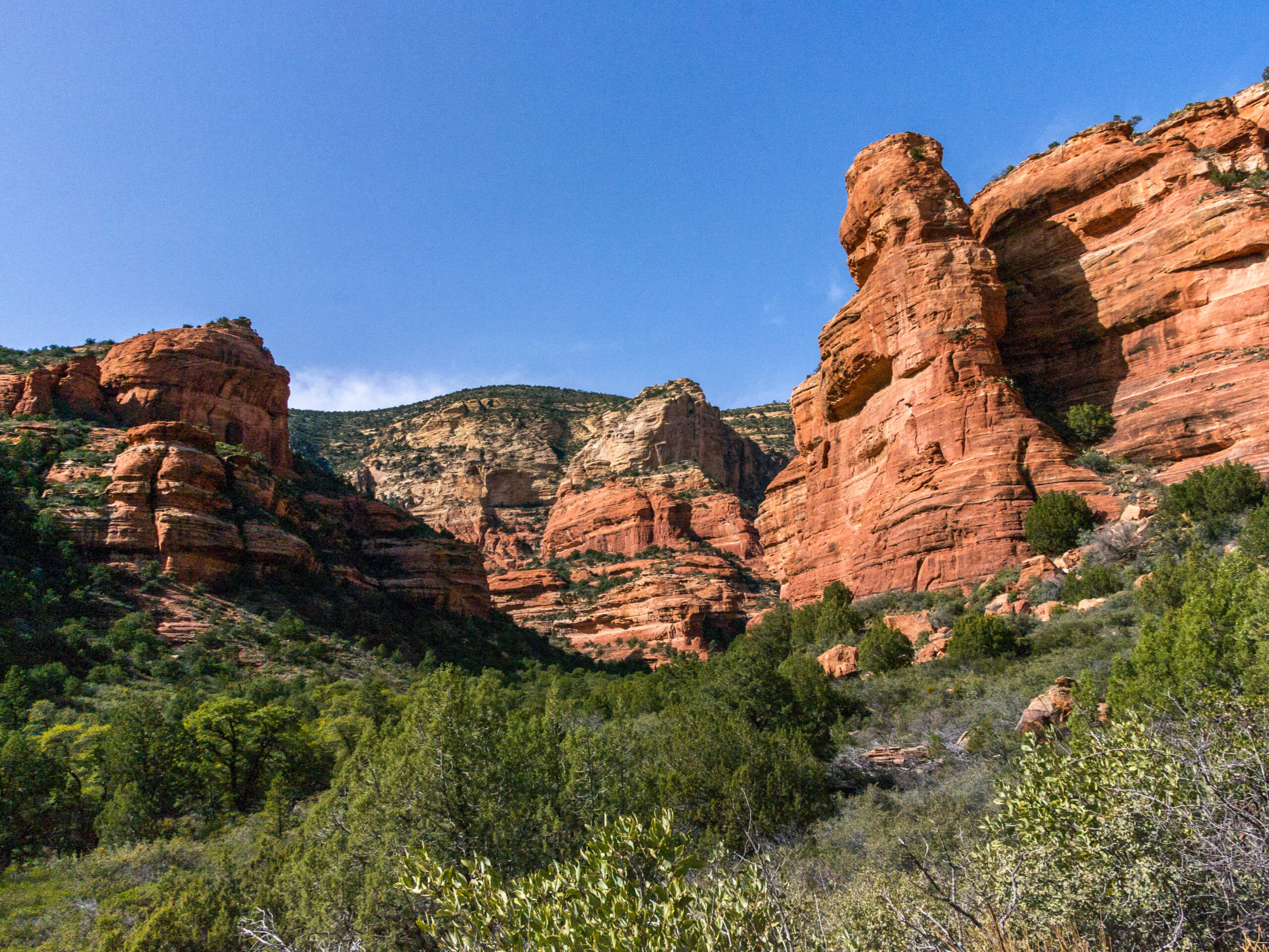
Fay Canyon Trail
Difficulty Rating:
The Fay Canyon Trail is a popular trip for its beautiful natural arch bridge and box canyon experience. This hike is easy-moderate and suitable for most skill levels. It sees heavy traffic, but it’s worth it! We recommend downloading a GPS track for this hike as the trail isn’t always very well defined, especially close to the arch.
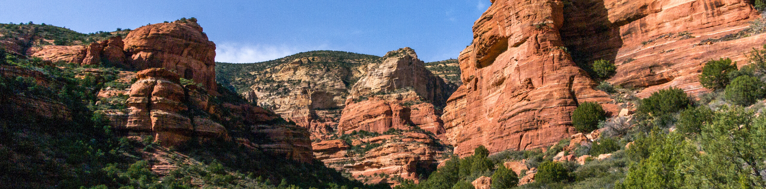
Fay Canyon stretches towards Bear Mountain in the Red Rock Secret Mountain Wilderness. The red walls towering overhead add a sense of grandeur to the trail, making it a fun hike for anyone wanting a very Sedona experience without needing to work too hard. An option off-trail scramble at the end provides excellent views from atop a red Supai sandstone cliff.
Getting there
The trailhead for Fay Canyon Trail is on Boynton Pass Road.

About
| Backcountry Campground | No |
| When to do | Year-round |
| Pets allowed | Yes - On Leash |
| Family friendly | Yes |
| Route Signage | Poor |
| Crowd Levels | High |
| Route Type | Out and back |
Fay Canyon Trail
Elevation Graph
Weather
Fay Canyon Trail Description
Fay Canyon Trail is a lovely hike in the Red Rock Secret Mountain Wilderness near Sedona. This hike takes you through a dramatic box canyon and to a natural sandstone arch. It’s a suitable hike for beginners and pairs well with the nearby Boynton Canyon Hike.
This hike isn’t signed and the trail isn’t always very clear, so we recommend downloading a GPS track, especially to find the arch. While it may not always be clear which way to go, try to remain on previously travelled ground to minimize the impact on the environment.
The canyon supports a diverse range of desert flora and fauna and shows off the unique geological features of this area, particularly the canyons and cliffs formed over many years by erosion.
Beginning from the trailhead, hike along Fay Creek to the northwest. If you’re not careful, it’s easy to walk right past the arch. Keep an eye on your GPS track just under a half-mile into the hike.
Turn right to hike to the arch. There isn’t a well-defined path, so choose what looks best. Check out the arch, snap some photos, and then return to the main trail.
Take a right to continue hiking through the canyon. The sheer red walls rise dramatically around you in some places, and the canyon views are quite unique.
The trail ends at a dead-end in front of a sandstone wall. Many hikers climb up this cliff to enjoy an expansive view, but this is an unsanctioned side trip and doing so may damage the off-trail environment.
From the end of the canyon, you’ll return to the trailhead on the same trail.
Hiking Route Highlights
Fay Canyon Arch
The Fay Canyon Arch is a small natural sandstone overhang just off of Fay Canyon. The arch may be small, but its precarious placement and unique shape make it a worthwhile stop. The path to the arch isn’t marked or well-defined, but it’s easy enough for beginners to hike to.
Frequently Asked Questions
Is Fay Canton always open?
Yes, the trail is open year-round.
Do you need a Red Rock Pass for Fay Canyon?
Yes. Grab a pass from any other trailhead with a kiosk in the area or from the ranger station.
Is Fay Canyon busy?
The trail is heavily trafficked, but not as severely as some other popular trails in the Sedona area.
Insider Hints
There can sometimes be a small waterfall in the canyon if it’s rained recently.
Bring lots of water and avoid hiking in midday if you’re visiting in the summertime.
The nearby Enchantment Resort has excellent food if you’re hungry after your adventures.
Similar hikes to the Fay Canyon Trail hike

Margs Draw Trail
Margs Draw Trail is a bit of a hidden gem. This trail doesn’t get as much traffic as other nearby…

Baby Bell, Llama, and Bail Loop
The Baby Bell, Llama, and Bail Loop is a 3.6mi hike in Sedona near Bell Rock and Courthouse…

Herkenham Trail
Herkenham Trail is a 2.0mi out and back trail in the Coconino National Forest near Sedona. This route…
Comments