
Chuckwagon, Mescal Mountain, and Long Canyon Loop
View Photos
Chuckwagon, Mescal Mountain, and Long Canyon Loop
Difficulty Rating:
The Chuckwagon, Mescal Mountain, and Long Canyon Loop is an 8.4mi hike in Sedona that makes use of several trails to show off Seodna’s iconic scenery. This hike is a longer one, but the elevation gain is modest and it’s fairly easy to find your way. Bring plenty of water and prepare to be exposed to the sun if you visit between April and October.
Getting there
The trailhead for the Chuckwagon, Mescal Mountain, and Long Canyon Loop is off Long Canyon Road.

About
| Backcountry Campground | No |
| When to do | April-September |
| Pets allowed | Yes - On Leash |
| Family friendly | Older Children only |
| Route Signage | Average |
| Crowd Levels | Moderate |
| Route Type | Loop |
Chuckwagon, Mescal Mountain, and Long Canyon Loop
Elevation Graph
Weather
Chuckwagon, Mescal Mountain, and Long Canyon Loop Description
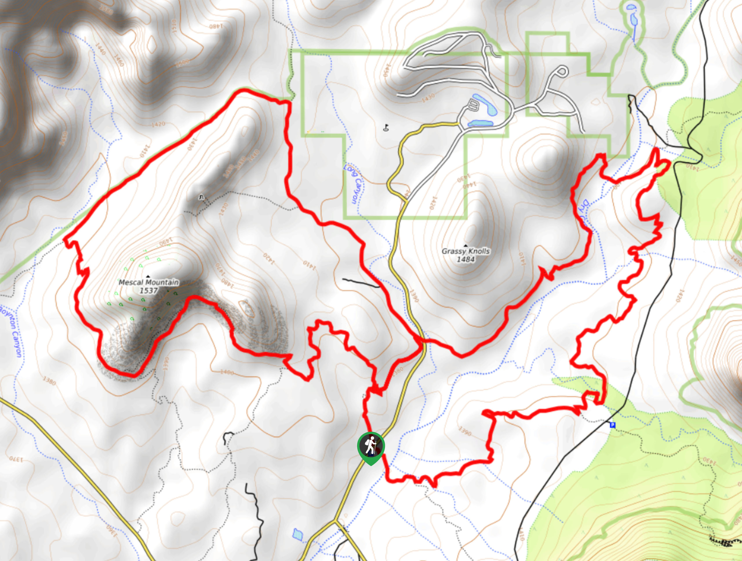
The Chuckwagon, Mescal Mountain, and Long Canyon Loop is a fantastic hike in the Sedona area that shows off the natural beauty of this unique place. This loop is a bit longer, but the modest elevation gain keeps it accessible for most skill levels. This hike takes you to Mescal Mountain, the Grassy Knolls, and more.
While the signage in this area is good, a GPS track can help you navigate longer loops like this if you’re new to the area. There are lots of junctions on this route.
From the trailhead, go east across Dry Creek and then stay left. You’ll swing close to Devil’s Bridge if you fancy a stop, but you’ll hike through the desert to a Y-junction. Stay left for Chuckwagon Trail and follow it past Long Canyon Road and go right onto Long Canyon Trail. Take this to Deadman’s Pass Trail, where you’ll turn left and hike along the backside of Mescal Mountain.
Take a left to follow the base of Mescal Mountain and then follow Mescal Trail back to the trailhead by the road.
Similar hikes to the Chuckwagon, Mescal Mountain, and Long Canyon Loop hike

Margs Draw Trail
Margs Draw Trail is a bit of a hidden gem. This trail doesn’t get as much traffic as other nearby…

Baby Bell, Llama, and Bail Loop
The Baby Bell, Llama, and Bail Loop is a 3.6mi hike in Sedona near Bell Rock and Courthouse…

Herkenham Trail
Herkenham Trail is a 2.0mi out and back trail in the Coconino National Forest near Sedona. This route…
Comments