Allens Bend Trail
View Photos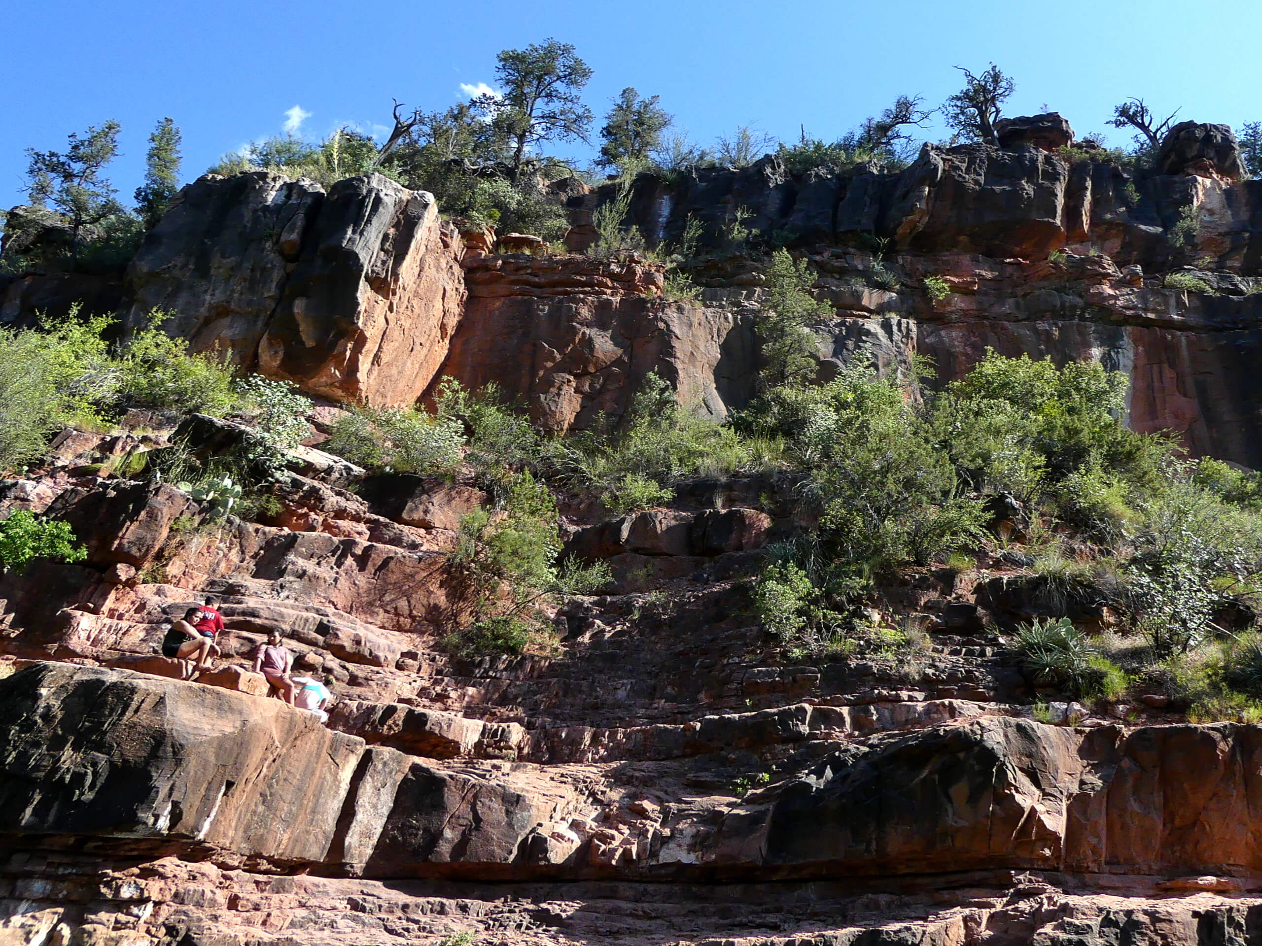
Allens Bend Trail
Difficulty Rating:
Allens Bend Trail is a 1.1mi moderately trafficked hike in Sedona that begins from the Grasshopper Point Picnic Area. This is a nice walk for the whole family, giving you the chance to stretch your legs and see some of Sedona’s scenery along the creek. This hike sees less traffic than many other trails in Sedona, so it’s a nice choice to pair with a picnic. You’ll have a nice spot to swim in the canyon before the hike, and then you’ll be able to enjoy the creek as you walk.
This hike follows a small part of a longer trail through Casner Canyon, so adventurous hikers can go further if they want to keep exploring. It’s not a very well-signed trail, so consider downloading a GPS track, especially if you want to explore the canyon.
Getting there
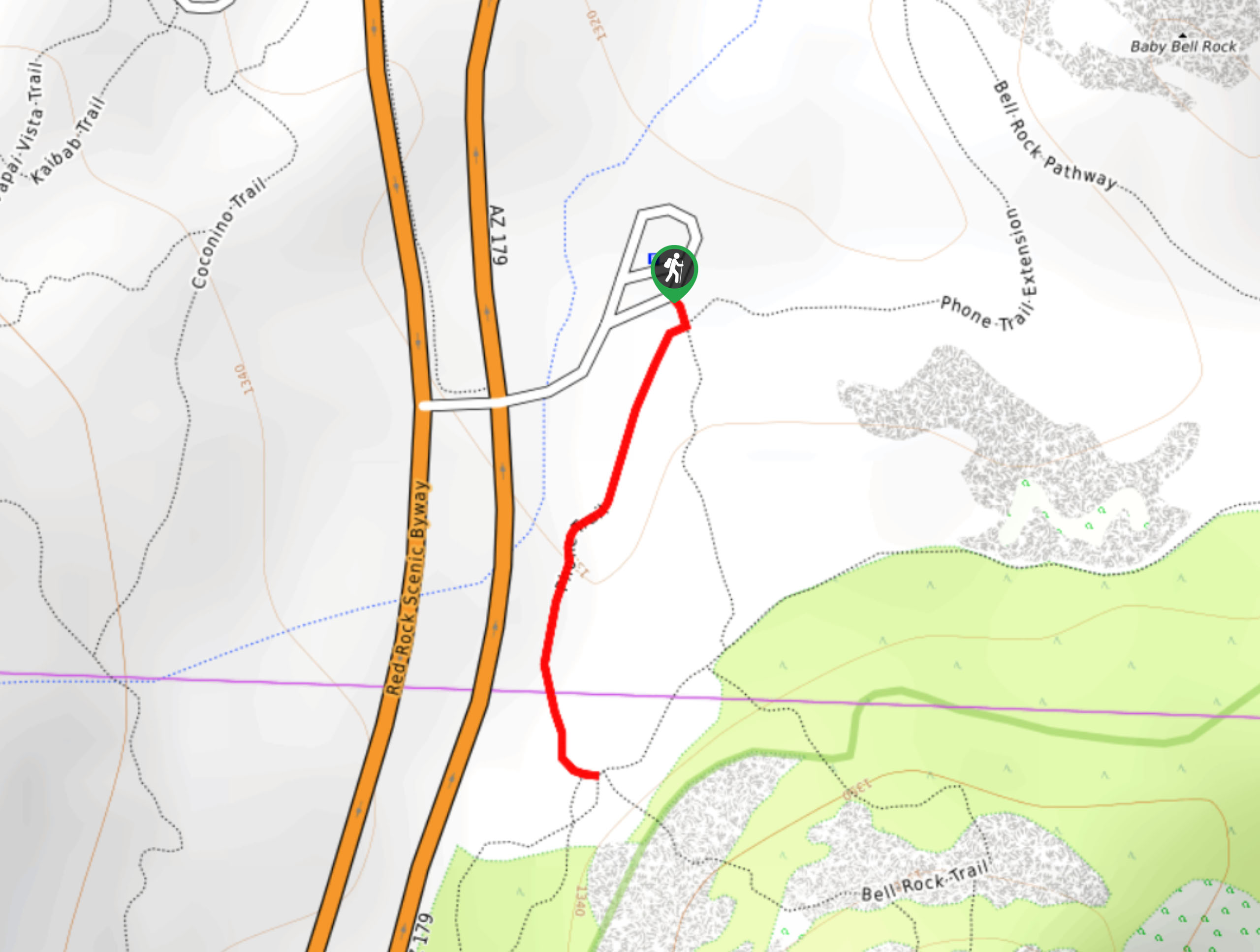
The trailhead for the Allens Bend Trail is at the Grasshopper Point Picnic Area off Highway 89A.

About
| Backcountry Campground | No |
| When to do | Year-round |
| Pets allowed | No |
| Family friendly | Yes |
| Route Signage | Poor |
| Crowd Levels | Moderate |
| Route Type | Out and back |
Allens Bend Trail
Elevation Graph
Weather
Allens Bend Trail Description
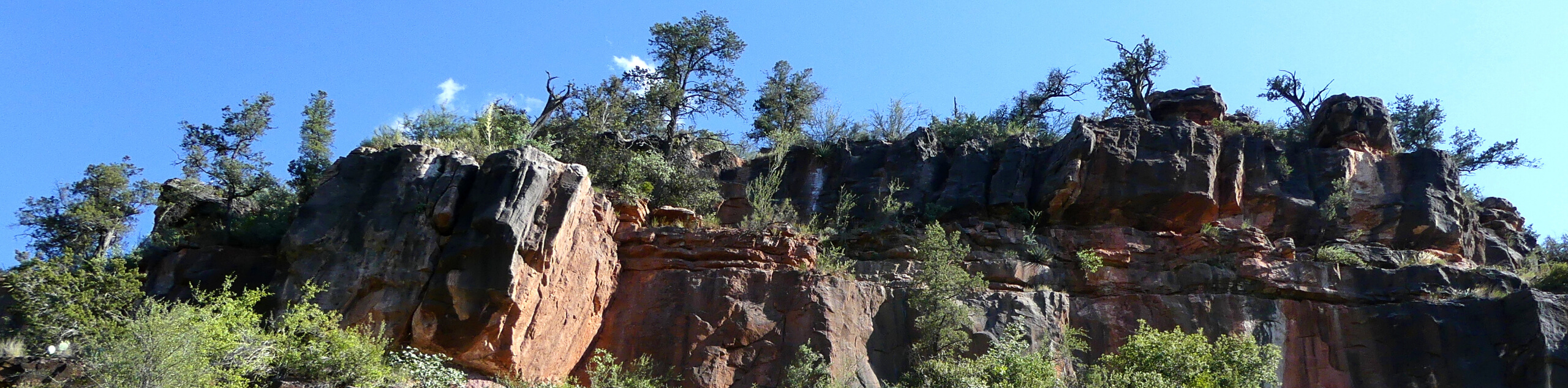
Allens Bend Trail is a great family-friendly adventure that starts from the Grasshopper Point Picnic Area. This hike takes you along Oak Creek and offers the option to continue hiking through Casner Canyon if you want a bit more of a challenge and more distance. If not, you can just take this easy, quick walk to admire the beauty of the creek and the cliffside that flanks it.
This trail is beautiful, even if it doesn’t have the same dramatic sightlines that others in Sedona do. The flowing creek, the juniper trees, the red rocks, it’s very pretty. This hike is especially good if you’re wanting to enjoy fall colors, so definitely swing by if you’re in Sedona in late September and early October.
The picnic area hugs the creek and offers a nice swimming hole. Spend some time enjoying it either before or after your hike. The water is aqua and you’ll feel sheltered by the red canyon walls.
There is a modest fee required to access Grasshopper Point and a Red Rock pass won’t be valid. Since it’s a short hike, it’s a good idea to pack a picnic and spend some time at the point before hiking to get your money’s worth.
The trail isn’t always well-marked, but when in doubt, follow the river. The route generally sits between the cliff wall and the water. While you might be tempted to jump in, take care to pick a part of the creek that isn’t flowing quickly and know that it could be chilly!
From the picnic area, take the trail that heads roughly north along Oak Creek. Stroll next to the canyon walls with the water on your right. Check out the juniper trees and other unique plant life in the area. The desert has a fascinating array of flora and fauna and it diversifies the closer you are to a water source.
The trail crosses Oak Creek when you’re across from the mouth of Casner Canyon. You can either cross over and continue into the canyon or turn back here and return to your swimming hole and picnic spot.
Trail Highlights
Oak Creek
Oak Creek and the Oak Creek Canyon are defining elements of Sedona’s landscape. The river and the gorge stretch between Flagstaff and Sedona, and the gorge is recognized as a “smaller cousin of the Grand Canyon” thanks to its beauty. The canyon ranges from 800ft to 2000ft tall and is about 12.0mi long. Oak Creek is mostly responsible for carving the gorge over many years.
Frequently Asked Questions
Is Grasshopper Point free?
There is a modest fee to access this area. Your Red Rock pass won’t cover admission into this area.
Is Grasshopper Point a hike?
Grasshopper Point is an area in the Oak Creek Canyon that is used for swimming, picnicking, fishing, and hiking.
Insider Hints
Bring a towel to take a dip if you’re here in the summer.
If you want to explore the canyon, we recommend sturdy boots as the footing is loose and rocky.
Similar hikes to the Allens Bend Trail hike

Margs Draw Trail
Margs Draw Trail is a bit of a hidden gem. This trail doesn’t get as much traffic as other nearby…
Broken Arrow and Morgan Road Loop
Broken Arrow Trail is a very popular route in Sedona used by hikers, mountain bikers, and off-roaders. This route uses…
Phone Trail
If you’re hiking to Bell Rock from the Bell Rock Trailhead, Phone Trail can be used instead of the Bell…
Comments