Airport View Trail
View Photos
Airport View Trail
Difficulty Rating:
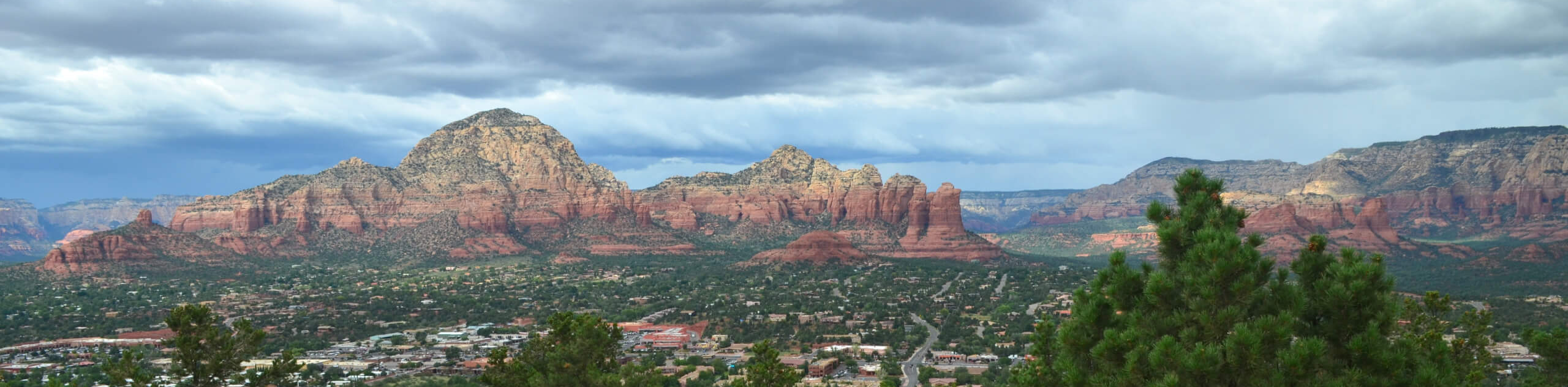
The Airport View Trail takes you from the upper parking area at the Sedona Airport to Airport Mesa, where there’s said to be a vortex. This is a great trail if you want a wide-open view of the city and it also allows you to watch unique small aircraft take off and land at the airport. It’s a nice hike to do to explore the mesa before settling in to watch the sunset. Expect heavy traffic on this route.
Getting there
The trailhead for the Airport View Trail is at the northeastern end of the parking lot adjacent to the airport on Airport Road.

About
| Backcountry Campground | No |
| When to do | Year-round |
| Pets allowed | Yes - On Leash |
| Family friendly | Yes |
| Route Signage | Good |
| Crowd Levels | High |
| Route Type | Out and back |
Airport View Trail
Elevation Graph
Weather
Airport View Trail Description
The Airport View Trail is an easy 1.4mi hike that takes you across Airport Mesa to a vortex site with a stellar view in all directions. You’ll be able to see 360 degrees across Sedona and the surrounding mountains and buttes, making for a very camera-worthy view. You can also read about the vortexes thanks to the signage at the endpoint of this hike.
This trail is quite rocky, so good boots are recommended. The parking area charges $3 (subject to change) and the trail begins at the northeastern end of the lot through the signed gate. If you want a longer hike in this area, try the Sedona Airport Loop Trail.
Walk across the lot to the signed gate. Through the gate, you’ll hike on an undulating rocky trail over the highway. There are some light climbs and descents, but it’s not very difficult for most hikers. It does get narrow in parts, and the trail is usually busy. Follow this trail to the saddle, where you can ascend the rock formation across from you by following the fencing (recently installed to protect the area outside of the trail). There’s a bit of climbing over smooth rock involved, but you can use the sturdy wire fencing for support. Atop the hill, revel in the view and take a moment to read the signage. See which rock formations you can spot, and tune inwards to feel the energy of the vortex.
When you’re ready, retrace your steps back to the parking lot.
Insider Hints
Mesa Grill near the airport is a great spot for lunch or dinner. Try the fries!
Similar hikes to the Airport View Trail hike

Margs Draw Trail
Margs Draw Trail is a bit of a hidden gem. This trail doesn’t get as much traffic as other nearby…

Baby Bell, Llama, and Bail Loop
The Baby Bell, Llama, and Bail Loop is a 3.6mi hike in Sedona near Bell Rock and Courthouse…

Herkenham Trail
Herkenham Trail is a 2.0mi out and back trail in the Coconino National Forest near Sedona. This route…
Comments