

Teepee Rocks Trail
View Photos
Teepee Rocks Trail
Difficulty Rating:
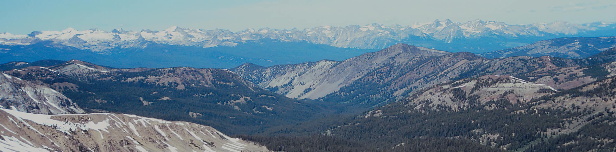
The Teepee Rocks Trail explores a natural wonder in the Sawtooth National Forest. Wander through the garden of white-rock, teepee-shaped spirals that rise from the landscape and revel in mesmerizing views of the surrounding mountainscape.
Getting there
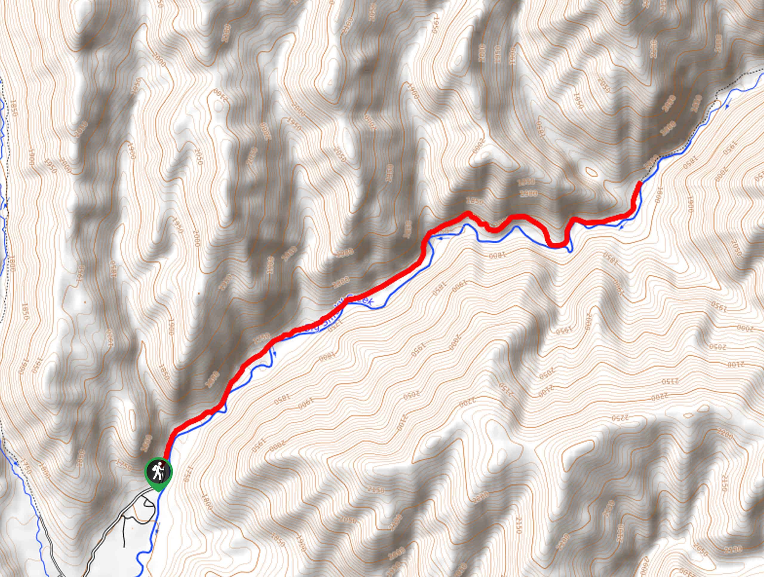
Access this adventure from Trapper Creek Road.

About
| Backcountry Campground | Dispersed Camping |
| When to do | April-October |
| Pets allowed | Yes - On Leash |
| Family friendly | Yes |
| Route Signage | Average |
| Crowd Levels | Low |
| Route Type | Out and back |
Teepee Rocks Trail
Elevation Graph
Weather
Teepee Rocks Hike Description
The Teepee Rocks Trail explores the labyrinth of unique spires in southern Idaho. Wander through the corridors of the white-hued outcrops and enjoy the expansive vistas of the Idaho Mountains. Note this area is not developed, so please practice the Leave No Trace Principles and be mindful of the fragile environment. Additionally, after rainfall, the terrain becomes quite slippery, so it is important to take your time and exercise careful footing. Finally, note the path is not signposted, though it is pretty easy to maneuver. Bring the trail GPS if you are nervous about navigating the route.
Setting out from the parking lot off Trapper Creek Road, you will be led northward, wandering along the dirt road bound by a white bluff on your right-hand side. Gradually climbing through the sagebrush steppe, the path will soon deliver you to an intersection. Here, keep right traveling northeastward along the exposed route. After some hiking, you will reach the garden of the unique spirals.
Climb into the community of spires, explore the impressive outcrops, and revel in the gorgeous panoramic views. Then, when you are ready to return to the trailhead, simply head back the way you came to the parking lot.
Similar hikes to the Teepee Rocks Trail hike

Heart Lake Trail
The Heart Lake Hike explores an area of tree burn that is abundant with lush regrowth in the Sawtooth National…
Fourth of July Lake Trail
Awe-inspiring scenery and idyllic alpine lakes await you on the Fourth of July Lake Trail. This pleasant trail leads adventurers…
Skillern Hot Springs Hike
A relaxing spa-like experience awaits you on the Skillern Hot Springs Hike. This pleasant trail explores the banks of Big…
Comments