
Ross Falls Hike
View Photos
Ross Falls Hike
Difficulty Rating:
The Ross Falls Hike is a family-friendly adventure in the Sawtooth National Forest that culminates at a mesmerizing waterfall tumbling over a rocky alcove. Get out into the fresh air and admire Idaho’s native flora and fauna.
Getting there
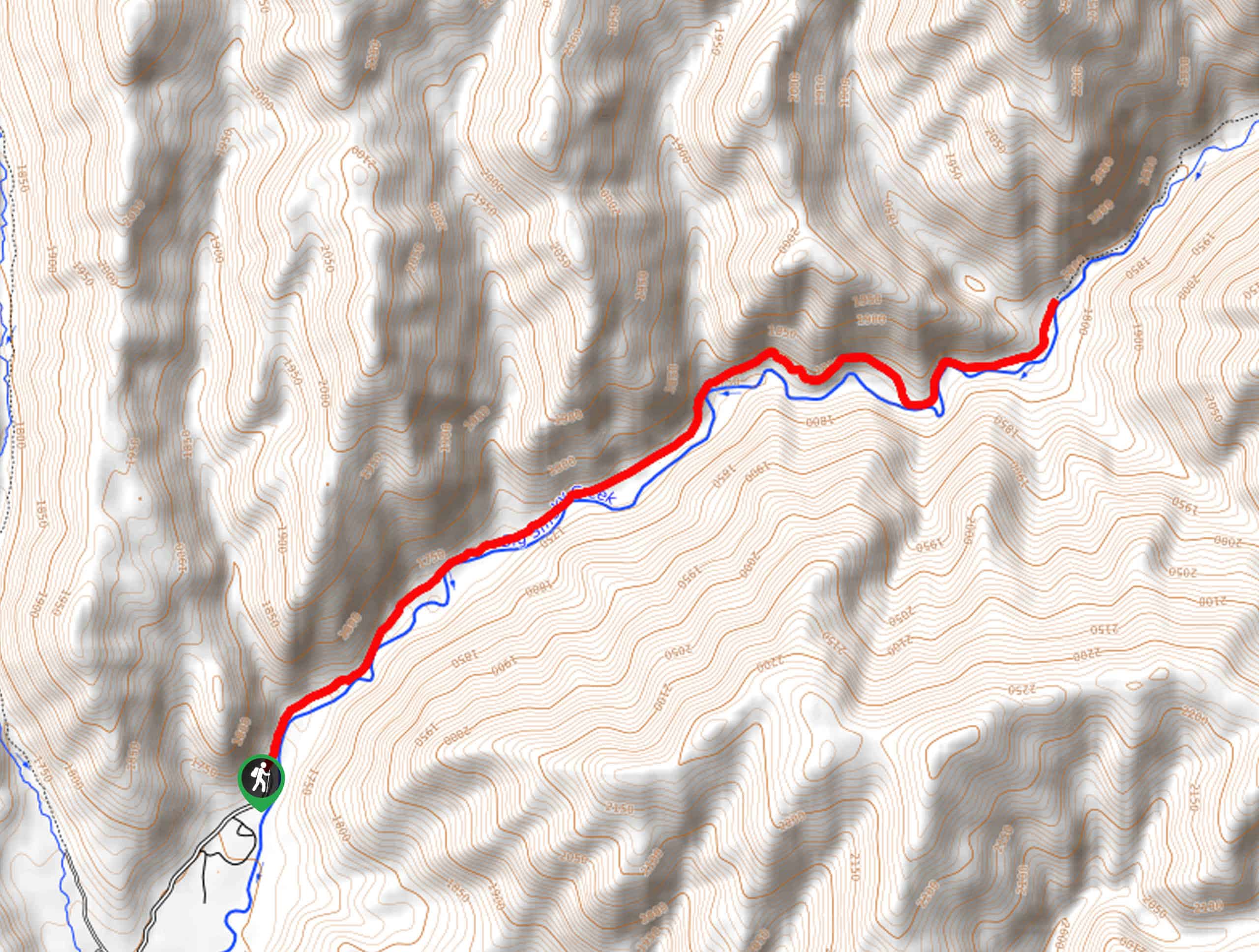
The Ross Falls Hike is located off Rock Creek Road.

About
| Backcountry Campground | No |
| When to do | Year-round |
| Pets allowed | Yes - On Leash |
| Family friendly | Yes |
| Route Signage | Average |
| Crowd Levels | Moderate |
| Route Type | Out and back |
Ross Falls Hike
Elevation Graph
Weather
Ross Falls Hike Description
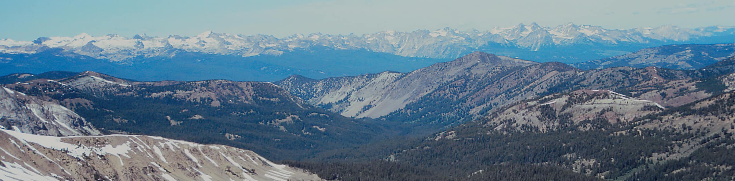
Those seeking a short, but scenic adventure near Twin Falls, Idaho, will likely appreciate the Ross Falls Hike. This pleasant trail wanders through mixed woodlands adorned with lush undergrowth and along a meandering creek. Just a hop, skip, and a jump away from the road, you will reach the mesmerizing cascade that billows over the sheer rock face! Note that while you can explore this route year-round, spring is the best time to visit during the peak-run off-season.
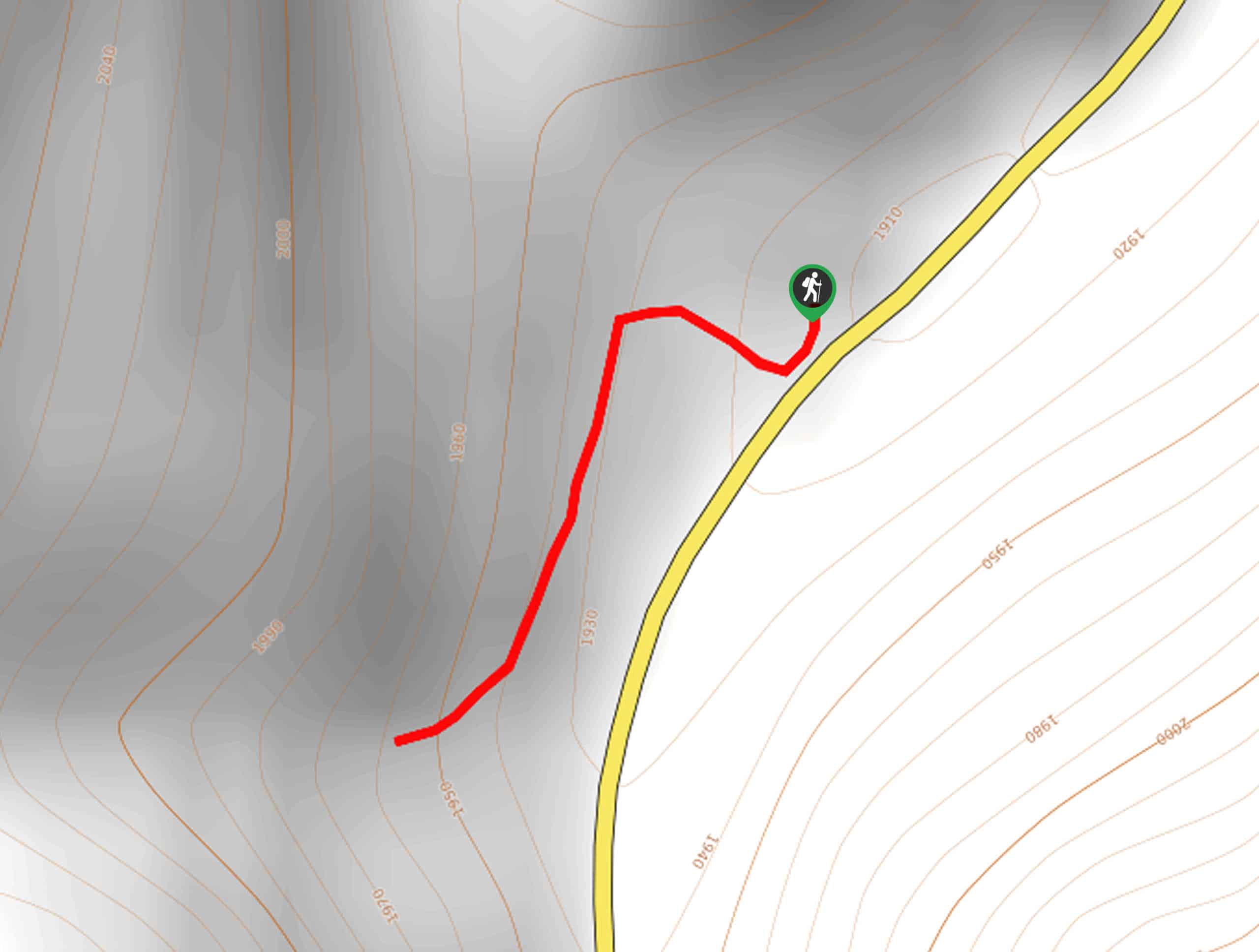
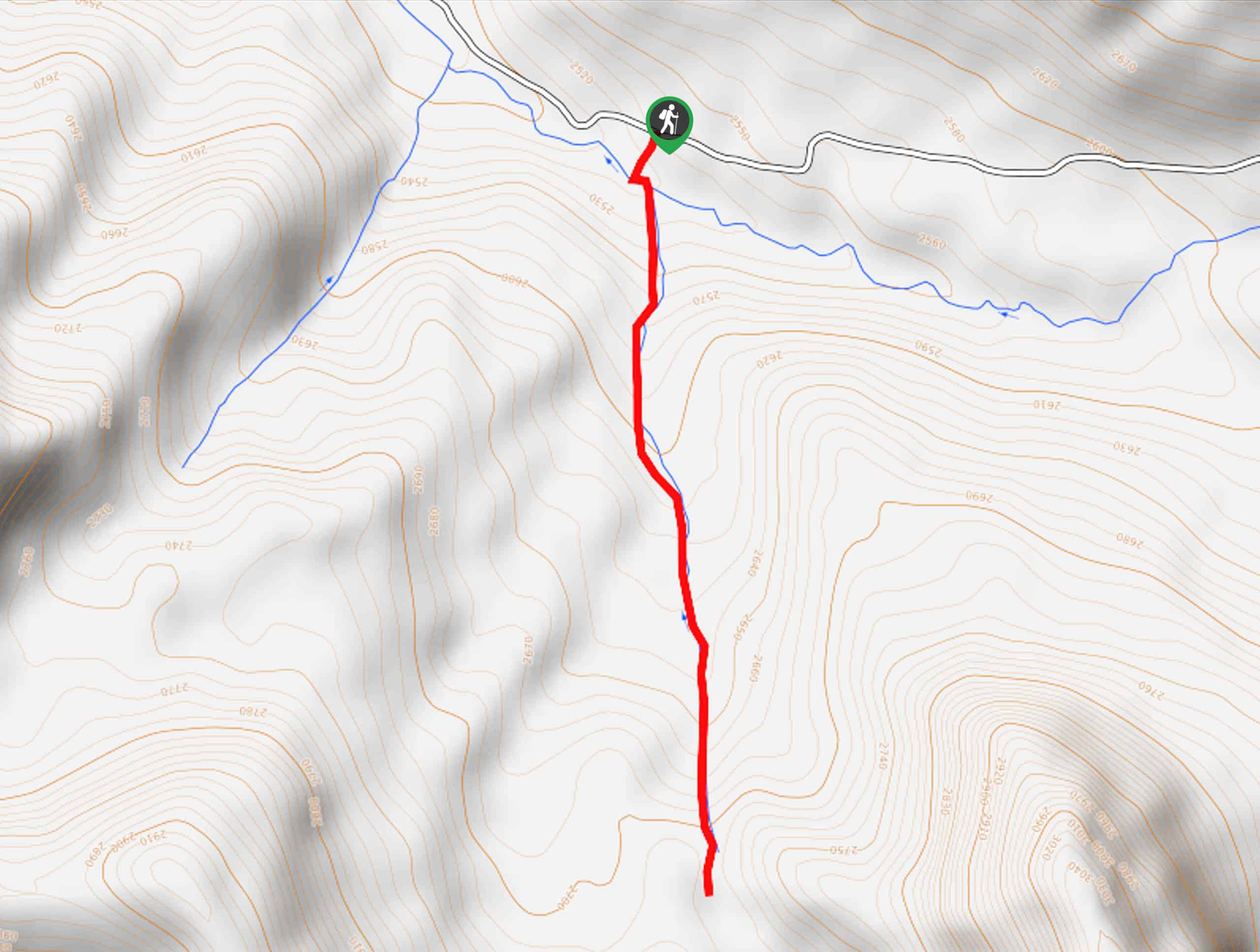
Setting out from the trailhead, take the trail signposted for the Ross Falls Trail. The first few steps of your adventure travel west before diverting southwardly, gradually climbing through the verdant forests alongside the meandering creek. Minding your footing on the rocky terrain as you ascend, the path will soon unfold to the sights of Ross Falls. Admire the scenes of the looming rock wall and continue to the base of the cascades.
Explore the falls and rejuvenate your tired feet in the chilly alpine waters. When you are through exploring the waterfall, turn around and retrace your steps back to the trailhead.
Similar hikes to the Ross Falls Hike hike
Heart Lake Trail
The Heart Lake Hike explores an area of tree burn that is abundant with lush regrowth in the Sawtooth National…
Fourth of July Lake Trail
Awe-inspiring scenery and idyllic alpine lakes await you on the Fourth of July Lake Trail. This pleasant trail leads adventurers…
Skillern Hot Springs Hike
A relaxing spa-like experience awaits you on the Skillern Hot Springs Hike. This pleasant trail explores the banks of Big…
Comments