Manifold Track Circular Walk
View PhotosManifold Track Circular Walk
Difficulty Rating:
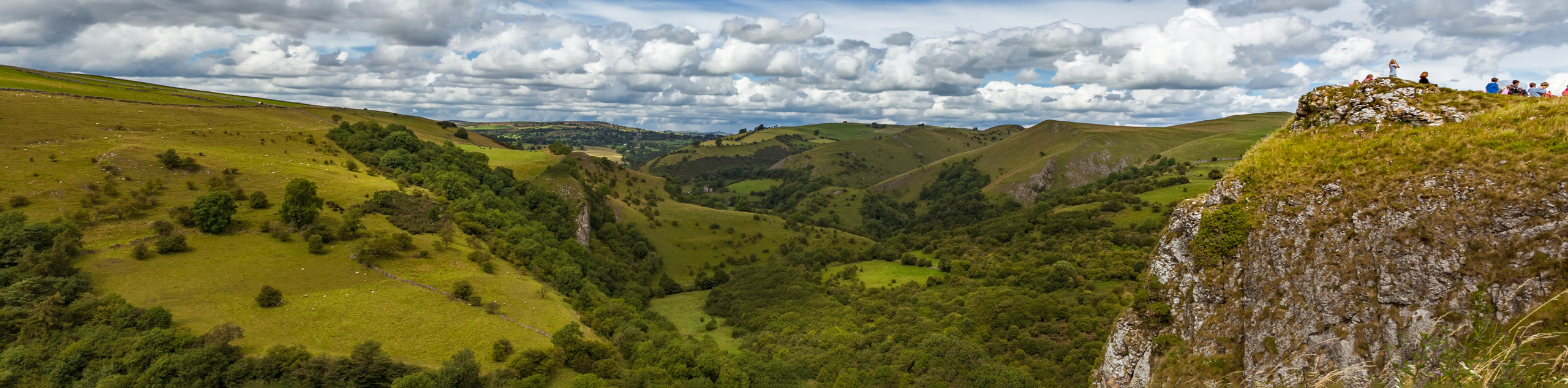
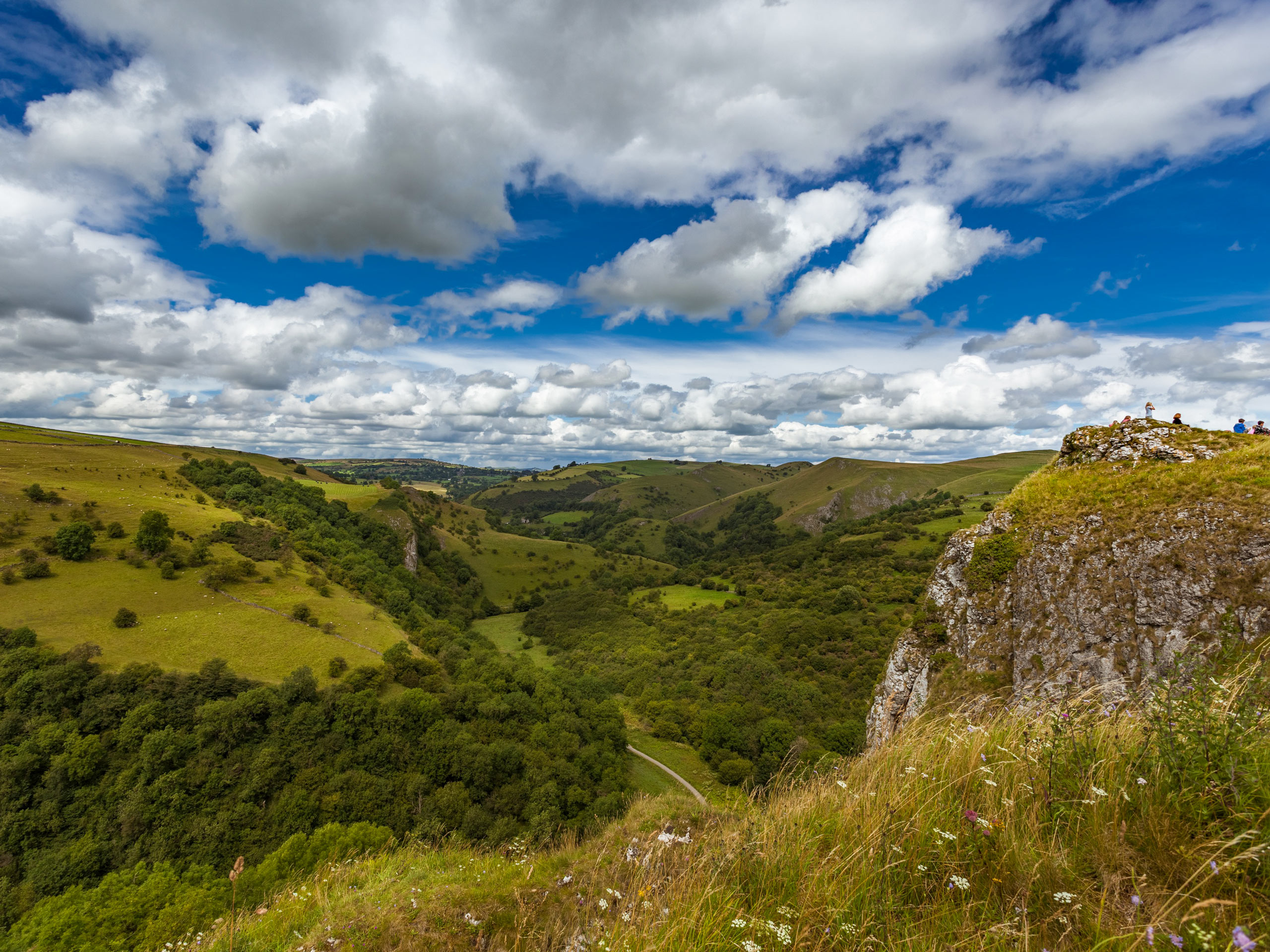
The Manifold Track Circular Walk is an 5.5mi circuit route that sets out from the village of Wetton and traverses the surrounding farmland to skirt alongside the coursing waters of the Manifold River. While out on this walk, you will experience breathtaking views across the Derbyshire landscape and visit the various local sites that can be found along the banks of the river. This route can be quite busy at times, so make sure to set out early to beat the crowds!
Getting there
To reach the Manifold Track Circular Walk trailhead from the Wetton Village Hall and Tea Rooms, head southwest for 0.1mi and turn left at Leek Road. In 226ft, you will find the starting point for the walk on your right.

About
| When to do | Year-Round |
| Backcountry Campsites | New House Farm |
| Pets allowed | Yes - On Leash |
| Family friendly | Yes |
| Route Signage | Average |
| Crowd Levels | Moderate |
| Route Type | Circuit |
Manifold Track Circular Walk
Elevation Graph
Weather
Manifold Track Circular Walk Description
The Manifold Track Circular Walk is a scenic walk in Derbyshire, although it might not be suitable for all walkers. The trail largely cuts through the countryside and features several small ascents and descents before winding along the banks of the Manifold River. Some stretches of terrain along the walk will be uneven and sometimes muddy depending on the time of year.
This route is a pleasant walk through open farmland, rolling green hills, and riverside terrain that is sure to be the highlight of your weekend. While out on the trail, you will walk around several local landmarks, including Wetton Hill, Thor’s Cave, and the Wetton Mill that can be found along the banks of the Manifold River. This is a perfect walk if you are after some scenic views of the countryside without too much difficulty.
Setting out from the trailhead, turn right and follow along the road for 0.1mi, turning left onto Carr Lane and continuing on for another 0.2mi into the village of Wetton. Turn left onto High Withes Lane and make your way through town for 0.1mi before turning right onto the lane. Continue along the lane for 0.2mi and keep straight to access the trail at the bend in the road. After crossing over two stiles, make your way straight across the open farmland for 0.4mi, where you will need to cross a series of several more stiles, before coming to a fork in the path.
Keep right here and continue across the field, heading straight through a junction to a small stream crossing. Continue northwest along the trail for 0.2mi, crossing over a stile and passing through a gate to cut through the trees and arrive at a lane. From here, follow along the road as it forks to the left and continues on for 0.2mi, where you will find a gate on your left in the bend of the road.
Pass through the gate and follow the trail south along the stone wall, where you will come to another gate in 0.14mi. Make your way through it to continue on through the scenic countryside for another 0.2mi, with scattered sections of wood on your left. Pass through a series of two stiles and keep on down the path for 313ft, turning right at the next junction. After 0.3mi along the path, you will cross over another stile and pass through a gate to make your way past the cottage and along Manifold Valley Road towards the Wetton Mill.
After passing by a karst cave known as Nan Tor on your left, you will walk by the Wetton Mill and make your way over the River Manifold before turning left at the road. Follow this to the southeast for 0.4mi, as it follows alongside the flowing waters of the river and eventually meets up with Leek Road. Directly opposite you will find a gate and beyond it, your next trail.
Pass through the gate and follow the track as it meanders alongside the winding River Manifold for the next 1.3mi, providing some nice views of the surrounding countryside and a serene waterside atmosphere. This portion of the walk doesn’t feature any confusing directions, so just keep straight along the track and take in the natural beauty around you. Once you have arrived at a gate, pass through it and cross the car park to turn left on the road and make your way once again over the river.
Follow along Larkstone Lane for 266ft and pick up the trail on your left to briefly cross through the countryside before meeting back up with the road. Continue along it for another 0.2mi, once again heading left and crossing over a stile to cut across the open terrain. In 0.1mi, pass through the gate and head left on Carr Lane, following it for 0.1mi. Branch off to the left here, where you will once again cross several stiles that separate the fields that make up the final stretch of the walk. After passing through the gate, make your way to the road where you can pick up your vehicle and head home having just completed the Manifold Track Circular Walk.
Other amazing walks in Peak District National Park
Check out our guides to Kinder Scout, Mam Tor, Stanage Edge, Dovedale, and Padley Gorge. Or see all of our Peak District walks on 10Adventures.
Insider Hints
There are several car parks throughout the village of Wetton that can be utilized.
The trail can become quite busy in certain areas, especially in Wetton and the area around Thor’s Cave. Arrive early to beat the crowds.
Pop into the Wetton Village Hall and Tea Rooms for some post-walk refreshments.
Similar hikes to the Manifold Track Circular Walk hike

Valehouse Reservoir Circular
The Valehouse Reservoir Circular is a 3.1mi lollipop trail near Glossop that travels around the edge of the…

Three Edges Walk
The Three Edges Walk is a challenging circuit in Derbyshire that will take you along three escarpments that offer some…

Edale Rocky Ridges Walk
The Edale Rocky Ridges Walk is just that - an adventurous walk along a rugged ridgeline. While out on the…
Comments