Lathkill Dale Walk
View Photos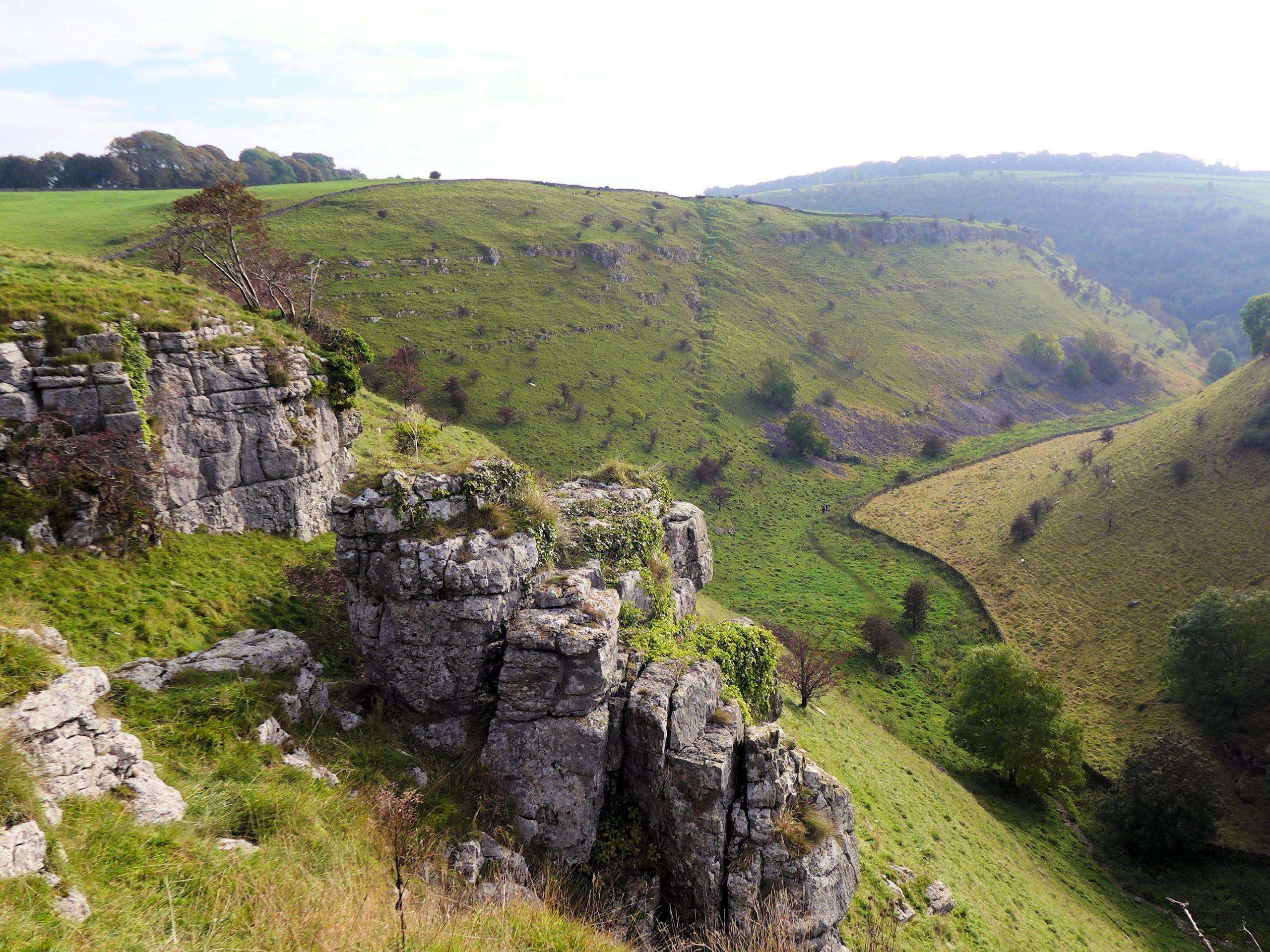
Lathkill Dale Walk
Difficulty Rating:
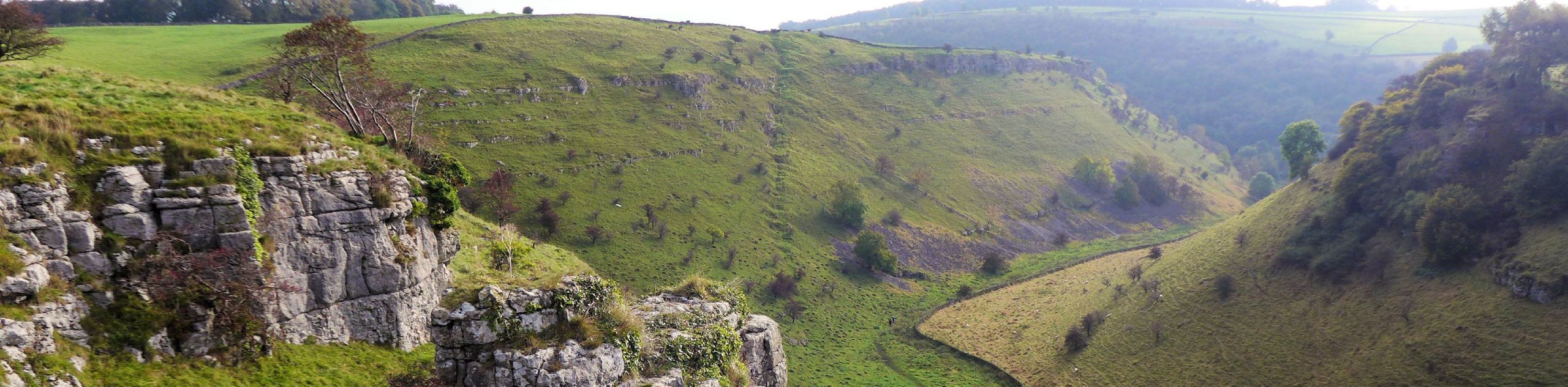
The Lathkill Dale Walk is an 8.5km circuit in Derbyshire that sets out near the village of Youlgreave and passes through the pristine english countryside to arrive in a charming dale along the banks of the River Lathkill. Once there, you will be able to walk along the water’s edge and take in the views of the beautiful river valley that is flanked by limestone cliffs. With plenty of scenic views and historical sites to visit, this route is perfectly suited for a weekend stroll in the Peak District.
Getting there
To reach the Lathkill Dale Walk car park from Youlgreave, drive north on Moor Lane for 1.1mi, and you will find the car park on the left.

About
| When to do | March-October |
| Pets allowed | Yes - On Leash |
| Family friendly | Older Children only |
| Route Signage | Average |
| Crowd Levels | Moderate |
| Route Type | Circuit |
Lathkill Dale Walk
Elevation Graph
Weather
Lathkill Dale Walk Description
Although the Lathkill Dale Walk only features a small amount of elevation gain along the route, there are a few steep sections that you should take note of, particularly the steep stone steps that are often slippery after a good rainfall. This, in addition to the open stretches of farmland that you will need to traverse, makes decent walking footwear a priority for this journey.
Setting out from the car park, make your way across the road and follow the trail as it cuts across the farmland to the west. After a brief walk through Low Moor Wood, you will pass by Low Moor Farm on your left and cross a few more fields before making your descent along the steep stone steps into the forest. Keep right here to continue through the beautiful forests of the Lathkill Dale Nature Reserve before arriving at the banks of the River Lathkill.
Make your way over the footbridge that spans the river and head east, following the coursing river as it cuts through the dramatic landscape that is characterized by the limestone cliffs towering overhead. After passing by a charming waterfall, you will make your way through Palmerston Wood and eventually arrive at the ruins of Bateman’s House, the former residence of Thomas Bateman who worked for the Lathkill Mine. Continuing east along the trail, you will pass by several old mines before arriving at the Lathkill Lodge. Follow the path back across the river to climb uphill and cut across the open farmland, eventually arriving back at the car park where you began your walk.
Other amazing walks in Peak District National Park
Check out our guides to Kinder Scout, Mam Tor, Stanage Edge, Dovedale, and Padley Gorge. Or see all of our Peak District walks on 10Adventures.
Similar hikes to the Lathkill Dale Walk hike

Valehouse Reservoir Circular
The Valehouse Reservoir Circular is a 3.1mi lollipop trail near Glossop that travels around the edge of the…

Three Edges Walk
The Three Edges Walk is a challenging circuit in Derbyshire that will take you along three escarpments that offer some…

Edale Rocky Ridges Walk
The Edale Rocky Ridges Walk is just that - an adventurous walk along a rugged ridgeline. While out on the…
Comments