
Fairholmes Derwent Valley Walk
View Photos
Fairholmes Derwent Valley Walk
Difficulty Rating:
Located in the scenic Upper Derwent Valley, the Fairholmes Derwent Valley Walk is a scenic route that allows you to view some of the charming terrain that can be found in the Peak District. While out on the trail, you will experience views that stretch across the open moor and down into the valley with the Ladybower Reservoir nestled below. Walking this trail will also provide you with access to countless other adventures that can be found in the area - just make sure to arrive early enough for parking.
Getting there
To get to the trailhead for the Fairholmes Derwent Valley Walk from Bamford, make your way north for 1.9mi along Ashopton Road/A6013 and turn left onto the A57. Turn right after 0.7mi and follow the road for another 2.3mi, where you will arrive at the car park next to the Upper Derwent Visitor Centre.

About
| When to do | March-November |
| Backcountry Campsites | No |
| Pets allowed | Yes - On Leash |
| Family friendly | Older Children only |
| Route Signage | Average |
| Crowd Levels | Moderate |
| Route Type | Circuit |
Fairholmes Derwent Valley Walk
Elevation Graph
Weather
Fairholmes Derwent Valley Walk Description
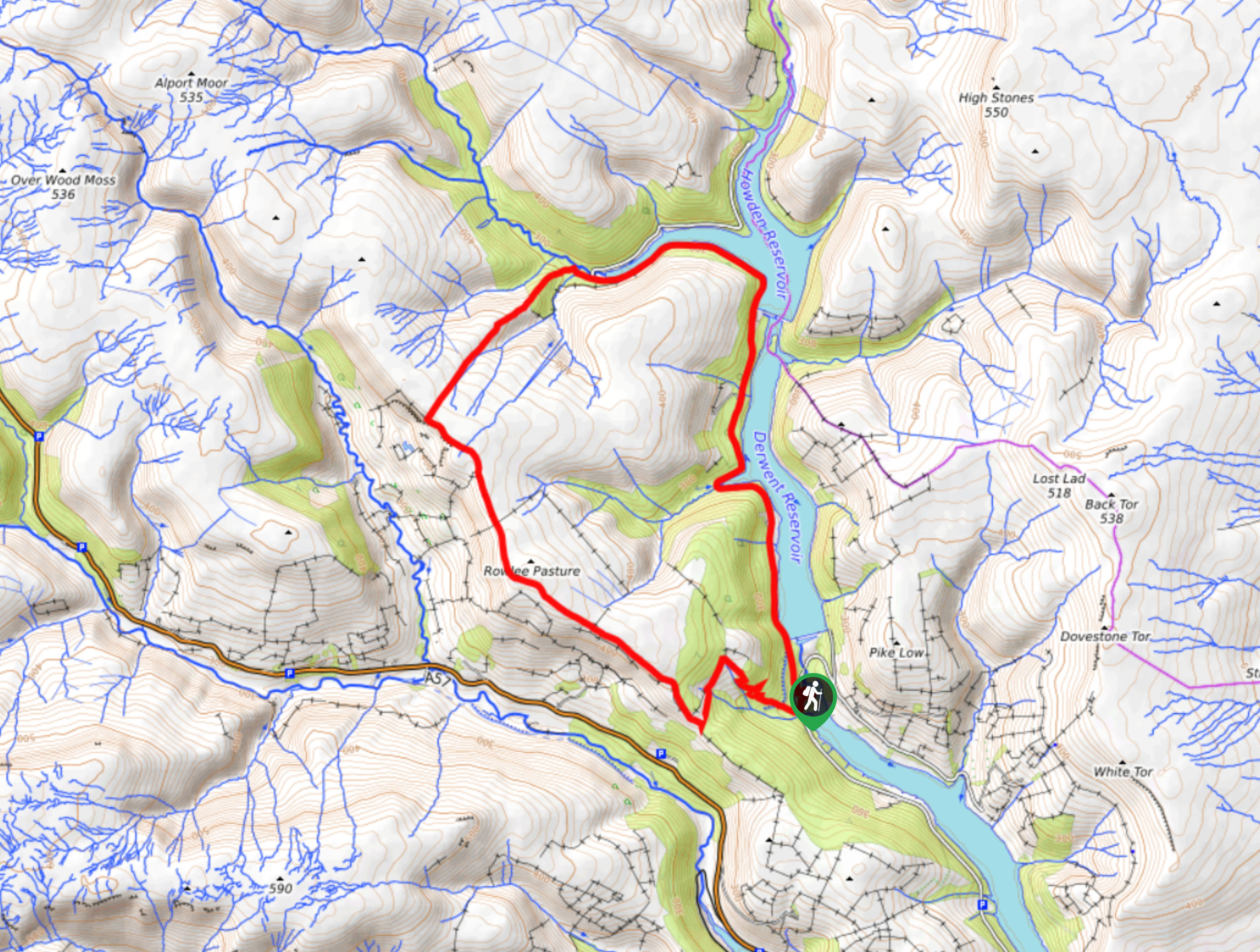
The Fairholmes Derwent Valley Walk is a popular route in the Peak District due to its location in the Upper Derwent Valley, an area well known for its access to a variety of outdoor activities. Setting out from the car park at the visitor centre, cross over the road and make your way west to climb the forested slope and arrive at the Lockerbrook Farm Outdoor Centre. From here, continue along the trail to the south to make your way around the forest, before climbing slightly uphill to cross the moor to the north. After taking in the views of the Peak District landscape, you will eventually arrive at the edge of the Howden Reservoir. Follow along the edge of the water, as the trail leads you south to pass the Howden and Derwent dams before arriving back at the trailhead where you began.
Other amazing walks in Peak District National Park
Check out our guides to Kinder Scout, Mam Tor, Stanage Edge, Dovedale, and Padley Gorge. Or see all of our Peak District walks on 10Adventures.
Similar hikes to the Fairholmes Derwent Valley Walk hike

Valehouse Reservoir Circular
The Valehouse Reservoir Circular is a 3.1mi lollipop trail near Glossop that travels around the edge of the…

Three Edges Walk
The Three Edges Walk is a challenging circuit in Derbyshire that will take you along three escarpments that offer some…

Edale Rocky Ridges Walk
The Edale Rocky Ridges Walk is just that - an adventurous walk along a rugged ridgeline. While out on the…
Comments