
Derwent Edge Walk
View Photos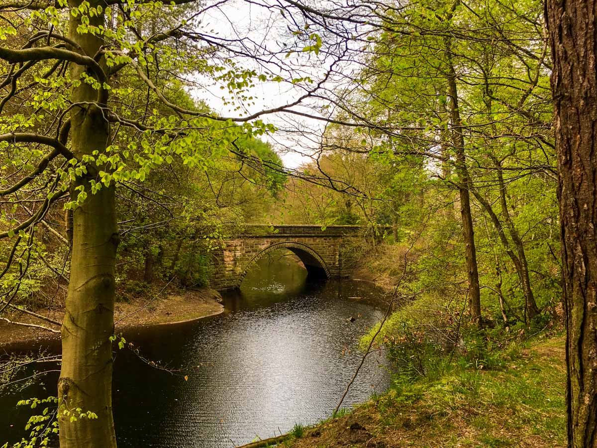
Derwent Edge Walk
Difficulty Rating:
Derwent Edge Walk takes you from the Lady Bower Reservoir up steep, wood-lined ravines to emerge on top of the moors. On a clear day expect phenomenal views of the Derwent valley and its unique "gritstone (sandstone) tors".
Getting there
To get to the Derwent Edge Trailhead by car, turn off the A57 Snake Pass road at Ladybower Reservoir following the brown signposts for Derwent Valley Dams. There is paid parking at the visitor centre.

About
| When to do | All Year |
| Backcountry Campsites | No |
| Toilets | At the trailhead (Fairholmes) |
| Family friendly | No |
| Route Signage | Average |
| Crowd Levels | Moderate |
| Route Type | Circuit |
Derwent Edge Walk
Elevation Graph
Weather
Derwent Edge Walk Description
To start the Derwent Edge Walk from Fairholmes, go past the visitors centre in the direction of the Derwent Dam. You don’t have far to walk before you are staring up at its huge stone wall supported by two gothic towers. Occasionally large amounts of rainfall cause the dam to overflow creating a spectacular waterfall.
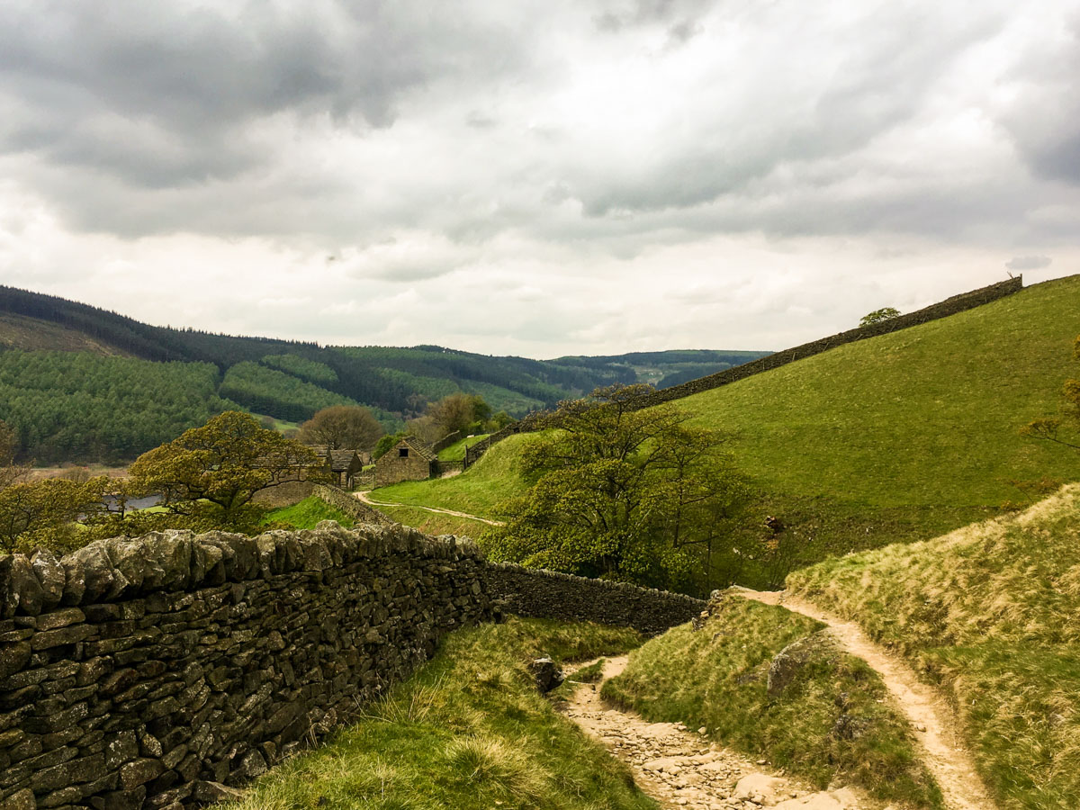
Follow the path as it passes in front of the dam and climb the steps at the eastern tower and turn left at the top to join a large bridleway going around the banks of the reservoir. After just 656ft along this track, just before a small bridge, turn right onto a steep footpath that climbs Hollins Clough. The path stays close to the Clough, which is on your left.
On top of the moor, the path starts to veer right and away from the Clough to reach a track junction. Take the left grassy track and stay on it across the moor until you reach a fence and the track turns right alongside it.
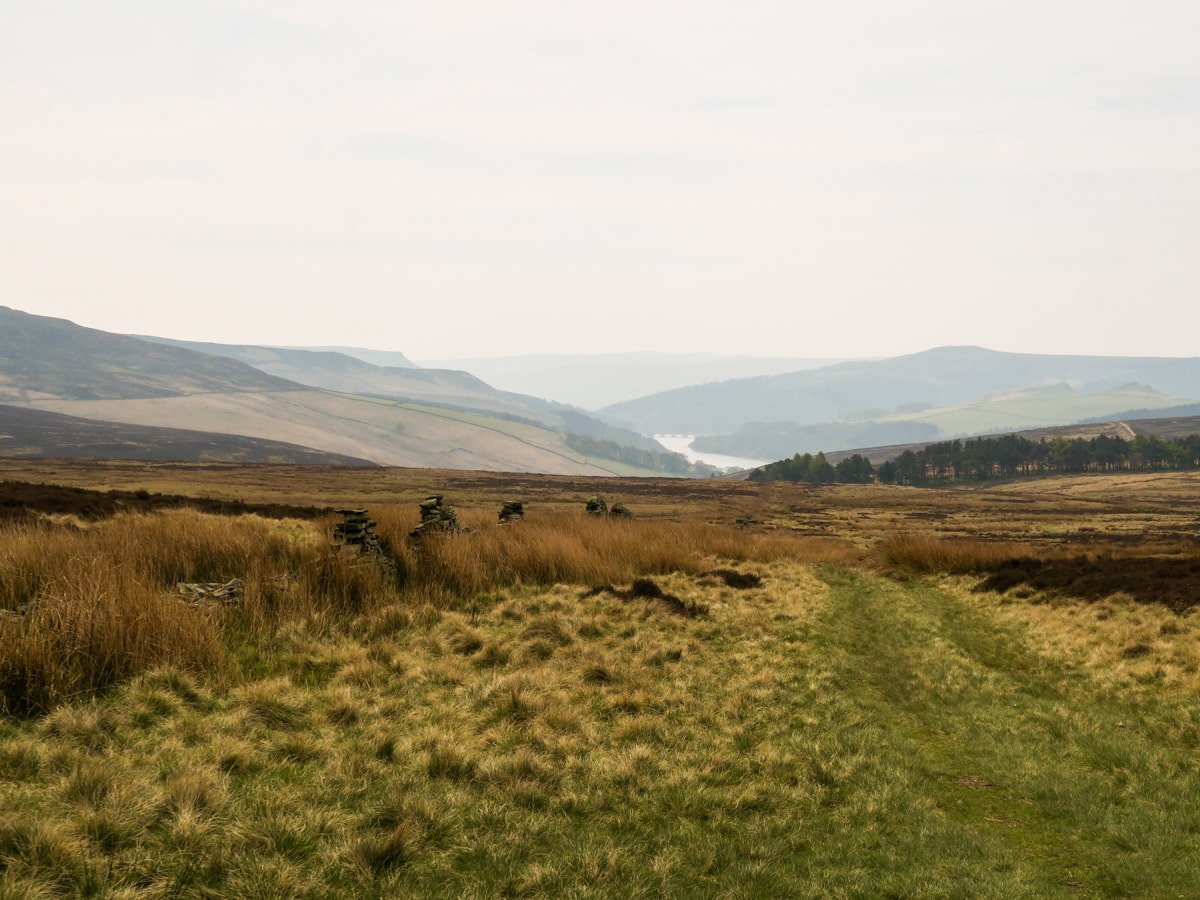
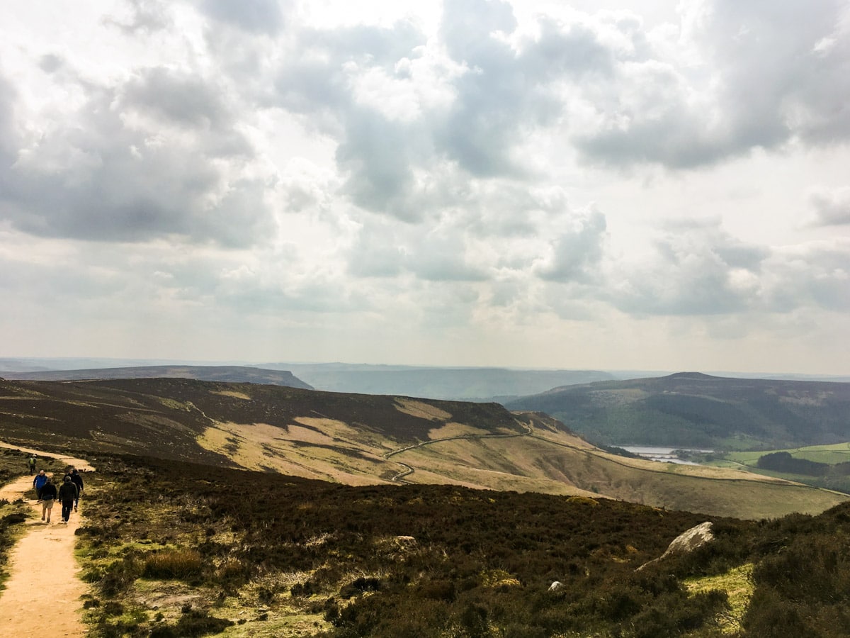
You will soon come to a stile. Behind you are phenomenal views of the Derwent and Ladybower Reservoirs. Cross the stile and follow a narrow path through the heather to emerge on another grassy track.
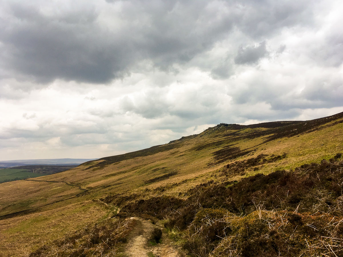
Turn left onto this grassy track and continue ahead towards Lost Lad and Back Tor, which will be visible in the distance on a clear day. Ignore a track that descends gently to the right following a stone wall. Instead, continue straight ahead to the foot of Lost Lad Hillend, following the signs to Derwent Edge.
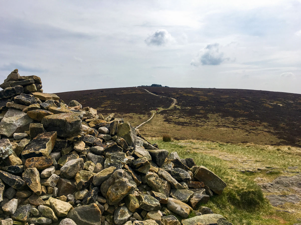
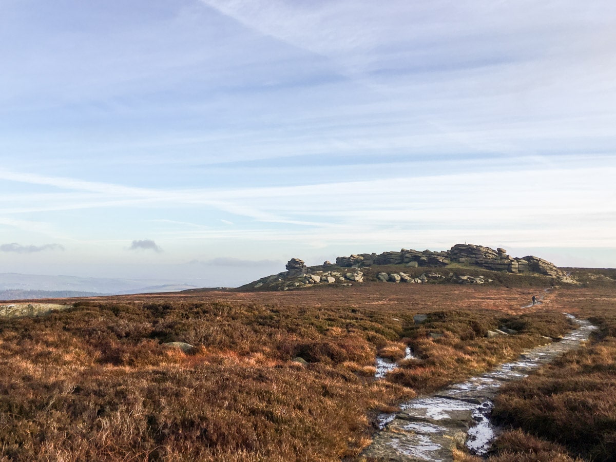
Soon you will intercept an obvious flagstone path that leads East across to Lost Lad (1699ft). From Lost Lad, you will descend briefly before climbing up to Back Tor (1765ft), the highest trig point, with shortwith stone pillars on the route. Climb atop the boulders and enjoy one of the Peak District’s finest views.
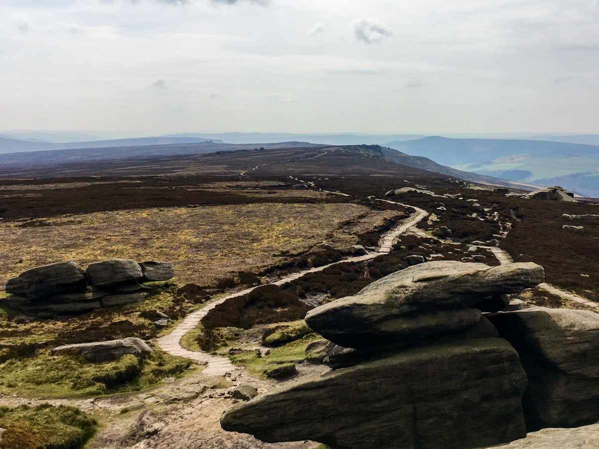
From Back Tor, the path that faces South along Derwent Edge is well defined. You will pass several unusual rock features on this path with unusual names; Cakes of Bread, Dovestone Tor, Salt Cellar and Wheel Stones.
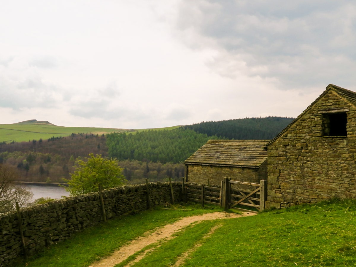
At 1640ft, after Wheel Stones, you will reach a signed path junction. Take the path to the right that drops off the edge and back towards Ladybower reservoir. Follow this path until it intercepts a bridleway that leads down the side of a plantation and to a collection of old barns at Grindle Clough.
Squeeze through the small farm gates and onto a steep flagstone path, down across a pasture. Emerging on the quiet reservoir road, turn right and follow the road North for 1.6mi back to Fairholmes.
Trail highlights
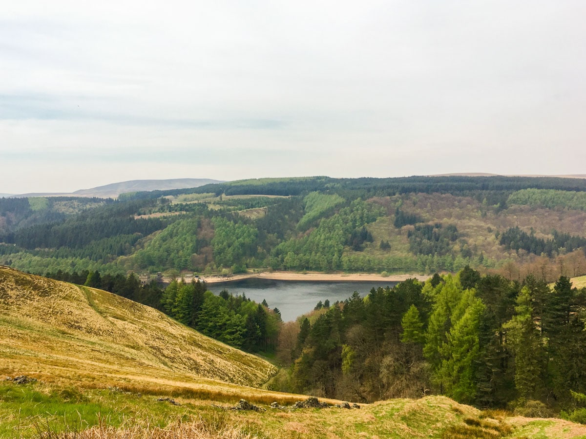
Derwent and Ladybower Reservoirs
Derwent Reservoir is in the middle of three reservoirs that is located in the Upper Derwent Valley in the Northern end of Derbyshire. The Ladybower Reservoir sits at the end of these rivers and Derwent River flows first through Howden Reservoir and then to Ladybower.
The Derwent Reservoir is the main water supply that nourished North East England. The Derwent Reservoir takes approximately 3- 4 hours to complete where the Ladybower Reservoir takes approximately 2.5 hours.
Derwent Edge
The Derwent Edge is located in the Peak District National Park in the English county of Derbyshire. The highest point of this edge is located at Black Tor and the height is 1765ft.
The Derwent Edge has unique features such as the unusually shaped gritstone tors which have been affected by frost, rain and wind over centuries and have given them the shape they are now.
Want to find more great walks in the Peak District? Check out these amazing routes:
Insider Hints
Consider a sunset hike along the ridge for a truly special Peak District panorama. The crowds will be much lower too.
Unwind afterwards with some proper Peak District ‘pub grub’ at the nearby Strines Inn, built in 1275. You can also choose to start your hike onto the edge from here, just follow the footpath onto Back Tor.
You can get the 273/274 bus Sheffield - Derwent Dams - Castleton and arrive at Fairholmes.
Derwent reservoir was used by 617 squadron pilots in WW2 as a practice sight for low level flights required for dam buster raids. The story is worth a read at the visitors centre on your return.

Similar hikes to the Derwent Edge Walk hike

Valehouse Reservoir Circular
The Valehouse Reservoir Circular is a 3.1mi lollipop trail near Glossop that travels around the edge of the…

Three Edges Walk
The Three Edges Walk is a challenging circuit in Derbyshire that will take you along three escarpments that offer some…

Edale Rocky Ridges Walk
The Edale Rocky Ridges Walk is just that - an adventurous walk along a rugged ridgeline. While out on the…
Lance Cooling 3 years ago
Lance Cooling 3 years ago
First time with the other half in the hills and she absolutely loved it, took our time as the view was so great ??
Karl 3 years ago
Trvlwatkin 3 years ago
Benlaw1981 4 years ago
Marvellous walk. Took us a long time as we have children aged 4 and 8, so lots of stops for climbing rocks and picnics. Paths after the first climb to the main bridleway are a little fiddly, otherwise the route is very easy to navigate. After the brisk initial climb and the climb onto the Edge the route is easy going. Stunning views and fantastic rock formations to boulder on. Highly recommended.
morro6590 4 years ago
Amazing walk- can do this in a shorter time if you don’t stop to take photos all the time! Worth taking some form of wind proof/ soft shell with you as it can get pretty breezy up at the top! The views are fantastic along Derwent Edge. The history behind the disappearance of Derwent village is pretty amazing as well and one to look up on.
Squarepants11 4 years ago
You shouldn't miss visiting this one in the Peak District. I had so much fun during the hike and the scenery is inspiring.
Elenastankova 4 years ago
Felt a little emotional upon reaching the peak. I'm so in love with the view <3
Stephen L. 4 years ago
Magnificent views! This hike takes you from Lady Bower Reservoir up steep, wood-lined ravines to emerge on top of the moors. Phenomenal views of the Derwent valley and its unique "gritstone (sandstone) tors"
FellWalker 4 years ago
Gorgeous views with a nice steady and clear path to walk with.