Tramway Road to Bottom Station Trail
View Photos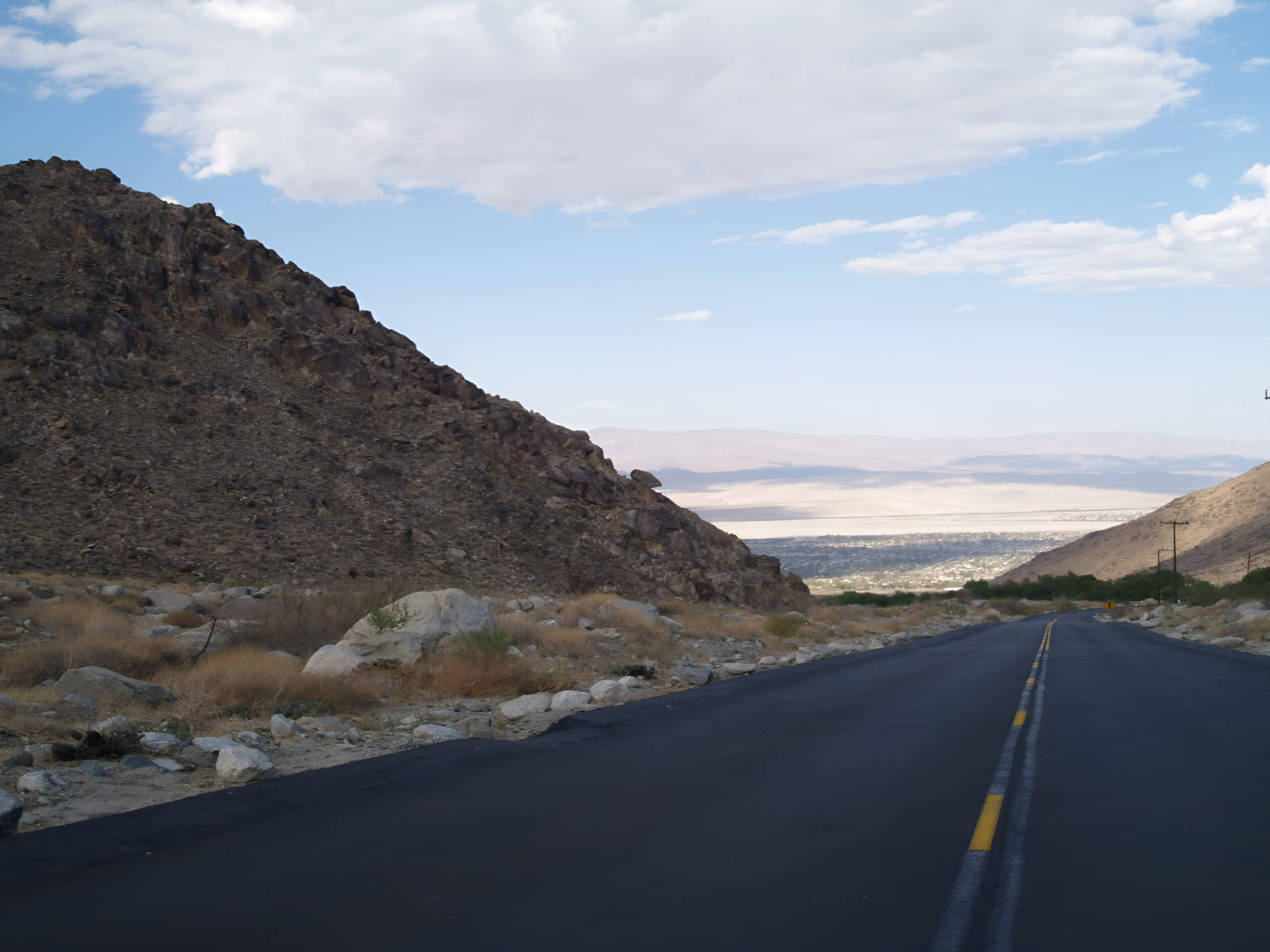
Tramway Road to Bottom Station Trail
Difficulty Rating:
The Tramway Road to Bottom Station Trail is a local favorite! The unraveling scenery fused with the workout it provides and dog-friendliness only add to its popularity. It’s a good idea to set out early as the heat can be unbearable later in the day, especially during the summer, late spring, and early autumn.
Getting there
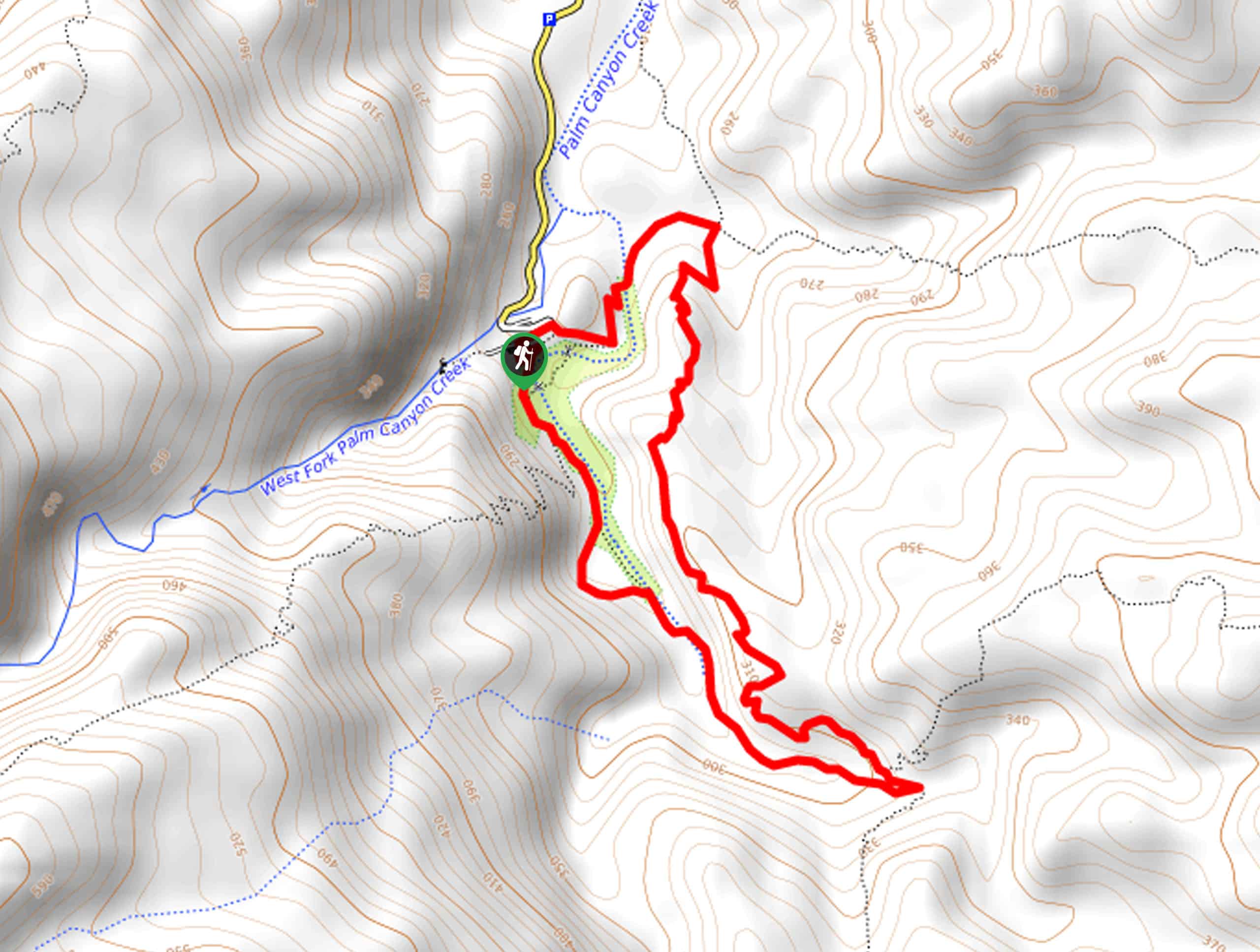
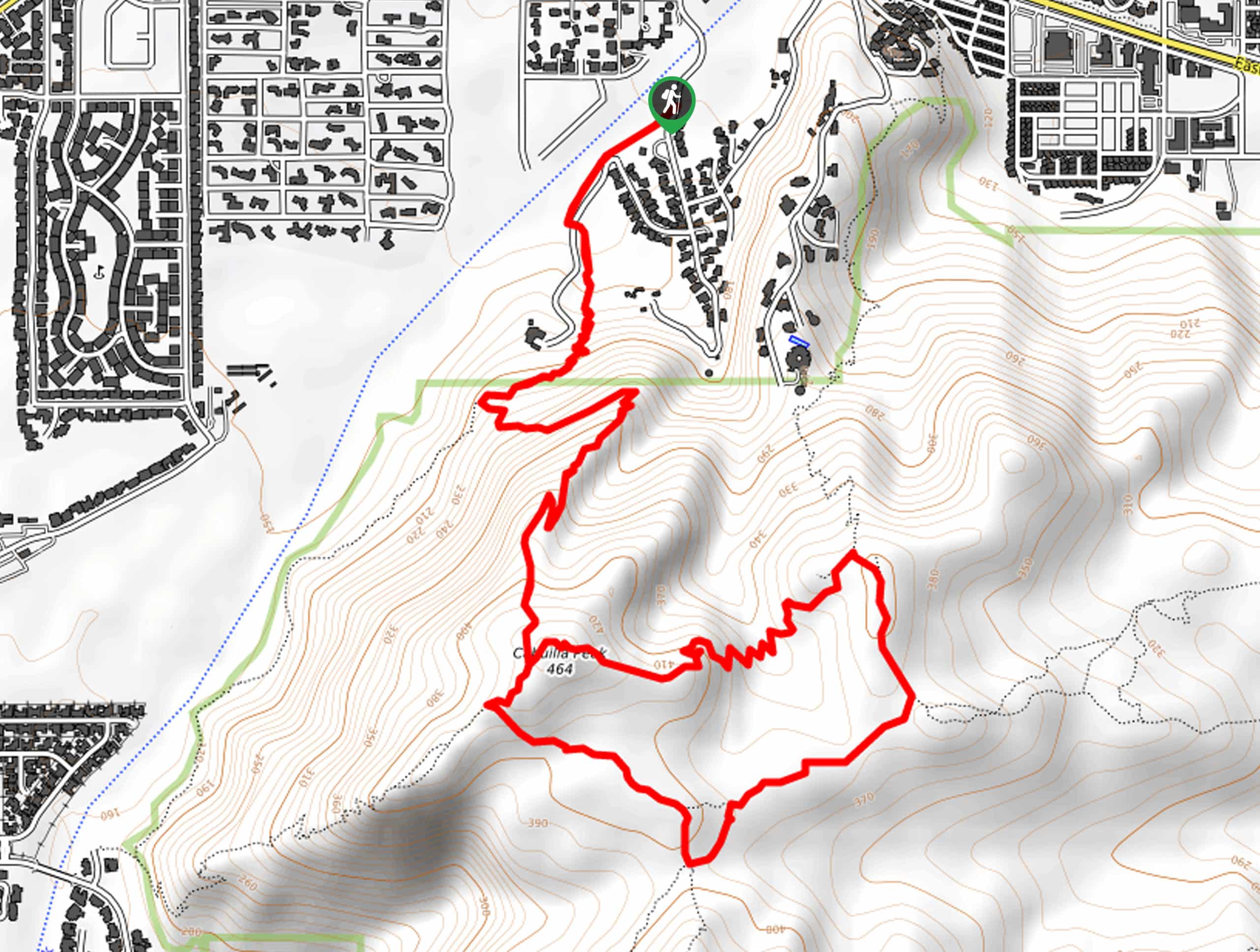
The Tramway Road to Bottom Station Trail starts from Tramway Road, just off of 111 (Palm Canyon Drive), at the Palm Springs Visitor Center.

About
| Backcountry Campground | No |
| When to do | October-April |
| Pets allowed | Yes - On Leash |
| Family friendly | No |
| Route Signage | Average |
| Crowd Levels | Moderate |
| Route Type | Out and back |
Tramway Road to Bottom Station Trail
Elevation Graph
Weather
Trail Description
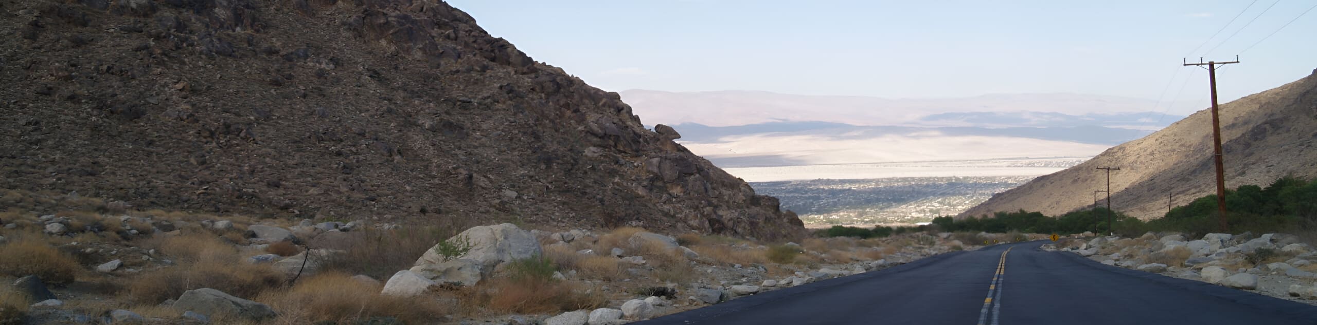
The Tramway Road to Bottom Station Trail follows a paved pathway to the Palm Springs Aerial Tramway, but don’t let the “paved pathway” persuade you to try this hike. The scenery unveiling along the way and the elevation gain will have you huffing, puffing, and appreciating the surrounding scenery simultaneously. Plus, you can bring your dog with you!
Setting out from your car, follow Tramway Road to Bottom Station. On the way back, along the same road, as this is an out-and-back route, you’ll face the views of the stunning valley backed by mountains. This adventure is remarkable and makes for a morning well spent.
Similar hikes to the Tramway Road to Bottom Station Trail hike
Victor Loop Trail
Victor Loop Trail packs the best of Palm Springs into one incredible trail: a palm tree oasis, mountainous backdrop, valley…
Berns Trail
Berns Trail packs a heart-pumping workout, incredible views of Palm Springs, and a mountainous backdrop into one phenomenal outdoor adventure.…
North Lykken Trail to Palm Springs Art Museum
Looking for a good workout? North Lykken Trail to Palm Springs Art Museum takes you along a challenging trail to…
Comments