
Hill 88 Loop hike
View Photos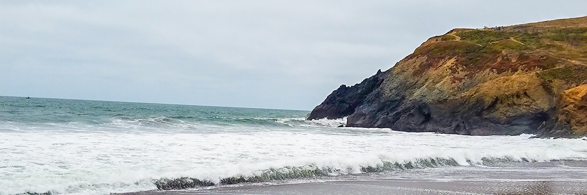


Hill 88 Loop hike
Difficulty Rating:
Hill 88 Loop, located in the Golden Gate Recreation Area in Marin County, is an excellent choice for dog lovers who wish to take their four-legged friends on hiking adventures near the beach. This is a great trail with amazing views, but if you do not like dogs be sure to avoid the busy times of day!
Getting there
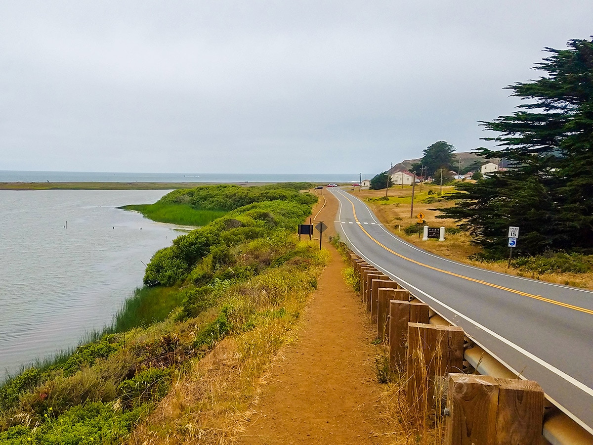
Cross the Golden Gate Bridge and take exit 442 onto Alexander Ave. Then take a left onto Bunker Road and follow it for 3.1mi, and it turns into Mitchell Road. Park at the Fort Cronkhite Parking Lot at the end of Mitchell Road.

About
| When to do | Year round |
| Backcountry Campsites | No |
| Toilets | Parking lot |
| Pets allowed | Yes |
| Family friendly | Yes |
| Route Signage | Good |
| Crowd Levels | Moderate |
| Route Type | Loop |
Hill 88 Loop
Elevation Graph
Weather
Route Description for Hill 88 Loop
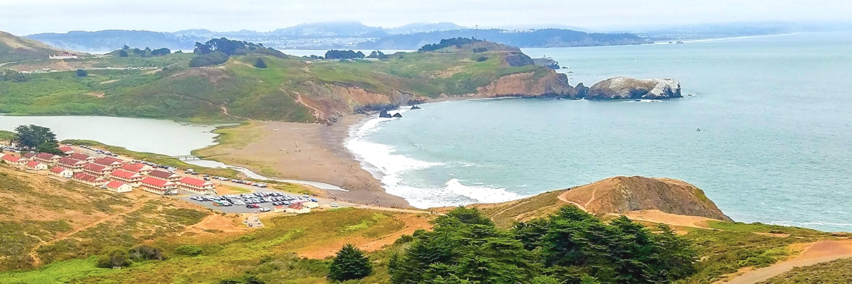
The Hill 88 Loop starts across the street from the parking lot and heads out on a path beside Mitchell Road, going past Rodeo Lagoon. This part of the route goes for 0.7mi then use the crosswalk to access the Miwok Trail Trailhead. This happens when Mitchell Road / Bunker Road goes right.
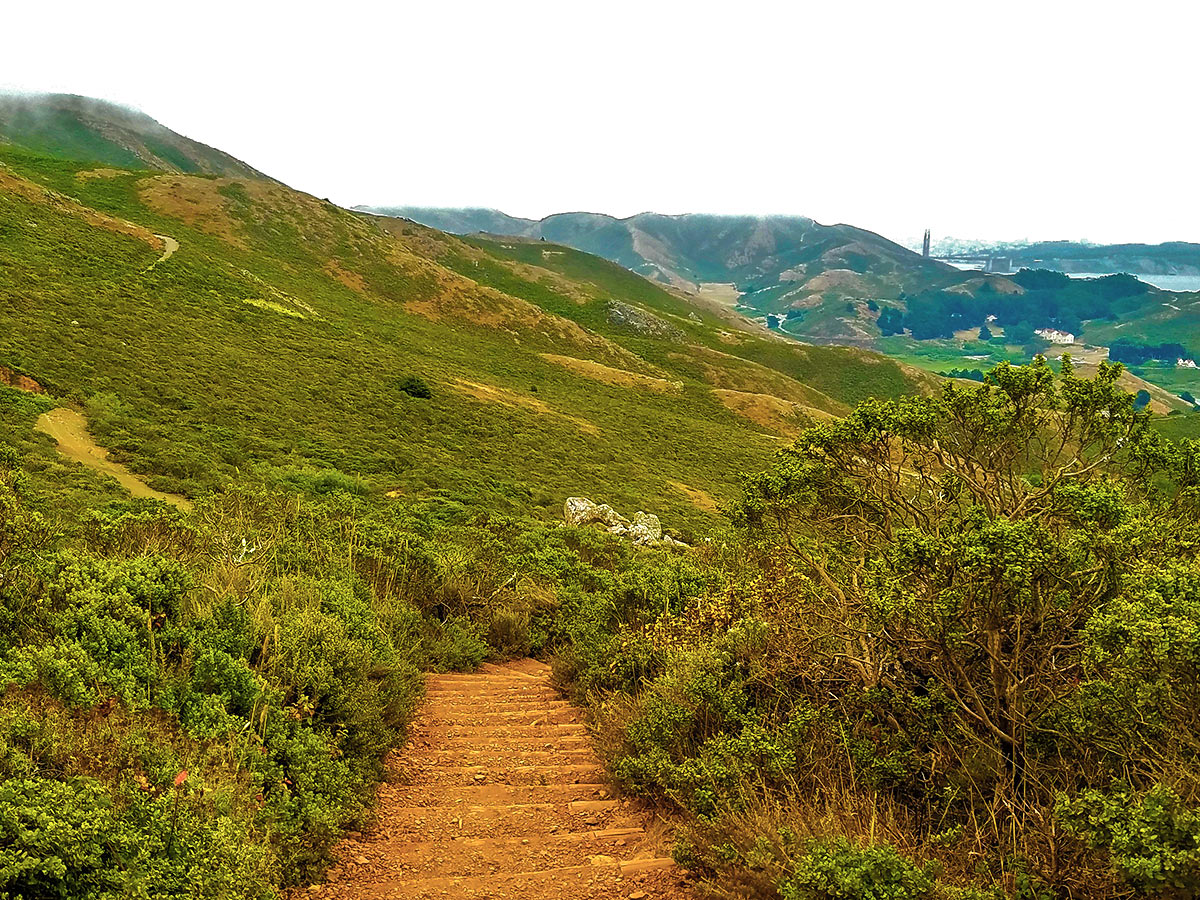
Once on the Miwok Trail stay on this trail for 1.7mi as it curves around to the left. When you come to a junction, make a sharp left to switch to the Wolf Ridge Trail.
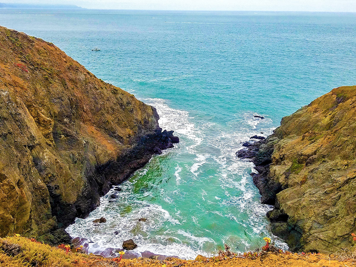
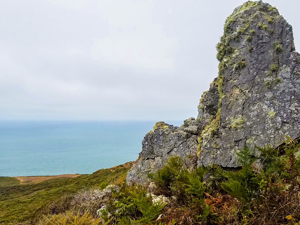
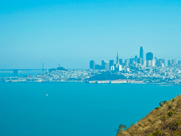
After being on the Wolf Ridge Trail for 0.7mi switch to the left trail which is called the Coastal Trail. Climb this trail to the top of Hill 88, which is the site of an old military radar control center. The views from the top of Hill 88 are spectacular!
Once back down the hill go left when you get back to the Wolf Ridge Trail. You are now on the Coastal Trail. Keep left at the next 5 forks to stay on the Coastal Trail.
At the 6th fork make a right to start the descent down the hill. Then continue to follow signs for the Coastal Trail until you reach the parking lot.
Insider Hints
This hike is 100% dog friendly, most of the Golden Gate Recreation Area is dog friendly!
The parking lot fills up on the holidays and weekends, be sure to arrive early in the day to get a parking spot.
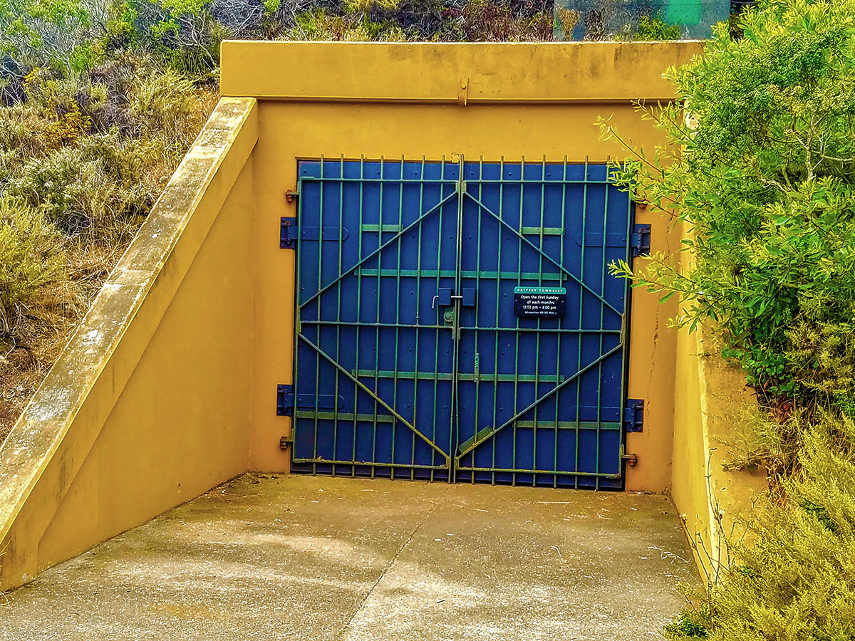
If you have some time plan on exploring the old ruins of the Batteries and other structures within the park just off the trails.
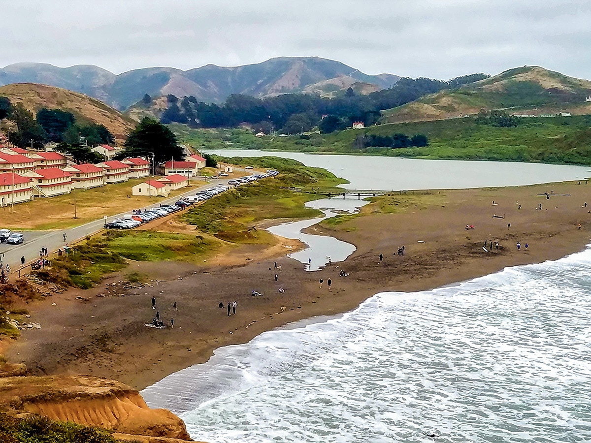
Consider stopping off at Rodeo Beach after your hike. We love this beach, and can spend a long time enjoying the ocean views and watching surfers catch waves in Rodeo Cove.

Similar hikes to the Hill 88 Loop hike
Salt Point Trail
The Salt Point Trail a great way to experience the serenity of the untouched coastline with very little elevation change.…
Kirby Cove
The Kirby Cove trail is highly traveled by tourists and for good reason. This hike has some of the best…
Tomales Point Trail, Marin County
The Tomales Point hike is located in the Point Reyes National Seashore, sandwiched between Tomales Bay and the Pacific Ocean.…
Francine Robertson 4 years ago
Good place for bot hiking and learning military history. Awesome views.
MichaelShulman 4 years ago
We decided to explore the old ruins of the Batteries after the hike, and we highly recommend doing it with this hike.
Nora T. 4 years ago
Awesome of the coastline and the city.
Stumpyboots 4 years ago
Absolutely beautiful views and a great hike.Will definitely go back
Kenny Walks 4 years ago
A great hike so close to San Francisco! Enjoy the views from the top and take your time wandering the myriad paths that crisscross the coast on your way back down.
Stevie M 4 years ago
You won't regret taking this hike. You'll have access to the amazing views of the city, the ocean, hills and beach.
psalm 4 years ago
It was a simple yet incredibly charming area for walks and sight-seeing.
Charles W. 4 years ago
Great place. It's very busy with children and dogs around.
Gordon Y. 5 years ago
Simply amazing. Lots of dogs around. Pretty fun until they start barking at each other.
Shiloh R. 5 years ago
Had an awesome time exploring the ruins of the batteries after doing this hike. It was so cool.