The Solent Way Walk
View Photos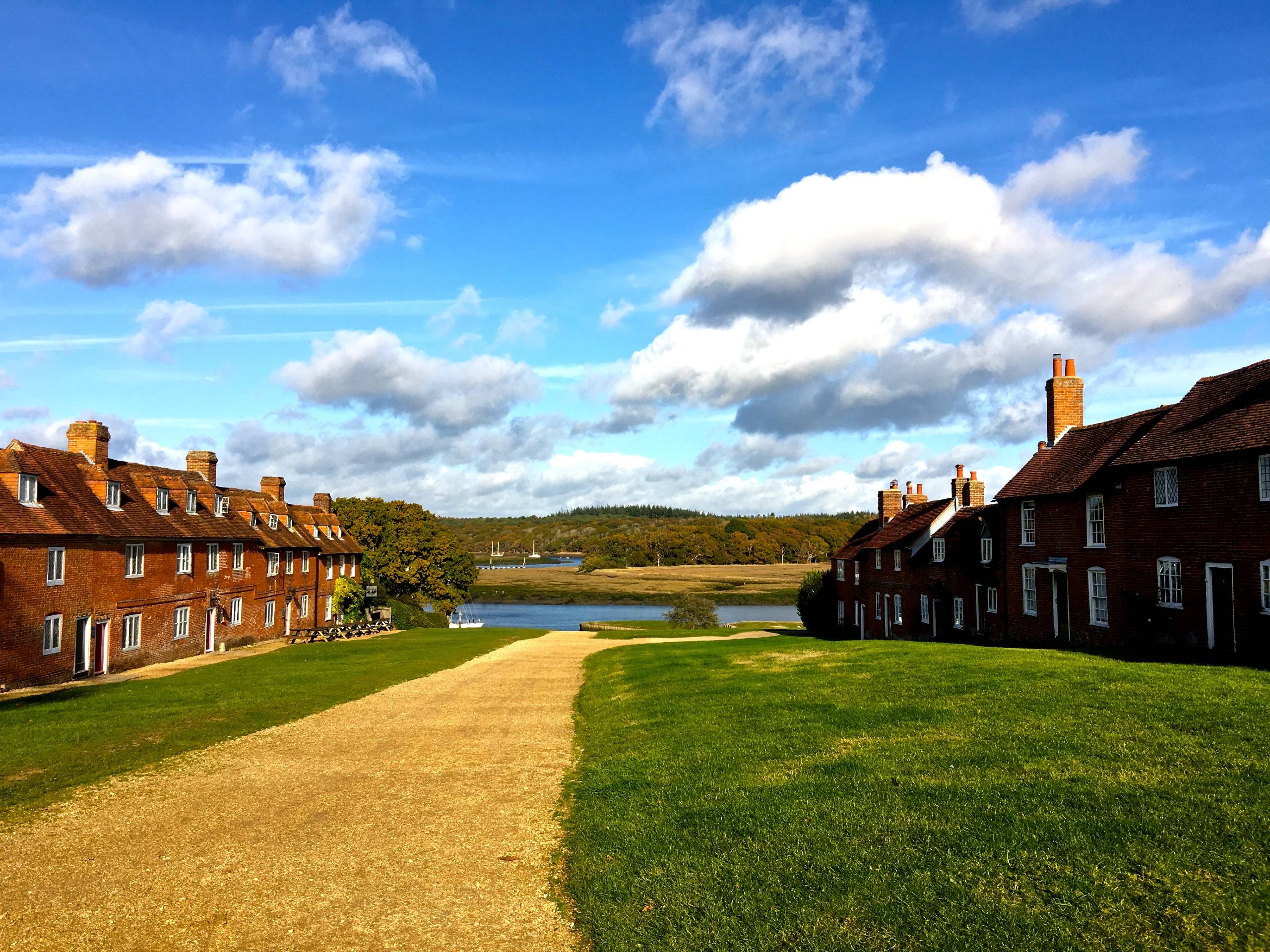
The Solent Way Walk
Difficulty Rating:
The Solent Way is a 60.0mi footpath along the Hampshire coast, passing through the New Forest and providing walkers with glorious views of the Solent and its surroundings. This walk covers the section from Lymington to Beaulieu, starting east along the coast before turning north as you stroll through verdant woods and historic villages. With plenty of interesting places to stop and explore, there’s something on this Solent Way walk for everyone!
Getting there
The Solent Way Walk starts from the town of Lymington. If traveling by rail, the Lymington Town station is conveniently just south of the bridge from which you start the walk. If traveling by car, there are plenty of places to park in town. There are two car parks between Cannon and High Streets, or you could head along the water south of the railway station for more parking space.

About
| When to do | Year-round |
| Backcountry Campsites | No |
| Pets allowed | Yes - On Leash |
| Family friendly | Yes |
| Route Signage | Average |
| Crowd Levels | Moderate |
| Route Type | One Way |
The Solent Way Walk
Elevation Graph
Weather
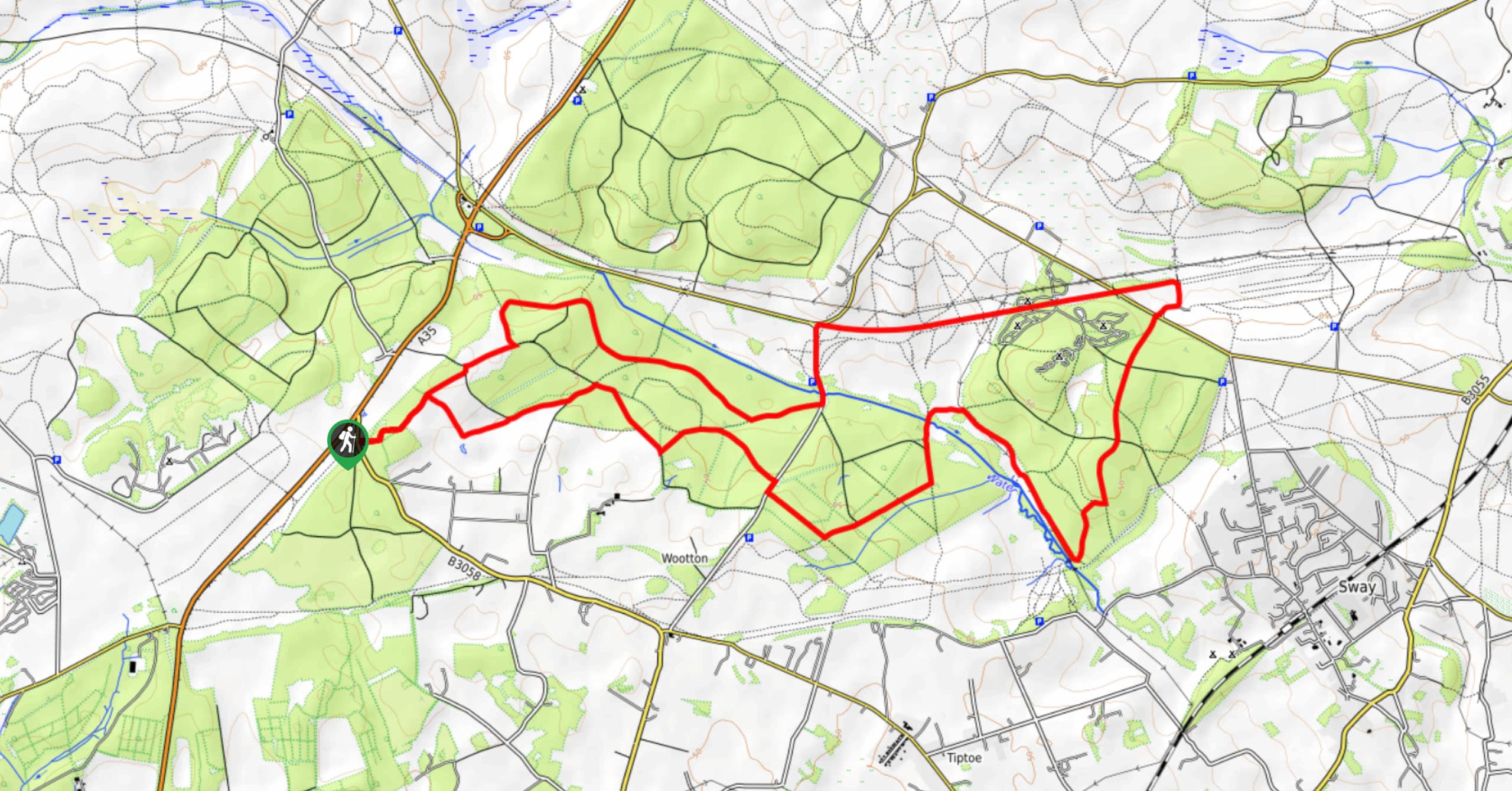
The Solent Way Walk Description
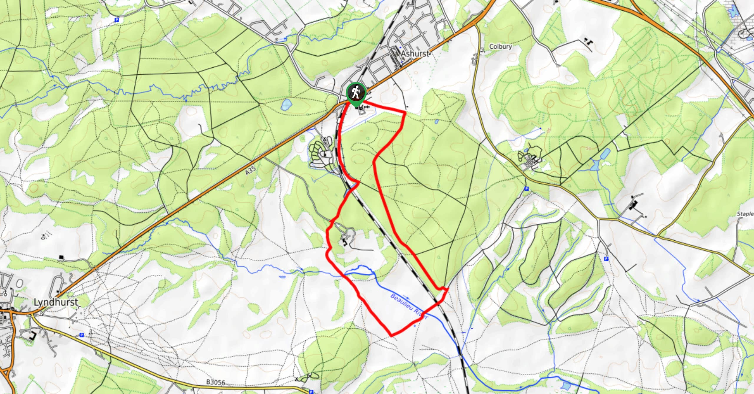
From Lymington, set off heading east along Bridge Road, crossing the river. Turn right on the other side, and as the road gets wider, turn off to the left to find a track that runs parallel to the road. Follow this for a quick 164ft, and before you reach the buildings ahead you’ll spot a path leading off to the left. Turn and walk along this, reaching the Lymington obelisk, erected in the mid-19th-century in tribute to Sir Harry Burrard Neale. Turn right on Monument Lane, then take your first left to continue walking east.
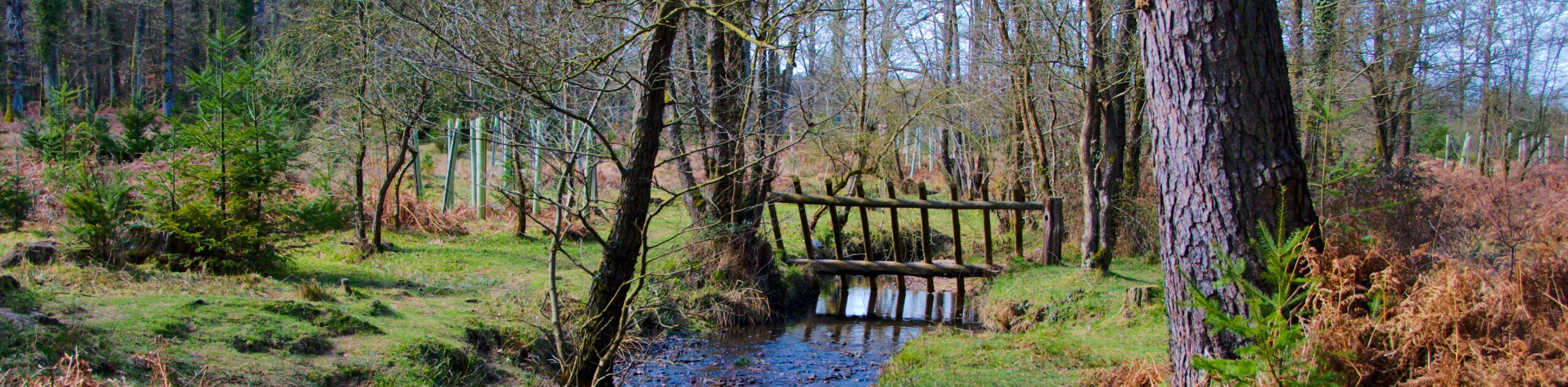
The path leads along the edge of a golf course and wood. At Snooks Lane, take a left and immediate right to continue along a track. At Shotts Lane, turn right and walk south, crossing South Baddesley Road and walking along the edge of a wood before finding a footpath on your left as you reach its end. Turn and follow this footpath east. At the junction, bear slightly right to find the footpath, which continues east before veering to the right and joining Sowley Lane. Turn left and walk along the lane as it bends to the north. You’ll pass by Sowley Pond, which kept fish for monks and is today designated a Site of Special Scientific Interest.
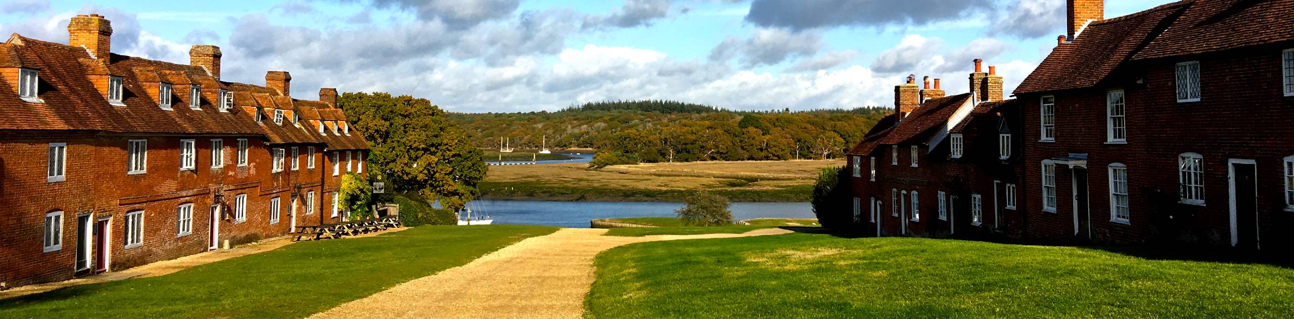
At the next T-junction, turn right and continue along the road. Pass the old St. Leonard’s barn, and keep left at the junction to head north. The lane crosses a stream before reaching a crossroads. Turn right, then take your first left to continue northward. Cross the road and continue in the same direction along a footpath which snakes through the village buildings of Buckler’s Hard towards the Beaulieu River. Follow this path up along the river and past the village. At a junction of paths, you can bear right to follow the river more closely, or stay left for a direct walk northwest through the woods.
The final stretch takes you through pleasant woodland and widens into a track on the final approach to Beaulieu. Spend some time exploring this lovely village (the Palace House and National Motor Museum are two highlights) before catching a bus back to Lymington. The 112 should take you all the way back to the center of town.
Similar hikes to the The Solent Way Walk hike
Ashurst to Deerleap Walk
The Ashurst to Deerleap Walk makes for a fun family outing due to the gentle elevation gain and lovely moorland…
Bolderwood to Knightwood Oak Walk
The Bolderwood to Knightwood Oak Walk makes for a great option if you’re craving moody forest scenery with the potential…
Burley and Sway Walk
The Burley and Sway Walk meanders along varied terrain, ranging from gravel and grass tracks, stream crossings, and muddy conditions.…
Comments