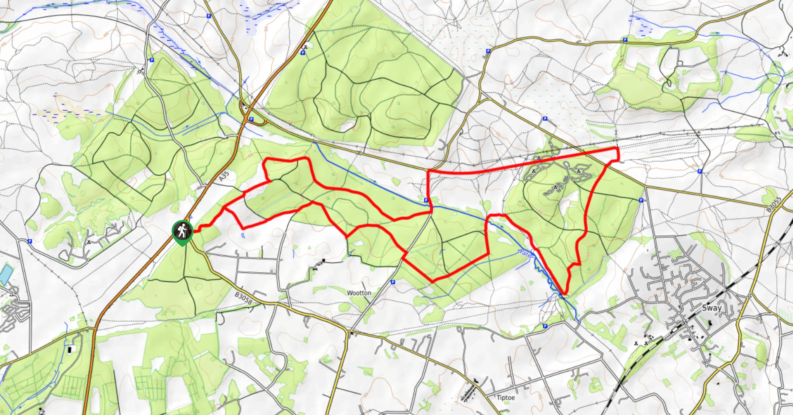
Fordingbridge, Woodgreen, Hale, Godshill Round Walk
View Photos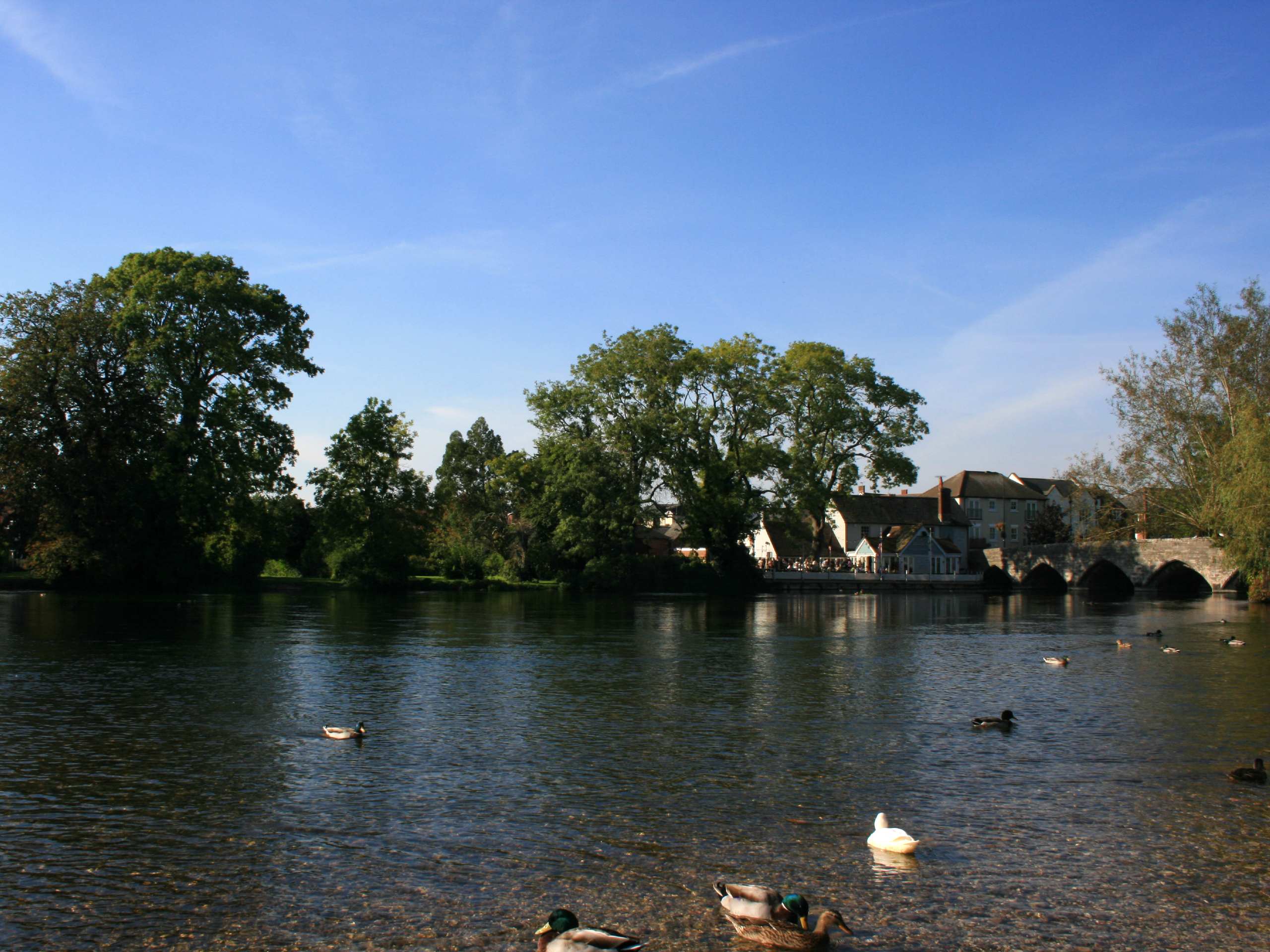
Fordingbridge, Woodgreen, Hale, Godshill Round Walk
Difficulty Rating:
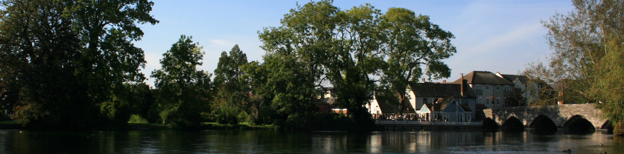
The Fordingbridge, Woodgreen, Hale, Godshill Round Walk is a great walk if you’re looking for an adventure that takes you from village to village! You will spend a significant amount of time meandering along roads, with some sections being quite busy; however, the woodland and views over Avon Valley will make up for it.
Getting there
To get to the start of the Fordingbridge, Woodgreen, Hale, Godshill Round Walk, head to Fordingbridge, and park in the Fordingbridge Car Park.

About
| When to do | Year-round |
| Backcountry Campsites | No |
| Pets allowed | Yes - On Leash |
| Family friendly | Older Children only |
| Route Signage | Average |
| Crowd Levels | Moderate |
| Route Type | Circuit |
Fordingbridge, Woodgreen, Hale, Godshill Round Walk
Elevation Graph
Weather
Fordingbridge, Woodgreen, Hale, Godshill Round Walk Description
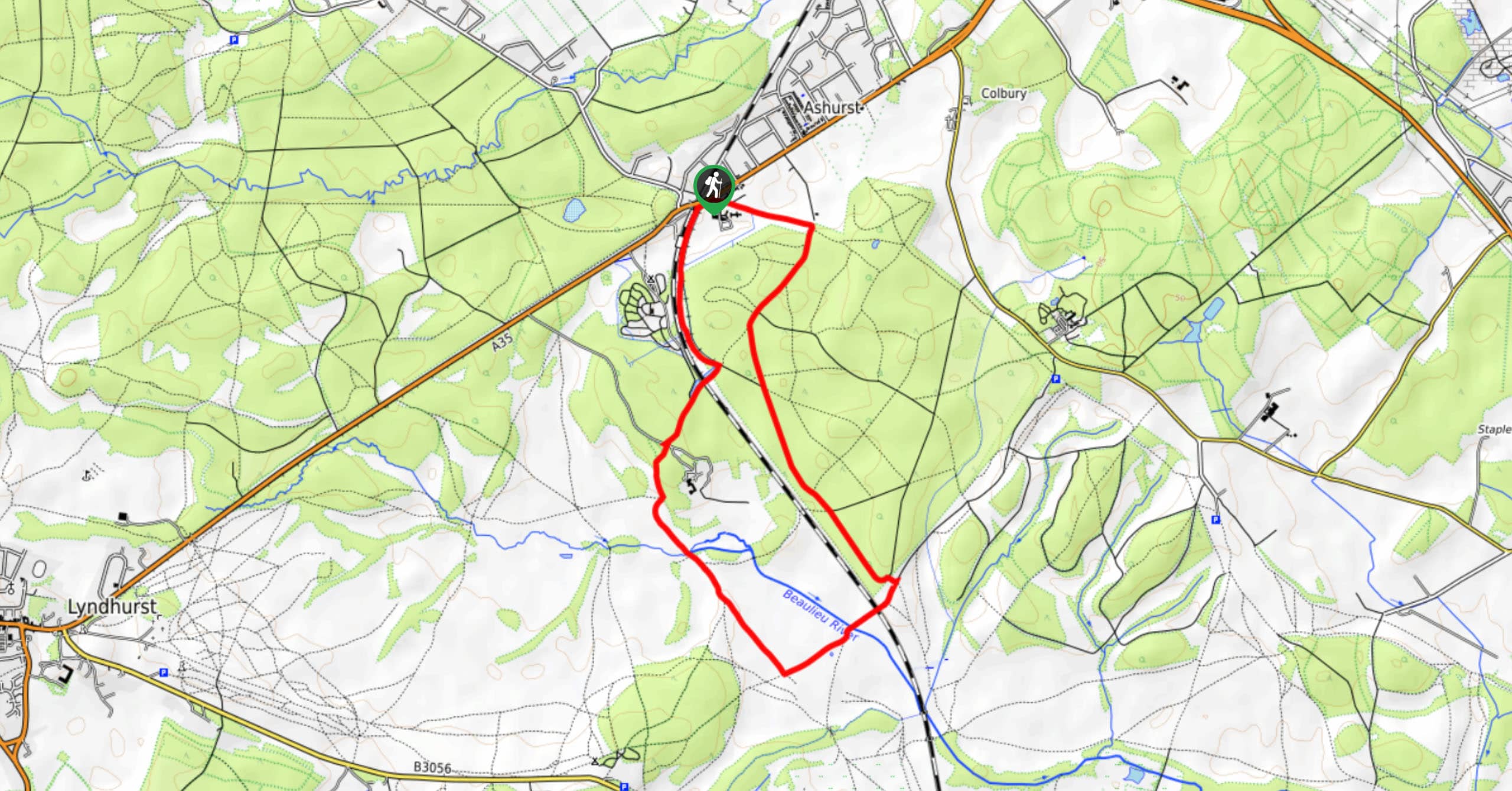
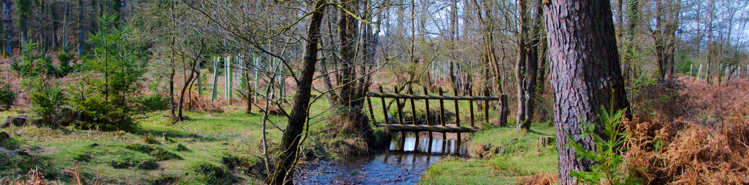
The Fordingbridge, Woodgreen, Hale, Godshill Round Walk is a longer route that passes through villages, each sprinkled with its own quirks! Starting from Fordingbridge, a once market town, now equipped with cafes, shops, pubs worth checking out, you’ll head towards Woodgreen, where there are forest ponies and crumbling leftovers of Godshill Castle. From here, you’ll go to Hale, another charming village with St. Mary’s Church. Lastly, you’ll reach Godshill. Stop at The Fighting Cocks for some much-needed refreshments before completing your journey. The Godshill section takes you along a busy road section, so don’t come into this walk expecting the perfect combination of pleasant, natural views and inviting villages, as some of the road parts can be tough to navigate.
Similar hikes to the Fordingbridge, Woodgreen, Hale, Godshill Round Walk hike
Ashurst to Deerleap Walk
The Ashurst to Deerleap Walk makes for a fun family outing due to the gentle elevation gain and lovely moorland…
Bolderwood to Knightwood Oak Walk
The Bolderwood to Knightwood Oak Walk makes for a great option if you’re craving moody forest scenery with the potential…
Burley and Sway Walk
The Burley and Sway Walk meanders along varied terrain, ranging from gravel and grass tracks, stream crossings, and muddy conditions.…
Comments