Dockens Water and Pitts Wood Walk
View Photos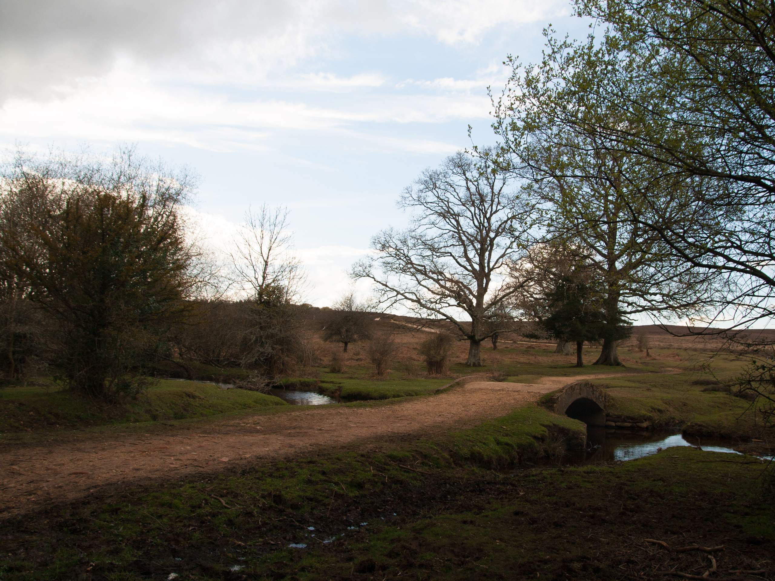
Dockens Water and Pitts Wood Walk
Difficulty Rating:
Dockens Water and Pitts Wood is a longer version of the Fritham Circular Walk, an excellent choice when you want to extend your day in the New Forest. This walk starts and ends just outside the beloved Royal Oak pub, and takes you on a circular journey along gravel tracks, winding footpaths, and cycleways that meander through the woods and meadows. With a little bit of everything, this is a perfect option for a few hours outdoors.
Getting there
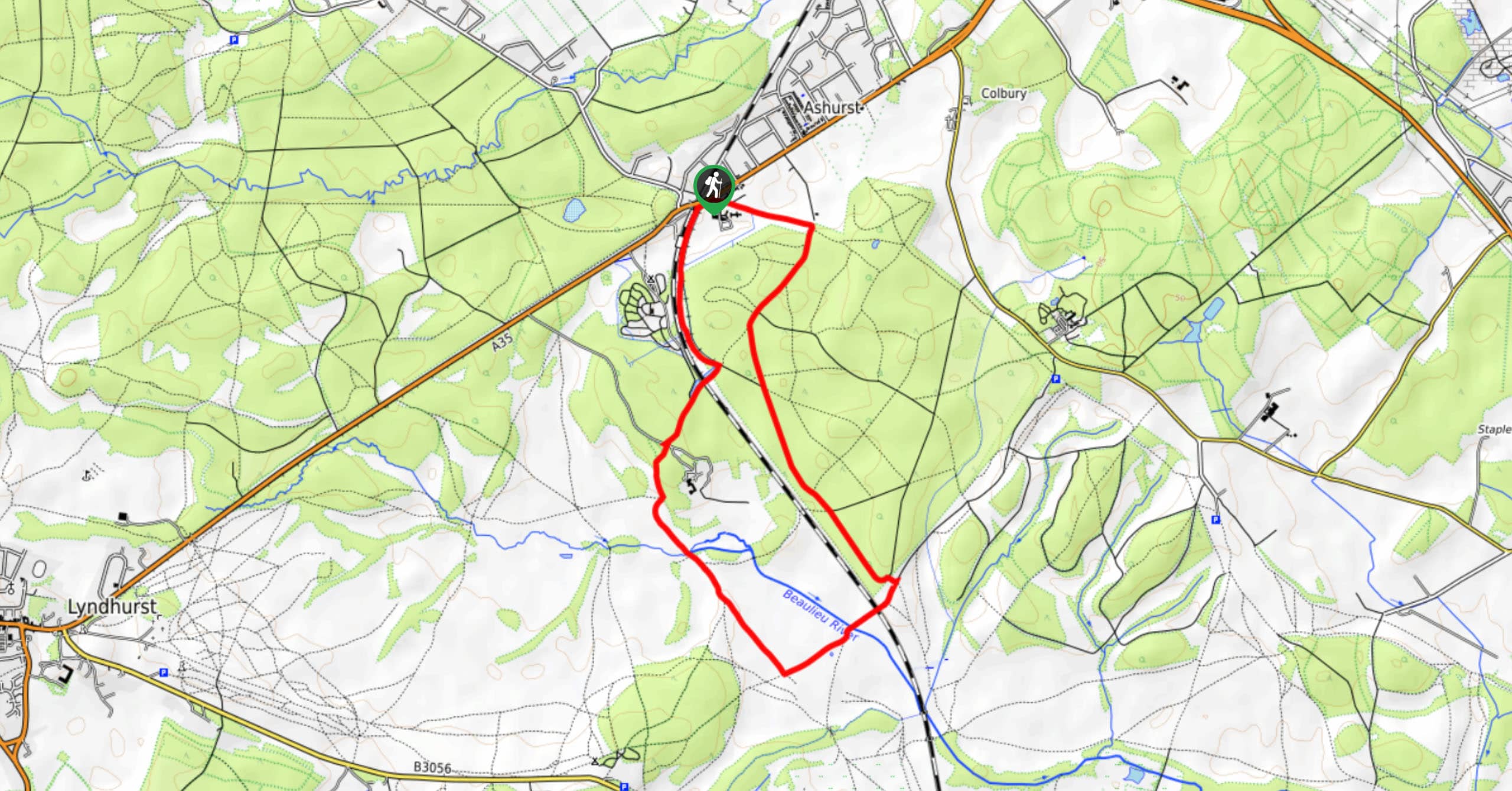
To start this walk around Dockens Water and Pitts Wood, head for the village of Fritham, just east of Fordingbridge. If driving from east to west through the village, you’ll spot the celebrated Royal Oak pub on your right, then a turnoff on your left 328ft past the pub for a car park.

About
| When to do | Year-round |
| Backcountry Campsites | No |
| Pets allowed | Yes - On Leash |
| Family friendly | Yes |
| Route Signage | Average |
| Crowd Levels | Moderate |
| Route Type | Circuit |
Dockens Water and Pitts Wood Walk
Elevation Graph
Weather
Dockens Water and Pitts Wood Walk Description
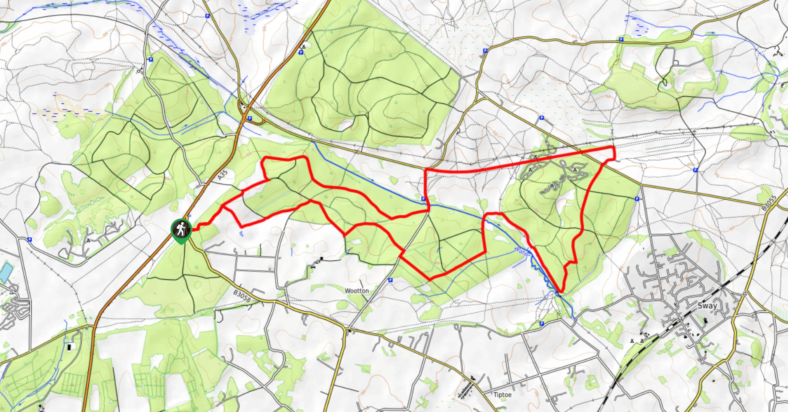
Set out from the car park through a gate on a wide track in a southwest direction. Ignore the various footpaths that branch off from this track (unless you want to add on a bit of exploring!). At the first clear junction, bear left to continue along the track, which bends more and more directly towards the south. Cross the Dockens Water via a footbridge, then turn right. Pass by the first option to turn left, then take the second after strolling past a cottage and over another small footbridge. Head through the gate, and at the following four-way junction, turn right. You’ll be walking through the wooded Broomy Inclosure, not far from the Dockens Water, which you’re soon to see again.
Take your first available right onto a smaller footpath, which bears north to cross the river and head into an open area. Turn left at the track, then take your first right onto another footpath which curves to the right around the edge of the Halsey Inclosure. This heads north across the Latchmore Brook, with a tangle of footpaths surrounding you. No matter which one you end up taking, you’ll want to continue north until you reach Ditch End, at a confluence of streams. From here, find and follow the track that bears directly east. This takes you into the Pitts Wood Inclosure, with lovely trees surrounding your steps.
Stay right at the next two forks. As you exit Pitts Wood, spot a footpath on your left, which curves up to the left, joining a track that angles northeast. Follow this all the way to the edge of the road. Just before you reach it, turn right onto a cycleway which crosses a stream. Where the cycleway turns to the right, take the footpath on the left, then your first right. Head over a footbridge, go right onto a track then quickly left, and right at the intersection of paths. As you enter a final stretch of woods, bear left at the fork and follow this all the way to the Royal Oak, just across the street from the car park.
Similar hikes to the Dockens Water and Pitts Wood Walk hike
Ashurst to Deerleap Walk
The Ashurst to Deerleap Walk makes for a fun family outing due to the gentle elevation gain and lovely moorland…
Bolderwood to Knightwood Oak Walk
The Bolderwood to Knightwood Oak Walk makes for a great option if you’re craving moody forest scenery with the potential…
Burley and Sway Walk
The Burley and Sway Walk meanders along varied terrain, ranging from gravel and grass tracks, stream crossings, and muddy conditions.…
Comments