Boldre Village Walk
View Photos
Boldre Village Walk
Difficulty Rating:
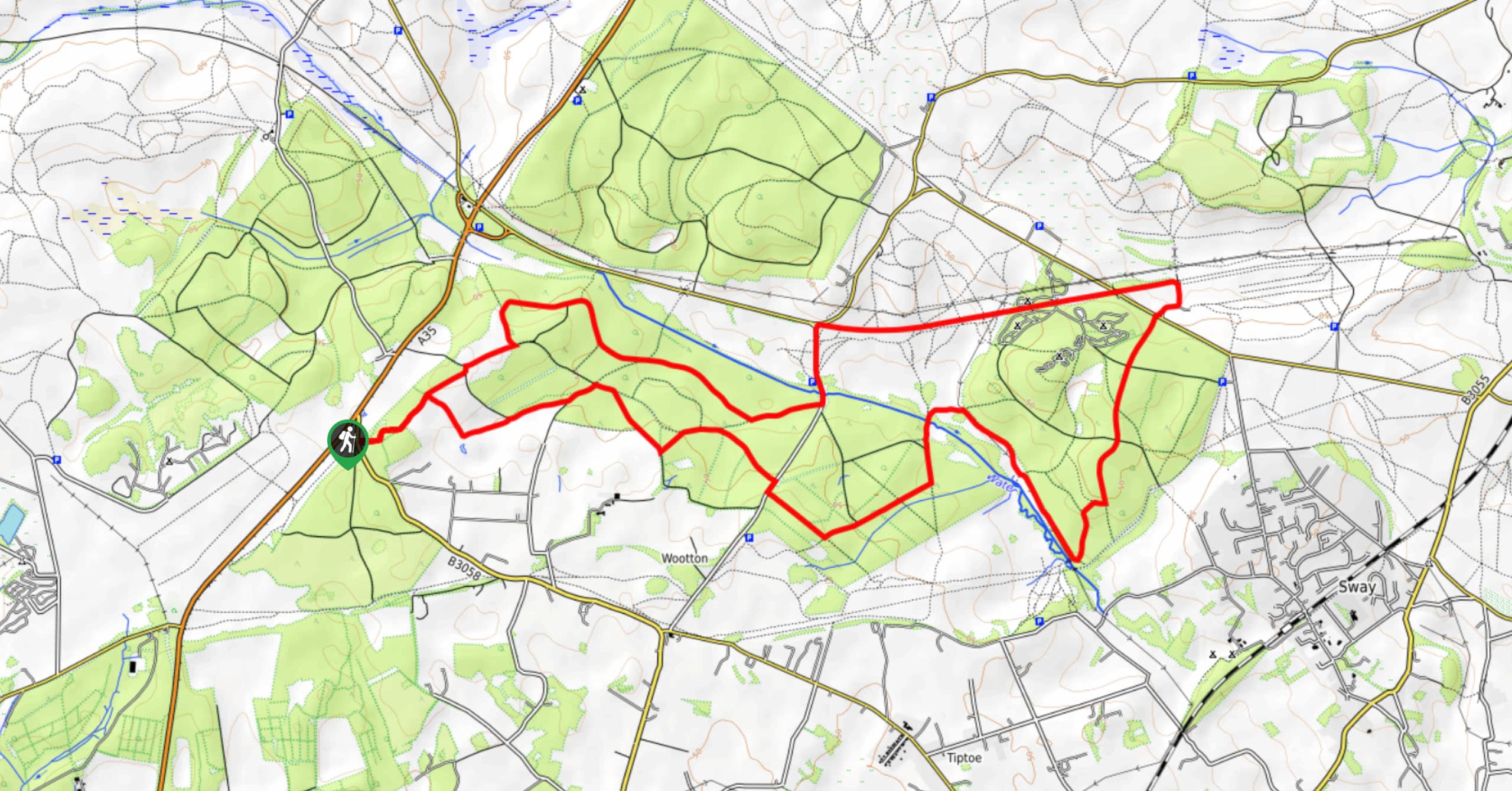
The Boldre Village Walk offers a great mix of forests and farmland on an easily navigable circular route. Work your way north along country lanes before looping west through several farms before crossing the Lymington River a few times on your way back around. Make sure you’ve got your wellies on if you visit after a rain! A stop at The Red Lion pub is the perfect way to cap this walk.
Getting there
This circular walk starts from the village of Boldre. From Lymington, head north along the A337, and turn right at Boldre Lane to reach the center of the village. The Red Lion pub (just to the left of the junction) has parking, but you may want to try somewhere else nearby as they are known to reserve this for customers.

About
| When to do | Year-round |
| Backcountry Campsites | No |
| Pets allowed | Yes - On Leash |
| Family friendly | Yes |
| Route Signage | Average |
| Crowd Levels | Moderate |
| Route Type | Lollipop |
Boldre Village Walk
Elevation Graph
Weather
Boldre Village Walk Description
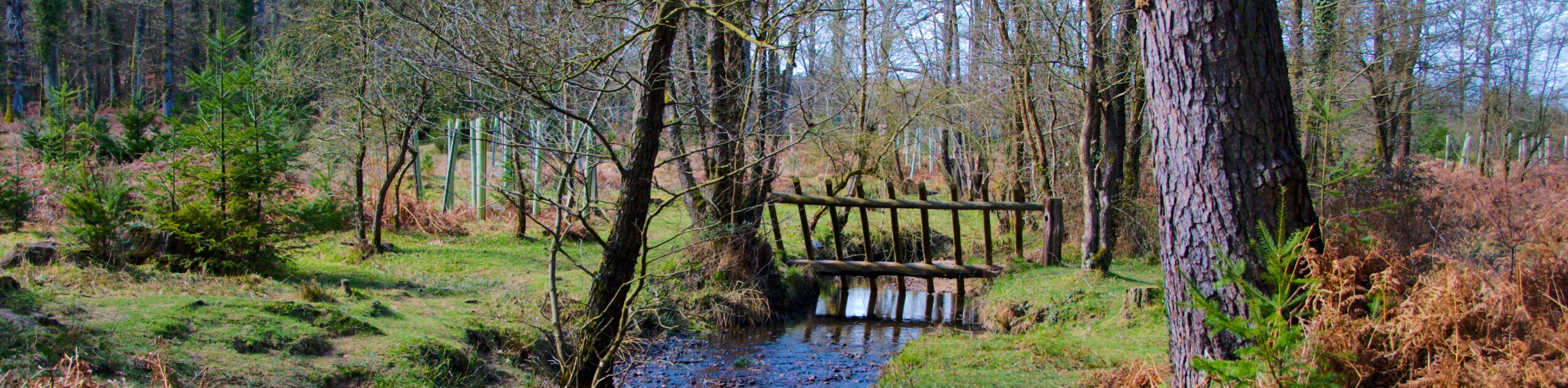
From the pub, walk east along the main road, crossing a bridge over the Lymington River. Turn left onto Rodlease Lane and continue north. Roughly 500 meters up the lane, you’ll spot a footpath on your right, which you should turn onto. Take the left at the fork which soon follows. Reaching Church Lane, turn left and follow the lane to the picturesque Boldre Church. As you approach, you’ll spot a track on your right – turn and take this through the church car park and back onto a narrow lane. Follow this north for a good stretch, walking through farmland. Keep your eyes out for the farm animals that call this stretch of New Forest home!
Make a left at Dilton Farm, and continue west along a bridleway. At first it’s farmland on both sides, but as the path bends to the left, you’ll have the woods on your right-hand side. Reaching the forest, continue along the bridleway and cross the Lymington River. At the T-junction, turn left, then right at the next fork. This section takes you through Fluder’s Clump. At the next junction of paths, turn left and walk back out to Royden Lane. Turn right and follow the country lane south. Head through the first intersection, and at the following junction, bear left on a footpath that crosses the Lymington River once more. Reaching Rodlease Lane, turn right and retrace your steps back to your parking spot.
Similar hikes to the Boldre Village Walk hike
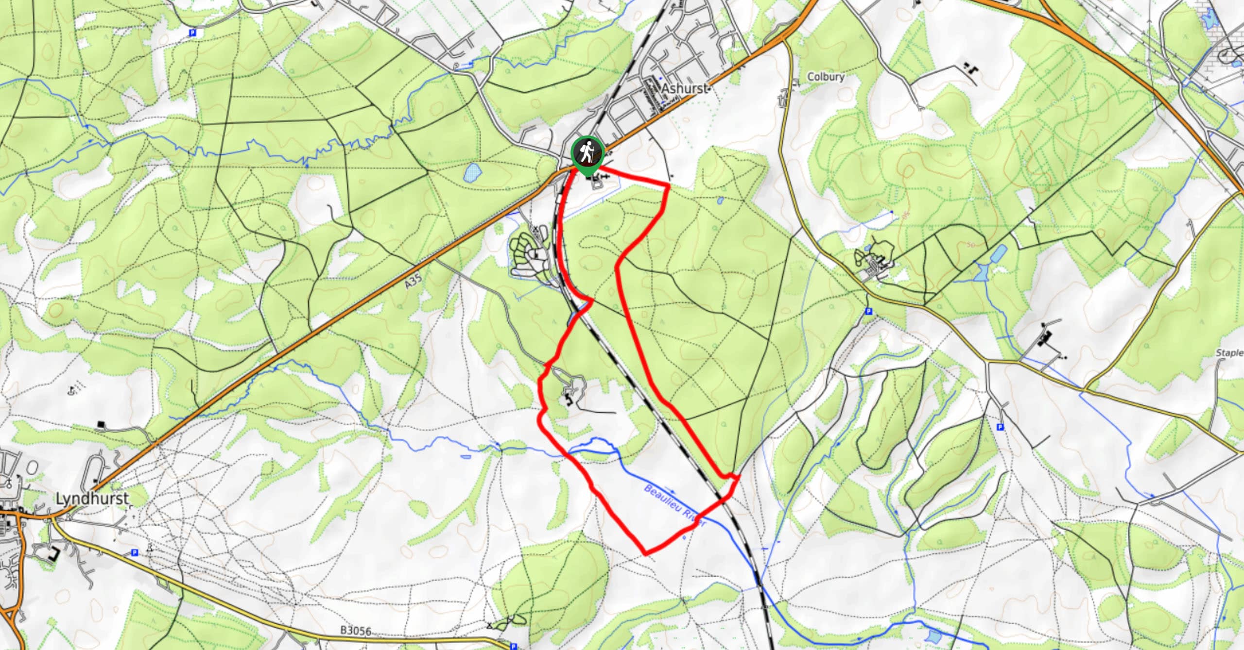
Ashurst to Deerleap Walk
The Ashurst to Deerleap Walk makes for a fun family outing due to the gentle elevation gain and lovely moorland…
Bolderwood to Knightwood Oak Walk
The Bolderwood to Knightwood Oak Walk makes for a great option if you’re craving moody forest scenery with the potential…
Burley and Sway Walk
The Burley and Sway Walk meanders along varied terrain, ranging from gravel and grass tracks, stream crossings, and muddy conditions.…
Comments