Heliotrope Ridge
View Photos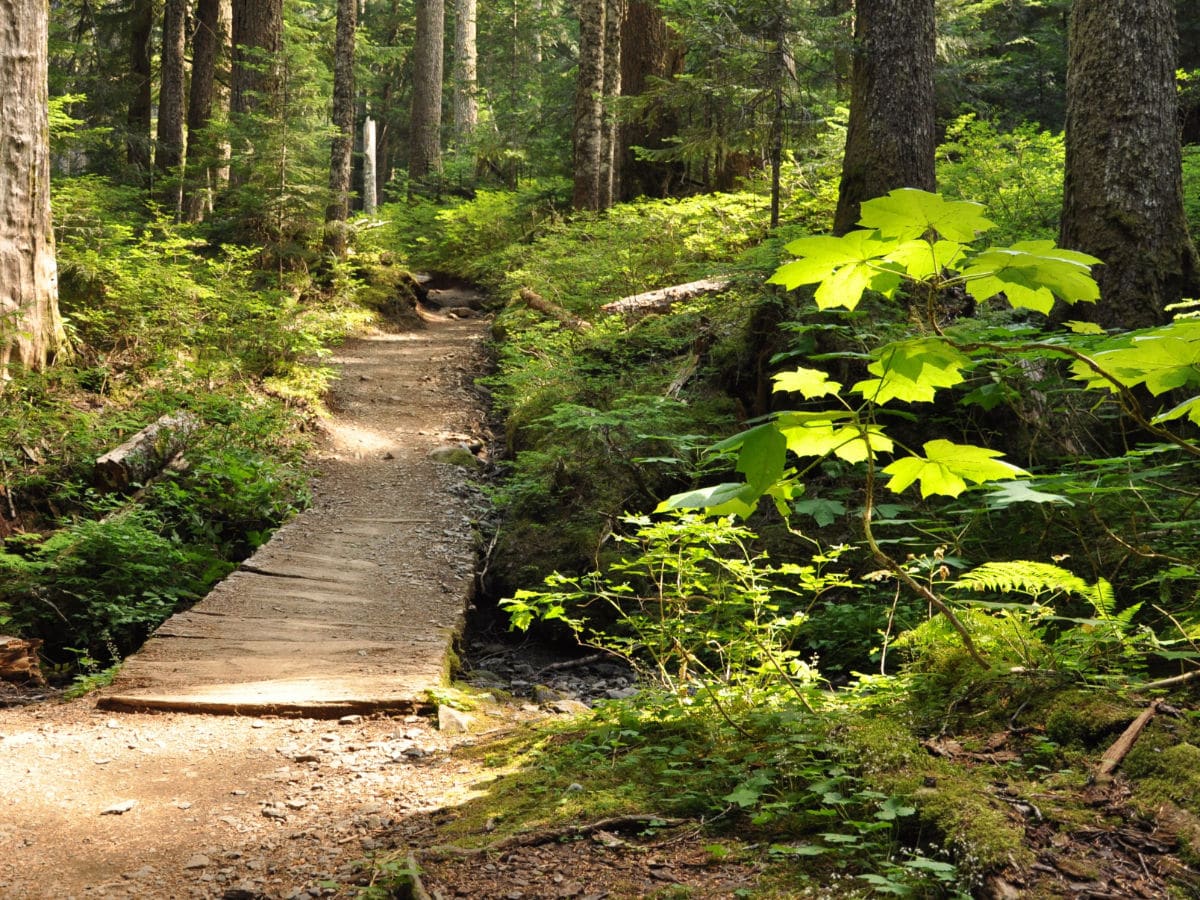

Heliotrope Ridge
Difficulty Rating:
This popular hike up Heliotrope Ridge crosses several creeks before reaching a spectacular overlook of Coleman Glacier. Along the way, hikers share the path with mountaineers attempting to summit Mount Baker.
Getting there
To get to the Heliotrope Ridge trailhead, head east from Bellingham on Mount Baker Highway (HWY 542) to milepost 34. 1.0mi after passing Glacier Public Center, turn right onto Forest Rd 39. Follow for 8.0mi to the parking lot: a Northwest Forest Pass is required here.

About
| When to do | Summer / Fall |
| Backcountry Campsites | Yes, Harrison Camp, Hogsback Camp |
| Toilets | Yes, at trailhead |
| Family friendly | No |
| Route Signage | Average |
| Crowd Levels | Moderate |
| Route Type | Out and back |
Heliotrope Ridge
Elevation Graph
Weather
Heliotrope Ridge Route Description
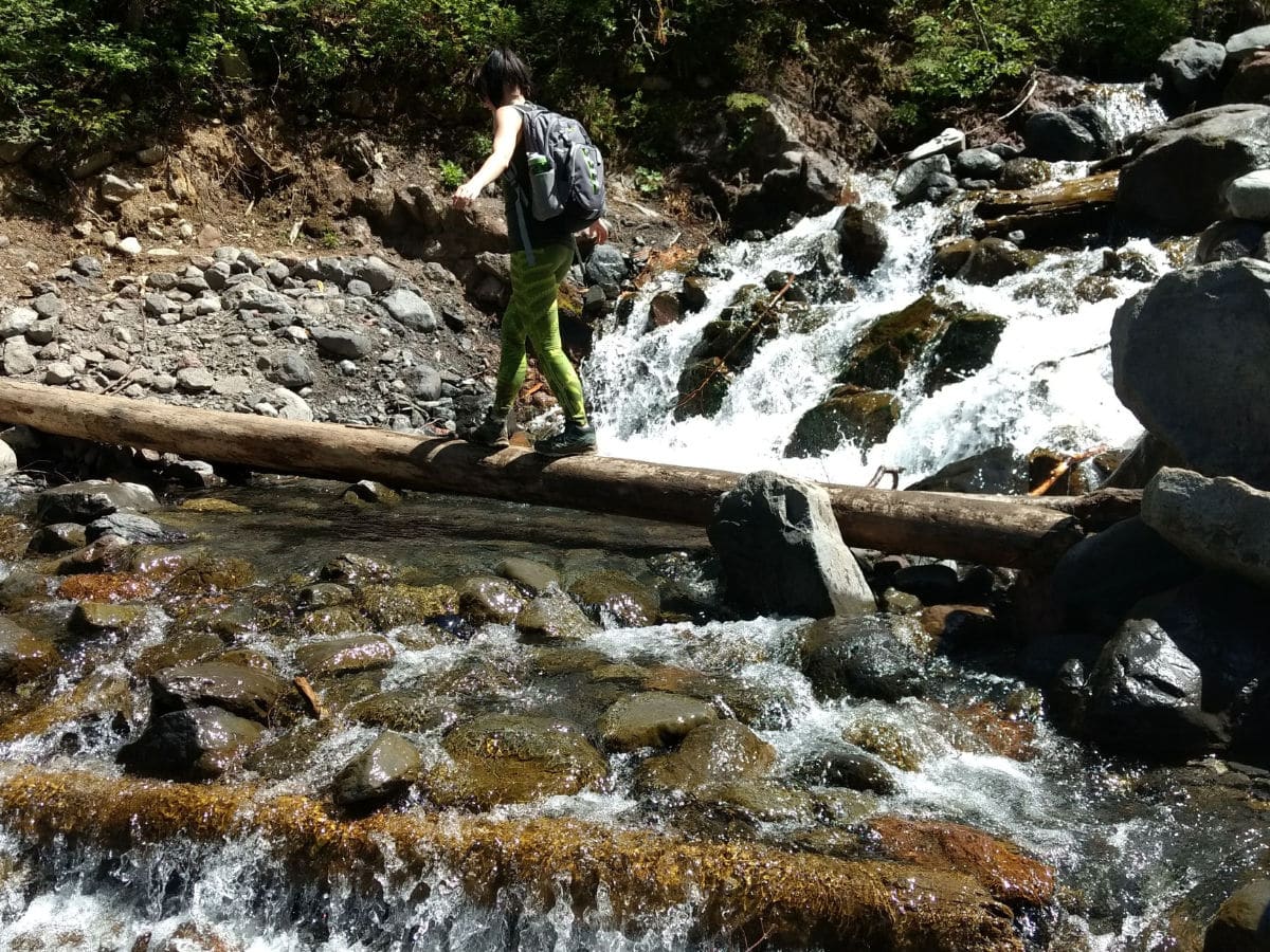
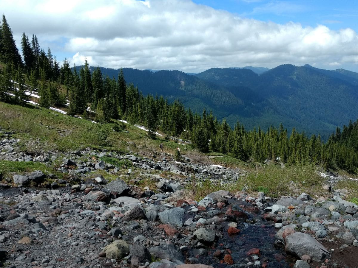
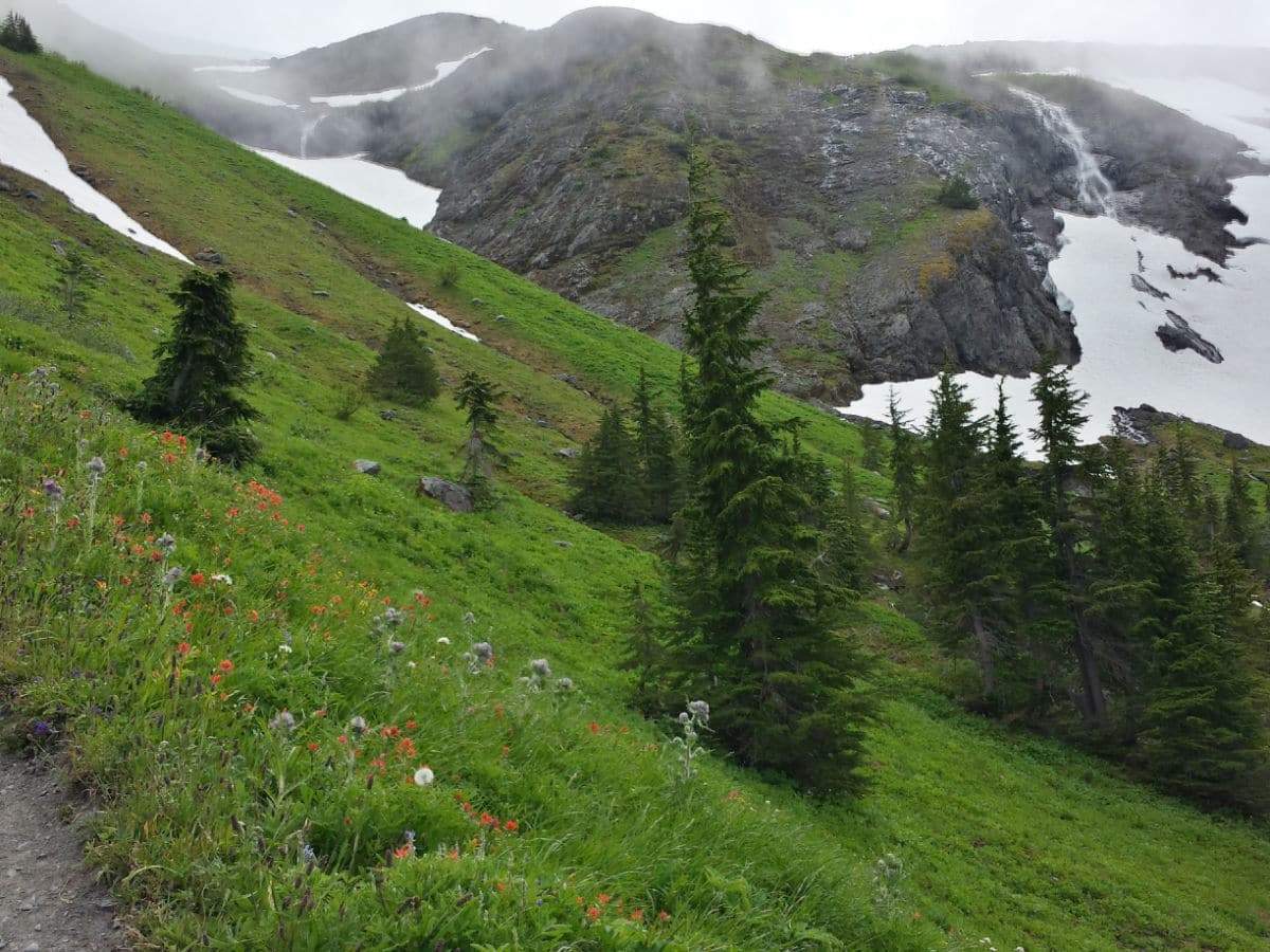
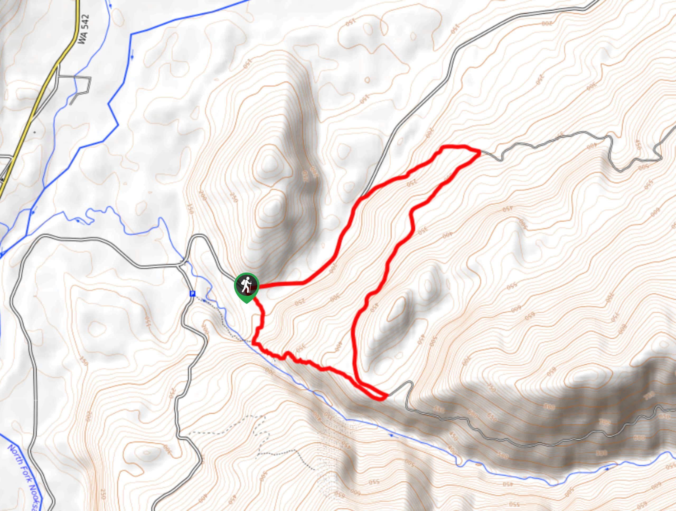
To begin the Heliotrope Ridge trail, set out east from the parking area, dropping immediately to cross the bridge over Grouse Creek. Tree cover provides shelter from the elements. The trail climbs towards Mount Baker. Reach the first bridge-free creek crossing at 1.0mi, rock-hopping your way across carefully.
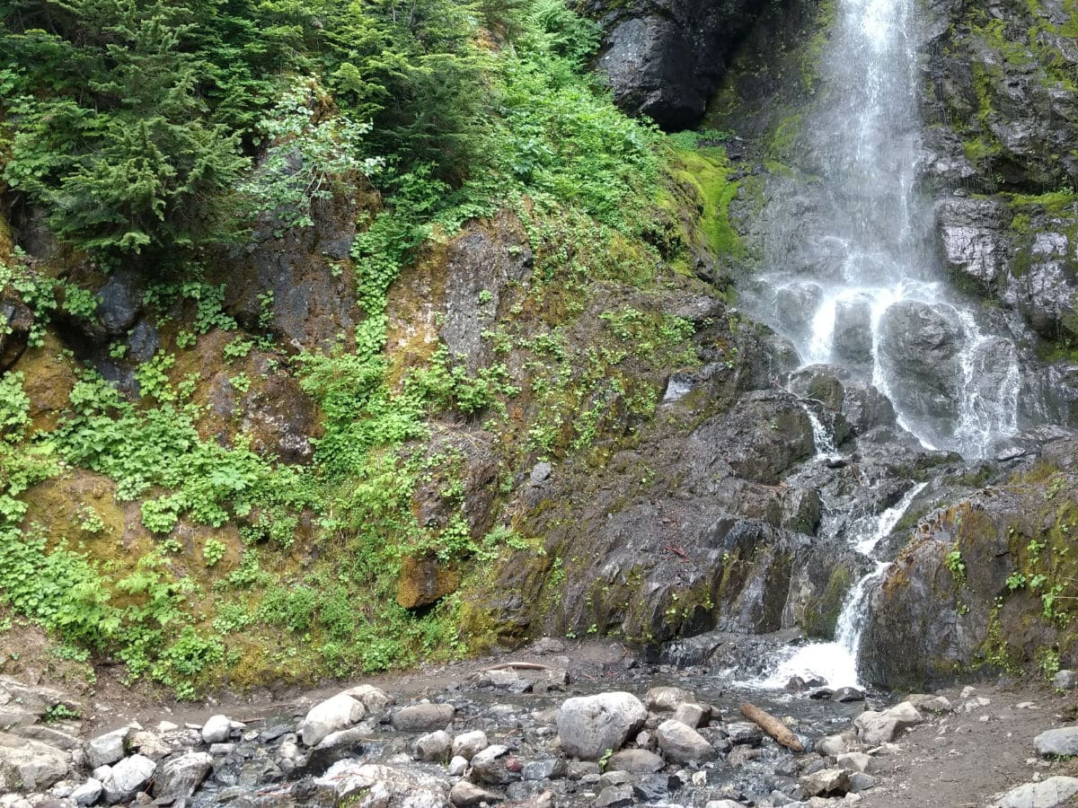
Then, you’ll climb a set of switchbacks before crossing Kulshan Creek. From here on out you’ll encounter several creeks of varying width, depth, and flow.
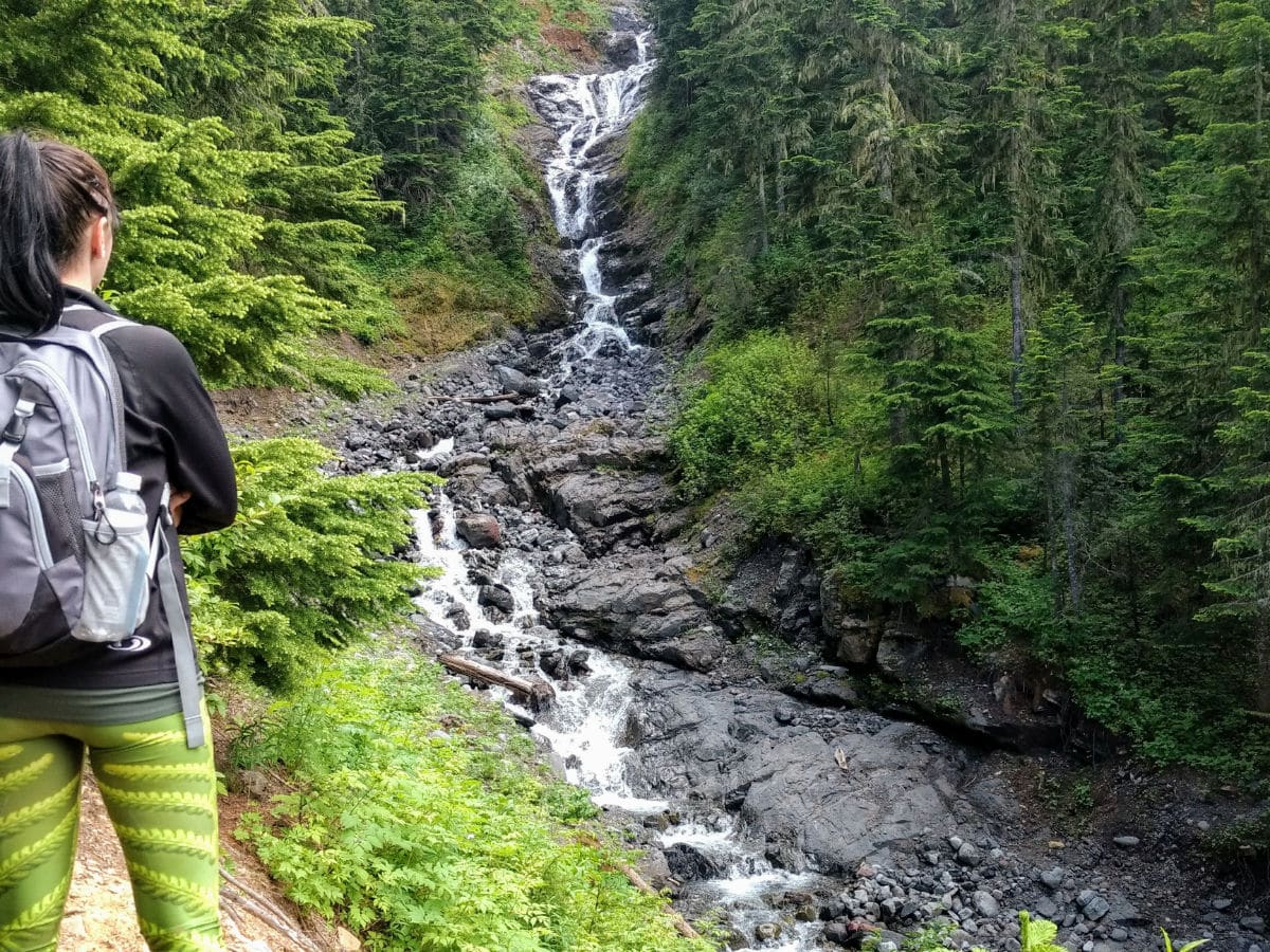
The Heliotrope Ridge trail climbs to a flat site where the Kulshan Cabin (built in 1925 by the Mount Baker Club) once stood. At around 2.0mi, the former cabin site is now used for camping with a backcountry toilet nearby. Shortly thereafter the trail crosses the West Fork of Heliotrope Creek, then reaches a junction with the Climber’s Trail at 2.4mi.
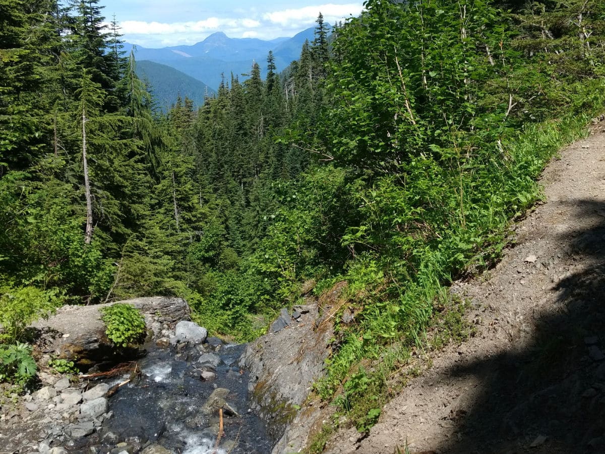
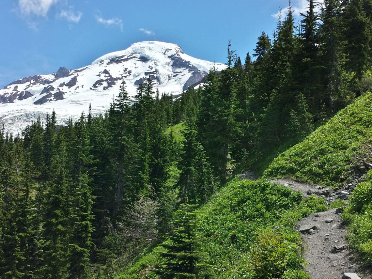
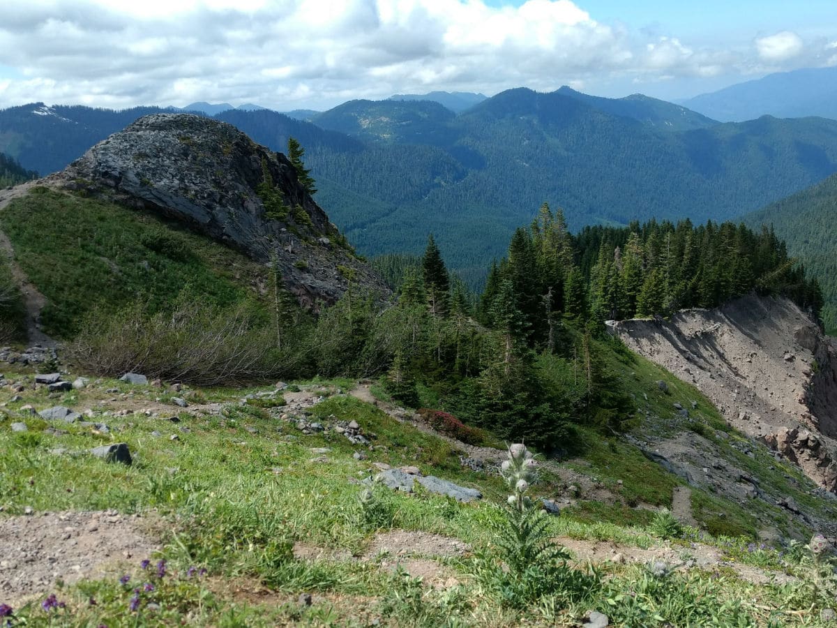
Continue straight to stay on the Heliotrope Ridge Trail. Mount Baker comes into view as you leave the forest behind, crossing the various braids of Heliotrope Creek. It’s easy to lose the trail in this section, so pay close attention. Your destination is a knoll at 2.8mi, at the moraine’s edge. Alternatively, you can follow any of the various paths up to the edge of the moraine.
The final climb to the knoll is steep, with loose rocks underfoot. At the top, you can meander up and down the ridge, but take care to stay away from the edge. It’s a long way down!
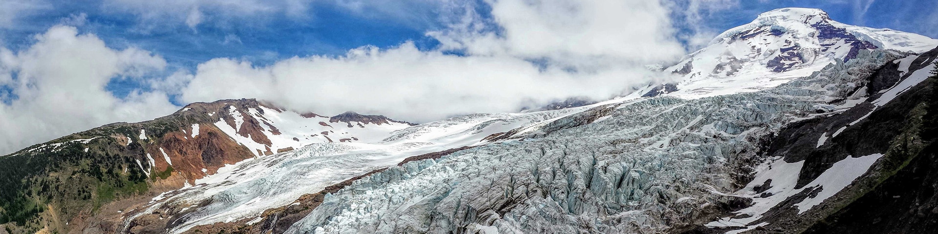
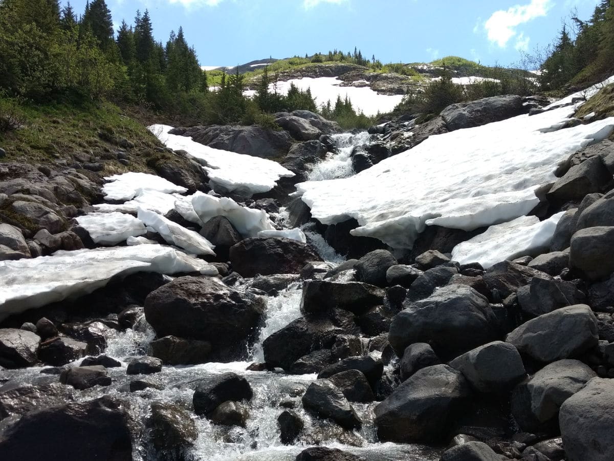
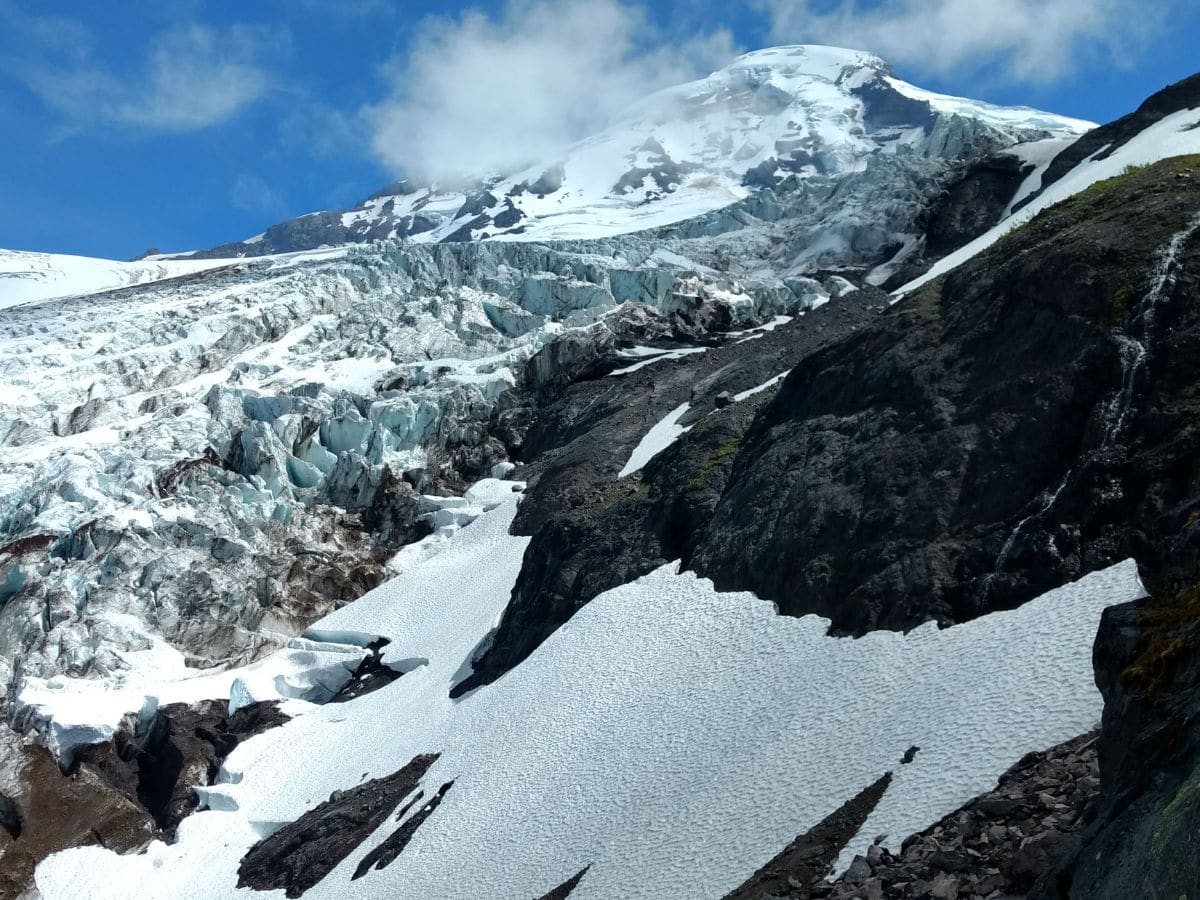
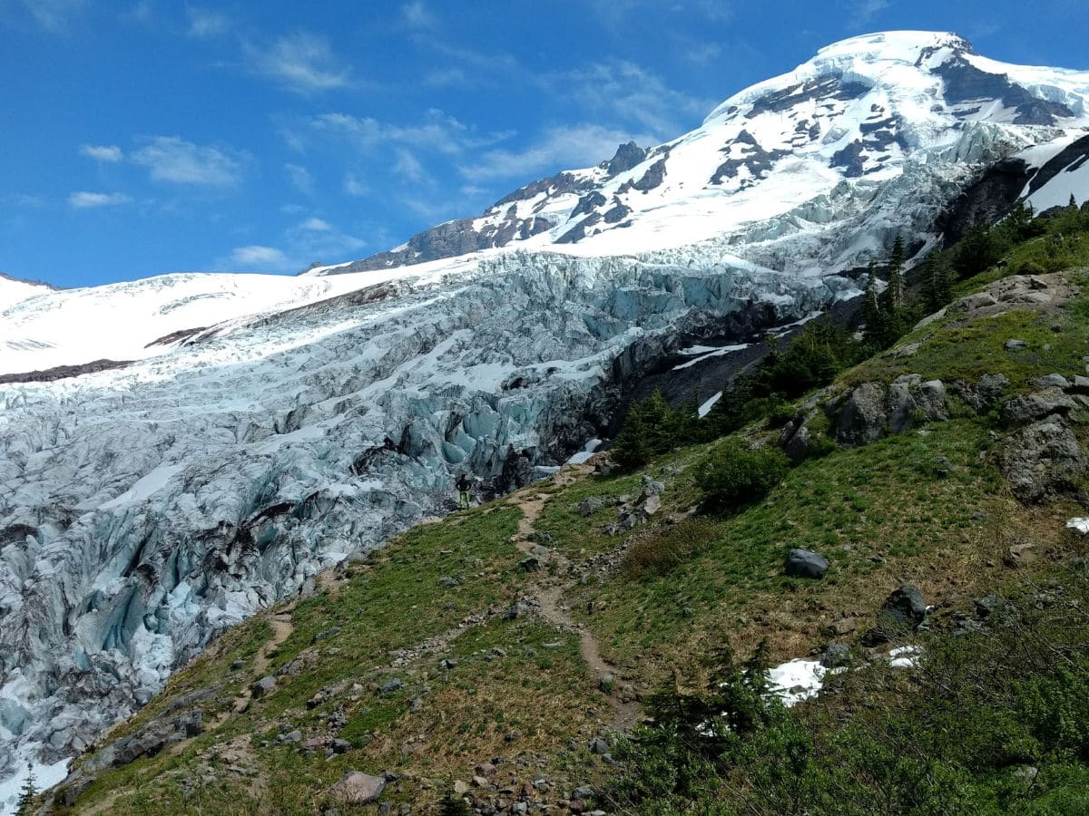
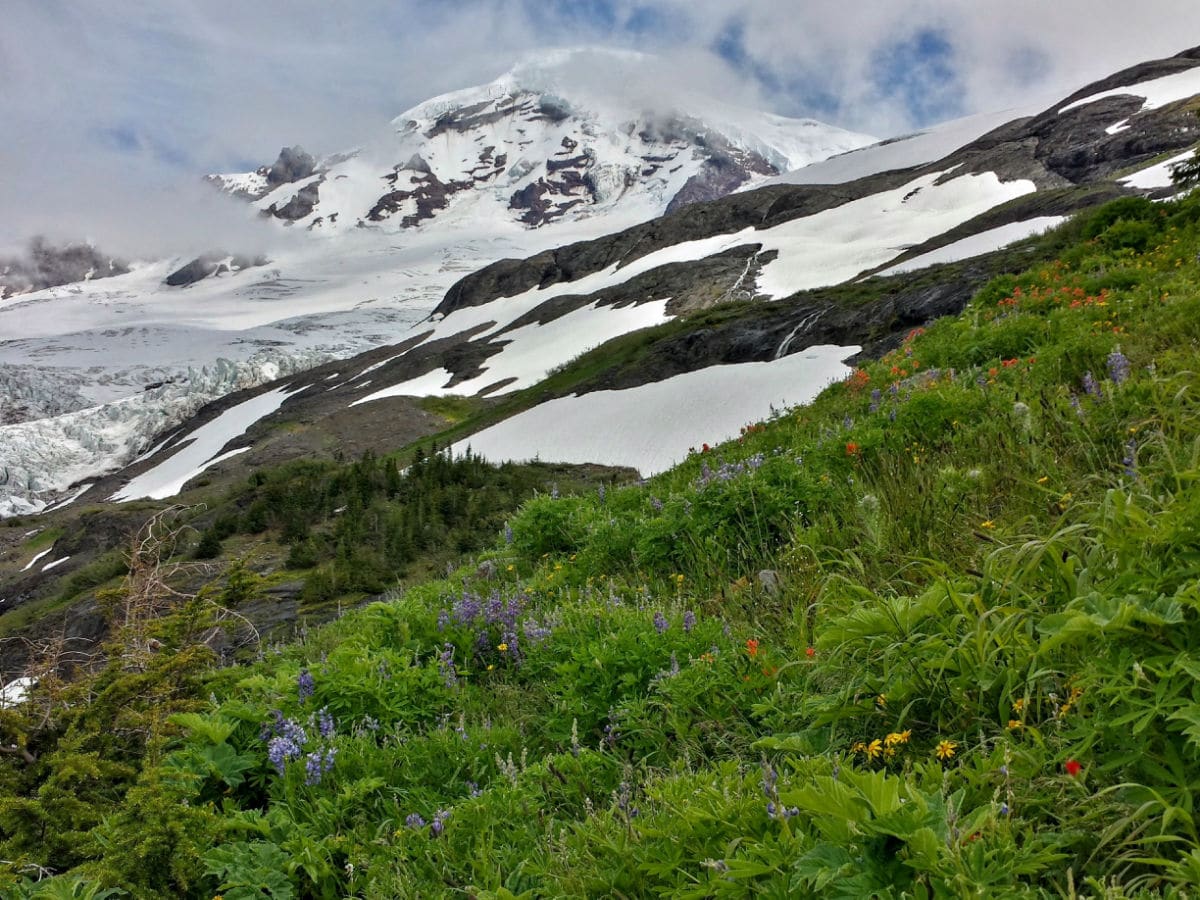
Once you’ve reached the overlook, peer out over the sea of glacier-blue ice. This is the Lower Coleman Icefall, part of the greater Coleman Glacier. Those giant ice chunks in front of you are called seracs. Often formed by intersecting crevasses, they can be as big as a car – or even a house. Above, Mount Baker stands tall at 10781ft. Bastille Ridge is visible across the moraine.
Return the way you came, taking care to watch your footing on the way down from the knoll.
Hiking Trail Highlights
Coleman Glacier
The Coleman Glacier is the largest of the 11 named glaciers that descend from the iconic peak of Mount Baker. With a surface area of approximately 5.2 square kilometers, the Coleman Glacier dominates the western slope of the peak, nestled between the Roosevelt Glacier and the Heliotrope Ridge. Like the other glaciers on Mount Baker, the Coleman Glacier retreated significantly in the period between 1980 and 2006.
The Coleman Glacier is a popular ascent route for climbers seeking to conquer the summit of Mount Baker. This is a challenging and technical climbing route, as many crevasses emerge in the glacier as the season progresses, making it difficult to find an accessible route. For many hikers, it’s enough to gaze upon the majesty of this impressive glacier from the lookout point, where you’ll enjoy a remarkable view over a dazzling sea of bright blue ice.
If you’d like to see more great hikes in Mount Baker, check out the Yellow Aster Butte, Skyline Divide and the Chain Lakes Loop.
Insider Hints
Consider a side trip up the Climber’s Trail on the way back for more Coleman Glacier views. The route is steep, climbing about 0.5mi to the viewpoint. Hikers should not proceed beyond this point without mountaineering experience, training, and climbing gear.
Stay off the glacier at all times.
Bring your trekking poles and an extra pair of socks - there’s a good chance you’ll get your feet wet while crossing several creeks along this trail.
Visit this trail early in the morning if possible. Creek levels tend to run higher and faster in the afternoon heat, which can make for challenging crossing conditions.
The Climber’s Trail is a good alternative for those who feel uncomfortable crossing Heliotrope Creek.

Similar hikes to the Heliotrope Ridge hike
Twin Lakes Trail
Twin Lakes Trail is a 14.7mi hike in the Mount Baker Wilderness that leads you to two picturesque…
Racehorse Falls Loop
The Racehorse Trail Loop is an easy hike to a pretty waterfall that cascades over several tiers. The hike to…
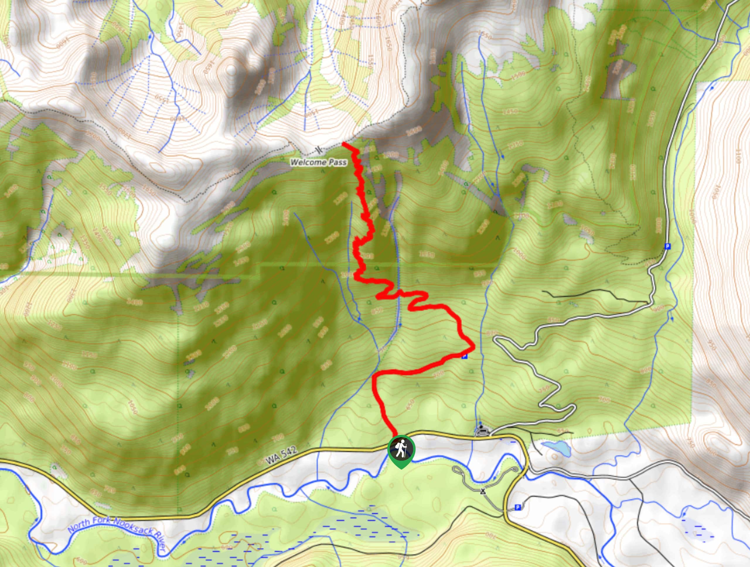
Welcome Pass Hike
The hike to Welcome Pass on High Divide Trail offers fantastic views of the surrounding mountains and lakes too numerous…
Miranda Q. 4 years ago
Coleman Glacier is impressive! Can't believe the first time I saw it!
Papa smurph 4 years ago
Absolutely insane glacier views! Beautiful scenery.
E.david 4 years ago
Wonderful views with perfect weather!
Sally S. Norbert 4 years ago
An absolutely gorgeous hike through old growth forest. This hike is well worth doing.
Lambert O 4 years ago
Glacier view is amazing. Gorgeous views
Aleysha C. 4 years ago
The trail is rigorous in a good way. The hike was beautiful. Waterfall and streams are gorgeous.
HIllaryPNW 4 years ago
Wonderful hike, great views at the end! Not a very difficult hike either.
Meighan 4 years ago
Stunning Coleman Glacier.
Kohaku Ichinose 4 years ago
The route is steep. It is difficult to climb, but no worries, once its over you'll see great views!(ㆁᴗㆁ✿)
Zoey Mann 4 years ago
Amazing glacier views all around. A perfect snow paradise!