
Silverado Canyon Motorway Trail
View Photos
Silverado Canyon Motorway Trail
Difficulty Rating:
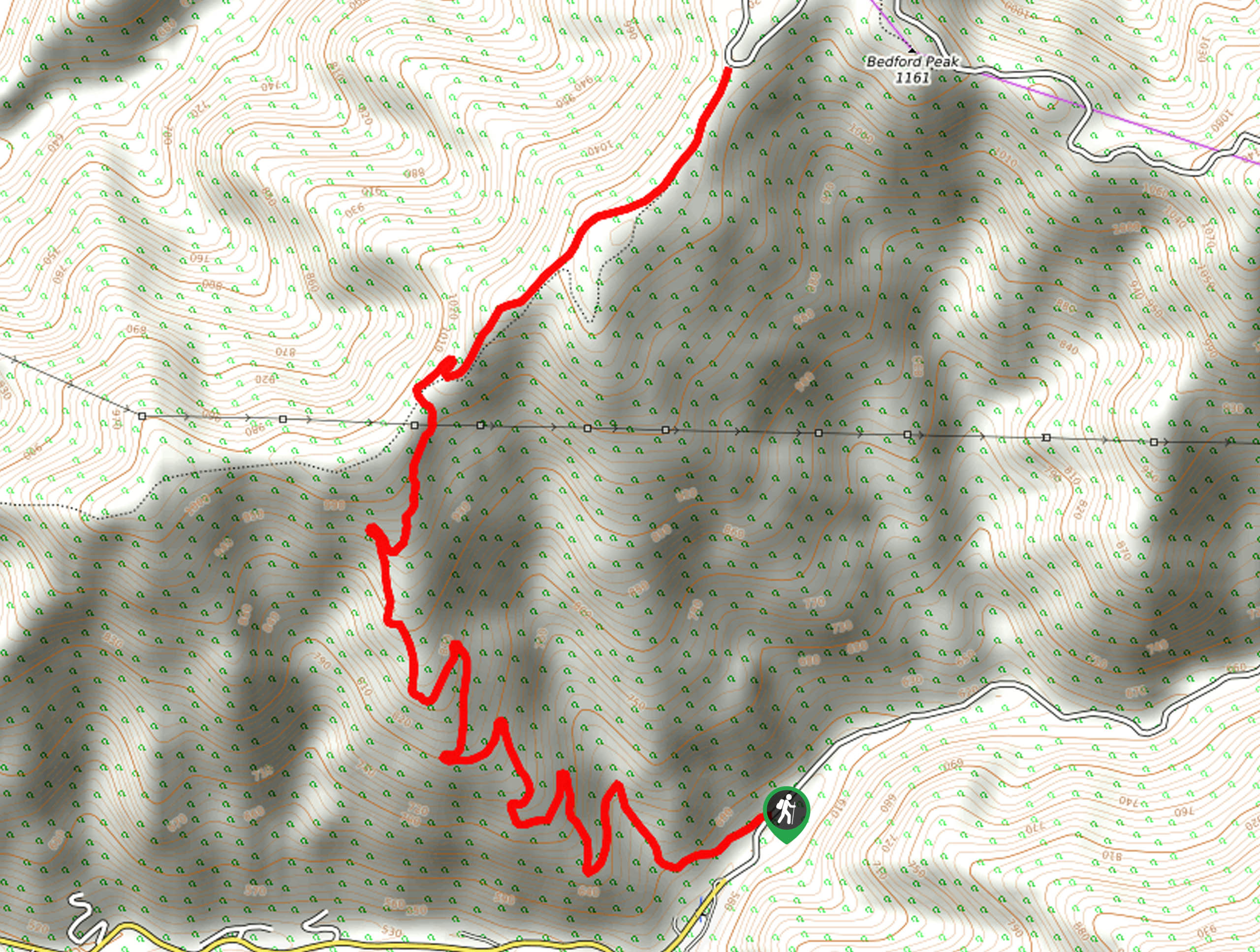
The Silverado Canyon Motorway Trail is a steep hiking route southeast of Los Angeles that climbs uphill through some rugged terrain. While out on the trail, you will follow a track that winds uphill through a series of switchbacks to enjoy some beautiful views from atop Bedford Peak. Make sure to purchase and display an adventure pass in your vehicle prior to setting out on your hike.
Getting there
The starting point for the Silverado Canyon Motorway Trail can be found near the Maple Springs Trailhead on Maple Springs Road.

About
| Backcountry Campground | No |
| When to do | Year-Round |
| Pets allowed | No |
| Family friendly | No |
| Route Signage | Average |
| Crowd Levels | Moderate |
| Route Type | Out and back |
Silverado Canyon Motorway Trail
Elevation Graph
Weather
Silverado Canyon Motorway Trail Description
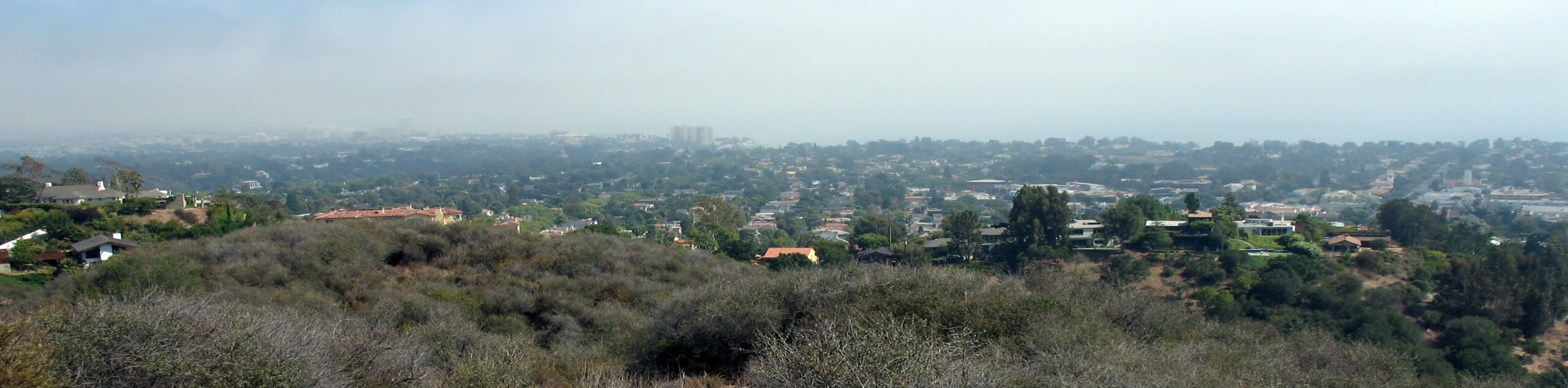
Popular with both hikers and mountain bike enthusiasts alike, the Silverado Canyon Motorway Trail is a steep and rugged route that will produce some wonderful views overlooking the undulating terrain of the Cleveland National Forest.
Setting out from the trailhead, you will make your way west along the track, following it as it immediately begins climbing uphill through a series of steep switchbacks. Make sure to remain alert as you hike this route, as there will undoubtedly be mountain bikers heading down the trail.
After passing through the switchbacks, the trail will turn to the northeast and climb further uphill, before arriving near the summit of Bedford Peak. Take a few moments to pause and catch your breath while enjoying the views, before heading back down along the same route to return to your starting point.
Similar hikes to the Silverado Canyon Motorway Trail hike
Rivas Canyon Trail
Hiking the Rivas Canyon Trail is a wonderful experience near Los Angeles that will take you through a canyon for…
Sullivan Canyon Loop Hike
Hiking the Sullivan Canyon Loop is a moderate-length adventure in Los Angeles that traverses a tricky bit of canyon terrain.…
Bee Rock Loop Hike
The Bee Rock Loop Hike is a quick outdoor adventure that will see you loop around Griffith Park. While out…
Comments