
Kenter Fire Road and Whoop-de-Doos Trail
View Photos
Kenter Fire Road and Whoop-de-Doos Trail
Difficulty Rating:
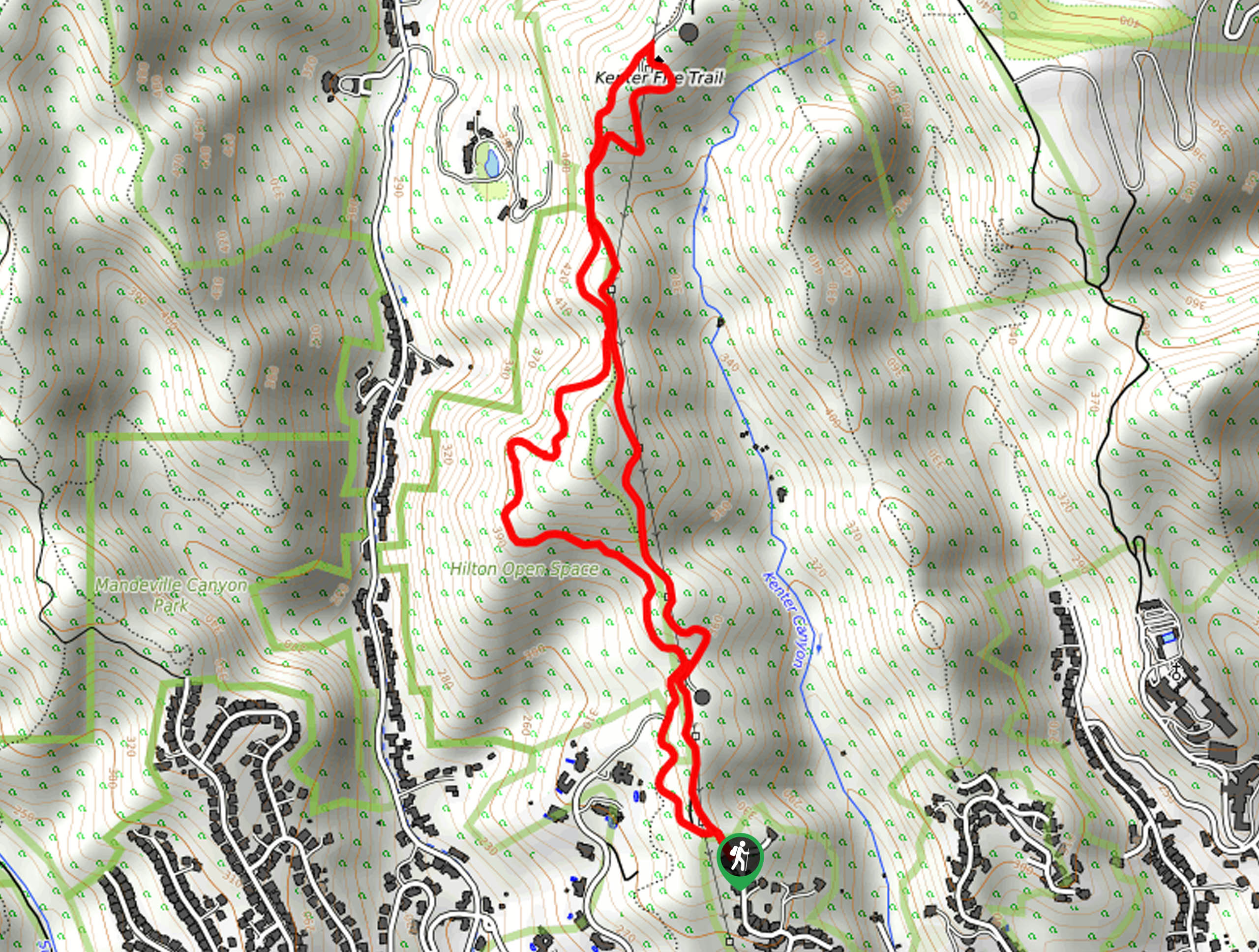
The Kenter Fire Road and Whoop-de-Doos Trail is a fun hiking route west of Los Angeles that traverses some rugged terrain for a spectacular view. While out on the trail, you will climb uphill along the fire road and steadily gain elevation while taking in the natural beauty of the Southern California landscape. Sections of this trail are a bit steep, so make sure to exercise caution when descending and bring trekking poles for extra stability.
Getting there
The starting point for this hike can be found at the end of N. Kenter Avenue.

About
| Backcountry Campground | No |
| When to do | Year-Round |
| Pets allowed | Yes - On Leash |
| Family friendly | Older Children only |
| Route Signage | Average |
| Crowd Levels | Moderate |
| Route Type | Lollipop |
Kenter Fire Road and Whoop-de-Doos Trail
Elevation Graph
Weather
Kenter Fire Road and Whoop-de-Doos Trail Description
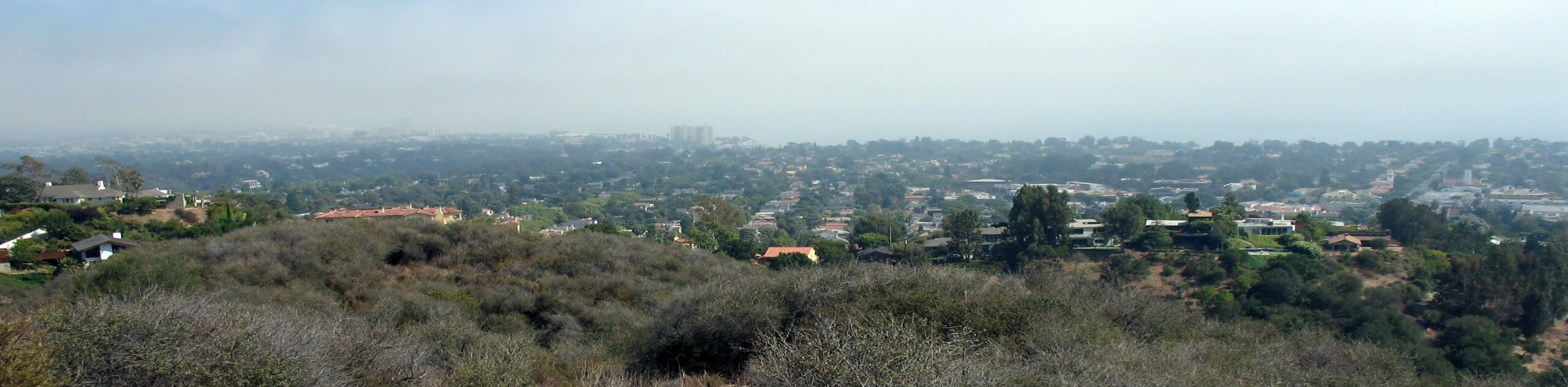
If you are hoping to get out of the city to enjoy some beautifully scenic views while on a hike through the rugged hills surrounding L.A., then the Kenter Fire Road and Whoop-de-Doos Trail will make for a great day trip.
Setting out from the trailhead, you will follow along the Kenter Fire Road as it leads north into the hills. Be sure to take your time here and enjoy the scenic views that sprawl out in every direction, including the city to the southeast.
Eventually, you will come to a junction and turn left, now making your way south along the Canyon Back Trail. Here, you will enjoy some more beautiful views, before making your descent into the trailhead where you started your hiking excursion.
Similar hikes to the Kenter Fire Road and Whoop-de-Doos Trail hike
Rivas Canyon Trail
Hiking the Rivas Canyon Trail is a wonderful experience near Los Angeles that will take you through a canyon for…

Sullivan Canyon Loop Hike
Hiking the Sullivan Canyon Loop is a moderate-length adventure in Los Angeles that traverses a tricky bit of canyon terrain.…
Bee Rock Loop Hike
The Bee Rock Loop Hike is a quick outdoor adventure that will see you loop around Griffith Park. While out…
Comments