Skiddaw
View Photos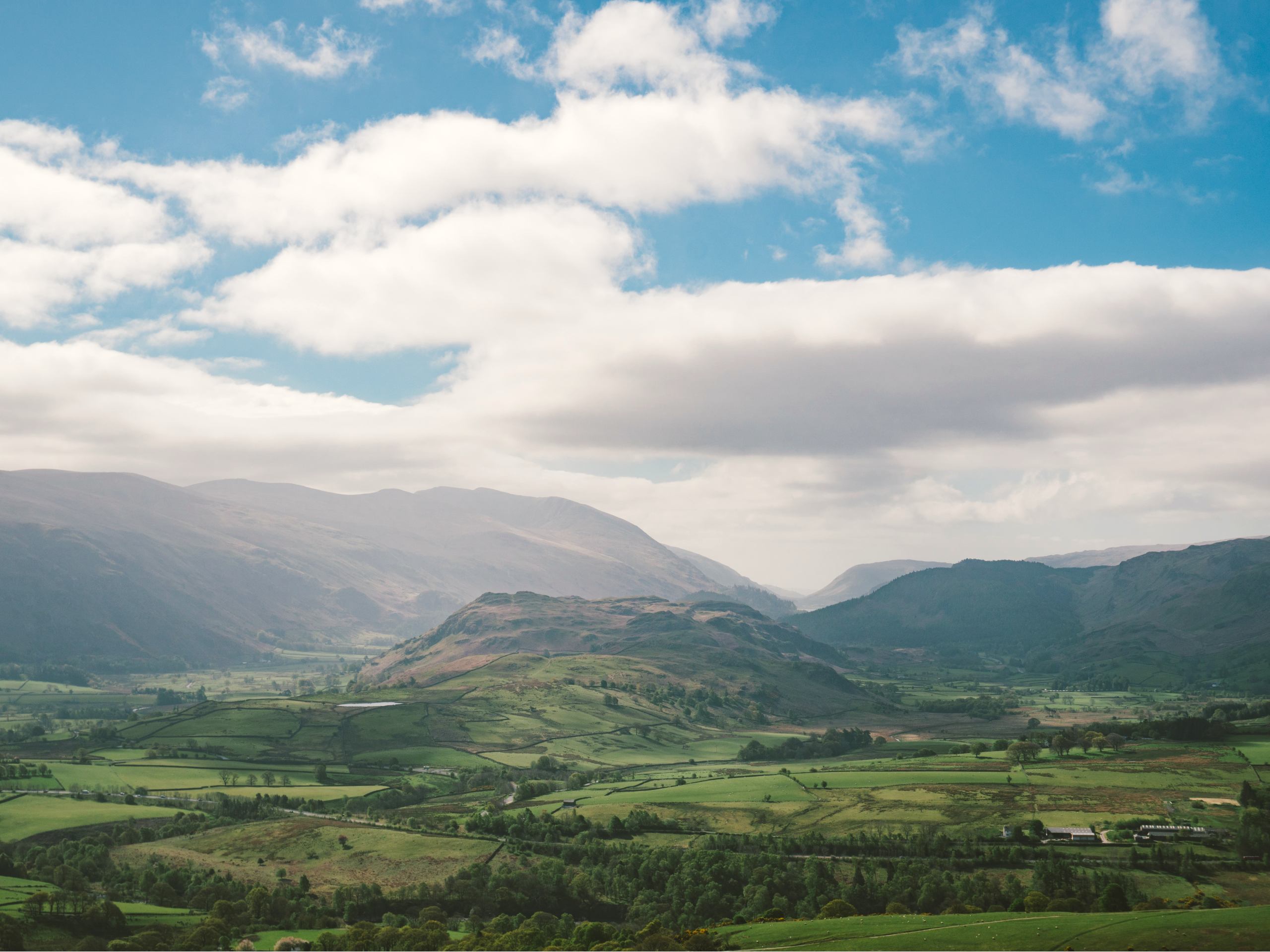
Skiddaw
Difficulty Rating:
The walk up Skiddaw is an amazing journey that will take you up the steep mountainside to reach the summit viewpoint atop England’s 6th highest peak. Although it may sound daunting, the path is well-maintained and defined, making it a fairly easy adventure as far as summit walks go. Be sure to arrive early, as parking can be limited.
Getting there
To reach the car park for the Skiddaw Trail from Keswick, drive northwest on Main Street for 0.3mi and turn right onto Crosthwaite Road. After 0.4mi, take the second exit at the roundabout onto A591 and follow it for 0.1mi. Turn right and continue on for 0.9mi, making another right onto Gale Road. In 0.1mi, you will arrive at the car park.

About
| When to do | March-November |
| Backcountry Campsites | No |
| Pets allowed | No |
| Family friendly | Older Children only |
| Route Signage | Average |
| Crowd Levels | Moderate |
| Route Type | Out and back |
Skiddaw
Elevation Graph
Weather
Skiddaw Trail Description
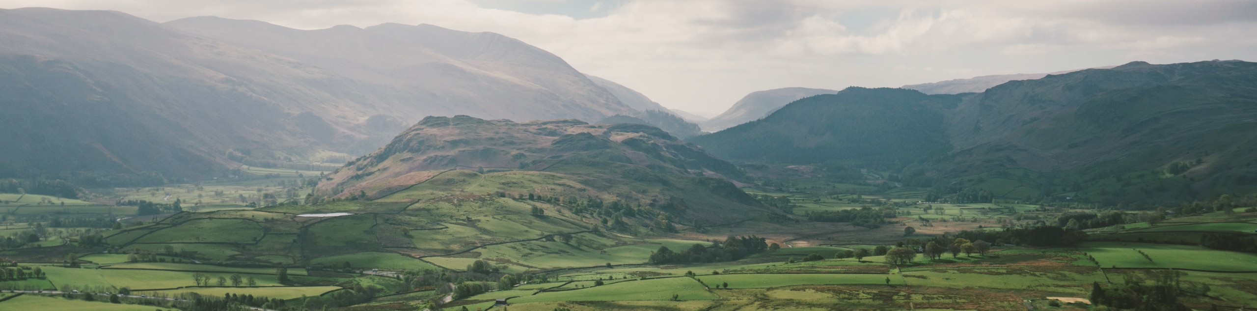
As one of the most dominant features across the landscape of the northern Lake District, the Skiddaw Trail features a few obstacles that you should note before setting out on your adventure. The initial portion of the trail is very steep, and while this does level out a bit, you will still face a good amount of elevation gain throughout the walk. Make sure to wear comfortable walking shoes, and bring plenty of water for the strenuous climb. Additionally, upper portions of the trail are a bit exposed to the elements, so remember to wear plenty of layers to protect yourself from the wind.
Even with all of the steep walking, the Skiddaw Trail is well-trodden and easy to navigate, making for a pleasant – if challenging – climb up the mountainside. From the car park, the path gradually climbs through the countryside for a short distance before you begin the slog up the steep slopes of Skiddaw. Upon reaching the summit, you will have some amazing views of nearby peaks that include Lonscale Fell, Skiddaw Little Man, Carl Side, and Long Side, as well as the waters of Bassenthwaite Lake in the valley below. With top-notch views and a direct route to the summit, this route is perfectly suited for casual and seasoned walkers alike.
Setting out from the south end of the Underskiddaw car park, take the trail to the northeast to cross over a stile and begin the gradual uphill climb through the open farmland. Continue on for 0.2mi, passing through a gate to arrive at a junction. Bear left and make your way through the kissing gate, keeping straight for the next 0.6mi as you climb the steep terrain of the hillside and cross one stile.
Keep right at the junction here and continue on for another 0.2mi, where you will arrive at another fork in the path. Keep left and enjoy the views of Lonscale Fell to the east, as the trail takes you further uphill in the direction of the summit. After 0.8mi, pass straight through the gate and follow the trail as it skirts around Little Skiddaw Man on your left.
On the final approach to the summit of Skiddaw, you will need to keep straight for 0.6mi and traverse the ridgeline before arriving at the scenic lookout. From this mountaintop perch, you will have some breathtaking views of the surrounding Lake District landscape. To the south, you will be able to spot Carl Side, Long Side, and Skiddaw Little Man that you passed on the way up; to the west, the deep blue waters of Bassenthwaite Lake, and to the northeast you will see the peaks of Great Calva and Bakestall.
After taking in the spectacular views and pausing for a quick lunch, turn back and retrace your steps down the mountainside to return to the car park having completed the Skiddaw Trail.
Trail Highlights
Skiddaw
The 6th highest summit in England, Skiddaw can be found just north of Keswick and dominates the landscape in this northern part of the Lake District. With a direct and well-maintained route to the summit, Skiddaw is often considered the easiest mountain of its size in the area to summit.
Bassenthwaite Lake
One of the largest bodies of water in the Lake District, Bassenthwaite Lake is a long, narrow, and shallow lake with a maximum depth of 69ft. Fed and drained by the River Derwent, Bassenthwaite Lake is the only body of water in the Lake District to actually use the word lake in its name, with others utilizing waters, meres, or tarns as descriptive terms.
Frequently Asked Questions
Is climbing Skiddaw difficult?
While the route does feature a good amount of uphill climbing, the route to the summit of Skiddaw is very well-defined, making it a moderate walk at the most.
Is Skiddaw safe?
While climbing the 6th highest peak in England might sound like a daunting experience, in reality the trail is well-defined and maintained, making it a suitable walk for casual and seasoned walkers alike.
Insider Hints
High points along the trail are exposed to the elements and can be very cold/windy. Wear plenty of layers.
Although you can walk this trail with dogs, portions of the trail might be too steep for them. If you aren’t sure of your climbing ability, it may be best to leave them at home.
The car park at the trailhead can get extremely busy during peak hours. Be sure to arrive early.
Wear proper walking boots, as the route features a good amount of uphill climbing.
Similar hikes to the Skiddaw hike

Osprey Viewpoint & Bassenthwaite Lake Walk
The Osprey Viewpoint & Bassenthwaite Lake Walk is a scenic Lake District adventure that will expose you to some beautiful…

Hawkshead, Wray Castle, and Windermere Walk
The Hawkshead, Wray Castle, and Windermere Walk is a fantastic journey that will lead you through some picturesque locations that…

Pike of Blisco and Crinkle Crags Walk
The Pike of Blisco and Crinkle Crags Trail is a challenging adventure that will see you climb several rugged peaks…
Comments