Scafell Pike Corridor Route
View Photos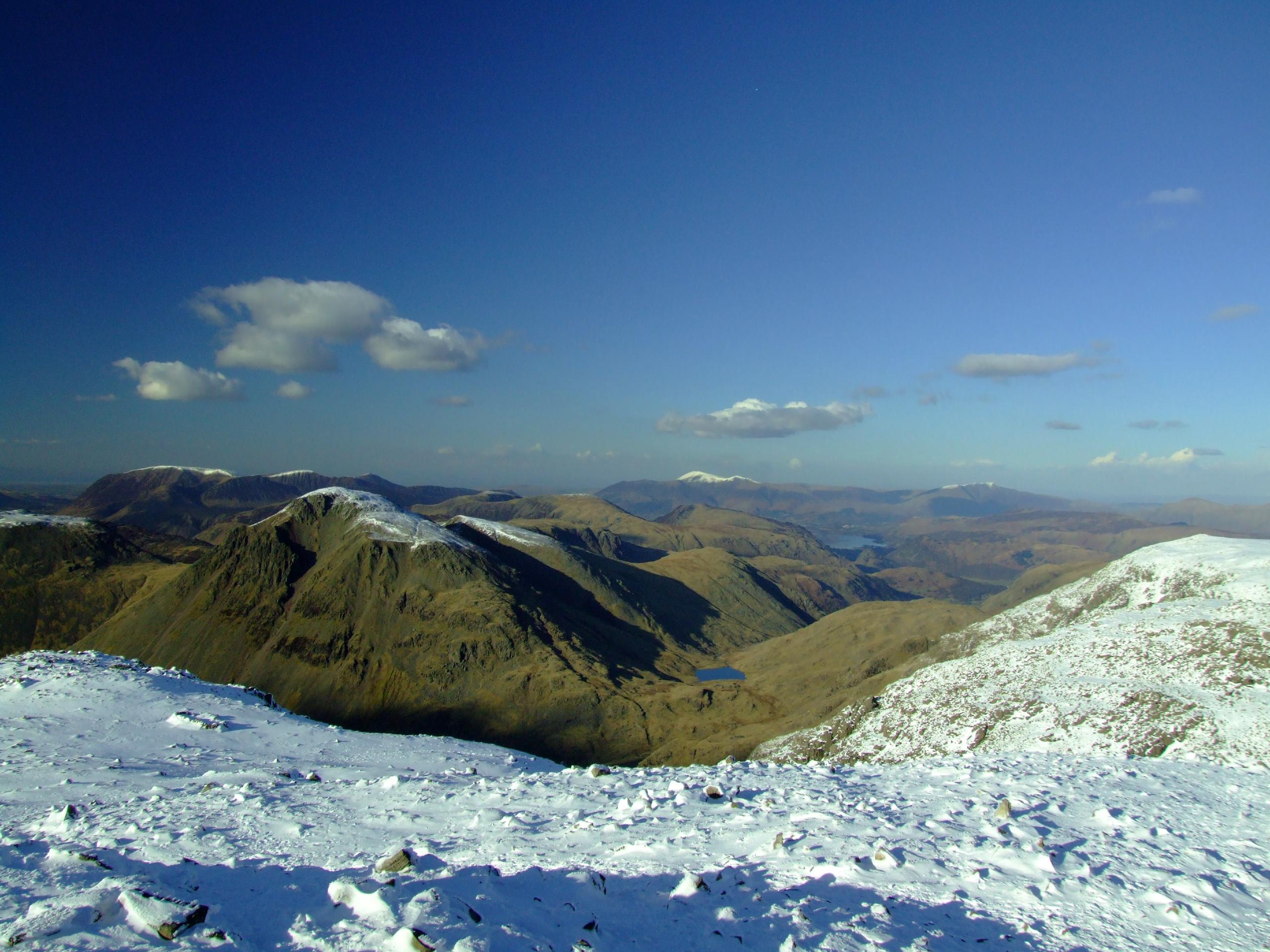
Scafell Pike Corridor Route
Difficulty Rating:
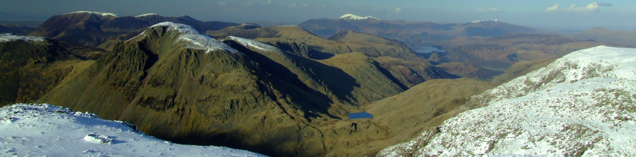
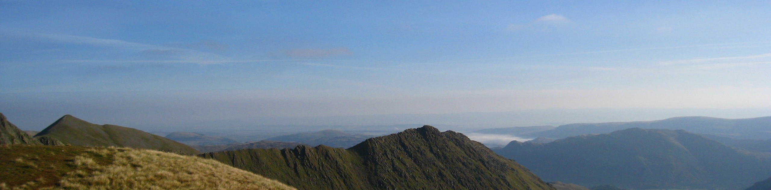
The Scafell Pike Corridor Route is a challenging adventure in the Lake District that climbs up a number of steep and rocky fells for some truly breathtaking views. This trail will see you walk along the waters of Lingmell Beck before climbing up the poorly-marked and rocky terrain of Great End. From here, you will make your way further uphill to Scafell Pike and Lingmell for some amazing views overlooking Wast Water and countless peaks. This is a tough climb that will require some basic route finding, but the spectacular views are enough to outweigh the negatives of this route.
Getting there
To reach the car park for the Scafell Pike Corridor Route from The Screes Inn in Nether Wasdale, head east for 0.3mi and turn left, continuing on for another 5mi. Turn right here to enter the car park.

About
| When to do | March-October |
| Backcountry Campsites | Wasdale Head Campsite |
| Pets allowed | No |
| Family friendly | No |
| Route Signage | Poor |
| Crowd Levels | Moderate |
| Route Type | Lollipop |
Scafell Pike Corridor Route
Elevation Graph
Weather
Scafell Pike Corridor Route Description
While the Scafell Pike Corridor Route will produce some truly amazing views overlooking the surrounding Lake District landscape, it will likely also produce a few headaches along the way. The trail climbs up a stretch of terrain that is steep and made up of loose rock on the ascent of Great End. Additionally, this portion of the walk is poorly marked and the rocky nature of the path makes route finding a challenge. Be sure to bring a GPS and pay close attention in this area to stay on the correct path. Walkers utilizing this trail should also wear sturdy walking boots with good ankle support for stability on the rugged and uneven terrain.
Setting out from the car park, follow the road northeast until you come to Burnthwaite Farm, picking up the trail that leads through the buildings toward the east. Continue walking along the edge of Lingmell Beck and keep left at the fork to climb uphill and traverse the lower slopes of Great Gable. Follow the trail south as it begins to climb more sharply uphill along the rugged and poorly-marked terrain of Great End, eventually reaching the viewpoint at the summit. After a brief rest, continue along the trail to the southwest, climbing slightly further uphill to reach Scafell Pike.
From this elevated position, you will enjoy some remarkable views that sweep across the undulating terrain of the Lake District and include Wast Water in the valley far below. After spending some time on the summit, continue downhill to the northwest to visit the summit of Lingmell before retracing your steps back to the main trail. Follow this north to descend the steep slopes of the fell, eventually arriving back at the banks of Lingmell Beck. From here, you will head west and backtrack along the initial stretch of trail that will see you return to the car park where you started the walk.
Similar hikes to the Scafell Pike Corridor Route hike
Nethermost Pike via East Ridge Walk
Walking to Nethermost Pike via East Ridge is a tough climb up several rugged fells that will expose you to…

Hawkshead, Wray Castle, and Windermere Walk
The Hawkshead, Wray Castle, and Windermere Walk is a fantastic journey that will lead you through some picturesque locations that…

Pike of Blisco and Crinkle Crags Walk
The Pike of Blisco and Crinkle Crags Trail is a challenging adventure that will see you climb several rugged peaks…
Comments