Langdale Pikes Walk: Pavey Ark, Harrison Stickle, Pike of Stickle
View Photos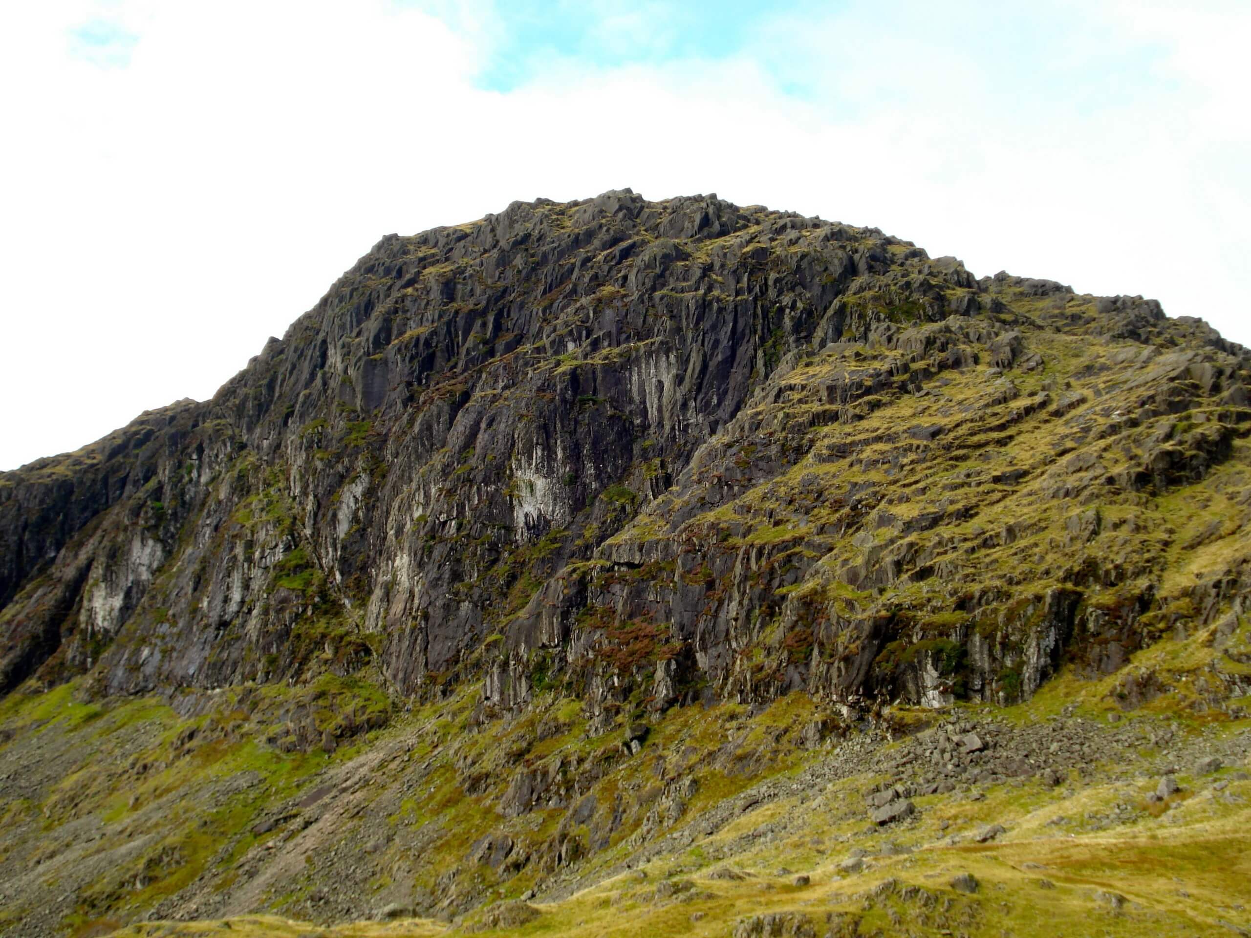
Langdale Pikes Walk: Pavey Ark, Harrison Stickle, Pike of Stickle
Difficulty Rating:
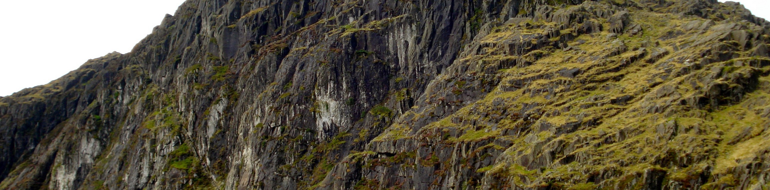
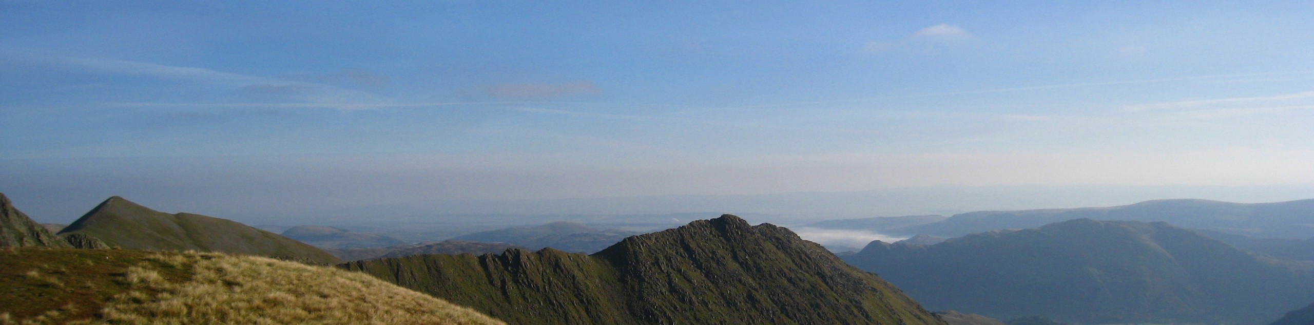
A walk along the Langdale Pikes: Pavey Ark, Harrison Stickle, Pike of Stickle is a challenging undertaking that will see you climb up the rocky hillside for views from each of these three summits. Views from the top of the trail will include a sweeping view across the Great Langdale Valley, with nearby valleys and fells of the Lake District further afield. This is a difficult route that should only be attempted by seasoned outdoor enthusiasts.
Getting there
To reach the Langdale Pikes: Pavey Ark, Harrison Stickle, Pike of Stickle trailhead from Elterwater, head to the northeast for 0.1mi and turn left onto B5343. Follow this road for 2.8mi and turn right to enter the car park.

About
| When to do | Year-Round |
| Backcountry Campsites | No |
| Pets allowed | No |
| Family friendly | No |
| Route Signage | Average |
| Crowd Levels | Moderate |
| Route Type | Lollipop |
Langdale Pikes Walk: Pavey Ark, Harrison Stickle, Pike of Stickle
Elevation Graph
Weather
Langdale Pikes Walk: Pavey Ark, Harrison Stickle, Pike of Stickle Description
Walking the Langdale Pikes Walk: Pavey Ark, Harrison Stickle, Pike of Stickle is a challenging adventure that is popular with seasoned walkers looking to experience some of the best terrain and views in the Lake District. The trail sets out from the car park and climbs uphill to the northwest along the rushing waters of Dungeon Ghyll Force, traversing the steep and rocky terrain on the way to the summit of Loft Crag. From here, you will continue across the rough terrain to reach the summit of Pike of Stickle for some amazing views overlooking the valley. Head to the northeast to cross over the barren landscape, working around the summits of Thunacar Knott and Pavey Ark to eventually turn south towards Harrison Stickle. After visiting this rocky summit, you will make your way downhill to the calm waters of Stickle Tarn. From here, continue your descent of the steep hillside along the rushing waters of Stickle Ghyll, taking in the final views of the Great Langdale Valley as you return to the car park.
Similar hikes to the Langdale Pikes Walk: Pavey Ark, Harrison Stickle, Pike of Stickle hike
Nethermost Pike via East Ridge Walk
Walking to Nethermost Pike via East Ridge is a tough climb up several rugged fells that will expose you to…

Hawkshead, Wray Castle, and Windermere Walk
The Hawkshead, Wray Castle, and Windermere Walk is a fantastic journey that will lead you through some picturesque locations that…

Pike of Blisco and Crinkle Crags Walk
The Pike of Blisco and Crinkle Crags Trail is a challenging adventure that will see you climb several rugged peaks…
Comments