Gummer’s How
View Photos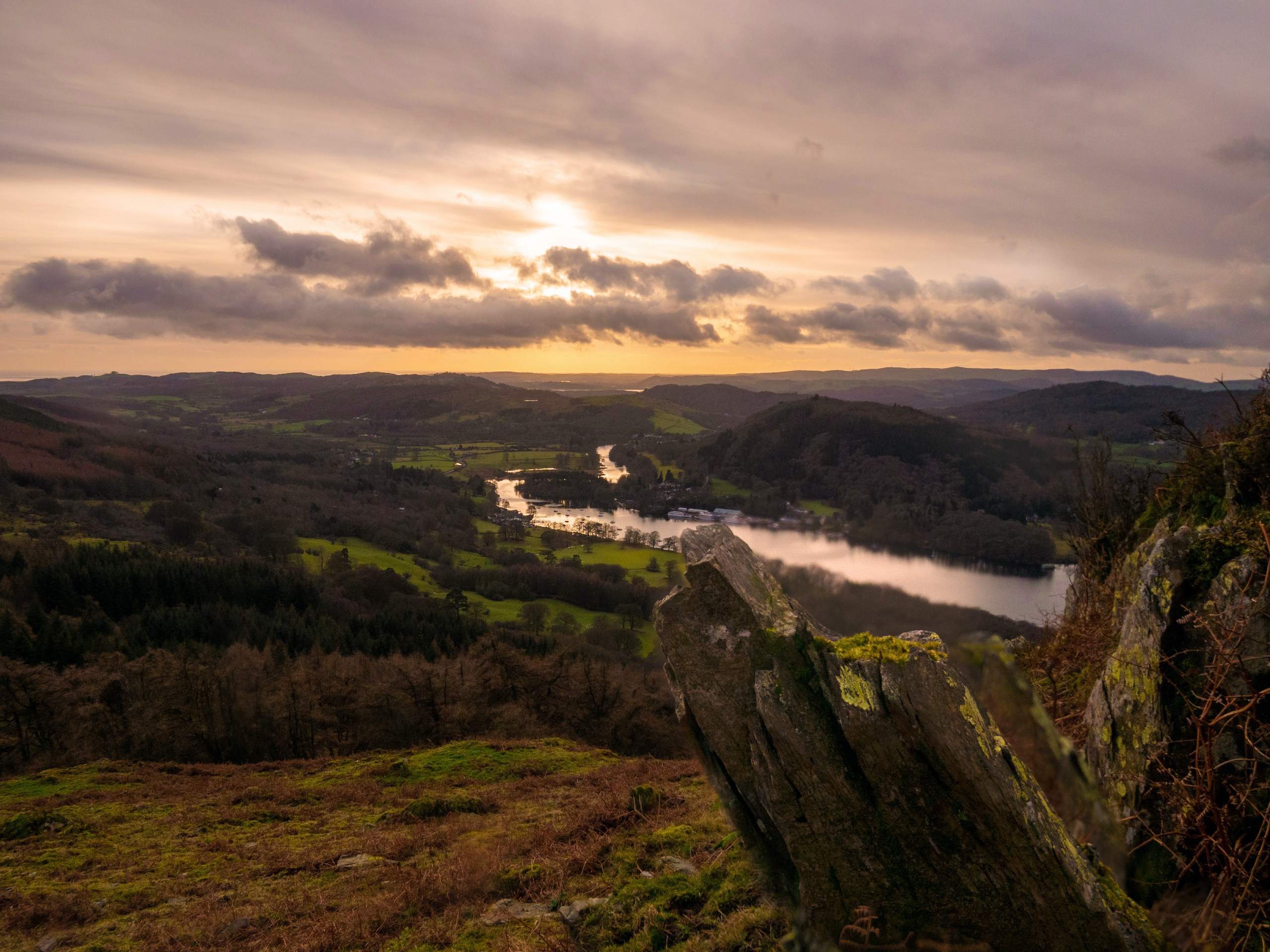
Gummer’s How
Difficulty Rating:
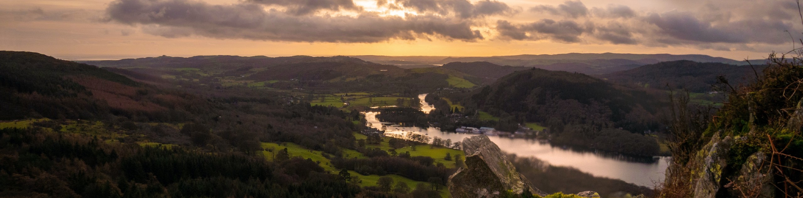
The walk up Gummer’s How is a quick adventure in the Lake DIstrict that climbs uphill for some amazing views overlooking Windermere. The trail passes through a tranquil stretch of woodland terrain before breaking out of the tree cover for a loop around the summit. Navigation on this lightly-travelled trail can be a bit tricky in places, but the amazing views from the summit make the short climb a worthy venture for walkers of all skill levels.
Getting there
To reach the car park for Gummer’s How from Newby Bridge, drive southeast on A590 for 0.2mi and take the first exit at the roundabout to continue on the A592 for 0.8mi. Turn right here onto Fell Foot Brow, and follow it for 0.7mi to find the car park on the right.

About
| When to do | Year-round |
| Backcountry Campsites | No |
| Pets allowed | Yes - On Leash |
| Family friendly | Older Children only |
| Route Signage | Poor |
| Crowd Levels | High |
| Route Type | Lollipop |
Gummer’s How
Elevation Graph
Weather
Gummer’s How Walk Description
Although Gummer’s How is only a short adventure, the trail can be a bit tough to navigate in certain areas. Make sure to bring a GPS or pay very close attention to the path in order to complete the loop portion of the circuit. Additionally, the lightly-travelled nature of the path means that it can also be a bit rugged under foot. Wear proper walking boots to better traverse the terrain.
If anything, the need for some basic route finding skills along the loop portion of this walk will only add to the sense of adventure that you will feel after taking in the amazing views from atop Gummer’s How. With a short overall distance and a fair amount of shade provided by the canopy of the forest, this trail is well-suited for a quick adventure on a hot summer day.
Setting out from the car park, follow the trail northeast for 275ft and turn left at the junction. After passing through the gate, make your way across the road to pick up the trail on the opposite side. Here, you will pass through another gate and cross an open stretch of terrain before entering into the cover of the forest.
Keep straight for 0.3mi, where you will exit the tree cover and come to another fork in the trail. Head left here to begin the relatively steep ascent to the summit of Gummer’s How. Even though the hill is fairly short, you will have a spectacular view across the Lake District landscape, including a sightline that runs the length of the dark blue expanse of Windermere.
After taking in the views, head east along the trail to slightly descend along the hillside and arrive at a junction. Head right here and keep an eye on the GPS to help you travers the lightly-travelled terrain along the eastern slope of the hill. After 0.1mi, you will meet back up with the main trail. Follow it to the left to head back through the forest on the return journey to the Gummer’s How car park.
Insider Hints
Route finding on the loop portion of the trail can be a bit tricky, so make sure to utilize a GPS to stay on track.
The trail is lightly-travelled and a bit rugged in areas. Wear proper walking boots.
Pack a lunch for a scenic hilltop picnic with amazing views.
Similar hikes to the Gummer’s How hike

Osprey Viewpoint & Bassenthwaite Lake Walk
The Osprey Viewpoint & Bassenthwaite Lake Walk is a scenic Lake District adventure that will expose you to some beautiful…

Hawkshead, Wray Castle, and Windermere Walk
The Hawkshead, Wray Castle, and Windermere Walk is a fantastic journey that will lead you through some picturesque locations that…

Pike of Blisco and Crinkle Crags Walk
The Pike of Blisco and Crinkle Crags Trail is a challenging adventure that will see you climb several rugged peaks…
Comments