Fairfield Horseshoe
View Photos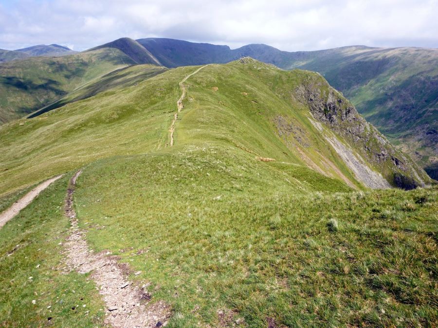
Fairfield Horseshoe
Difficulty Rating:
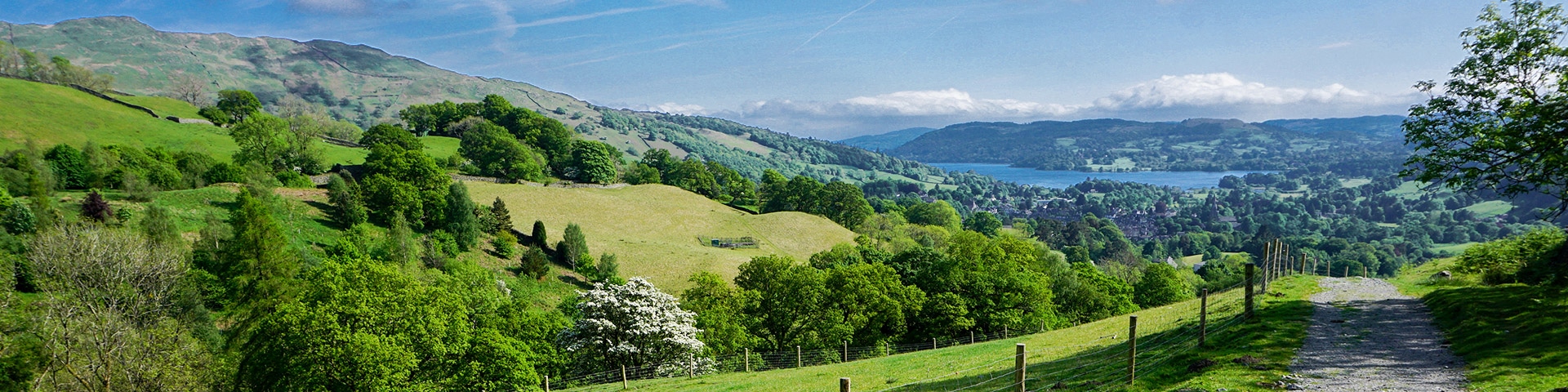
You can start this wonderful Fairfield Horseshoe walk right from Ambleside. Any day you can wake up and walk directly from your lodging to the trail is a great one! This wonderful route explores the peaks that surround the beautiful town of Ambleside and is a Lake District’s classic!
Getting there
To start the Fairfield Horseshoe walk, head to the Rydal Road (main) car park in Ambleside, just off of the A591 (Rydal Road).

About
| When to do | When Dry, no fog |
| Backcountry Campsites | No |
| Toilets | Starting car park |
| Family friendly | No |
| Route Signage | None |
| Crowd Levels | Moderate to High |
| Route Type | Circuit |
Fairfield Horseshoe
Elevation Graph
Weather
Route Description for Fairfield Horseshoe
There is something wonderful about waking up, having breakfast and then going on your walk directly from your accommodation. This route allows you to do just that, and the hike around Fairfield Horseshoe is one of the best Ambleside walks there is.
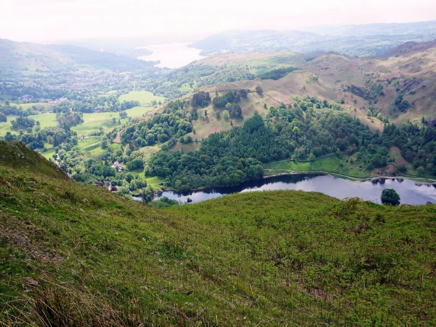
Start in the main car park on the northern side of Ambleside, just off Rydal Road. From the car park head north over the bridge and turn left onto Rydal Road, passing a police building. Note the Armitt Museum, across the street just right of the bridge you crossed.
Stay on the left-hand side of the road and after about 10 minutes cross over a bridge. Cross to the other side of the road and almost immediately go right, through some wrought-iron gates onto a rocky track past Park Gates Lodge on your left.
Follow this path and after 1.5mi from your starting point in the car park, take a track that heads off to the right. The path splits almost immediately and this time you go left towards some buildings. Go to the left of the main building towards Rydal Hall, crossing over a river on a substantial stone bridge and continue on a road between a cafe and the rear of Rydal Hall.
Continuing the Fairfield Horseshoe trail, you soon come to a steep road and go right uphill. You will pass Rydal Mount, the home of William Wordsworth, on your left. Soon after, continue uphill past a path going off to your left. The path you’re on splits quickly – take the left-hand path uphill towards a rocky path under a tree towards a gate.
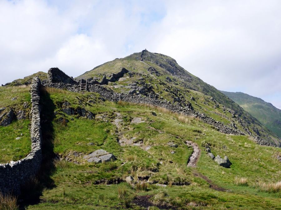
At 1.9mi from the start the Fairfield Horseshoe walking route heads uphill on stone steps. You will climb a ladder over a stone wall 1198ft later and continue uphill.
At 2.9mi from the start, you’ll come to a stonewall and take the protruding stone steps over it and then continue uphill.
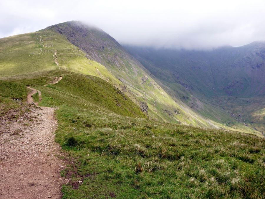
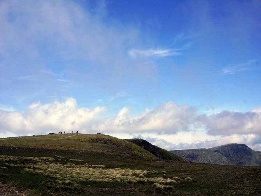
At 4.0mi from the start, the path splits. Go right to go up Heron Pike, which is a great stop for lunch. From here the path is pretty evident, curving in the horseshoe around to your right and coming back down on the hills on the other side of the valley. Your role is to stay on the ridge.
Leaving Heron Pike, continue north along the ridge eventually going over Great Rigg. This is a lovely ridge-walk for quite some time and is a pleasure in fine weather.
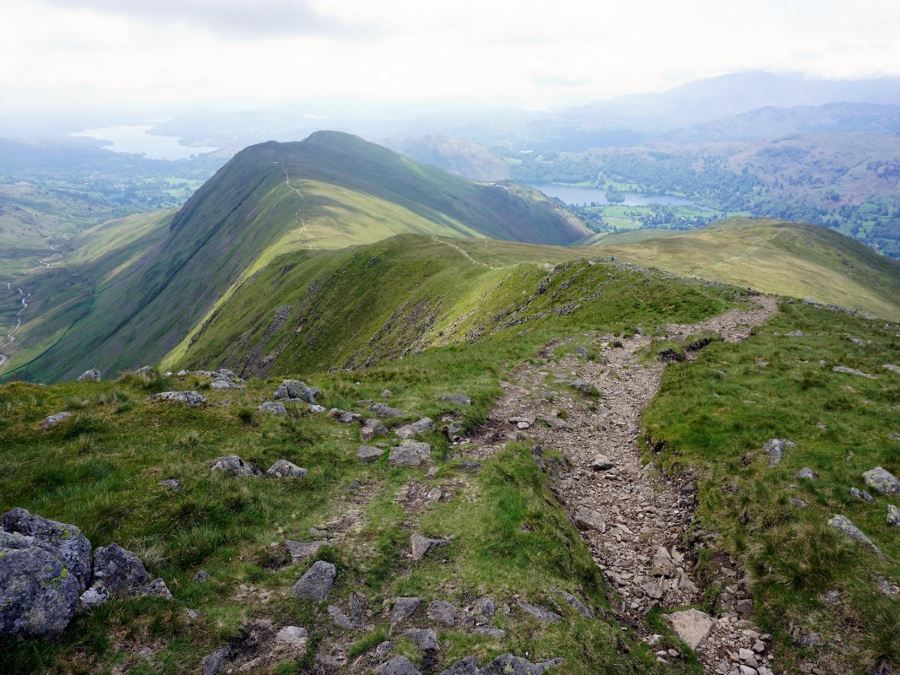
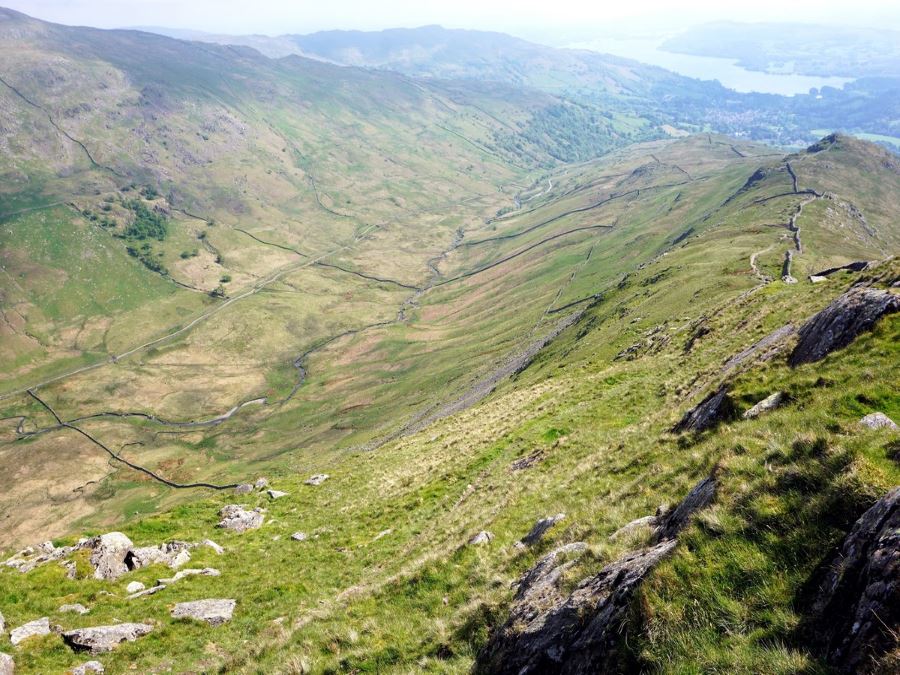
At 5.6mi from the start, you reach Fairfield and a series of stone wind shelters. After taking a break, continue on the path to the right going east across the ridges.
Stay east along the horseshoe and soon turn back towards Ambleside. Along the way you will pass Dove Crag, High Pike and Low Pike, however the views aren’t as spectacular as on the way up.
As you descend the broad ridge you will go along the left hand side of a stonewall. This is an exceptionally well built wall, running most of the way back down to the valley bottom. Along the way you will pass gates on your right, but continue down on the path, with the stone wall on your right. Pay attention – a few areas can get muddy, especially after heavy rains.
As you continue down along the stone wall you’ll notice a path running along the other side of it. We prefer to be on the path that keeps the stone wall on our right. Along the way (10.0mi there is a noticeable bog that could be trouble after a lot of wet weather. You may notice a small sign to the left of the route saying deep bog. Stick right close to the stone wall, but your boots may get a bit muddy.
2247ft after the start of the bog, go left and away from the fine stonewall along a clear stony path. 1936ft after this, you’ll reach a track – go right and continue downhill.
After approximately 1.7mi you come to a stone wall and follow the path left, then right. 902ft later continue on the left, ignoring a path heading off to the right (which goes back to Rydal). Your path crosses a bridge and then passes through a gate.
Soon after, you go through a metal gate and head straight down the road, passing some buildings from the University of Cumbria. When the road splits in three go straight down Nook Lane, continuing downhill and straight when another road comes out on the right.
When you come to a bigger road go right and then left at a traffic circle. Across the street is the car park, and there is a bridge just to your left on the other side of the road.
Walking Route Highlights
Fairfield Peak
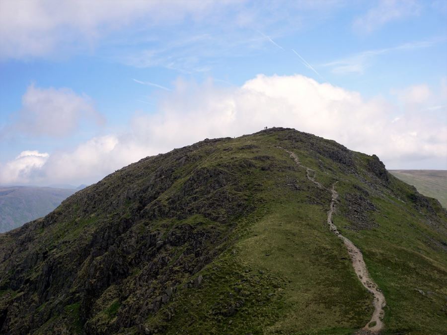
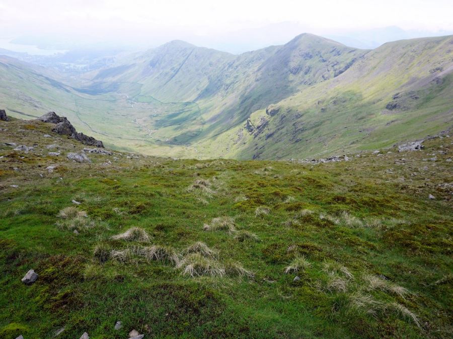
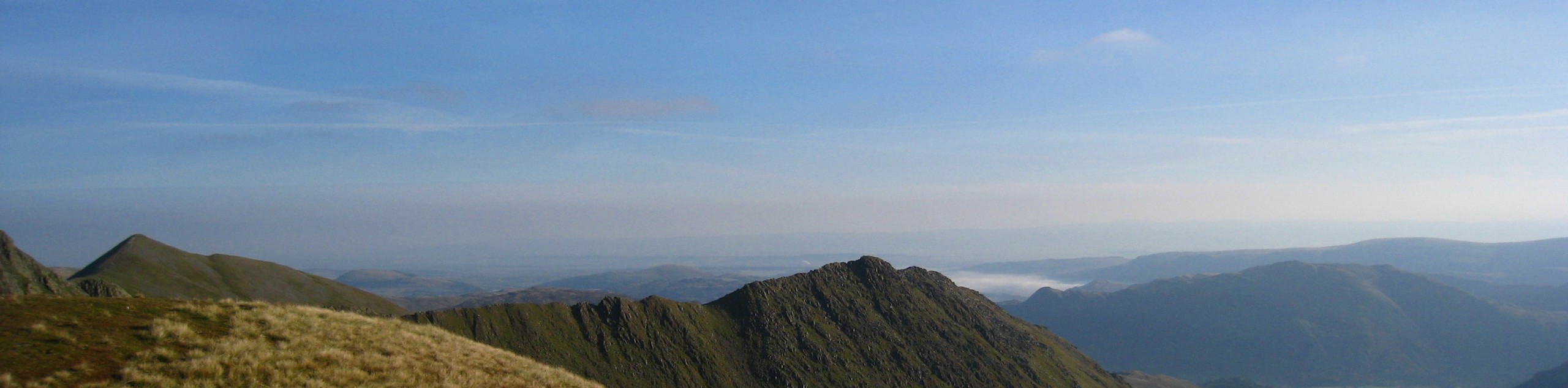
Fairfield is one of the highest peaks in the Eastern Fells, towering over its neighbors at an altitude of 2864ft. As Lake District legend Alfred Wainwright noted, Fairfield is a somewhat deceptive mountain: from the south it appears as a fairly unassuming, grassy horseshoe, but from the north, hikers can appreciate its dramatic precipices and deep, dark valleys. Either way, the joy of Fairfield is experienced from its summit, which provides some of the finest views over the Eastern Fells that you’ll get anywhere in the Lakes.
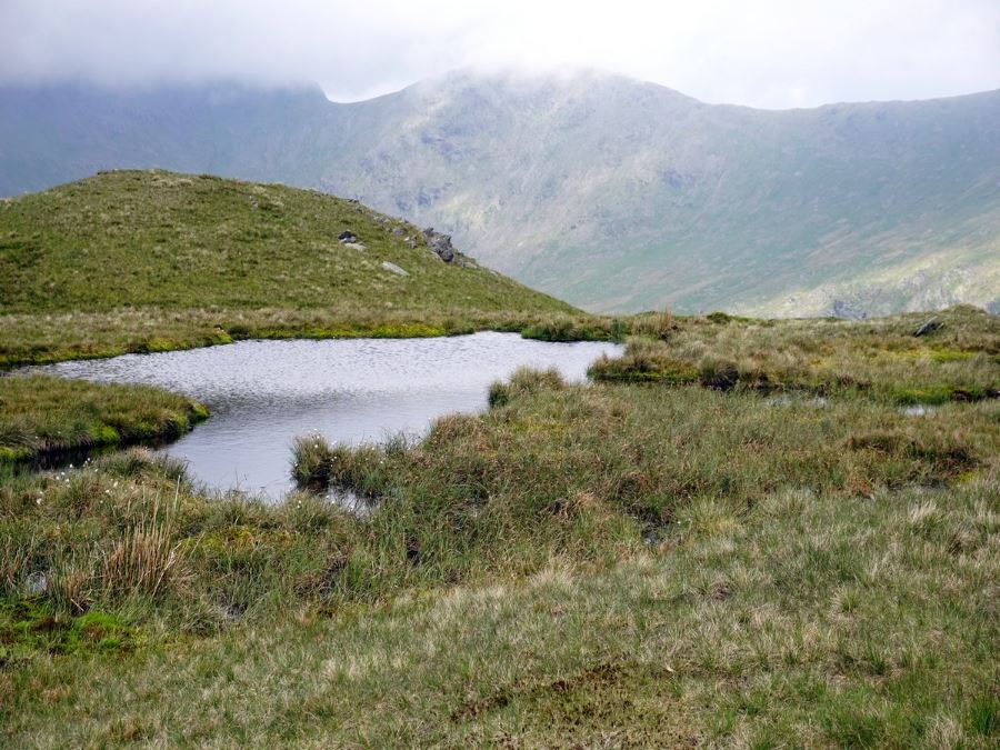
Just north of Fairfield, you’ll find the enigmatic Grisedale Tarn, a high mountain lake steeped in local myth. According to legend, the crown of the ancient king of Cumberland, Dunmail, was cast into the tarn after his death in battle. It now lies there waiting for the king to rise again.
Fairfield is the 15th tallest mountain in England, and can be conquered on a variety of different trails. Although the Fairfield Horseshoe is the most popular route, it’s also possible to climb Fairfield via the Deepdale Horseshoe, another stunning Lake District walk. Whichever route you choose, this ‘fair fell’ will offer you a wonderful day out hiking in the Lake District.
Ambleside
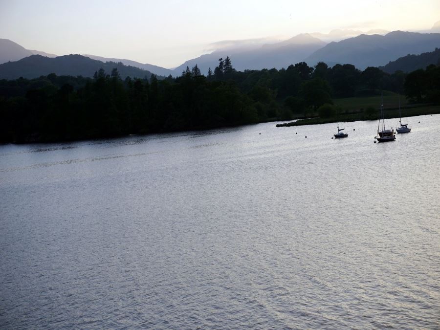
Ambleside is the de facto capital of the Lake District, and is a busy, bustling town with plenty of attractions for keen hikers. You’ll find lots of pubs, bars, restaurants and shops, so you can pick up anything from hiking gear to souvenirs during your trip to the Lakes (don’t forget the Kendal Mint Cake!). Although it can get very busy in summer and during the school holidays, Ambleside is a lovely and convenient base for your Lake District walking adventure.
One of the advantages of this route around the Fairfield Horseshoe is that the trail begins and ends in Ambleside itself, meaning you can stumble into a cosy pub for some refreshments when you’ve finished your walk. There are some excellent pubs and restaurants in town, making it the perfect place to relax after a full day of walking.
Fairfield’s Fighter Jets
One of the unusual features of a walk around the Fairfield Horseshoe is the chance of catching a glimpse of a few fighter jets sweeping down through the valley! This might not be what you expect to see in the rugged countryside of the Lake District, but local fighter pilots actually use the valley as a training ground. They often fly below the ridgeline, meaning that you can even see the heads of the pilots as they zoom past, descending low into the valley.
Frequently Asked Questions about the Fairfield Horseshoe
How many wainwrights are on Fairfield Horseshoe?
The Fairfield Horseshoe covers a grand total of eight ‘Wainwrights’, the iconic summits identified by Alfred Wainwright in his Pictorial Guide To The Lake District Fells. The eight Wainwrights on the route are: Fairfield, Hart Crag, Dove Crag, Great Rigg, High Pike (Scandale), Heron Pike (Rydal), Low Pike and Stone Arthur.
How high is Fairfield peak?
Fairfield is the 15th highest mountain in England and stands at 2864ft above sea level.
How long does it take to walk the Fairfield Horseshoe?
The walk around Fairfield Horseshoe is 11.4mi, and takes approximately 6-8 hours.
Looking for more great walks in the Lake District? Check out the Helvellyn Walk, Scafell Pike Walk, or the Old Man of Coniston.
Insider Hints
The Old School Room Tea Shop is a pleasant place just beside Rydal Hall.
Ambleside is a wonderful town and worth a visit, the area down by the lake is lovely on a sunny summer day.
One of the best places to stay close to the trailhead for Fairfield Horseshoe is the delightful Haven Cottage, which still retains traditional old features like wooden beams and feature fireplaces. Most rooms have picturesque mountain views. There is also free bicycle storage.
Another great place to stay near the Fairfield Horseshoe trail is Rydal Lodge. This 16th century lodge is located in Rydal village, surrounded by stunning scenery. It's also right next to the trail-head.

Similar hikes to the Fairfield Horseshoe hike
Nethermost Pike via East Ridge Walk
Walking to Nethermost Pike via East Ridge is a tough climb up several rugged fells that will expose you to…

Hawkshead, Wray Castle, and Windermere Walk
The Hawkshead, Wray Castle, and Windermere Walk is a fantastic journey that will lead you through some picturesque locations that…

Pike of Blisco and Crinkle Crags Walk
The Pike of Blisco and Crinkle Crags Trail is a challenging adventure that will see you climb several rugged peaks…
KirstyB 3 years ago
Really enjoyed this walk. Decent challenge with stunning views. Definitely up there in my top 5 walks.
Cherry Baby 4 years ago
It was a breathtaking place as my friends told me!
AlphM. 4 years ago
Fabulous views from the top of the Fairfield Horseshoe. I highly recommend it for nature lovers who want some challenge.
Maxine A. 4 years ago
It was a nice place and there was a nice town nearby.
Theo 4 years ago
The views from the peak were majestic! It's nice to see the lovely town of Ambleside from the top.
Frank Caultu 4 years ago
Exploring this side of Lake District felt great! The views along the way are fantastic. It was a little steep, well you just have to get used to it! It's extremely worth it!
Felix Legrand 4 years ago
A very scenic but strenuous walk! Best done anti-clockwise in my view
Linda Herzik 4 years ago
A wonderful and relaxing hike. Views along the way are fantastic subject to the weather. A little steep on the first climb up but pretty straight forward.
james pipes 4 years ago
Everything was lovely! The town, the trees, the mountains...
jakeH. 4 years ago
This hike isn't a strenuous, requires a certain level of fitness, but I'm sure you wouldn't expect less from the Lake District.