Mount Rysy
View Photos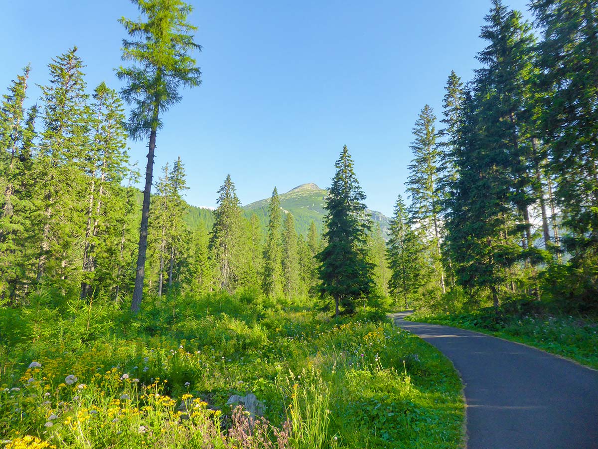
Mount Rysy
Difficulty Rating:
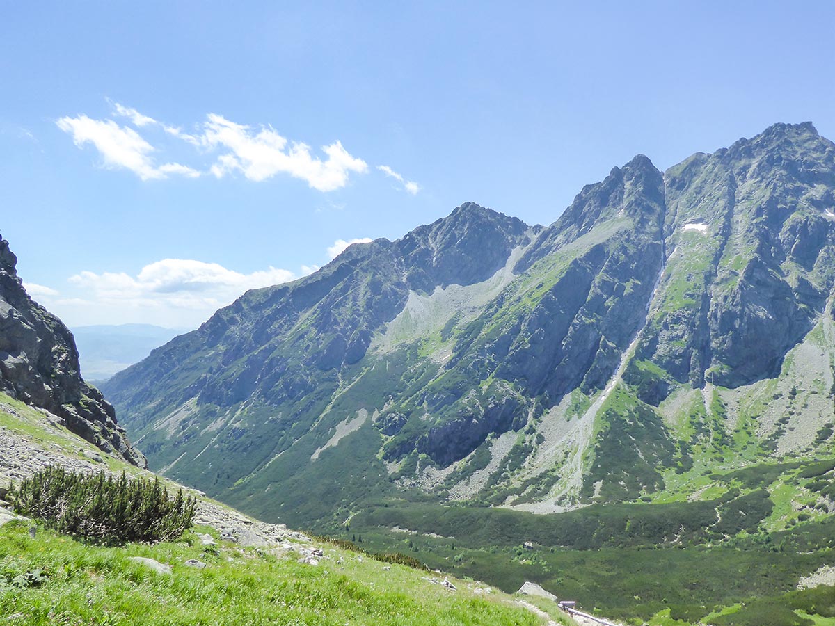
The Mount Rysy Hike is one of the most popular and beautiful hikes in the High Tatras, awarding you with stunning mountain views, beautiful tarns, and a great challenge along the trail. Rysy is the highest mountain in Poland and the seventh highest mountain in Slovakia. It’s also the highest peak in the Tatras you can climb without a guide, which is the reason it’s so popular among the local and foreign hikers.
Getting there
To get to the Mount Rysy Trailhead, use the electric train to go to the Popradske Pleso train stop.

About
| When to do | 15th June - 31st October |
| Backcountry Campsites | No |
| Pets allowed | No |
| Family friendly | No |
| Route Signage | Good |
| Crowd Levels | High |
| Route Type | Out and back |
Mount Rysy
Elevation Graph
Weather
Mount Rysy Trail Description
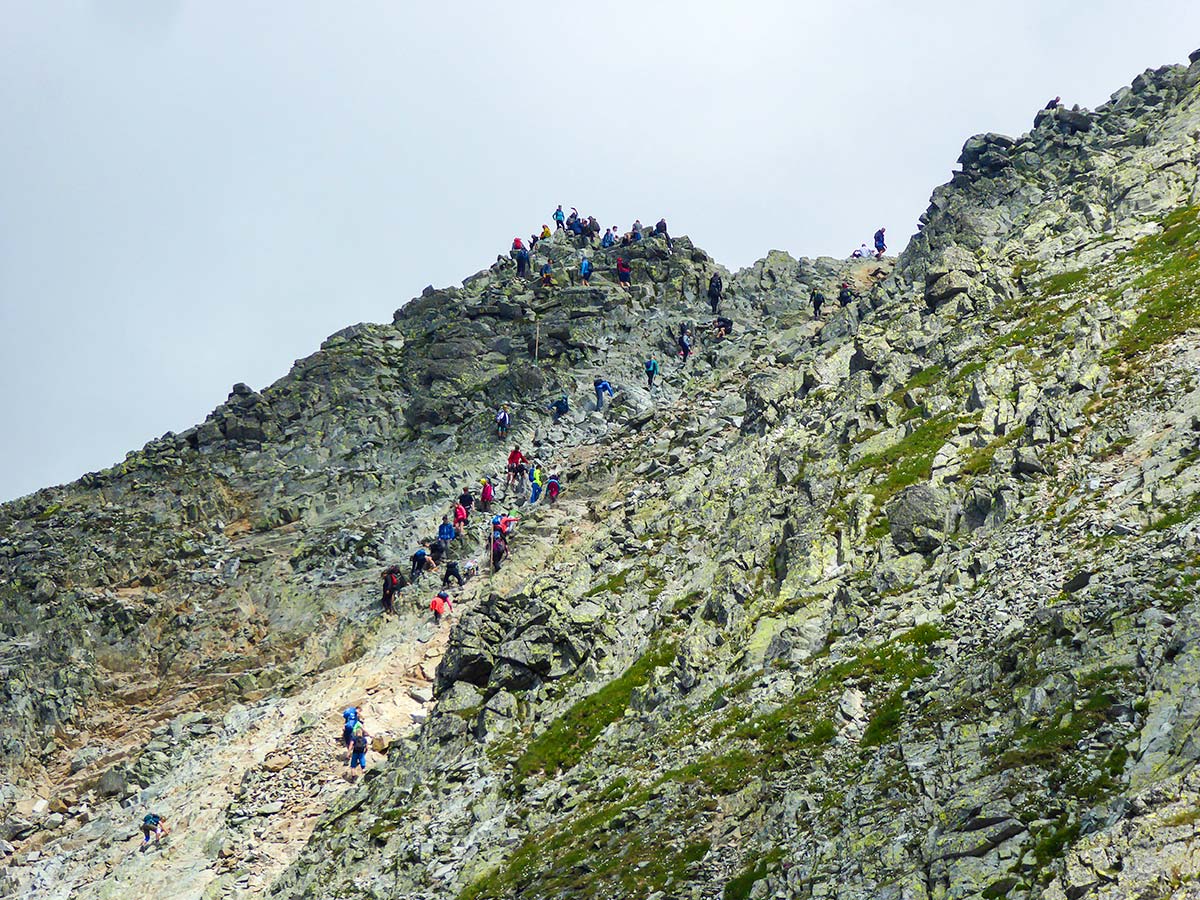
The Mount Rysi hike is marked as strenuous and with good reason. Hikers must be ready for a challenging hike including some exposed parts with chains and big crowds on top of the mountain (as the peak can be reached from both Slovakian and Polish sides of Tatras). The trail opens up on the 15th of June but the snow on the top part of the trail stays until mid-July so it is advised to either pick later in the summer or be very careful. Good hiking shoes are a must and having trekking poles is strongly advised. Also, we would recommend starting this hike as early as possible, not only because the parking fills up very quickly, but also because quite often after midday the mountain gets covered by fog or cloud. Rain on top of Rysy is not uncommon even after the sunniest mornings.
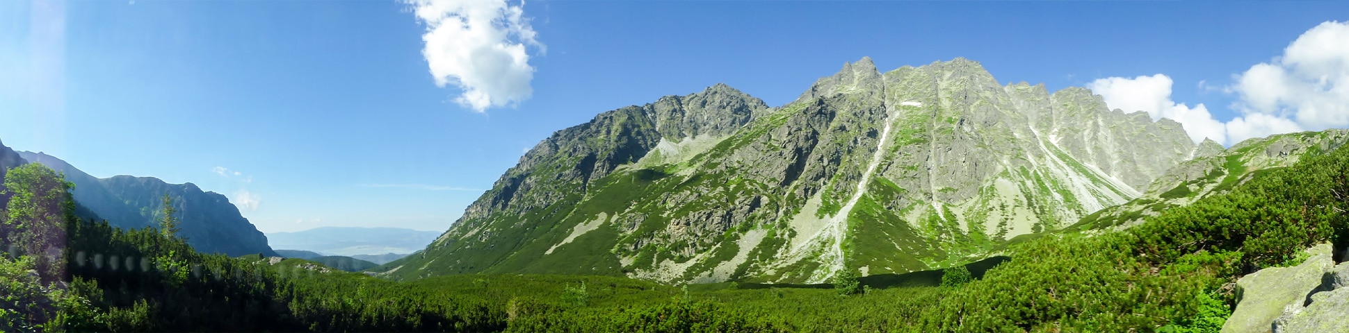
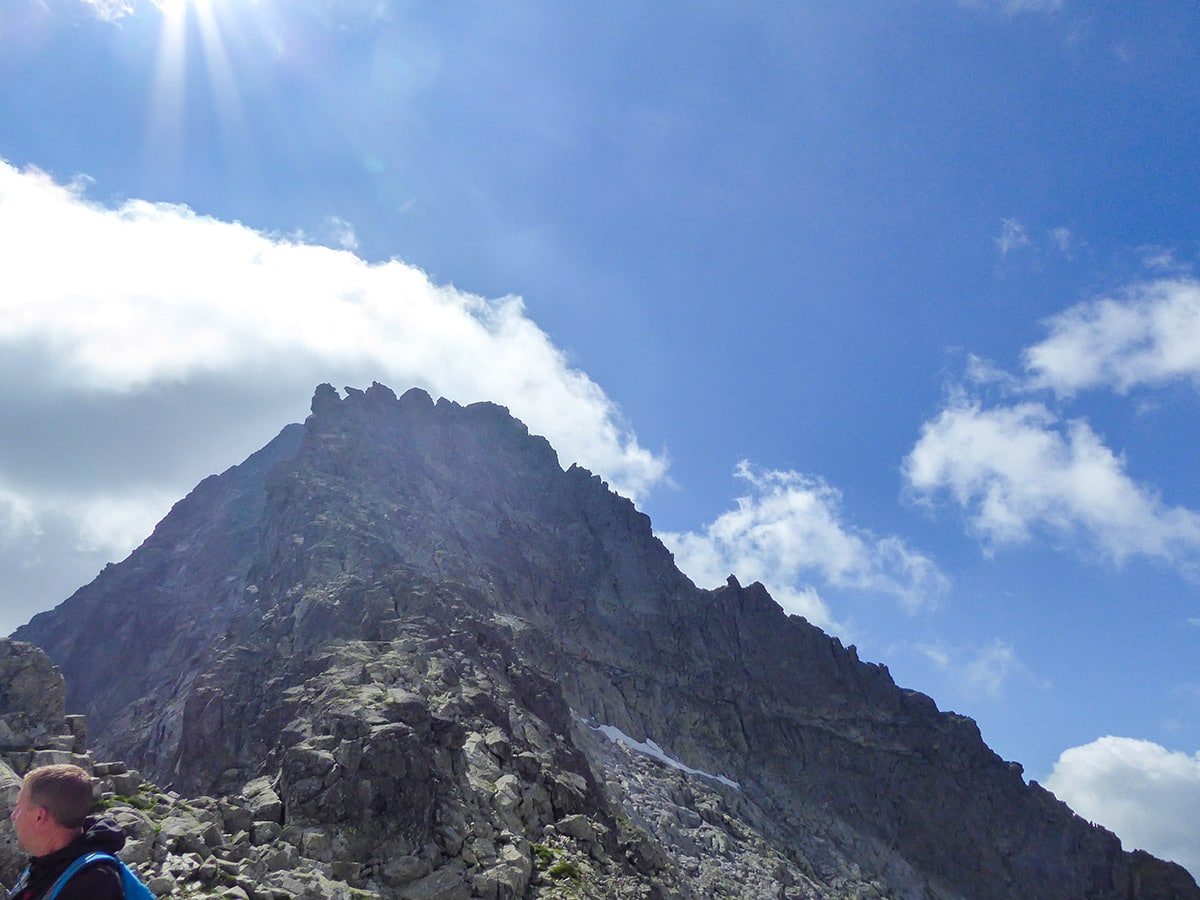
The Rysy Peak Hike is probably the most famous trail in the High Tatras. It is the seventh highest peak in Slovakia and the highest peak you can hike in The High Tatras without a guide. Rysy has three summits and is on the border between Slovakia and Poland. It’s also the highest peak in Poland. So naturally, there are a lot of people who want to challenge this mountain. It also comes with spectacular views.
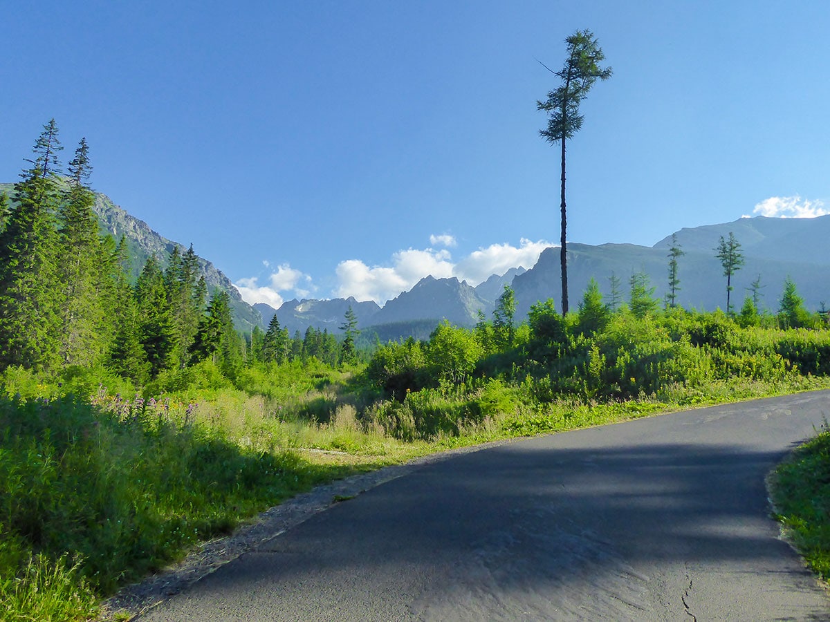
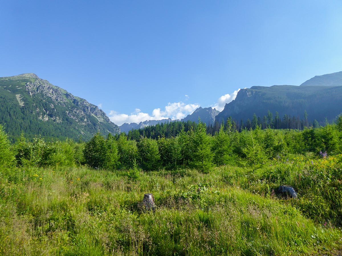
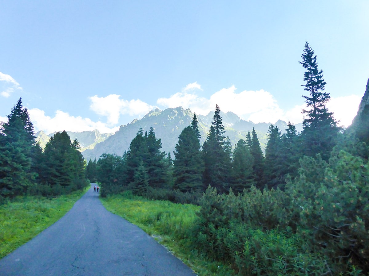
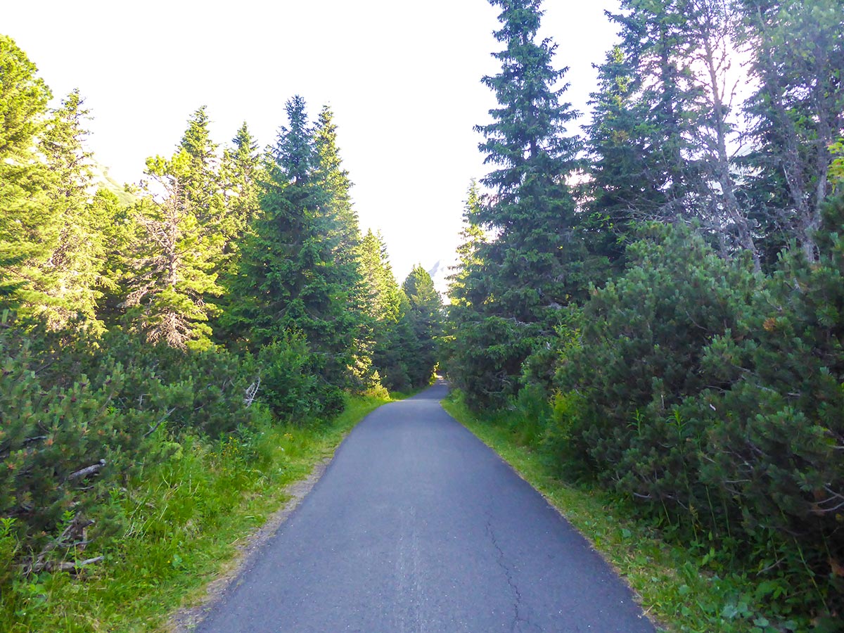
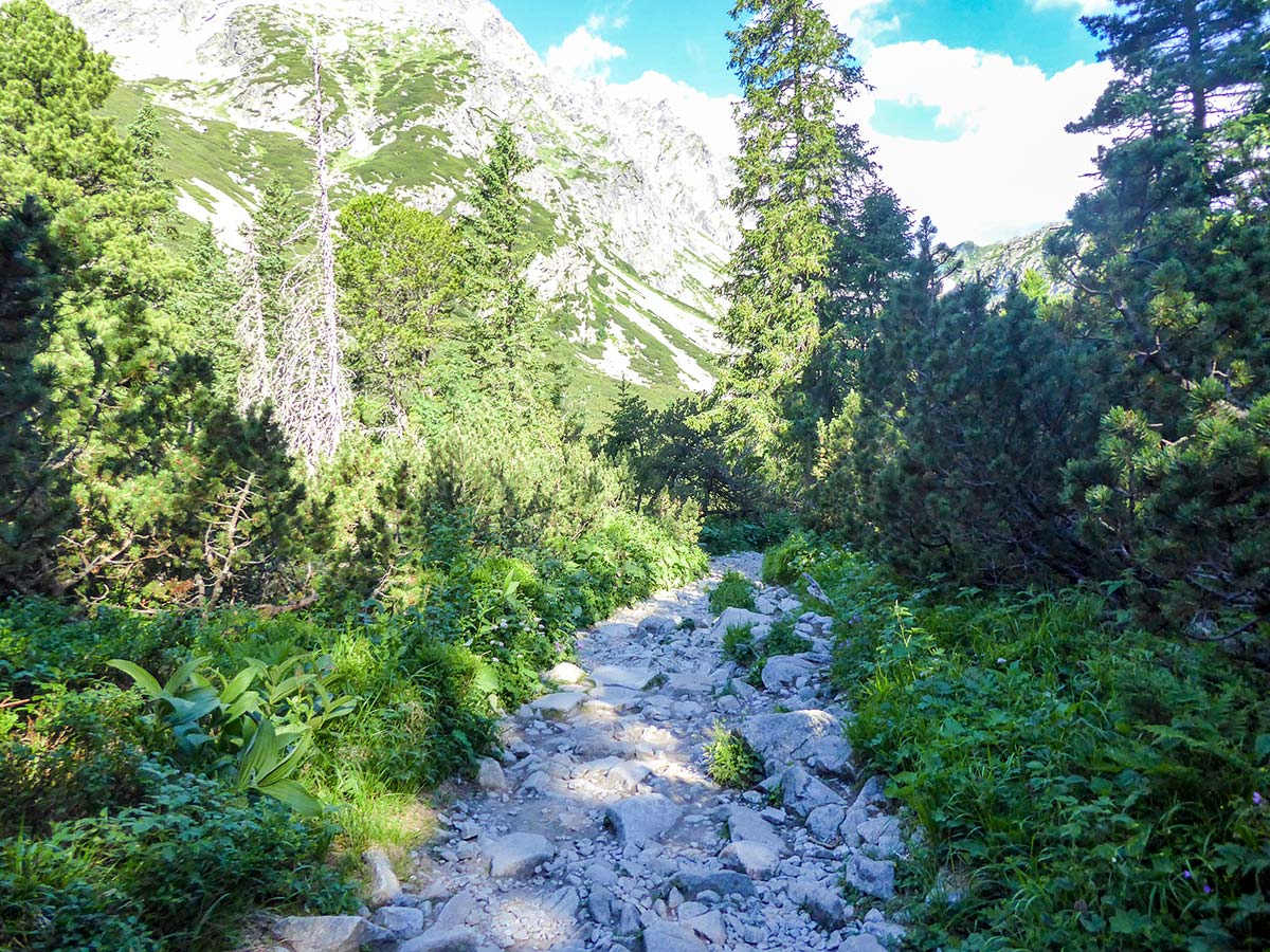
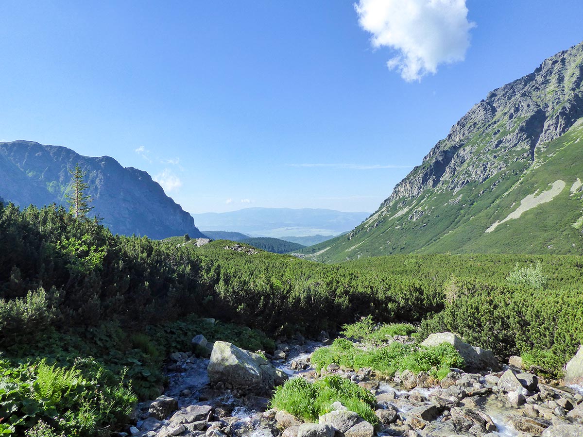
The hike on the Slovakian side starts either from Štrbské Pleso or Popradské Pleso. We recommend going from Popradské Pleso, as the hike is a little bit shorter this way and the trail from Popradské Pleso starts with a well-paved path which makes it easier for your knees, savingyou some much needed strength that will help you further up the mountain. The hike starts via the blue trail with a nice ascent. You start going up through a beautiful forest. The views of the surrounding mountains are amazing and also different, which we love about this national park. This route is also accessible by vehicles that are used to transfer supplies to the Popradské Chalet, so sometimes a car might try to pass by.
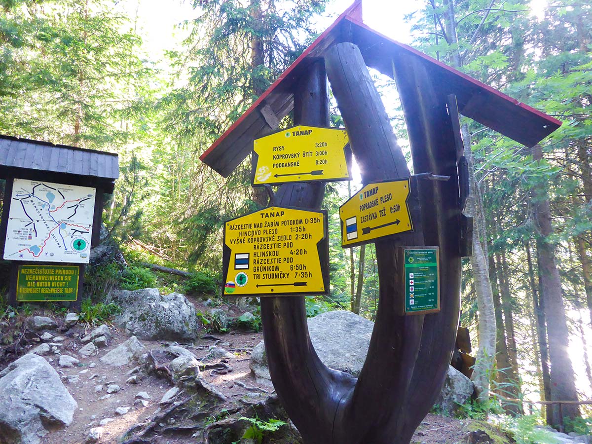
You will reach the first crossroad where you can choose to follow the blue trail which will lead you faster to the peak or the yellow one, which will take you closer by the Popradské Lake. We suggest taking the blue one to get to the peak faster as with time the crowds increase dramatically on this trail.
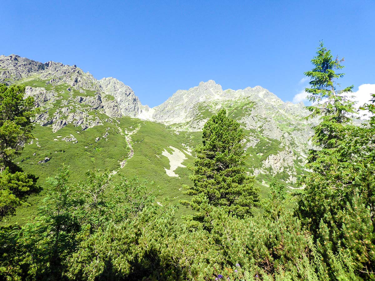
After about an hour and 20 minutes, you will reach another crossroad where you will see a shed and some people resting. This part is a big crossroad between quite a few points. The yellow trail leads down to the Popradské Pleso and the chalet, where a lot of families come to relax by the beautiful mountain lake. The blue trail continues to Koprovsky Peak, but it is also the first part of the trail towards the Rysy Mountain Chalet and Mt Rysy peak itself. Continuing on the blue trail, you will soon find yourself immersed in the forest. The nice paved path here becomes covered in rocks and tree roots. This is a really enjoyable part and it’s full of amazing views of Mengusovka Valley surrounded by a wall of mountains, one of which is Mt Rysy.
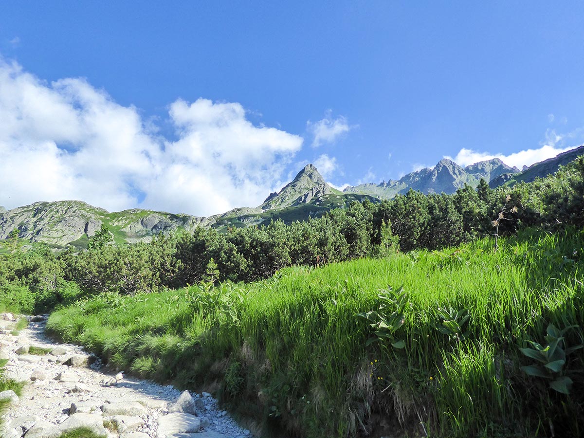
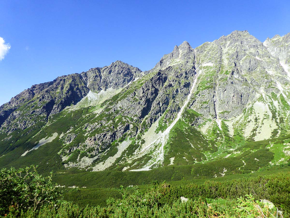
After 30-40 minutes of hiking, you will reach another crossroad. From here, follow the red trail towards Rysy. Now you will start ascending a lot more intensely and the trail becomes more difficult. Here, you will pass a nice stream and cross a wooden bridge, before climbing a series of switchbacks up the mountain. The views along this part of the trail are magnificent.
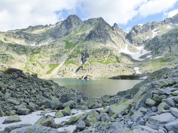
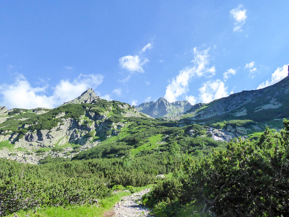
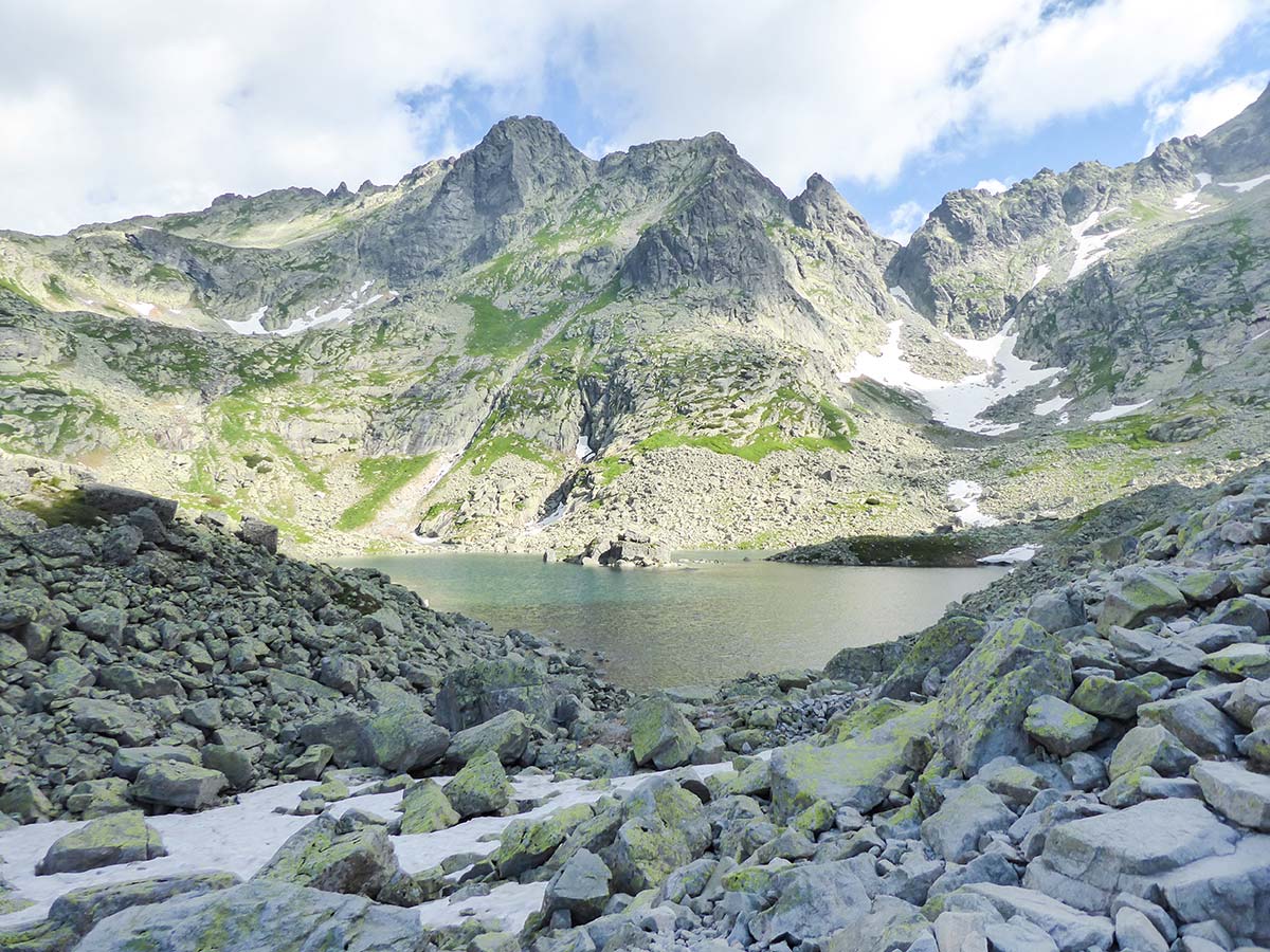
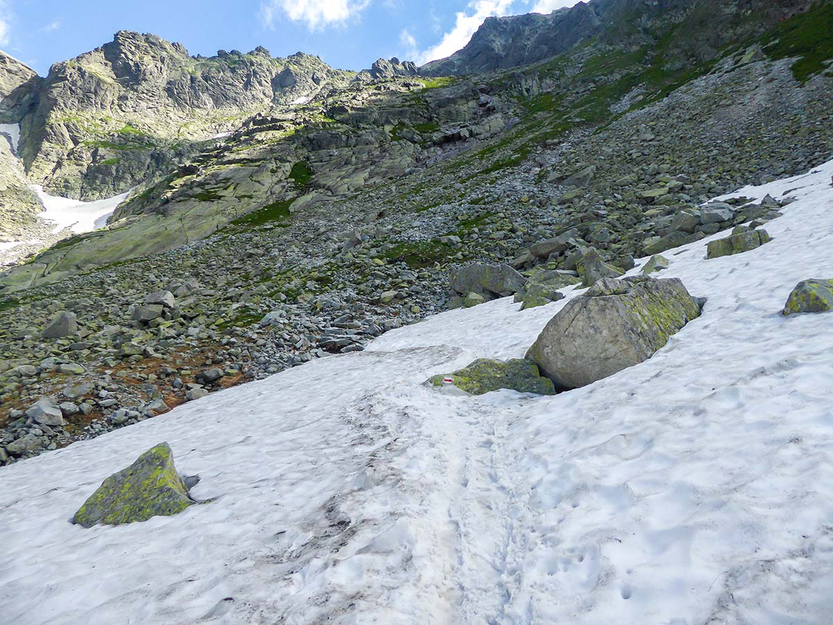
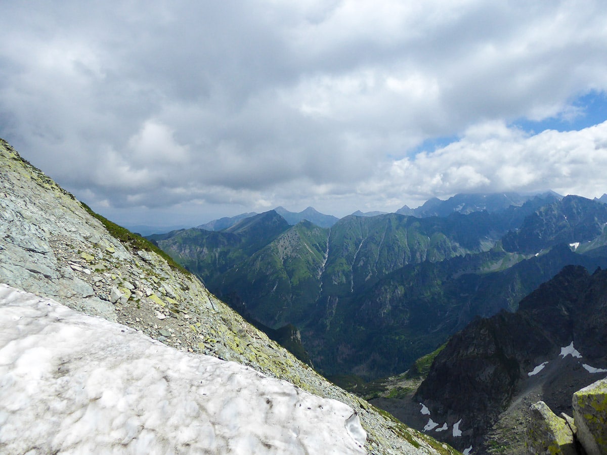
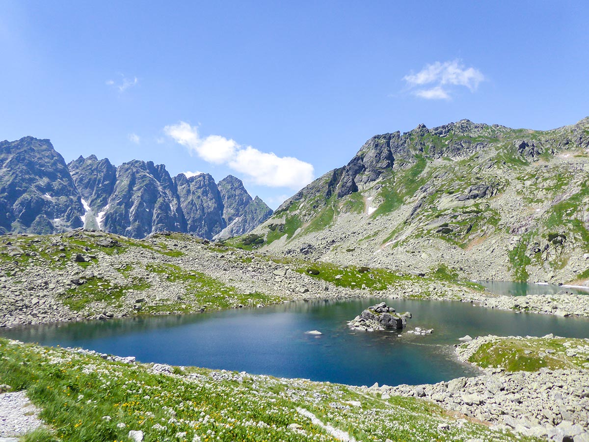
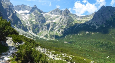
After quite a bit of ascending, you will reach another valley with two beautiful tarns, guarded by the mountains. Walk the trail and keep the tarns on your left. Be careful here as parts of the trail were still covered in snow during July, so it gets quite slippery with summer footwear. Continue ascending towards the mountain wall.
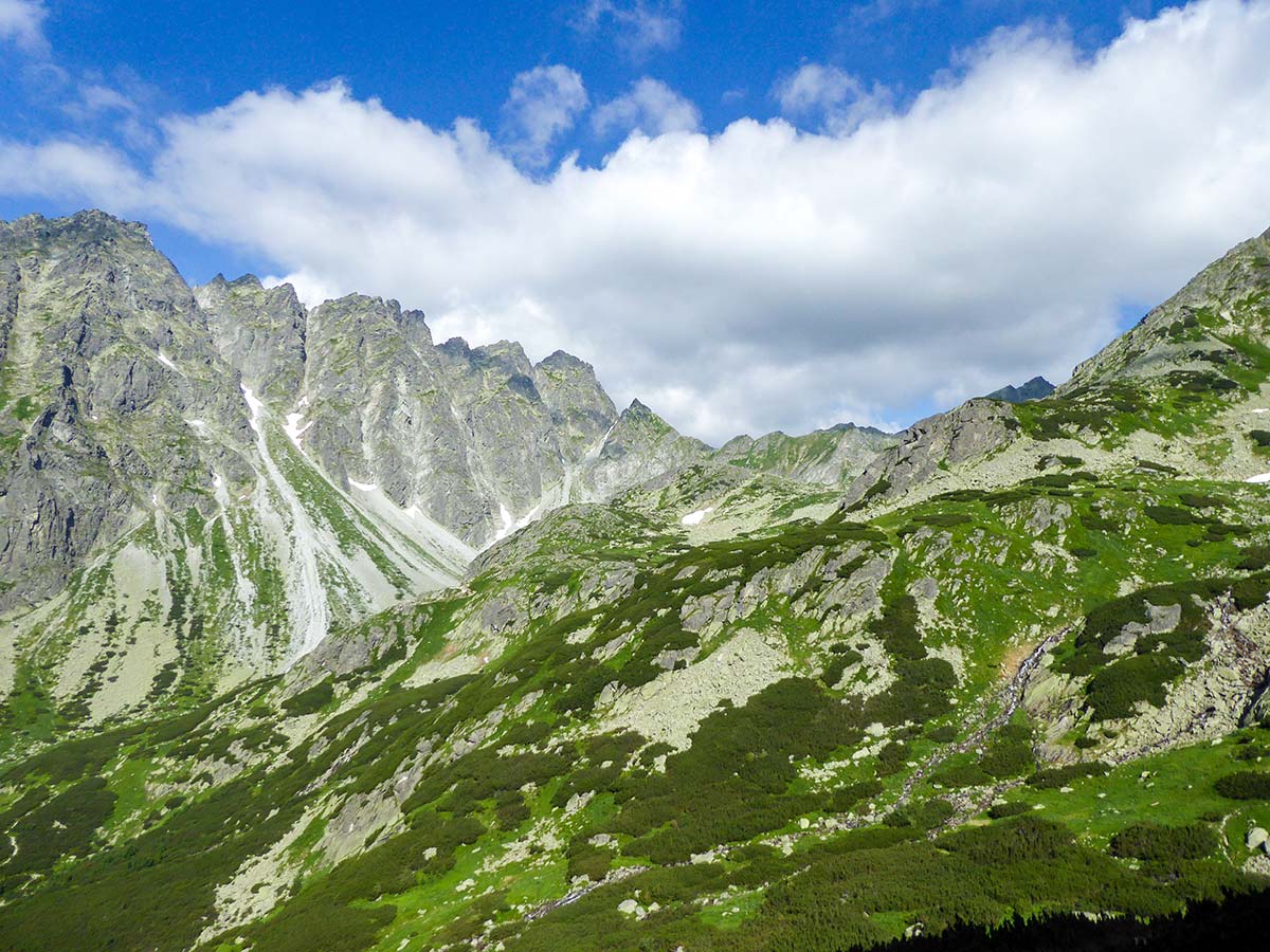
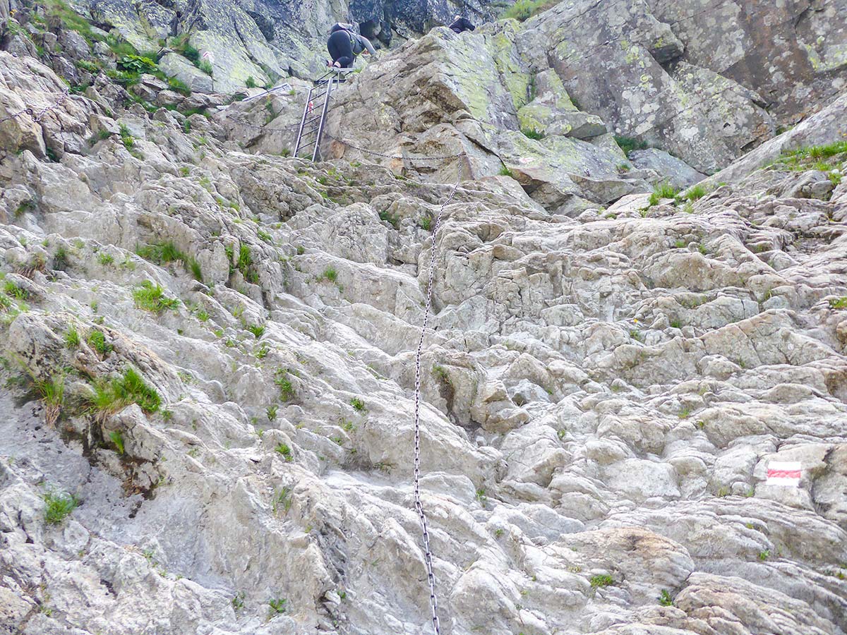
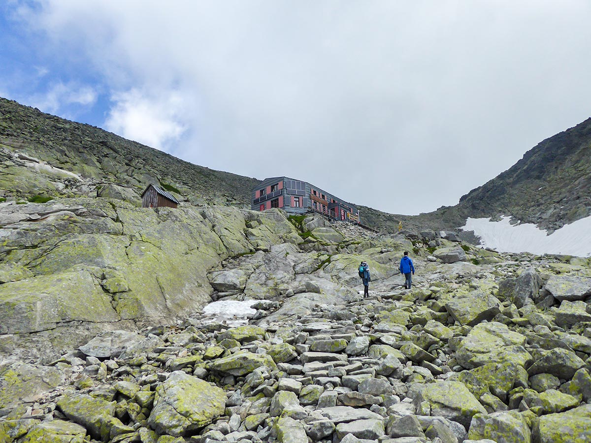
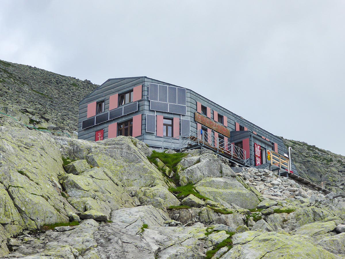
When you reach the mountain wall, you will need to use the chains and ladders to climb up. This is another difficult part of the trail but it is manageable. Just hold on to the chains and climb your way up. This part shows why it’s important to start early as later during the day there might be people queuing here to go up or down. Make your way through the metal steps, and ascend further up. After a while the trail becomes wider and less dangerous. Just before the Chalet under The Rysy Mountain, there is usually a patch of snow. It’s really easy to go up, but might be a bit dangerous and more difficult to descend. Be careful as it is really slippery with the melting snow.
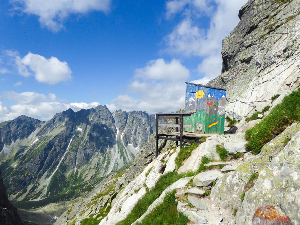
You can get some refreshments or hot drinks at the chalet, but we would suggest doing that on the return, to avoid crowds. If you need to, use the toilet on the mountain ridge which is a 2-minute ascent from the chalet. It has amazing views with a see-through plastic wall down the abyss.
A lot of people finish at the chalet, but the trail continues to Mount Rysy peak, just behind it. The ascent starts with two big patches of snow. Be careful here as you need to share the trail with those who are returning and it’s a bit too long to wait for others to pass. So try not to fall as you do not know what the snow covers. Usually, in these mountains, it might be a crack between rocks.
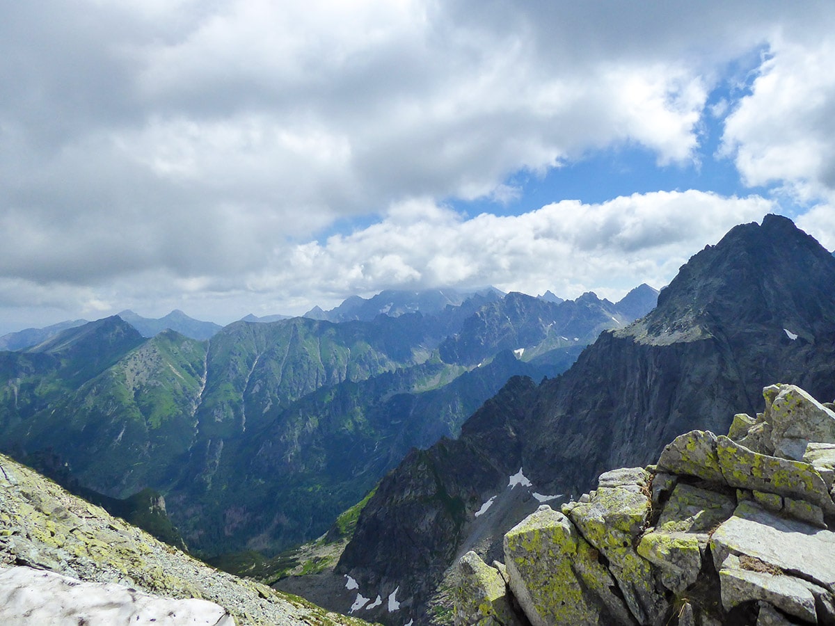
After the ascent, you will come up to a ridge. Enjoy the beautiful views down at Bielovodska Valley. From here you will see the highest peak in the region – Gerlachovsky Peak, Bradavica Mountain, and other sights you will see only from a few places in the High Tatras.
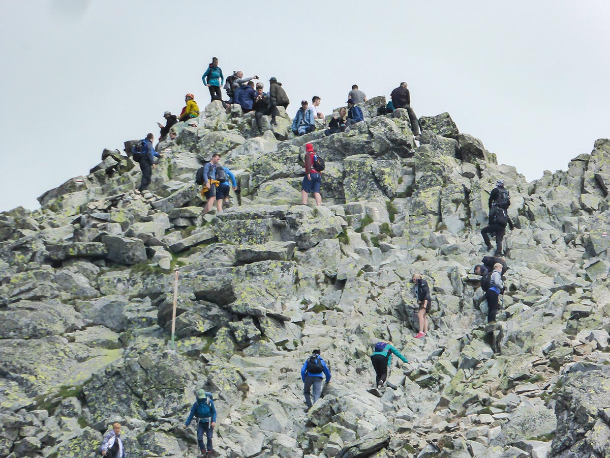
The Rysy summit is on your left, but it’s not the first peak you will see. The trail will become harder, as the climb gets quite steep and you start to ascend the false summit. After you climb the first peak, you will see the Rysy summit. It actually has three summits but the highest two are usually packed with people taking a break on them. Be very careful on this part as it descends to a ridge from where you start scrambling with your legs and arms up the last bit of Mt Rysy. It’s very important to follow the trail, as a lot of parts might seem like they are approachable but in the end, you might end up climbing up somewhere you cannot go anywhere from. So save your energy by following the red trail marks.
After you reach the summit, or both of the highest ones (one of them is in Poland, the other in Slovakia), enjoy the 360-degree views. Have a rest and carefully descend back the trail you came from. Depending on the time you started, you might have to let a lot of people pass through, as it’s a very popular hike and the traffic here is quite high. Some people start scrambling down through random parts of the mountain, but we strongly suggest climbing the way you came from.
After that, descend towards the chalet. Be careful along the snowy parts, as summer hiking footwear might be slippery on the snow and a lot of people fall here. The hardest snowy patch is just after the chalet, as it is quite steep and you might have to slide down. There might be an alternative trail on your left on the snow, but if it’s the end of June, be careful when using it as the snow usually melts from below, leaving a good one-meter gap between the rocky ground and the layer of snow. You might fall through and injure yourself.
The chain part might be more crowded and you might have to wait for someone to let you pass. After the chain part, the hike becomes more relaxing, although still tough due to the rocks you need to jump on all the time you are descending. Enjoy the beautiful views going down.
Trail highlights
Rysy
Situated on the border of Poland and Slovakia in the High Tatras, Rysy is a rugged mountain peak with three rocky summits of varying heights. The northwestern summit (8202ft) is a part of the Crown of Polish Mountains and is actually the highest point in that country, while the middle (8205ft) and south-eastern (8114ft) summits are both located on the Slovak side of the border.
The first documented ascent of the peak was made by Ede Blásy and Ján Ruman-Driečny Sr. in 1840, and it is the highest peak in the Tatra Mountains that can be accessed without a guide.
Find more amazing hikes in the High Tatras
Insider Hints
If you want to make the return different, you can go back to Štrbské Pleso. From Popradské Pleso, choose the red trail. It’s really scenic but you will have to ascend before you reach the town.
Visit the Popradské Pleso Chalet for refreshments after the big hike. Get a cold draught beer at the beautiful lake.
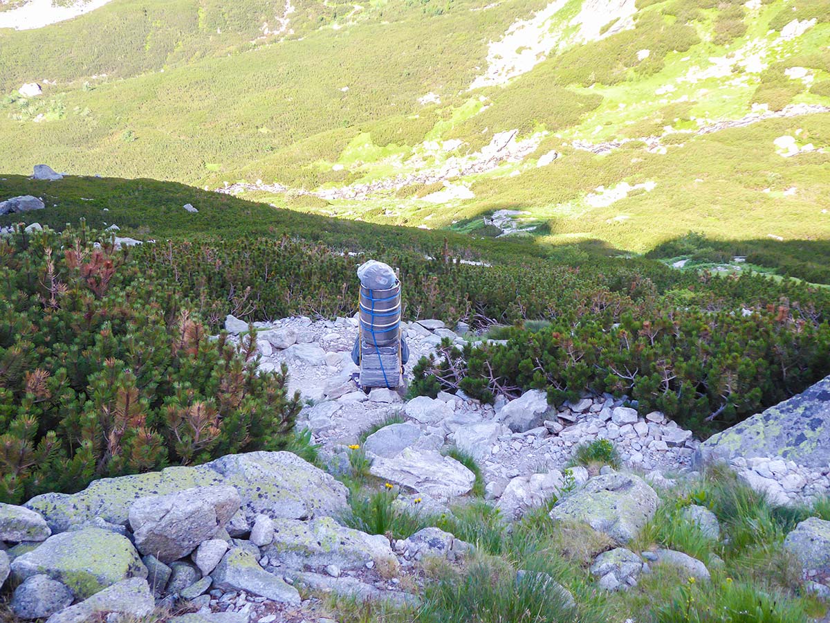
Feeling strong? At the Popradské Pleso crossroad, there are bags of 5-10 kg, made up for delivering to the Chalet under Mt Rysy. If you deliver one to the chalet you will be given… well, a cup of hot tea.
Start this hike early to avoid crowds. Remember that this is probably the most popular hiking destination in this region.
Bring hiking poles! Your knees will thank you for using them on your way down, trust us. Here's a great guide on how to choose and use hiking poles.

Similar hikes to the Mount Rysy hike
Zelené Pleso hike
The Zelené Pleso hike is one of the most beautiful adventures in the High Tatras, Slovakia. You will hike over a rugged…
Mlynická Dolina to Furkotská Dolina Loop
The Mlynická Dolina to Furkotská Dolina loop is an amazing hiking trail in the High Tatras. It takes you through…
Slavkovsky Štit
The Slavkovsky Štit Hike is a strenuous hike in the High Tatras, that leads you to one of the higher…
Udo Huber 4 years ago
Enjoyed the challenging trail. Feeling triumphant upon reaching the peak and beautiful view.
stephenmacqueen 4 years ago
Marvelous greeneries and mountains. It's a strenuous hike so better be prepared when you go there.
Kamil Blajak 4 years ago
It is worth to climb there and the views are simply wonderful
Maciej W. 4 years ago
We were really happy how amazing the trail was and the excellent mountain views
Akvilė Žiūkaitė 4 years ago
We did this amazing hike 2019, July. Definitely worth to go- the views are stunning. Just have in mind that this one is not the easiest one and you need to wear proper shoes (rocky and sometimes slippery trails). The first part of the hike was full of people even going wearing flipflops ,but as soon as you pass Morskie Oko the real hike begins:). True- it’s still a but crowded. And true you need to start early. But definetely stunning views!
Yinh Nguyen 5 years ago
It's surprising how many people hike here despite it being a difficult hike.
Steven B. 5 years ago
The traffic is enormous. Hate the crowd. Wasn't able to take a decent photo without anyone on the background.
Brent Carry 5 years ago
Amazing how you can see the border of Poland and Slovakia. Lot's of people go there wanted to challenge Mount Rysy.
Lele Mont 5 years ago
Long and rigorous hike, yet very rewarding. Highly recommended.
Charles F. 5 years ago
A lovely hike in the High Tatras. It's pretty challenging, but it's worth it. So exciting, full of surprises!