Mlynická Dolina to Furkotská Dolina Loop hike
View Photos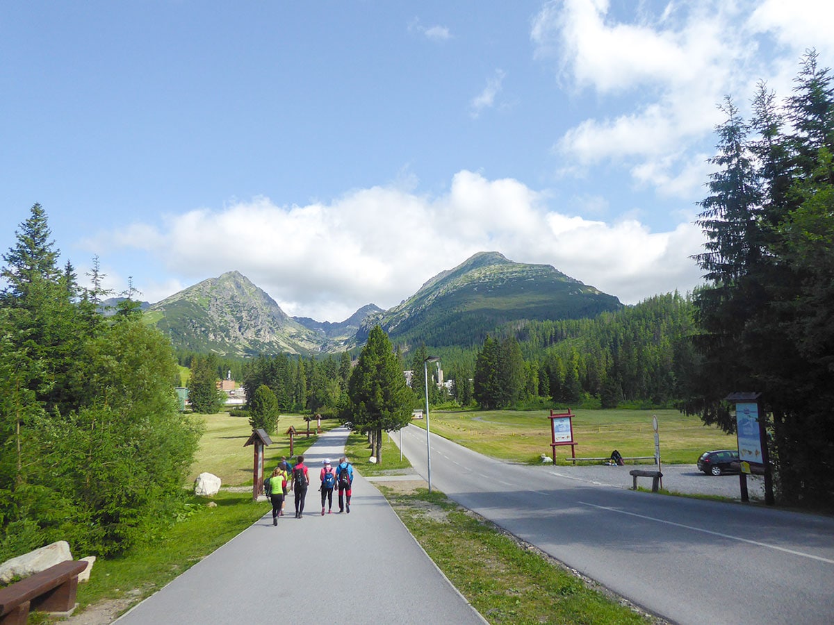
Mlynická Dolina to Furkotská Dolina Loop hike
Difficulty Rating:
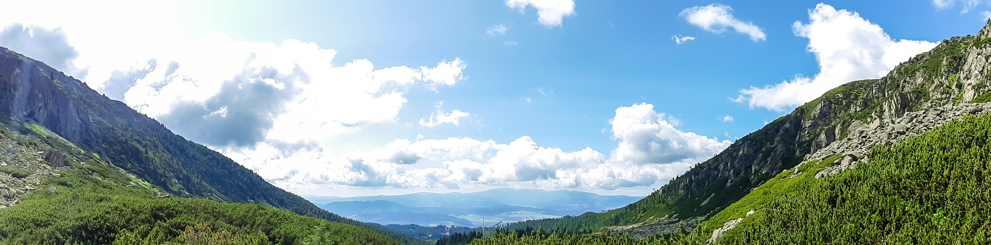
The Mlynická Dolina to Furkotská Dolina loop is an amazing hiking trail in the High Tatras. It takes you through the Mlynicka Valley, where you’ll see the beautiful Skok waterfall, charming mountain tarns and some of the best panoramic views out there. This strenuous hike leads you through the Bystra Lavka saddle, where you need to use your hands and chains to get to the other side of the mountain range into the Furkotska Valley.
Getting there
Use the electric train to get to Štrbské Pleso (or get here by car and park in one of the paid car parks) and go north right up to the skiing center. Leave the skiing center on your left and follow the yellow trail to Bystra Lavka.

About
| When to do | 15th June - 31st October |
| Backcountry Campsites | No |
| Pets allowed | Yes |
| Family friendly | No |
| Route Signage | Good |
| Crowd Levels | Moderate |
| Route Type | Circuit |
Mlynická Dolina to Furkotská Dolina Loop
Elevation Graph
Weather
Route Description for Mlynická Dolina to Furkotská Dolina Loop
The Mlynická Dolina to Furkotská Dolina loop hike starts in Štrbské Pleso, and you have to go counter-clockwise. Although some people start from the Furkotská Dolina (valley), it should not be done and is not allowed due to the dangerous part at the Bystra Lavka Saddle where the hikers that start clockwise will get in the way of the main flow of people. This hike is quite strenuous, especially getting through the saddle; make sure you have good footwear as there are snowy patches at the highest points of this trail.
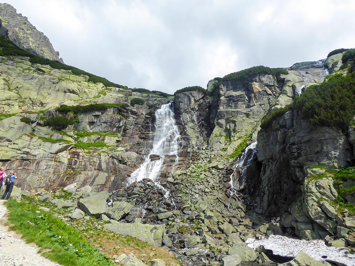
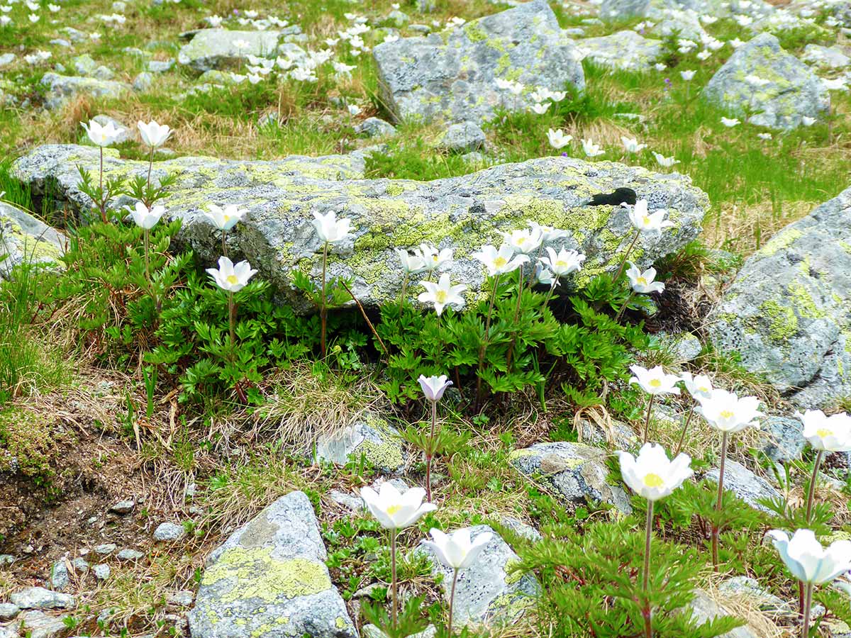
The Mlynická Dolina to Furkotská Dolina Loop was one of our favorite hikes in the High Tatras. It follows through the beautiful Mlynická Valley where you can see wonderful pine forests and mountain tarns. Skok waterfall is a beautiful place to visit – the waterfall is tall and intense and you can approach very close. There are numerous places where you can stop for a break with some wonderful views surrounding you.
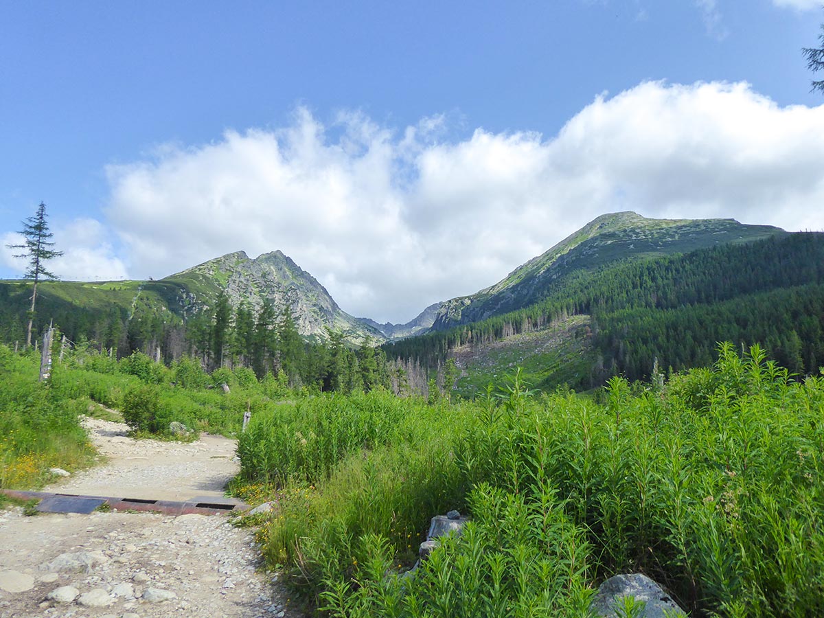
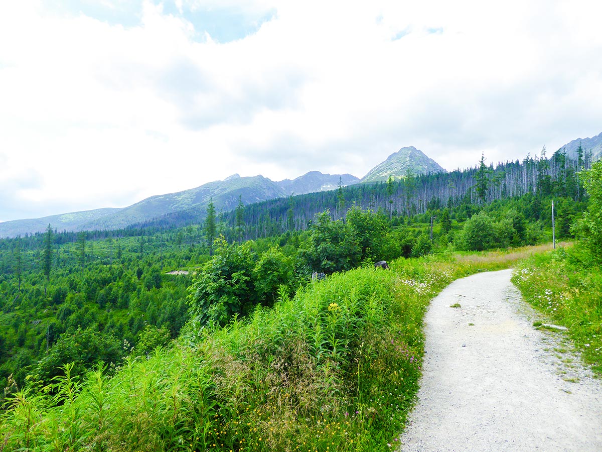
The route starts in Štrbské Pleso. Head north after you arrive at the train station or car park. The trail signage is clear and easy to find even in the town itself. Remember, that it’s advised to go counter-clockwise.
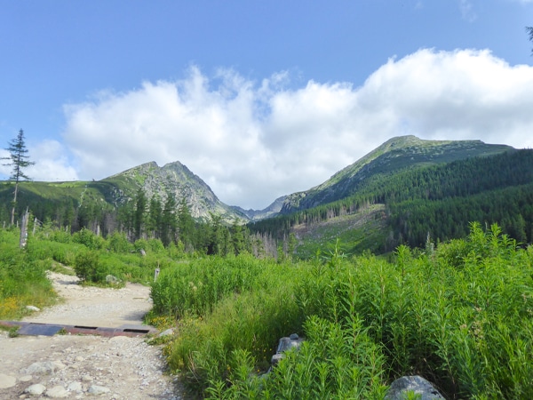
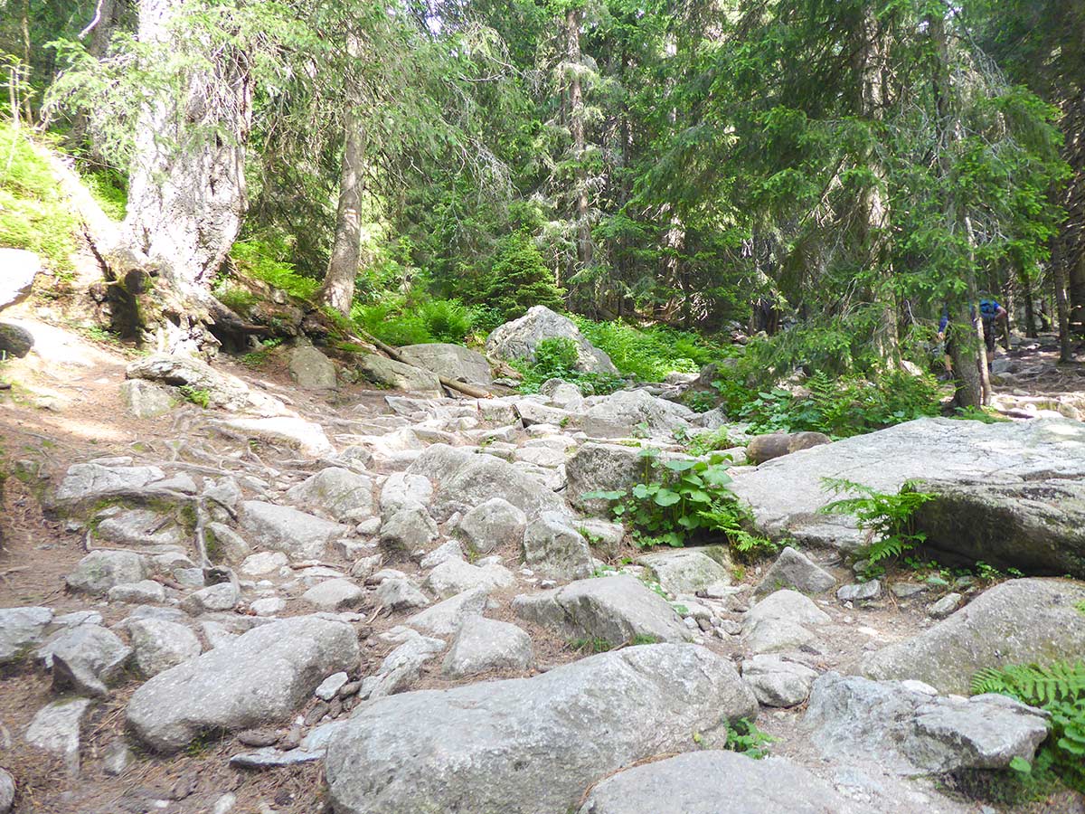
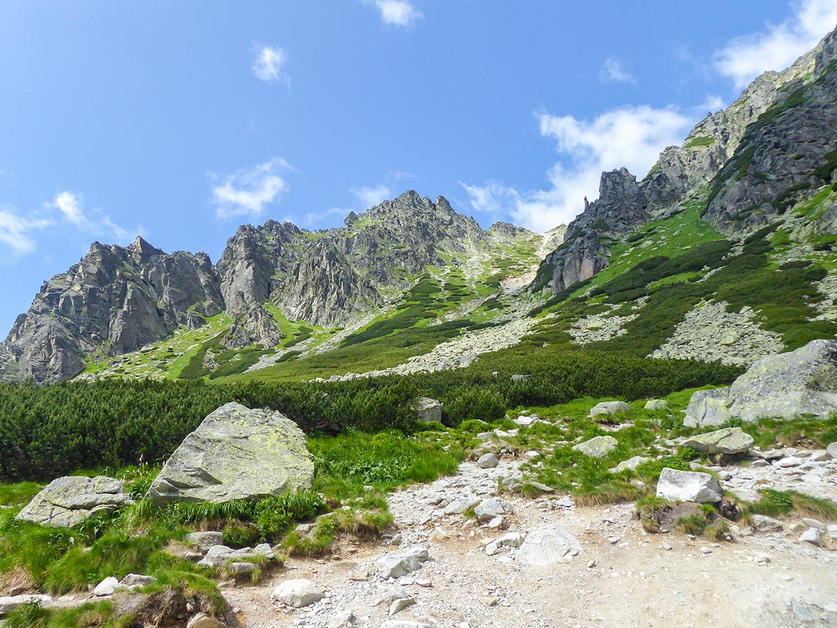
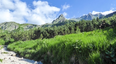
After you reach the skiing complex, leave it on your left. You will slowly walk into a beautiful pinewood forest. This part of the hike is really enjoyable, as the trail continues to lead you through the woods, steadily ascending towards the Mlynická Valley.
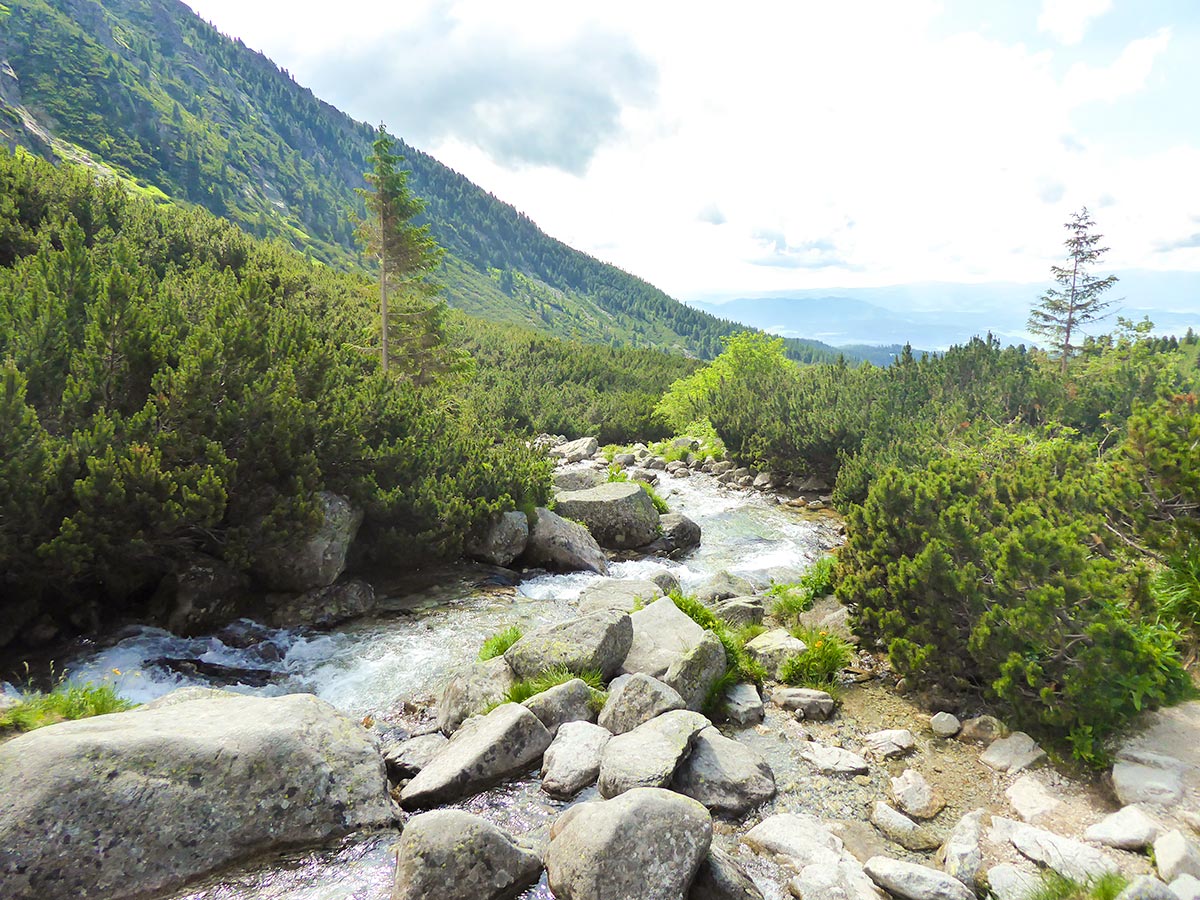
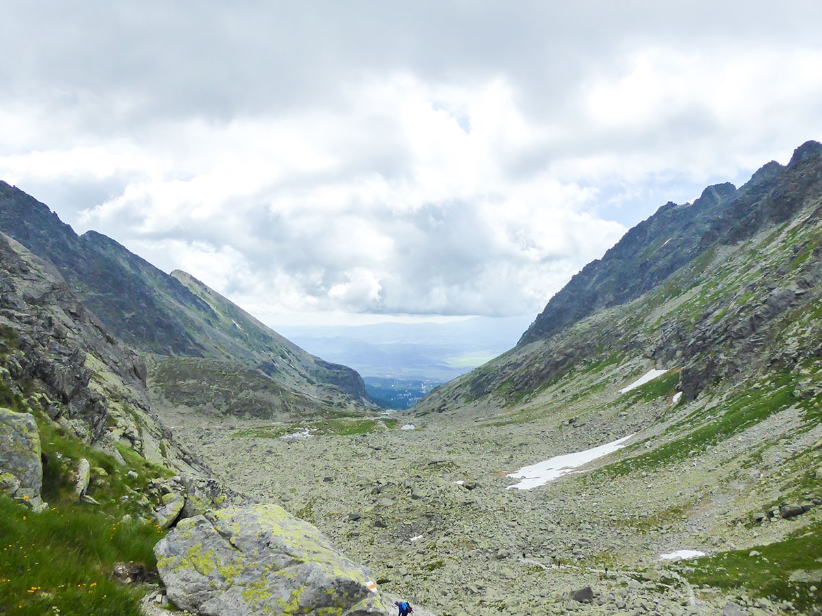
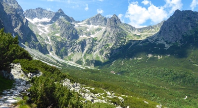
As you continue, you will reach the Mlynicky stream that runs down from the Skok waterfall. Follow the stream up, walking on its left bank. The ascent increases after you rise above the tree line into the valley. With fewer trees, you will see some amazing views of the Patria (7224ft), Predna Bašta (7789ft) and Satan (7946ft) mountains on your right and the Štrbské Solisko (2,302 m) peak on your left.
At about 2.9mi into the hike, you will reach the Skok Waterfall, which is a beautiful sight for the eyes, especially during the beginning of the season, when the water flow is strong from the melting snow. This is a nice place to take a break, or, if you are planning to do a family hike, make it your final destination.
From the Skok waterfall, the ascent increases and intensifies. You have to climb through the first part with chains. It’s not hard or exposed, but it helps to climb over a boulder, which is quite slippery, especially after a rainy day.
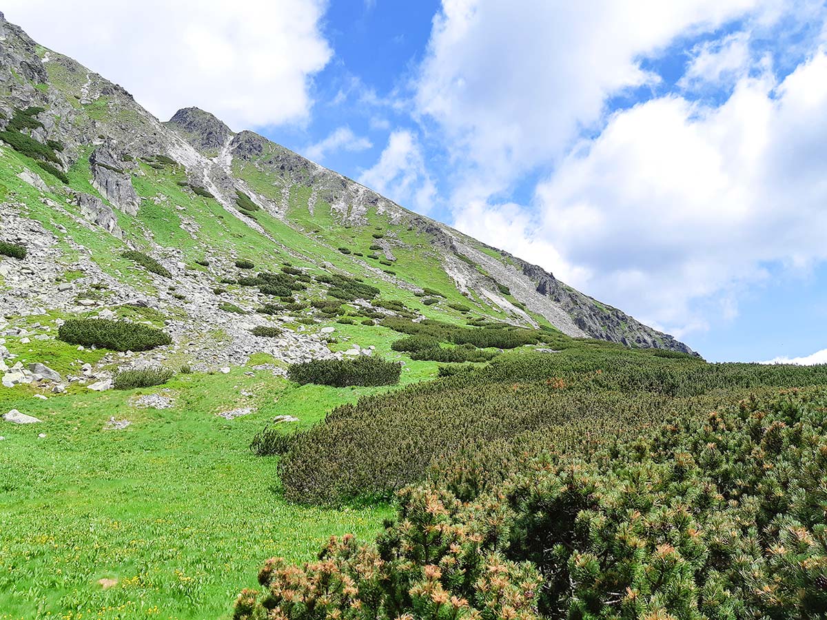
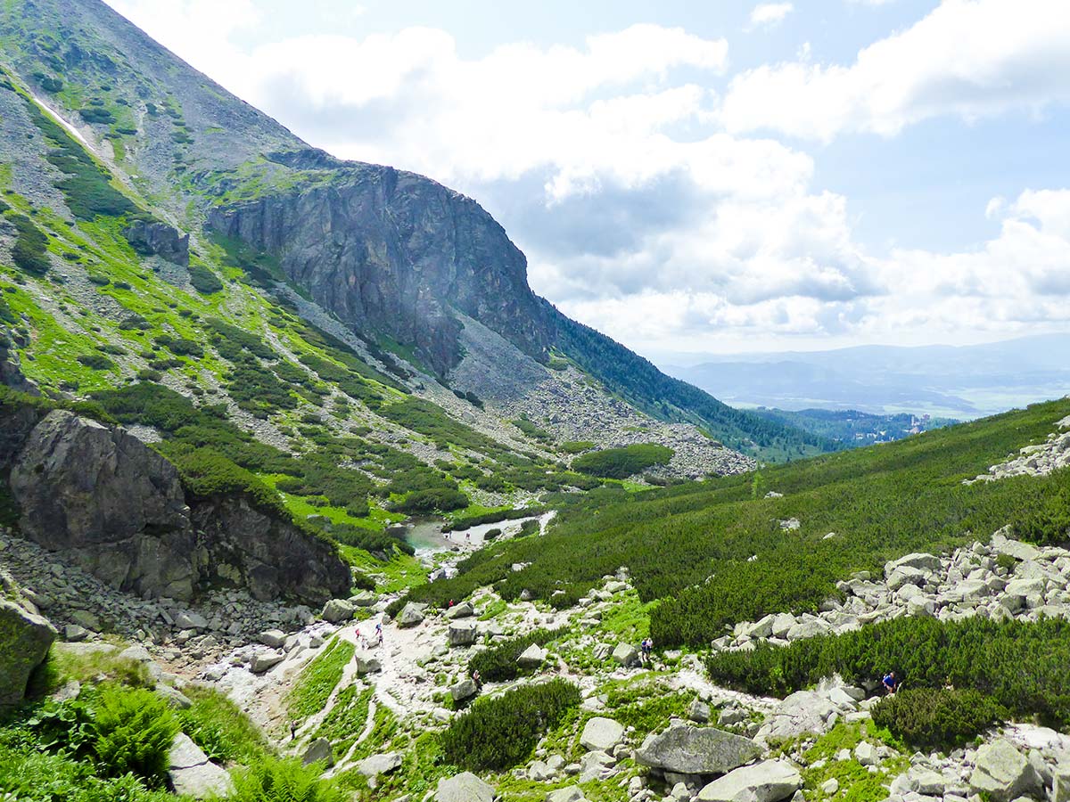
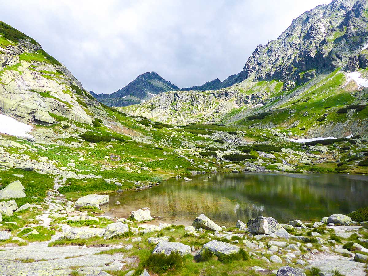
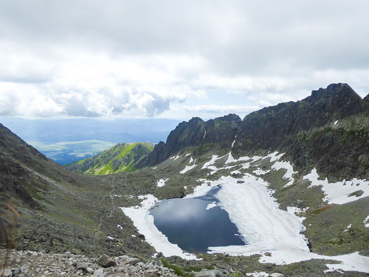
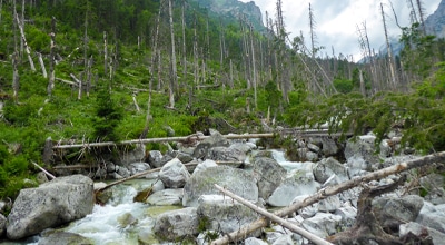
After another ascent, you will walk into another part of the valley where you will pass the Nad Skokom tarn and continue towards the rocky valley. The elevation evens out and you continue towards the Capie Lake. You will continue to follow the charming Mlynicky Stream. This is a beautiful place to look around as you are surrounded by beautiful peaks and numerous mountain tarns along the way.
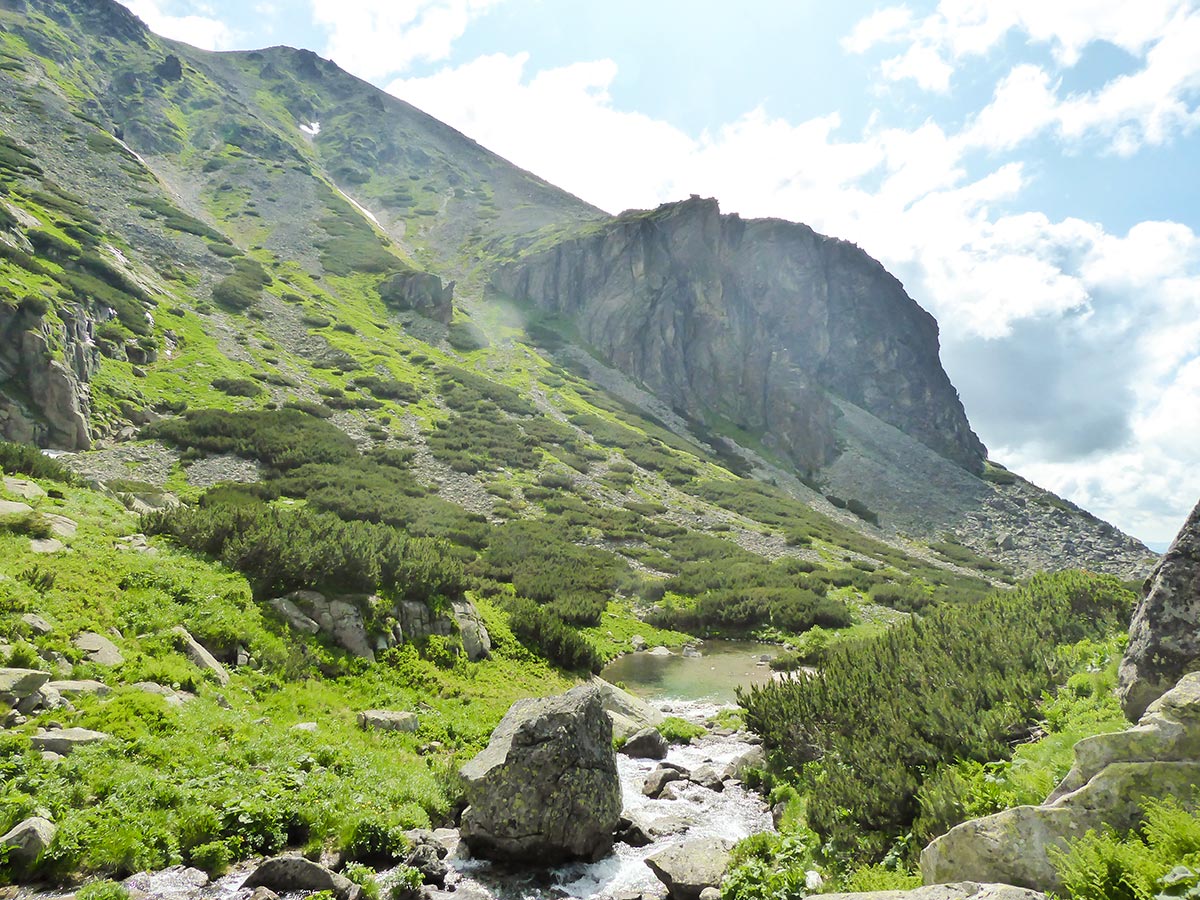
At around 6.9km into the hike, you will reach a steep rocky slope. You will have to switchback your way up the slope. After this physical part of the trail, you will reach the beautiful Capie Lake. Capie Tarn is surrounded by Štrbsky Peak on the right and Hruby Peak on the left. Just under Hruby Peak, you should be able to see the trail climbing steeply up towards the Bystra Lavka (7546ft) ridge.
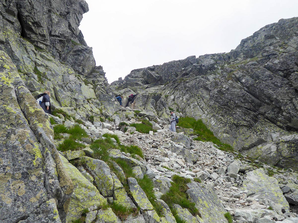
We recommend taking a break before you continue onto the hardest part of the trail. The location is peaceful and charming, perfect for a great picnic spot. From here, the trail will continue on the southern part of the lake, reaching the mountain slope. Make sure to follow the yellow trail, as the climb becomes steep and it can easily turn into a scramble if you don’t follow the right trail.
As you reach the halfway point on the Bystra Lavka slope, make sure to look around. You should see the partly frozen Okruhje Lake, which is hiding tucked away in the corner of Štrbsky Peak. Continue upwards, as the trail becomes even steeper. You might need to use your hands as the ascent intensifies. Just before the Bystra Lavka ridge, you will reach a safe spot, where a lot of hikers take the last break before climbing over the ridge onto the other side of the mountain.
Make sure to follow the yellow trail, to the south of the mountain. Although there is a path leading north, it is forbidden to walk there and there are signs that should stop hikers from going the wrong way. Sadly, we have witnessed people walking there, trying to avoid the climb over the ridge.
Even though we have done this hike in late June, there were still big patches of snow at this spot. Make sure to wear hiking boots with a good grip as our hiking boots were not meant for the winter season. We had slipped off the trail a few times and even got a leg into a crack between two rocks as the snow was already melting.
Just before Bystra Lavka ridge, you will have to cross an exposed part of the slope. It can be dangerous if there is still snow. Make sure to follow the trail, use your trekking poles or hands for balance if you need to.
After the slope, you get to the hardest part. Here you have to scramble your way up onto the Bystra Lavka ridge, cross to the other side of the mountain and scramble down from a steep rock onto the slope. Luckily, there are chains to help you out, but be careful here. You will need to have enough strength to pull yourself up using the chains and climb down holding one.
After this challenging bit, you will have to slowly descend the slope, while switch backing through the rocky trail. The beginning of the descent is steep but it becomes easier after the first 150 m of climbing down. All the trail down is covered in scree and rocks, so we really recommend taking hiking poles to take some pressure off your knees. It’s not really possible to keep a good pace, and you have to stay concentrated as a lot of these rocks move out of place when you place your feet on them
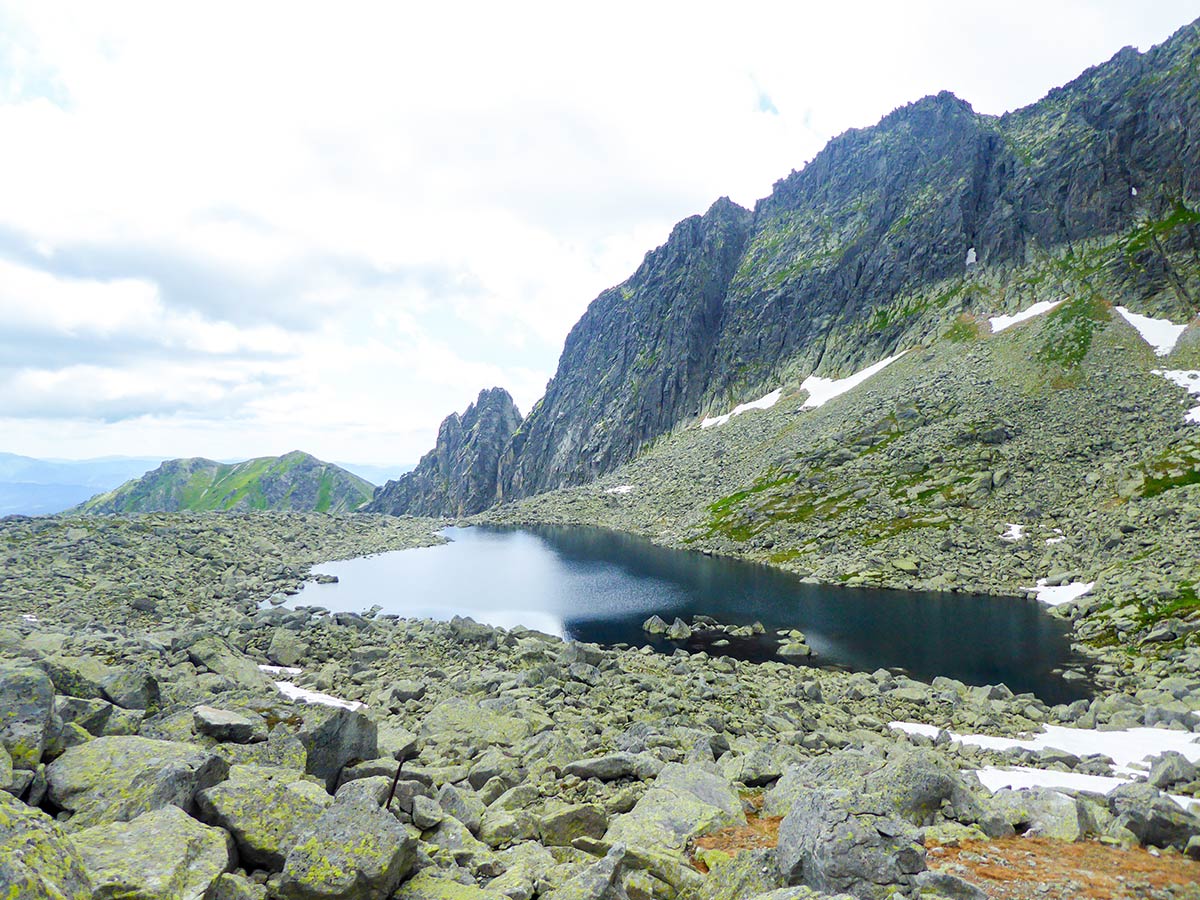
You will see Vysne and Nižné Wahlenbergovo tarns, which look like mirrors when untouched by the wind. After the first half of the Furkotska Valley, just before the Vysne Furkotske Tarn, there will be a beautiful place to have a break or a picnic. It will be the beginning of a sandy trail.
Afterward, you will descent towards Štrbské Pleso. At the sign Pod Soliskom, you can choose to continue on the yellow trail, which we have, or change it up and go to Štrbské Pleso through the blue trail. The blue one will take you through the Mountain hut Pod Soliskom but will also be a longer and harder route to go back.
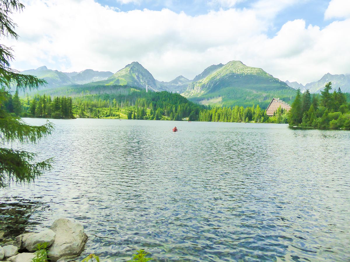
After the last rocky parts of the trail, you will descend into a beautiful valley. Here you will have the High Tatra Mountains behind you and in front, you’ll see a beautiful landscape with the Low Tatras covering the south. Continue to Štrbské Pleso Lake. At the end of the hike, you will reach the beautiful lake where you can chill out in cafes, have a beer or enjoy traditional Slovak food.
Find more amazing hikes in the High Tatras
Insider Hints
We recommend getting to Štrbské Pleso using the Electric train. The monthly train ticket costs you only 18 Eur and the weekly one - 16 Eur. The car parks are expensive and staying longer than 4 hours will cost you 10 Eur.
Take some time after the hike to get a boat ride in Štrbské Pleso. It’s a wonderful experience, with some of the best views in the High Tatras.
Take hiking poles. The trail down is really rocky and uncomfortable. Your knees will thank you for it.
The hike can be shortened and made into a great family hike if you go to the Skok waterfall and back.

Similar hikes to the Mlynická Dolina to Furkotská Dolina Loop hike
Zelené Pleso hike
The Zelené Pleso hike is one of the most beautiful adventures in the High Tatras, Slovakia. You will hike over a rugged…
Mount Rysy
The Mount Rysy Hike is one of the most popular and beautiful hikes in the High Tatras, awarding you with…
Zamkovského Mountain Chalet
Zamkovského Mountain Chalet hike is a beautiful trail that starts from Hrebienok. It’s an easy hike in the Slovakian High…
madarakatt 2 years ago
Amazing views, but get's quite difficult near the peek. If you get lucky, might see some chamois.
Cloudhigh 4 years ago
the views of the landscape that you get along the way are unforgettable. I would recommend it!
Iolanthe P. 4 years ago
Splendid but strenuous hike. Takes a lot of effort to see the panoramic views at the top.
Lele Mont 5 years ago
It took me 6.48 hrs to finish it. Honestly, I hardly noticed time while climbing, because it was so fun to do. The views were also spectacular.
hollygrail 5 years ago
Some of the best views you will ever see!! This hike requires endurance, and some sunscreen.
Brent Carry 5 years ago
Fantastic hiking trail. It is moderately difficult but absolutely doable.
Timothee Skimp 5 years ago
This was a phenomenal day hike. It was not that long. It is worth every bit of effort if you are an avid hiker/able-bodied human.