Yavapai Point via Rim Trail
View PhotosYavapai Point via Rim Trail
Difficulty Rating:
If you want jaw-dropping Grand Canyon views without needing to break a sweat, the hike to Yavapai Point on Rim Trail should be on your list. More of a very scenic walk than a hike, this route can be done by all ages and all skill levels. Don’t assume that because it’s easy, it misses out on scenery through– the Rim Trail boasts perfect, wide-open viewpoints of the Grand Canyon. Even if you do plan on bigger hikes at the canyon, this route is a great warmup to give you a preview of what’s to come.
This route conveniently starts from the main Grand Canyon Village with no navigation or shuttles required and easy access to all amenities nearby. Since there’s almost no public parking at Yavapai Point, you can also use this route to connect to the trailhead there if you have hikes planned that start from the point.
Getting there
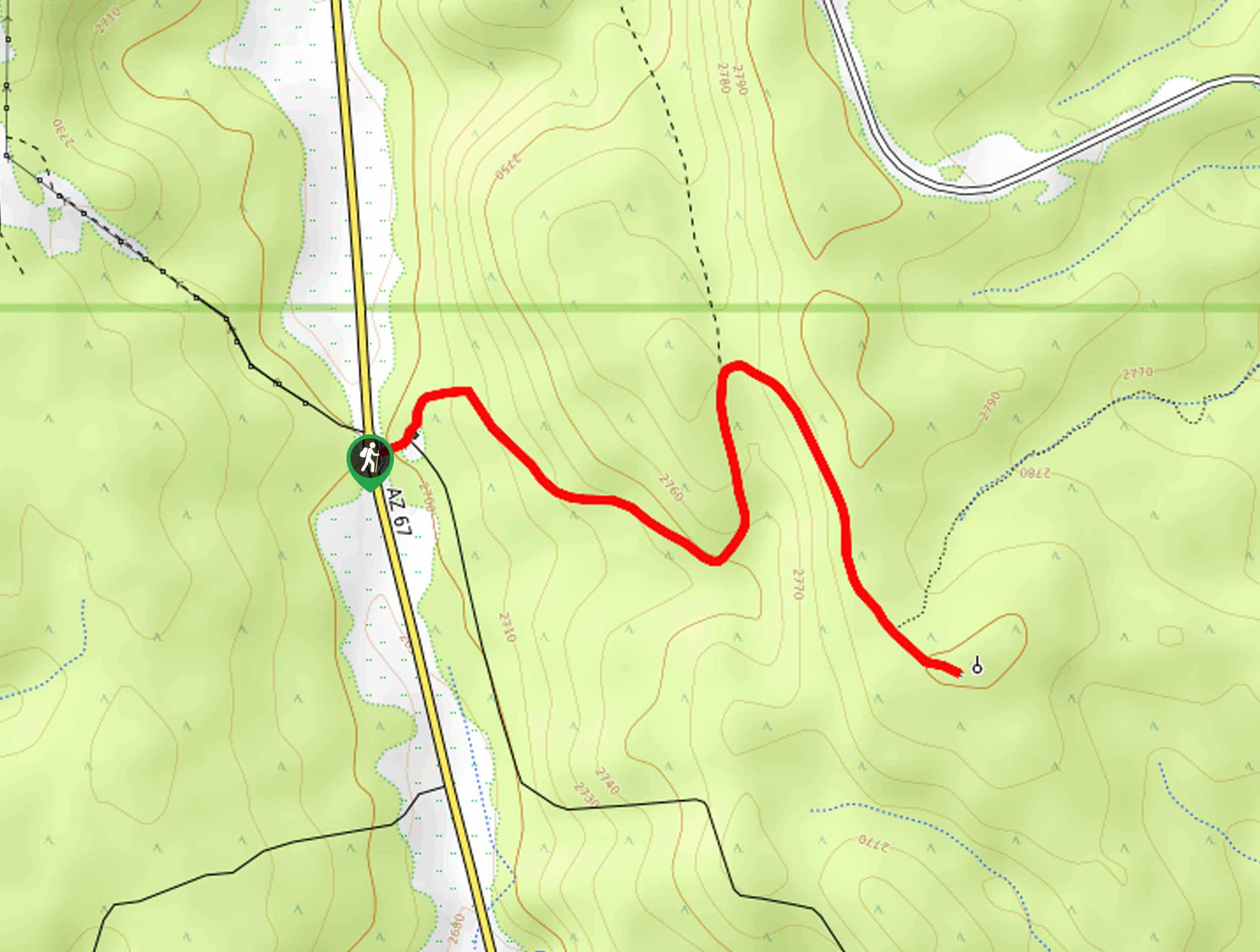
The trailhead for Yavapai Point via Rim Trail is in the parking area for the Grand Canyon village.

About
| Backcountry Campground | No |
| When to do | September-May |
| Pets allowed | No |
| Family friendly | Yes |
| Route Signage | Good |
| Crowd Levels | High |
| Route Type | Out and back |
Yavapai Point via Rim Trail
Elevation Graph
Weather
Yavapai Point via Rim Trail Description
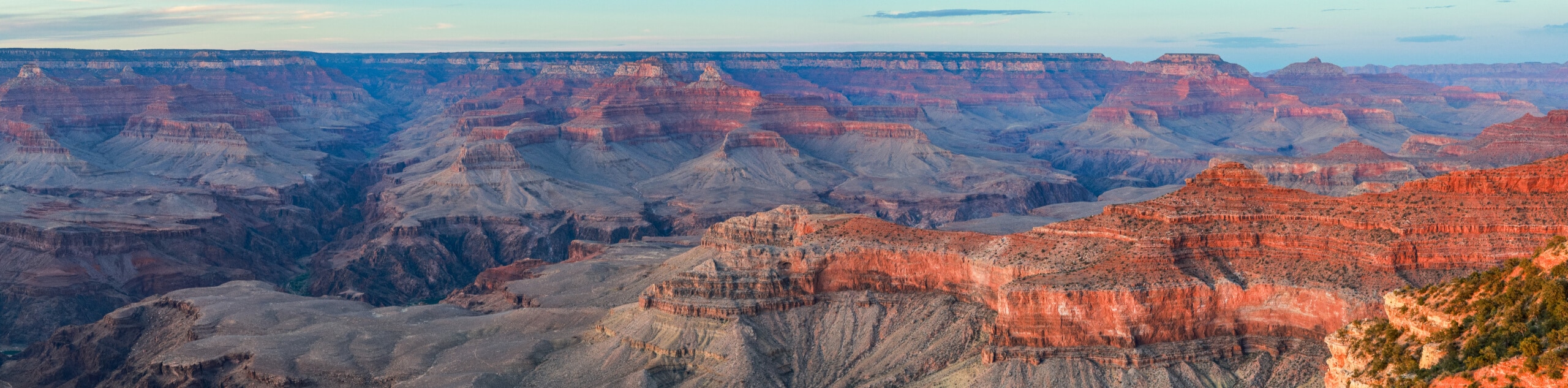
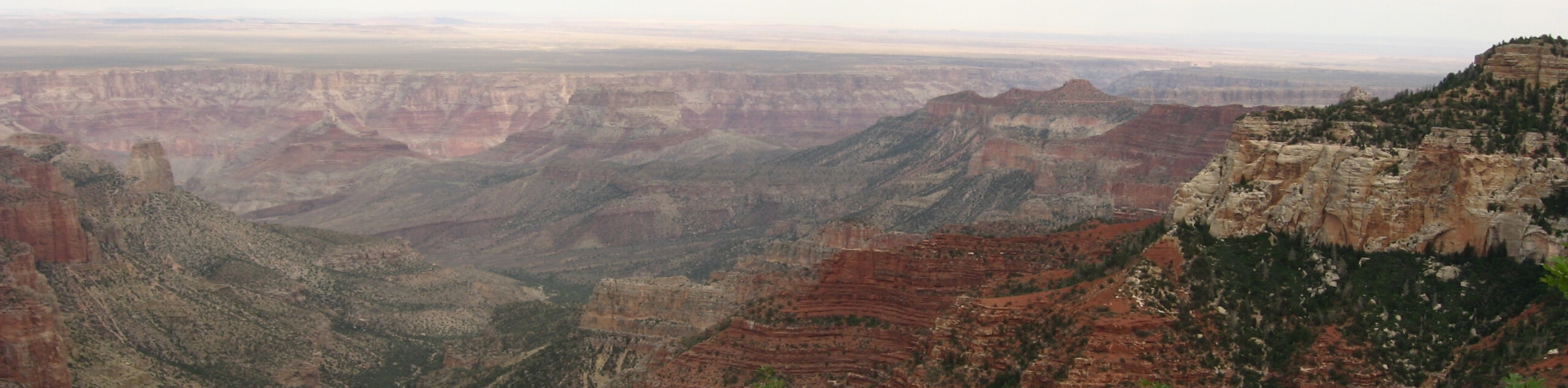
The Rim Trail follows a large stretch of the South Rim of the Grand Canyon, where most visitors to the park end up making their home base. Yavapai Point is one of the popular viewpoints on the South Rim, and the ease of access to this trail and this viewpoint make both extremely popular with visitors.
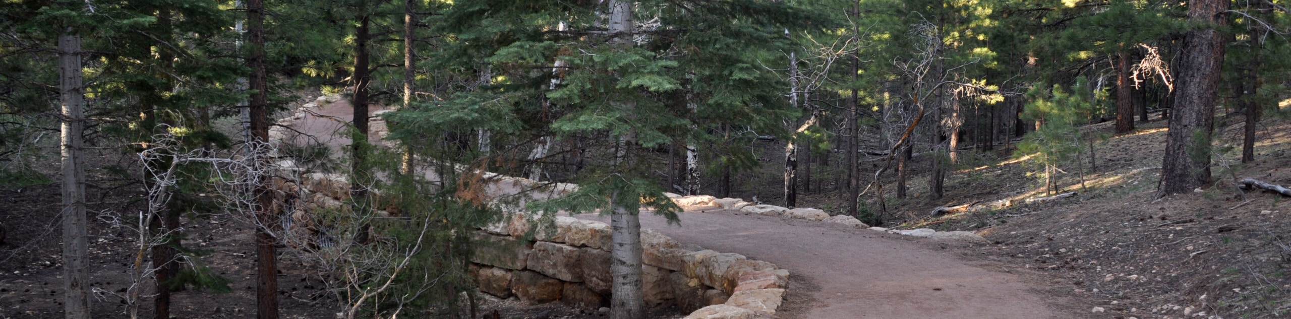
If you come to the Grand Canyon, you’ll likely end up walking on the Rim Trail without even meaning to. It’s the main route that links each of the many viewpoints over the canyon, and it’s a very laid-back trip. All ages and skill levels can enjoy this walk.
The route begins from the Grand Canyon Village, so you can stop into the Visitor Center to learn about the canyon and get your day’s activities planned before heading out, or you can grab a snack or drink to take along. Since this route originates from the village, there’s no need to figure out the shuttle system to enjoy it.
The Rim Trail can be used to reach the trailheads at Yavapai Point for hikers bound for longer trips since Yavapai Point offers extremely limited public parking. You can also use this route as a warm-up for longer trips on the South Kaibab Trail or Bright Angel Trail. Or, just wander along to soak up the expansive view as far as you like before heading back.
This route begins near Mather Point, one of the main viewpoints on the South Rim. You’ll hike left (west) along the trail that hugs the rim. There are viewpoints dotted all along the trail, so stop frequently to absorb the sheer size of the geological anomaly before you.
The route continues to Yavapai Point, where an interesting geology museum is worth a stop if you’re interested in how the canyon was formed. The museum is equally fun for kids and adults, with interactive exhibits providing a thorough explanation of how the canyon came to be.
From Yavapai Point, you’ll turn around and retrace your steps to the main village. Should you not wish to walk back, you can catch the orange shuttle back to the village instead.
Hiking Route Highlights
Grand Canyon
Revealing millions of years of geological history, the layered and massive Grand Canyon is a 3060 square mile canyon in Arizona. The canyon is 277.0mi long, up to 18.0mi wide and is over 6000ft at its deepest point. Carved by the Colorado River over millions of years, the canyon is now one of the world’s top natural attractions, bringing about 5 million visitors to its rim every year. Indigenous people have inhabited the canyon for many years, some considering it to be a holy site.
Frequently Asked Questions
How long is the Rim Trail?
The entire Rim Trail is about 13.0mi long.
Is the Rim Trail difficult?
The Rim Trail is one of the easiest walks in the park. It’s mostly flat, and barring some occasional ice in colder weather, it’s suitable for all ages and skill levels thanks to its paving.
Can you drive to Yavapai Point?
There is very limited public parking at Yavapai Point. Shuttles are available.
Insider Hints
You’ll need a pass to visit the Grand Canyon. Passes can be purchased ahead of time online or at the park gates.
It can take a long time to get through the park gates during normal visiting hours, so we recommend planning to arrive a bit early.
The park shuttles run frequently and consistently throughout the day and there’s no charge to use them.
Similar hikes to the Yavapai Point via Rim Trail hike
North Rim Fire Watchtower Hike
Adventure through the forest on the trail to the North Rim Fire Watchtower, a hike that sees very little traffic…
Grand Canyon Bridle Trail
The Grand Canyon Bridle Trail is a 3.2mi easy hiking trail on the North Rim of the Grand…
Roosevelt Point Trail
Roosevelt Point Trail is a short and sweet hike on the North Rim of the Grand Canyon known for its…
Comments